St Julian's Wood

Wood, Forest in Hertfordshire St. Albans

England

St Julian's Wood

Park Looking NE from TL138067 across the lake in the park, toward the abbey in TL1407
Park Credit: Rob Hinkley

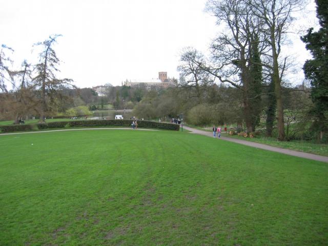
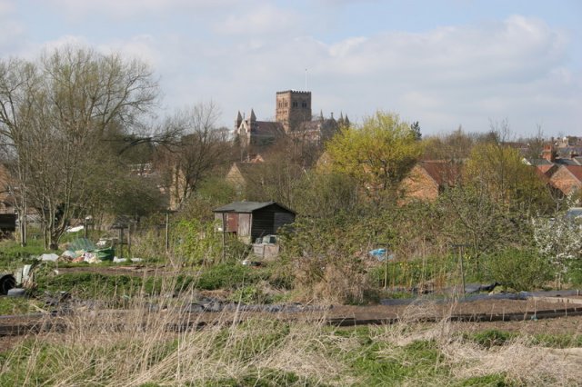
St Julian's Wood is a picturesque woodland located in Hertfordshire, England. Spanning over an area of approximately 50 acres, this enchanting forest is nestled within the rural landscape, offering a tranquil retreat for nature lovers and outdoor enthusiasts alike.

The woodland is characterized by its diverse range of tree species, including oak, beech, and silver birch, which create a stunning canopy overhead. The forest floor is adorned with a carpet of bluebells during the spring, adding a burst of color to the natural surroundings. Wildlife thrives within St Julian's Wood, with various bird species, such as woodpeckers and robins, making their homes in the treetops, while small mammals like squirrels and rabbits scurry about on the forest floor.

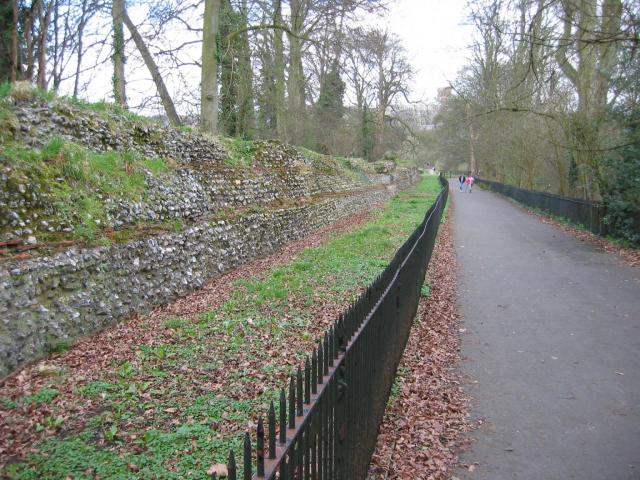
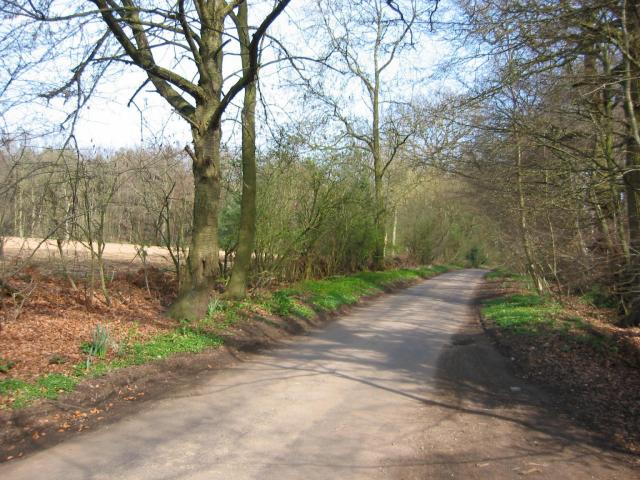
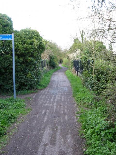
The wood features a network of well-maintained footpaths, allowing visitors to explore its serene ambiance at their own pace. These paths wind through the forest, providing opportunities for leisurely walks, jogging, or even birdwatching. Additionally, there are designated picnic areas where visitors can relax and enjoy a meal amidst the tranquility of nature.

St Julian's Wood has a rich history, dating back several centuries. It was once a part of the extensive estate owned by the St Julian family, who were renowned for their love of nature and conservation. Today, the wood is managed by a local conservation organization, ensuring its preservation and ongoing protection.

Overall, St Julian's Wood is a haven of natural beauty and serenity. Its stunning woodland scenery, rich biodiversity, and peaceful atmosphere make it a popular destination for nature enthusiasts seeking respite from the hustle and bustle of everyday life.

If you have any feedback on the listing, please let us know in the comments section below.

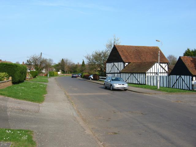
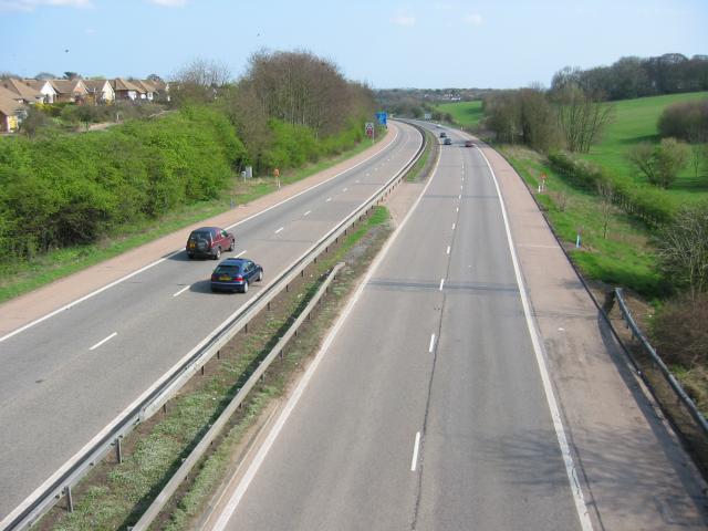
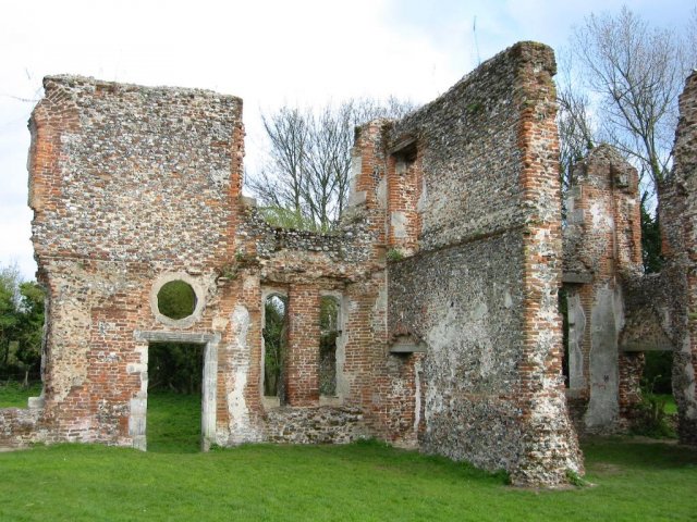
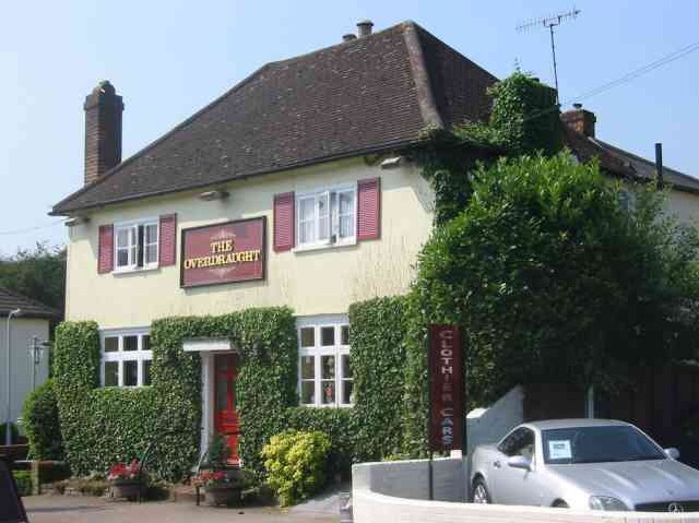
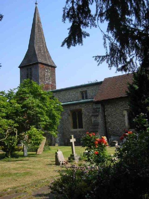
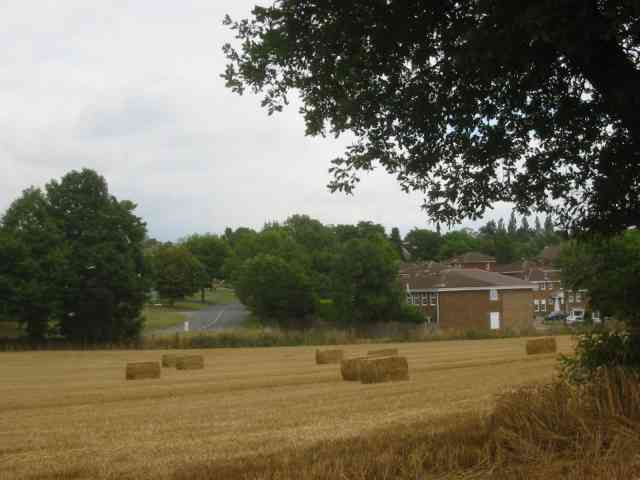
St Julian's Wood Images

Images are sourced within 2km of 51.731501/-0.35059736 or Grid Reference TL1404. Thanks to Geograph Open Source API. All images are credited.

Park Looking NE from TL138067 across the lake in the park, toward the abbey in TL1407
Park
Looking NE from TL138067 across the lake in the park, toward the abbey in TL1407
Roman city wall Looking NE from TL137066, with the old Roman city wall on the left.
Roman city wall
Looking NE from TL137066, with the old Roman city wall on the left.
Daneswick farm buildings Looking SE from TL122046
Daneswick farm buildings
Looking SE from TL122046
Road from Potters Crouch to Chiswell Green Looking East from TL123052 with copse on the right, open field and then woods on the left.
Road from Potters Crouch to Chiswell Green
Looking East from TL123052 with copse on the right, open field and then woods on the left.
Gateway to suburbia On the Western edge of Chiswell Green, having just left the farmland behind, looking East from TL131045.
Gateway to suburbia
On the Western edge of Chiswell Green, having just left the farmland behind, looking East from TL131045.
M10, from bridge. Looking East from the bridge over the M10 at TL137055.
M10, from bridge.
Looking East from the bridge over the M10 at TL137055.
Cycleway bridge Looking East over the bridge over the Ver on the St Albans to Hatfield cycleway - an abandoned railway line - at TL153063.
Cycleway bridge
Looking East over the bridge over the Ver on the St Albans to Hatfield cycleway - an abandoned railway line - at TL153063.
Ruined nunnery The ruined nunnery at TL151064
Ruined nunnery
The ruined nunnery at TL151064
The Allotments Near the River Ver are the Allotments just off Cottonmill Lane.
The Allotments
Near the River Ver are the Allotments just off Cottonmill Lane.
St Alban's R.C. Church at St Julians This church is almost at the southern edge of St Albans.
St Alban's R.C. Church at St Julians
This church is almost at the southern edge of St Albans.
A road in Chiswell Green The forest trees at least show that it has some attraction
A road in Chiswell Green
The forest trees at least show that it has some attraction
The Falcon Pub in Park Street, Herts This pub is at the centre of the village
The Falcon Pub in Park Street, Herts
This pub is at the centre of the village
The Overdraught Pub,  Park Street, Herts Is that a pun or is that a howler?
The Overdraught Pub, Park Street, Herts
Is that a pun or is that a howler?
St Stephen's Church  St Albans This church has sufficient land for car parking which is a boon as the road outside is always busy.
St Stephen's Church St Albans
This church has sufficient land for car parking which is a boon as the road outside is always busy.
The King Harry Pub St Albans This is an awkward junction with a double mini roundabout. Best avoided if possible. {see note re St Stephens Church}
The King Harry Pub St Albans
This is an awkward junction with a double mini roundabout. Best avoided if possible. {see note re St Stephens Church}
Sopwell Mill  redevelopment. The mill has been refurbished as offices but the turn to the right leads to a narrow bridge and a blind corner. Used by many commuters so rather tricky to negotiate.
Sopwell Mill redevelopment.
The mill has been refurbished as offices but the turn to the right leads to a narrow bridge and a blind corner. Used by many commuters so rather tricky to negotiate.
View of the Abbey This was the view from my bedroom window in Riverside Close before the trees grew higher
View of the Abbey
This was the view from my bedroom window in Riverside Close before the trees grew higher
The edge of the town This view from Bedmond Lane shows the abrupt demarcation between housing estate and farmland.
The edge of the town
This view from Bedmond Lane shows the abrupt demarcation between housing estate and farmland.
Show me another place!

St Julian's Wood is located at Grid Ref: TL1404 (Lat: 51.731501, Lng: -0.35059736)

Administrative County: Hertfordshire

District: St. Albans

Police Authority: Hertfordshire

What 3 Words

///wells.kick.limp. Near St Albans, Hertfordshire

Nearby Locations

St Julian's Wood

Related Wikis

Chiswell Green

Chiswell Green is a village, on the southern outskirts of St Albans, in the parish of St Stephen and district of the City of St Albans in Hertfordshire...

St Stephen, Hertfordshire

St Stephen is a civil parish in the St Albans City and District in Hertfordshire, England. It is located approximately 17 miles (27 km) north-northwest...

The Marlborough Science Academy

The Marlborough Science Academy is a secondary school and sixth form with Academy status, located in St Albans, Hertfordshire, England. It has a specialism...

Turning Forms

Turning Forms (BH 166) is a concrete sculpture by Barbara Hepworth, one of her first public commissions, made in 1950 for the Festival of Britain. It was...

Park Street railway station (England)

Park Street railway station serves the village of Park Street, Hertfordshire, England. It is the penultimate station on the Abbey Line. The station and...

St Stephen's Church, St Albans

St Stephen's Church is a Church of England parish church in St Albans, Hertfordshire, England. It is located to the south of the town centre, at the top...

Park Street, Hertfordshire

Park Street is a small Hertfordshire village on the southern outskirts of, and around 2 miles (3.2 km) south of the city centre of, St Albans in England...

How Wood

How Wood is a residential village, south of Park Street village between the centres of Watford and St Albans in St Stephen civil parish, Hertfordshire...

Nearby Amenities

Located within 500m of 51.731501,-0.35059736
Turning Circle
Lat/Long: 51.7345804/-0.3471219
Turning Loop
Lat/Long: 51.7293592/-0.3559662
Crossing
Lat/Long: 51.7342615/-0.3554693
Bus Stop
Ragged Hall Lane
Bench: yes
Bin: no
Bus: yes
Lit: yes
Naptan AtcoCode: 210021503520
Naptan Bearing: SW
Naptan CommonName: Ragged Hall Lane
Naptan Crossing: Allotment Gardens
Naptan Indicator: opp
Naptan Landmark: Allotment Gardens
Naptan NaptanCode: hrtawpwg
Naptan PlusbusZoneRef: STALBCY
Naptan ShortCommonName: NA
Naptan Street: Watford Road
Naptan Verified: no
Public Transport: platform
Shelter: yes
Source: naptan_import
Tactile Paving: yes
Lat/Long: 51.7344272/-0.3552569
Bus Stop
West Avenue
Naptan AtcoCode: 210021503540
Naptan Bearing: SW
Naptan CommonName: West Avenue
Naptan Crossing: United Reformed Church
Naptan Indicator: nr
Naptan Landmark: United Reformed Church
Naptan NaptanCode: hrtawpwj
Naptan PlusbusZoneRef: STALBCY
Naptan ShortCommonName: NA
Naptan Street: Watford Road
Naptan Verified: no
Public Transport: platform
Source: naptan_import
Lat/Long: 51.7312512/-0.357544
Bus Stop
West Avenue
Bus: yes
Naptan AtcoCode: 210021508240
Naptan Bearing: NE
Naptan CommonName: West Avenue
Naptan Crossing: Stanmount Road
Naptan Indicator: opp
Naptan Landmark: Stanmount Road
Naptan NaptanCode: hrtatwpg
Naptan PlusbusZoneRef: STALBCY
Naptan ShortCommonName: NA
Naptan Street: Watford Road
Naptan Verified: no
Public Transport: platform
Shelter: yes
Source: naptan_import
Lat/Long: 51.7318855/-0.3572688
Bus Stop
Ragged Hall Lane
Bench: yes
Bin: no
Lit: yes
Naptan AtcoCode: 210021508260
Naptan Bearing: NE
Naptan CommonName: Ragged Hall Lane
Naptan Crossing: Ragged Hill
Naptan Indicator: adj
Naptan Landmark: Ragged Hill
Naptan NaptanCode: hrtatwpj
Naptan PlusbusZoneRef: STALBCY
Naptan ShortCommonName: NA
Naptan Street: Watford Road
Naptan Verified: no
Public Transport: platform
Shelter: yes
Source: naptan_import
Tactile Paving: yes
Lat/Long: 51.735029/-0.3550464
Barrier: bollard
Bicycle: yes
Bollard: foldable
Description: Kissing gate for pedestrians. Narrow gap for bicycles which is too narrow for most handlebars. You have to lift your bike to get handlebars over the barrier.
Foot: yes
Lat/Long: 51.734236/-0.3552431
Traffic Calming: island
Lat/Long: 51.7313034/-0.3546785
Turning Circle
Lat/Long: 51.7321517/-0.3544977
Traffic Calming: island
Lat/Long: 51.7330753/-0.3566082
Post Box
Brand: Royal Mail
Brand Wikidata: Q638098
Brand Wikipedia: en:Royal Mail
Operator: Royal Mail
Operator Wikidata: Q638098
Post Box Type: pillar
Ref: AL1 258D
Royal Cypher: GR
Royal Cypher Wikidata: Q33102273
Lat/Long: 51.7352551/-0.3470959
Crossing
Crossing: unmarked
Crossing Markings: no
Tactile Paving: incorrect
Lat/Long: 51.7320993/-0.3440718
Street Lamp
Lamp Type: high_pressure_sodium
Source: Personal memory
Lat/Long: 51.732847/-0.3453072
Street Lamp
Lamp Type: high_pressure_sodium
Source: Personal memory
Lat/Long: 51.7329202/-0.3452958
Street Lamp
Lamp Type: high_pressure_sodium
Source: Personal memory
Lat/Long: 51.7330153/-0.3457928
Street Lamp
Lamp Type: high_pressure_sodium
Source: Personal memory
Lat/Long: 51.7331198/-0.3463106
Street Lamp
Lamp Type: led
Source: Personal memory
Lat/Long: 51.7328389/-0.3451857
Post Box
Brand: Royal Mail
Brand Wikidata: Q638098
Brand Wikipedia: en:Royal Mail
Collection Times: Mo-Fr 09:00; Sa 07:00
Operator: Royal Mail
Operator Wikidata: Q638098
Post Box Type: pillar
Ref: AL2 147D
Royal Cypher: GR
Royal Cypher Wikidata: Q33102273
Lat/Long: 51.7317925/-0.3573551
Traffic Calming: bump
Lat/Long: 51.7283401/-0.3544708
Traffic Calming: hump
Lat/Long: 51.7286545/-0.3544026
Traffic Calming: island
Lat/Long: 51.7339081/-0.3559647
Crossing
Crossing: unmarked
Lat/Long: 51.7341979/-0.3555398
Crossing
Crossing: unmarked
Tactile Paving: yes
Lat/Long: 51.73424/-0.3556631
Traffic Calming: island
Lat/Long: 51.7320085/-0.3570942
Traffic Calming: island
Lat/Long: 51.7317344/-0.3572534
Crossing
Crossing: marked
Lat/Long: 51.7315676/-0.3573738
Direction: 200
Generator Method: photovoltaic
Generator Output Electricity: yes
Generator Solar Modules: 8
Generator Source: solar
Generator Type: solar_photovoltaic_panel
Location: roof
Power: generator
Lat/Long: 51.7322095/-0.3565665
Direction: 145
Generator Method: photovoltaic
Generator Output Electricity: yes
Generator Solar Modules: 16
Generator Source: solar
Generator Type: solar_photovoltaic_panel
Location: roof
Power: generator
Lat/Long: 51.7306865/-0.3544201
Direction: 205
Generator Method: photovoltaic
Generator Output Electricity: yes
Generator Solar Modules: 5
Generator Source: solar
Generator Type: solar_photovoltaic_panel
Location: roof
Power: generator
Lat/Long: 51.7296644/-0.3563491
Direction: 115
Generator Method: photovoltaic
Generator Output Electricity: yes
Generator Solar Modules: 5
Generator Source: solar
Generator Type: solar_photovoltaic_panel
Location: roof
Power: generator
Lat/Long: 51.7296649/-0.356294
Direction: 210
Generator Method: photovoltaic
Generator Output Electricity: yes
Generator Solar Modules: 13
Generator Source: solar
Generator Type: solar_photovoltaic_panel
Location: roof
Power: generator
Lat/Long: 51.7350756/-0.3498756
Marker: post
Substance: oil
Utility: oil
Lat/Long: 51.7319888/-0.3458349
Marker: post
Substance: oil
Utility: oil
Lat/Long: 51.7318279/-0.3455245
Street Lamp
Lat/Long: 51.7319921/-0.3455732
Street Lamp
Lat/Long: 51.7322227/-0.3451923
Street Lamp
Lat/Long: 51.7322853/-0.3450556
Marker: post
Substance: oil
Utility: oil
Lat/Long: 51.7352492/-0.3544917
Marker: post
Substance: oil
Utility: oil
Lat/Long: 51.7318663/-0.344081
Street Lamp
Lat/Long: 51.7321649/-0.3442203
Street Lamp
Lat/Long: 51.7325872/-0.3436996
Street Lamp
Lat/Long: 51.7325582/-0.3435494
Traffic Calming: island
Lat/Long: 51.7333727/-0.3444491
Barrier: kerb
Kerb: lowered
Lat/Long: 51.7320598/-0.3443058
Crossing
Crossing: unmarked
Crossing Markings: no
Lat/Long: 51.7320798/-0.3442282
Crossing
Crossing: unmarked
Crossing Island: no
Crossing Markings: no
Tactile Paving: no
Traffic Calming: table
Lat/Long: 51.7290413/-0.3546726
Barrier: swing_gate
Bicycle: yes
Foot: yes
Material: metal
Motor Vehicle: no
Wheelchair: no
Lat/Long: 51.729032/-0.3547586
Barrier: cycle_barrier
Bicycle: yes
Foot: yes
Lat/Long: 51.7306493/-0.3530717
Barrier: cycle_barrier
Bicycle: yes
Foot: yes
Lat/Long: 51.7305895/-0.3531814
Lazy Llama Cafe
Heating: no
Leisure: outdoor_seating
Lit: no
Seasonal: no
Lat/Long: 51.7288585/-0.3540691
The data included in this document is from www.openstreetmap.org. The data is made available under ODbL.

Have you been to St Julian's Wood?

Leave your review of St Julian's Wood below (or comments, questions and feedback).