Oldbroom Covert

Wood, Forest in Bedfordshire

England

Oldbroom Covert

Stanford Road, Southill
Stanford Road, Southill Credit: David Howard

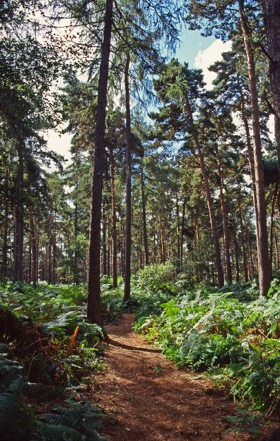
Oldbroom Covert is a picturesque woodland located in Bedfordshire, England. Covering an area of approximately 100 acres, this enchanting forest is a haven for nature enthusiasts and wildlife lovers. The woodland is situated in the heart of the county, a few miles away from the charming village of Oldbroom.

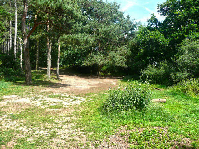
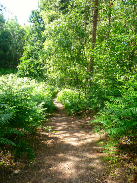
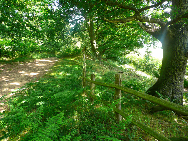
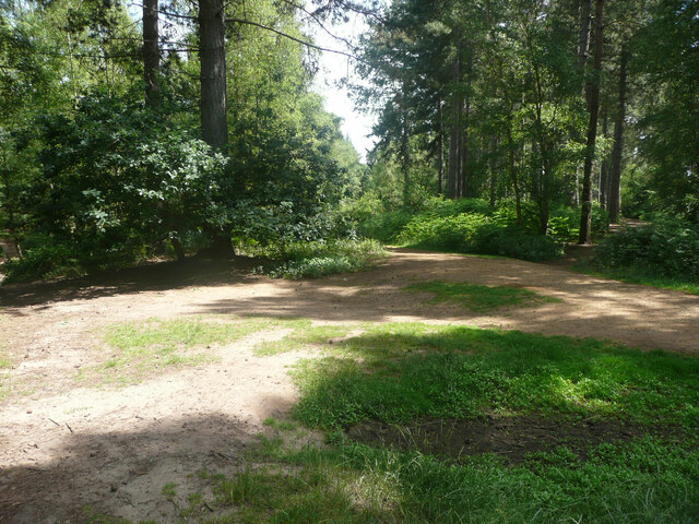
As you enter Oldbroom Covert, you are immediately captivated by the tranquility and beauty of the surroundings. Towering oak and beech trees dominate the landscape, their branches intertwining to create a dense canopy that filters sunlight and creates a magical atmosphere. The forest floor is carpeted with a rich variety of flora, including bluebells, wild garlic, and ferns, adding bursts of color and texture to the woodland.

The woodland is crisscrossed by a network of well-maintained footpaths, allowing visitors to explore its hidden corners and discover its hidden treasures. These paths wind their way through the forest, leading to secluded glades and open clearings, perfect for picnics or simply to sit and admire the beauty of nature.

Oldbroom Covert is also home to a diverse range of wildlife. Birdsong fills the air, with species such as woodpeckers, nightingales, and owls making their homes in the forest. Deer, foxes, and rabbits can also be spotted, adding to the sense of wilderness and natural harmony.

Whether you are seeking a peaceful retreat, a place for outdoor activities, or an opportunity to reconnect with nature, Oldbroom Covert offers a truly magical woodland experience. Its beauty and serenity make it a popular destination for locals and visitors alike, a hidden gem nestled in the heart of Bedfordshire.

If you have any feedback on the listing, please let us know in the comments section below.

Oldbroom Covert Images

Images are sourced within 2km of 52.061784/-0.34029595 or Grid Reference TL1341. Thanks to Geograph Open Source API. All images are credited.

Stanford Road, Southill
Part of the car park for Rowney Warren Wood, Southill The car park is also a picnic area.
Part of the car park for Rowney Warren Wood, Southill
The car park is also a picnic area.
Track in Rowney Warren Wood, Southill This track is along the southern edge of the wood.
Track in Rowney Warren Wood, Southill
This track is along the southern edge of the wood.
Path in Rowney Warren Wood, Southill It is all too easy to lose one's sense of direction in this wood, and also my GPS readings did not always indicate a position on one of the paths shown on the 1:25000 map.
Path in Rowney Warren Wood, Southill
It is all too easy to lose one's sense of direction in this wood, and also my GPS readings did not always indicate a position on one of the paths shown on the 1:25000 map.
Track in Rowney Warren Wood, Southill This track goes along the southern edge of the wood, and over the boundary fence at a lower level there is a bridleway, which is part of the John Bunyan Trail. Along the length of the track that I walked there was no connection between the two paths.
Track in Rowney Warren Wood, Southill
This track goes along the southern edge of the wood, and over the boundary fence at a lower level there is a bridleway, which is part of the John Bunyan Trail. Along the length of the track that I walked there was no connection between the two paths.
The John Bunyan Trail at the A600, Shefford The roundabout is at the junction with the B658 Sandy road.
The John Bunyan Trail at the A600, Shefford
The roundabout is at the junction with the B658 Sandy road.
Track junction in Rowney Warren Wood, Southill I am not certain about the grid reference.
Track junction in Rowney Warren Wood, Southill
I am not certain about the grid reference.
Disused railway bridge This 3 arch bridge (No. HIB18) takes the Southill road over the old Bedford to Hitchin line of the Midland Railway.  Before St. Pancras Station and the line from Bedford to London was built, Midland Railway trains accessed the GNR's Kings Cross station via Hitchin.  After the new line was built, the line became a backwater, and was closed to passengers in 1961 and to freight in 1964.
Disused railway bridge
This 3 arch bridge (No. HIB18) takes the Southill road over the old Bedford to Hitchin line of the Midland Railway. Before St. Pancras Station and the line from Bedford to London was built, Midland Railway trains accessed the GNR's Kings Cross station via Hitchin. After the new line was built, the line became a backwater, and was closed to passengers in 1961 and to freight in 1964.
Railway bridge near Ireland This old railway bridge is on the disused Bedford to Hitchin line of the Midland Railway which was fully closed in 1964.
Railway bridge near Ireland
This old railway bridge is on the disused Bedford to Hitchin line of the Midland Railway which was fully closed in 1964.
Farmland, Shefford, Beds View N from the Bedford Road.
Farmland, Shefford, Beds
View N from the Bedford Road.
Southill Park Woods, Bedfordshire Southill Park is near Biggleswade, Bedfordshire.  Southill is a charming estate village dominated by Southill Park, home of the Whitbread Family since 1795. Samuel Whitbread I founded the famous brewery of the same name. Before the Whitbread Family, Southill Park was home to the Byngs. In All Saints Church lies the body of Admiral Sir John Byng who was blamed for the loss of Minorca to the French and executed on the deck of his own ship in 1757.
Southill Park Woods, Bedfordshire
Southill Park is near Biggleswade, Bedfordshire. Southill is a charming estate village dominated by Southill Park, home of the Whitbread Family since 1795. Samuel Whitbread I founded the famous brewery of the same name. Before the Whitbread Family, Southill Park was home to the Byngs. In All Saints Church lies the body of Admiral Sir John Byng who was blamed for the loss of Minorca to the French and executed on the deck of his own ship in 1757.
Southill Park Woods, Bedfordshire Southill is a charming estate village dominated by Southill Park, home of the Whitbread Family since 1795. Samuel Whitbread I founded the famous brewery of the same name. Before the Whitbread Family, Southill Park was home to the Byngs. In All Saints Church lies the body of Admiral Sir John Byng who was blamed for the loss of Minorca to the French and executed on the deck of his own ship in 1757.
Southill Park Woods, Bedfordshire
Southill is a charming estate village dominated by Southill Park, home of the Whitbread Family since 1795. Samuel Whitbread I founded the famous brewery of the same name. Before the Whitbread Family, Southill Park was home to the Byngs. In All Saints Church lies the body of Admiral Sir John Byng who was blamed for the loss of Minorca to the French and executed on the deck of his own ship in 1757.
Southill Lower School Bedfordshire still has a lower / middle / upper school system.
Southill Lower School
Bedfordshire still has a lower / middle / upper school system.
Yew Tree Farm The yew seems to be blocking out the light.
Yew Tree Farm
The yew seems to be blocking out the light.
Gracious Farm. No.  Really.
Gracious Farm.
No. Really.
Shefford to Ireland road, Beds running through the centre of the square.
Shefford to Ireland road, Beds
running through the centre of the square.
Beal's Wood, Shefford, Beds with the course of the Bedford–Hitchin dismantled railway in the valley; view ESE from the old Bedford Road to Ireland.
Beal's Wood, Shefford, Beds
with the course of the Bedford–Hitchin dismantled railway in the valley; view ESE from the old Bedford Road to Ireland.
The Black Horse pub, Ireland, Beds
Show me another place!

Oldbroom Covert is located at Grid Ref: TL1341 (Lat: 52.061784, Lng: -0.34029595)

Unitary Authority: Central Bedfordshire

Police Authority: Bedfordshire

What 3 Words

///rephrase.input.discusses. Near Southill, Bedfordshire

Related Wikis

Ireland, Bedfordshire

Ireland is a hamlet in the civil parish of Southill, Bedfordshire, England.The hamlet was known as Inlonde in the 16th century. == References == ��2...

Southill Park

Southill Park contains the site of late medieval Gastlings or Gastlyns Manor House and is the name given to a country house in Southill, Bedfordshire,...

Camps End

Camps End is a hamlet near Castle Camps in Cambridgeshire, England. == References ==

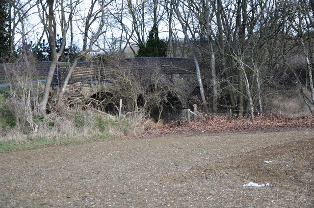
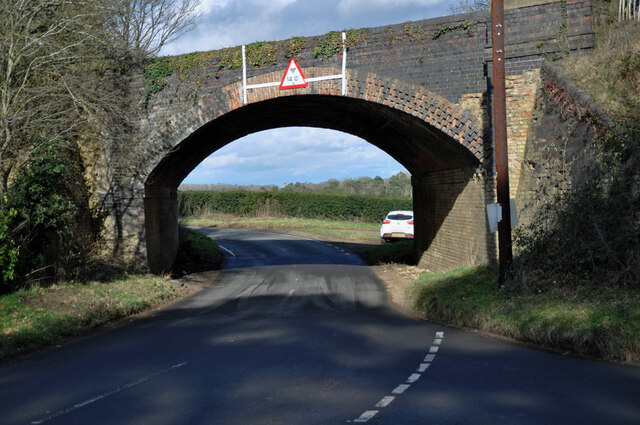
Southill railway station

Southill was a railway station on the Bedford to Hitchin Line which served the village of Southill in Bedfordshire, England. Opened in 1857, it gave more...

Bedford–Hitchin line

The Bedford–Hitchin line was a branch of the Midland Railway which served stations at Cardington, Southill, Shefford and Henlow Camp in Bedfordshire, England...

Southill, Bedfordshire

Southill is a rural village and civil parish in the Central Bedfordshire district of the county of Bedfordshire, England; about 8 miles (13 km) south-east...

Southill Lake and Woods

Southill Lake and Woods is a 25.3-hectare (63-acre) biological Site of Special Scientific Interest in Southill in Bedfordshire. It is part of Southill...

Old Warden

Old Warden is a village and civil parish in the Central Bedfordshire district of the county of Bedfordshire, England, about 6.5 miles (10 km) south-east...

Nearby Amenities

Located within 500m of 52.061784,-0.34029595
Height: 14'6"
Lat/Long: 52.0620687/-0.3472603
Direction: 275
Generator Method: photovoltaic
Generator Output Electricity: yes
Generator Solar Modules: 184
Generator Source: solar
Generator Type: solar_photovoltaic_panel
Location: roof
Power: generator
Lat/Long: 52.0653634/-0.3412802
Direction: 95
Generator Method: photovoltaic
Generator Output Electricity: yes
Generator Solar Modules: 186
Generator Source: solar
Generator Type: solar_photovoltaic_panel
Location: roof
Power: generator
Lat/Long: 52.0653526/-0.3411451
The data included in this document is from www.openstreetmap.org. The data is made available under ODbL.

Have you been to Oldbroom Covert?

Leave your review of Oldbroom Covert below (or comments, questions and feedback).