Hookland Wood

Wood, Forest in Sussex Horsham

England

Hookland Wood

London Road roundabout The roundabout at the north end of Ashington where London Road meets Billingshurst Road and Ivy Lane.
London Road roundabout Credit: Chris Thomas-Atkin

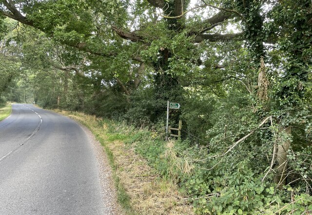
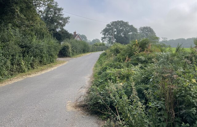
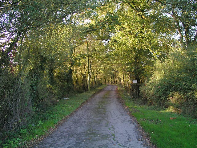
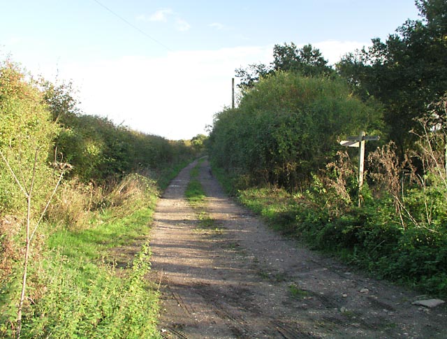
Hookland Wood is a charming woodland located in the county of Sussex, England. Spanning an area of approximately 50 hectares, this forest is nestled within the South Downs National Park, offering visitors a tranquil and picturesque setting to explore. The wood is easily accessible by road, situated just a short distance from the village of Hookland.

The forest boasts a diverse range of tree species, including oak, birch, beech, and ash, which create a rich tapestry of colors throughout the seasons. The deciduous canopy provides ample shade during the summer months, making it an ideal spot for picnics and leisurely strolls.

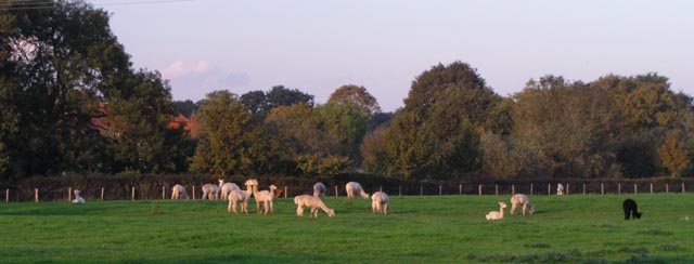
Hookland Wood is home to a variety of wildlife, making it a popular destination for nature enthusiasts. Visitors may catch glimpses of native species such as deer, foxes, badgers, and a wide array of birdlife. The forest's ecosystem is carefully preserved, ensuring the protection of its inhabitants and maintaining biodiversity.

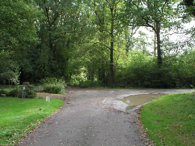
Well-maintained trails wind through the woodland, providing visitors with opportunities for both short walks and longer hikes. These paths lead to picturesque viewpoints, overlooking the surrounding countryside and offering stunning vistas of the South Downs.

The wood is also steeped in history and folklore, with ancient ruins and burial mounds scattered throughout its grounds. Local legends tell tales of mythical creatures and hidden treasures, adding a touch of mystery and intrigue to the woodland's allure.

Overall, Hookland Wood offers a peaceful retreat for nature lovers and history enthusiasts alike, inviting visitors to immerse themselves in the beauty and tranquility of this enchanting Sussex forest.

If you have any feedback on the listing, please let us know in the comments section below.

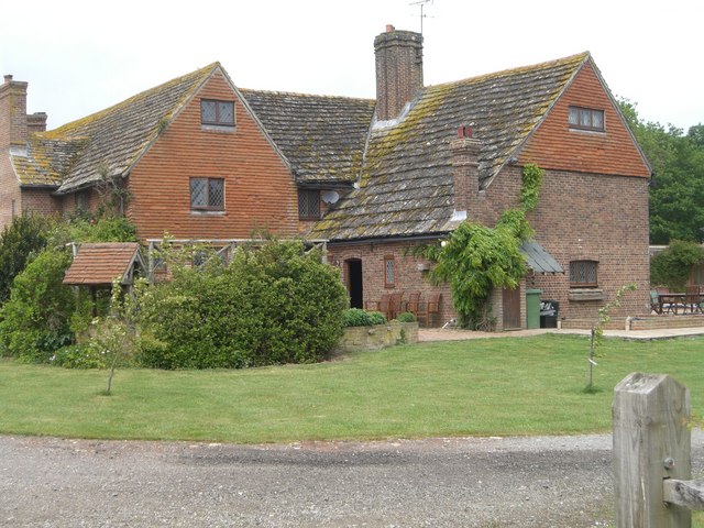
Hookland Wood Images

Images are sourced within 2km of 50.954963/-0.38552996 or Grid Reference TQ1318. Thanks to Geograph Open Source API. All images are credited.

London Road roundabout The roundabout at the north end of Ashington where London Road meets Billingshurst Road and Ivy Lane.
London Road roundabout
The roundabout at the north end of Ashington where London Road meets Billingshurst Road and Ivy Lane.
Oast Cottage Viewed from the Billingshurst Road the cottage is a Grade II listed building. See <span class="nowrap"><a title="https://historicengland.org.uk/listing/the-list/list-entry/1182086" rel="nofollow ugc noopener" href="https://historicengland.org.uk/listing/the-list/list-entry/1182086">Link</a><img style="margin-left:2px;" alt="External link" title="External link - shift click to open in new window" src="https://s1.geograph.org.uk/img/external.png" width="10" height="10"/></span>
Oast Cottage
Viewed from the Billingshurst Road the cottage is a Grade II listed building. See LinkExternal link
Spear Hill The junction of Spear Hill with Billingshurst Road.
Spear Hill
The junction of Spear Hill with Billingshurst Road.
Public footpath Public footpath number 2364 leaving Billingshurst Road near Bennetts Farm.
Public footpath
Public footpath number 2364 leaving Billingshurst Road near Bennetts Farm.
Bridleway at Goose Green Bridleway number 2362 leaves Billingshurst Road at the junction with Goose Green Lane and Cray’s Lane.
Bridleway at Goose Green
Bridleway number 2362 leaves Billingshurst Road at the junction with Goose Green Lane and Cray’s Lane.
Sir Robert’s Farm Viewed from Goose Green Lane.
Sir Robert’s Farm
Viewed from Goose Green Lane.
Basing Wood A lone oak stands guard over an army of firs. Taken from North Lane bridleway just north of Coombelands.
Basing Wood
A lone oak stands guard over an army of firs. Taken from North Lane bridleway just north of Coombelands.
Entrance to the British Alpaca Stud Bowford Farm, Goose Green seen from the A2133 Billingshurst Road. This farm has something of a reputation for its <a href="https://www.geograph.org.uk/photo/266679">TQ1218 : Alpacas</a>.
Entrance to the British Alpaca Stud
Bowford Farm, Goose Green seen from the A2133 Billingshurst Road. This farm has something of a reputation for its TQ1218 : Alpacas.
Entrance to Woolvens Farm Seen from the Billingshurst Road.
Entrance to Woolvens Farm
Seen from the Billingshurst Road.
Holly Gate Cactus Nursery This is sign-posted on the A24. We'd seen the sign for years and always wondered where it was!
Holly Gate Cactus Nursery
This is sign-posted on the A24. We'd seen the sign for years and always wondered where it was!
Junction of Cray's Lane and Peacocks Lane Seen from Peacocks Lane with Cray's Lane running left to right. Opposite Peacocks Lane is a track which was the old road to Warminghurst.
Junction of Cray's Lane and Peacocks Lane
Seen from Peacocks Lane with Cray's Lane running left to right. Opposite Peacocks Lane is a track which was the old road to Warminghurst.
Oakwood Seen from Hooklands Lane.
Oakwood
Seen from Hooklands Lane.
Entrance to Perrylands Seen from the A24.
Entrance to Perrylands
Seen from the A24.
Nine Corner Field Hovel Now home to agricultural machinery.
Nine Corner Field Hovel
Now home to agricultural machinery.
Blonks Barn Once part of Blonks Farm the barn has been converted into a domestic dwelling. Is there a law that says if you want to convert a barn into a house then it has to be ugly?
Blonks Barn
Once part of Blonks Farm the barn has been converted into a domestic dwelling. Is there a law that says if you want to convert a barn into a house then it has to be ugly?
Junction of Bridleway 1886/1 and Footpath 1886/2 On Benton's Lane near Wickwood Cottage.
Junction of Bridleway 1886/1 and Footpath 1886/2
On Benton's Lane near Wickwood Cottage.
Bentons Place Farm, Shipley Note the fine Horsham stone roof.
There was once a manor of Bentons which also included nearby 'Blonks' - farm and cottage.
Bentons Place Farm, Shipley
Note the fine Horsham stone roof. There was once a manor of Bentons which also included nearby 'Blonks' - farm and cottage.
Show me another place!

Hookland Wood is located at Grid Ref: TQ1318 (Lat: 50.954963, Lng: -0.38552996)

Administrative County: West Sussex

District: Horsham

Police Authority: Sussex

What 3 Words

///deliver.treatable.credited. Near Ashington, West Sussex

Related Wikis

Brightling Park

Brightling Park (previously known as Rose Hill) is a country estate which lies in the parishes of Brightling and Dallington in the Rother district of East...

Dial Post

Dial Post is a village in the Horsham District of West Sussex, England. The civil parish, where the lowest level political meetings are held, is West Grinstead...

Ashington, West Sussex

Ashington is a village and civil parish in the Horsham District of West Sussex, England. It lies on the A24 road 3 miles (4.8 km) north-east of Storrington...

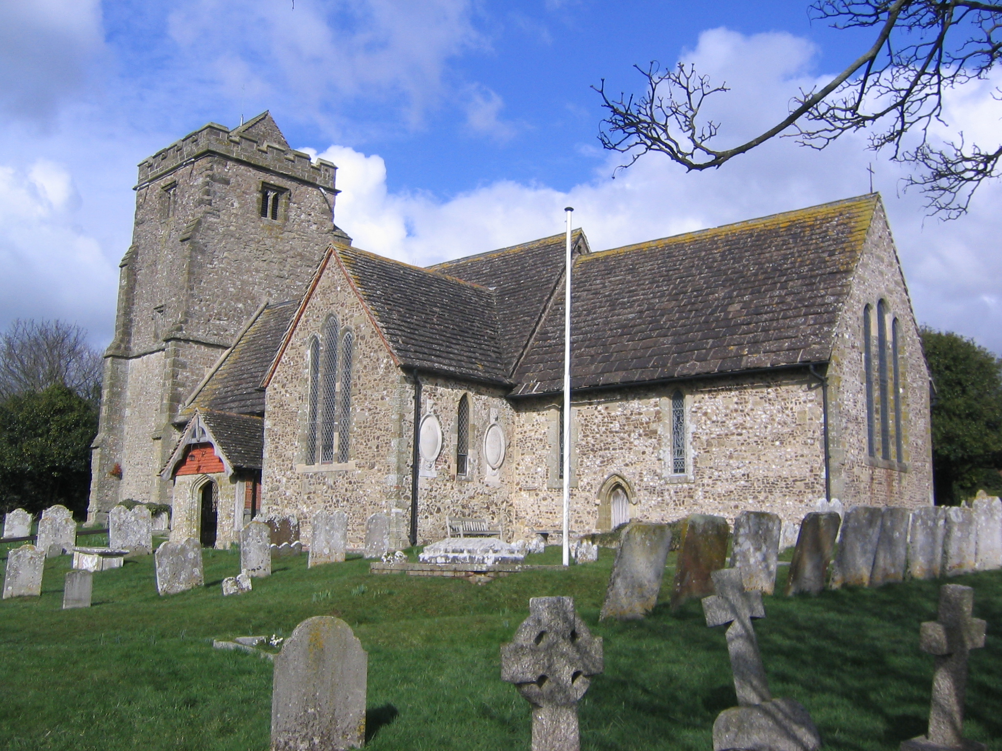
Church of the Holy Sepulchre, Warminghurst

The Church of the Holy Sepulchre is a former Anglican church in the hamlet of Warminghurst in the district of Horsham, one of seven local government districts...

Warminghurst

Warminghurst is a village and former civil parish, now in the parish of Thakeham, in the Horsham district of West Sussex, England. It lies on the Ashington...

Thakeham

Thakeham is a village and civil parish located north of the South Downs in the Horsham District of West Sussex, England. The village is situated approximately...

St Mary's Church, Shipley

The Church of St Mary the Virgin is an Anglican church in the village of Shipley, in West Sussex, England. It is in the Diocese of Chichester. Built in...

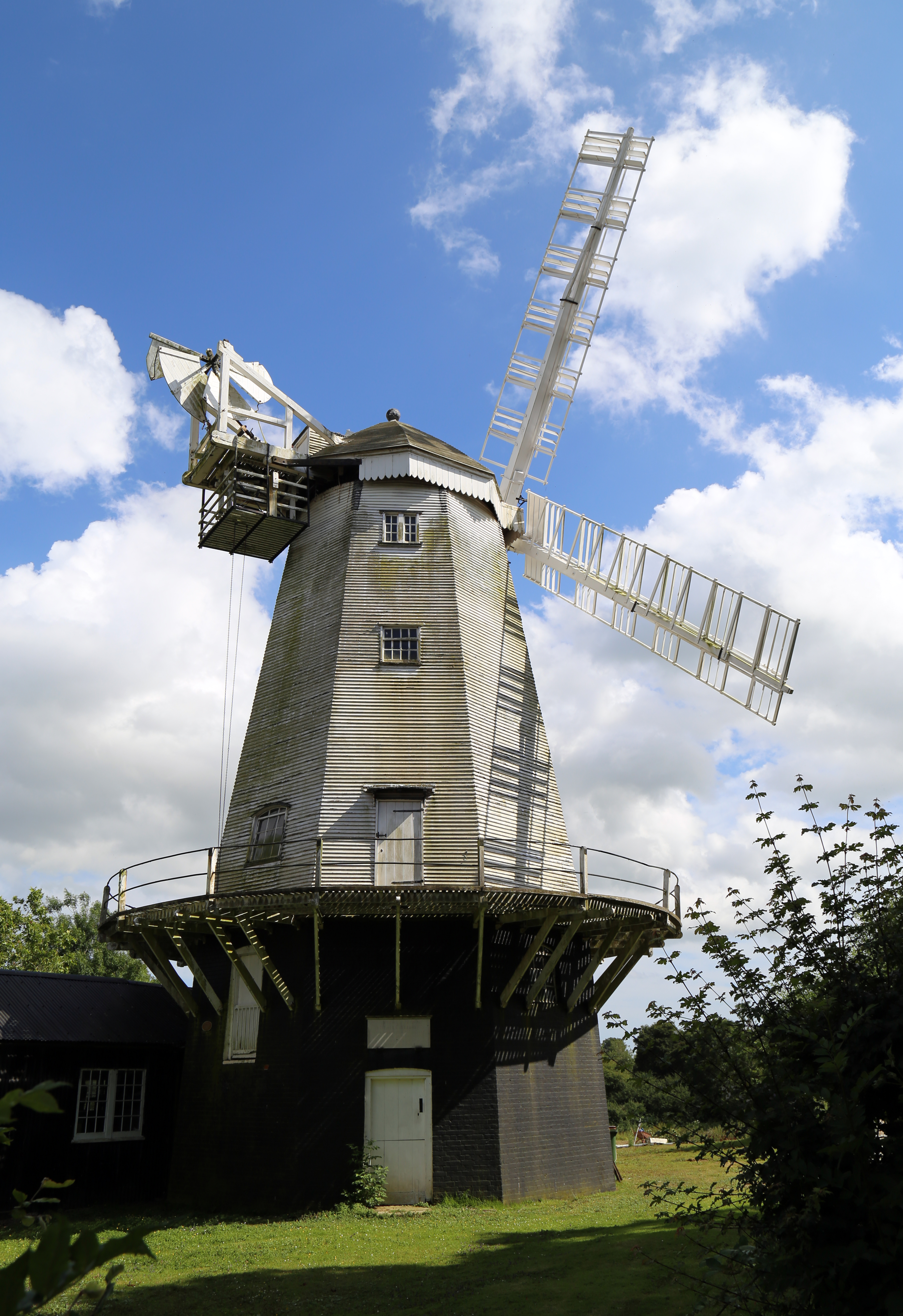
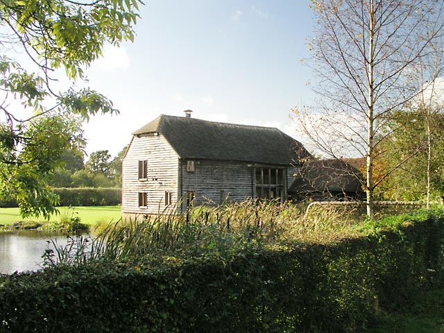
King's Mill, Shipley

King's Mill or Vincent's Mill, Shipley, West Sussex, England, is a smock mill built in 1879. == History == King's Mill was built in 1879 for Friend Martin...

Nearby Amenities

Located within 500m of 50.954963,-0.38552996
Power: pole
Lat/Long: 50.952721/-0.379487
Power: pole
Lat/Long: 50.9525824/-0.3808281
Power: pole
Lat/Long: 50.9522158/-0.3823918
Power: pole
Lat/Long: 50.9517917/-0.3840709
Power: pole
Lat/Long: 50.9514537/-0.3854308
Power: pole
Lat/Long: 50.9508268/-0.3879413
Power: pole
Lat/Long: 50.9509941/-0.386965
Power: pole
Lat/Long: 50.9514013/-0.3854013
Power: pole
Lat/Long: 50.9517224/-0.3839985
Power: pole
Lat/Long: 50.9521245/-0.3823838
Power: pole
Lat/Long: 50.9525064/-0.3808039
Power: pole
Lat/Long: 50.952645/-0.3794897
Oakwood Farm
Place: farm
Lat/Long: 50.9579417/-0.3827569
Artwork Type: statue
Tourism: artwork
Lat/Long: 50.9581001/-0.3826027
Oxcopse Farm
Place: farm
Lat/Long: 50.9517313/-0.381167
The data included in this document is from www.openstreetmap.org. The data is made available under ODbL.

Have you been to Hookland Wood?

Leave your review of Hookland Wood below (or comments, questions and feedback).