Ambrose Wood

Wood, Forest in Hertfordshire St. Albans

England

Ambrose Wood

Dalkeith Road c.1930s housing.
Dalkeith Road Credit: Ian Capper

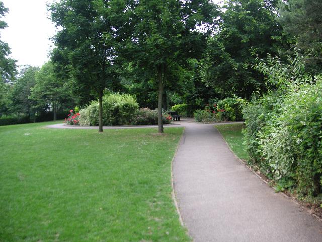
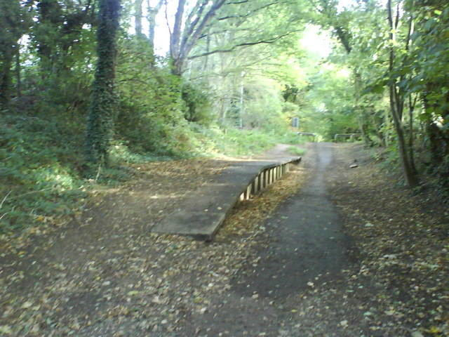
Ambrose Wood is a charming forest located in Hertfordshire, England. Covering an area of approximately 500 acres, it is a popular destination for nature enthusiasts and outdoor enthusiasts alike. The forest is known for its picturesque landscapes, dense woodlands, and diverse wildlife.

Home to a variety of tree species, including oak, beech, and birch, Ambrose Wood offers a tranquil and serene atmosphere. The forest floor is carpeted with a rich assortment of flora, such as bluebells, ferns, and wild garlic, creating a vibrant and colorful setting.

Visitors to Ambrose Wood can enjoy a range of activities. There are numerous walking trails and paths that wind through the forest, providing opportunities for leisurely strolls or more challenging hikes. The forest is also a popular spot for birdwatching, with a wide array of bird species, including woodpeckers, thrushes, and owls, calling it home.

In addition to its natural beauty, Ambrose Wood has a rich history. The forest has been around for centuries and has witnessed various historical events. It is believed to have been used as a hunting ground by medieval nobility, and remnants of ancient structures, such as earthworks and burial mounds, can still be found within its boundaries.

Overall, Ambrose Wood is a haven for nature lovers and history enthusiasts. Its stunning landscapes, diverse wildlife, and rich history make it a must-visit destination for those seeking a connection with nature and a glimpse into the past.

If you have any feedback on the listing, please let us know in the comments section below.
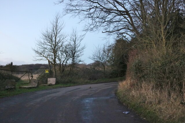
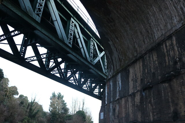
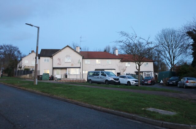
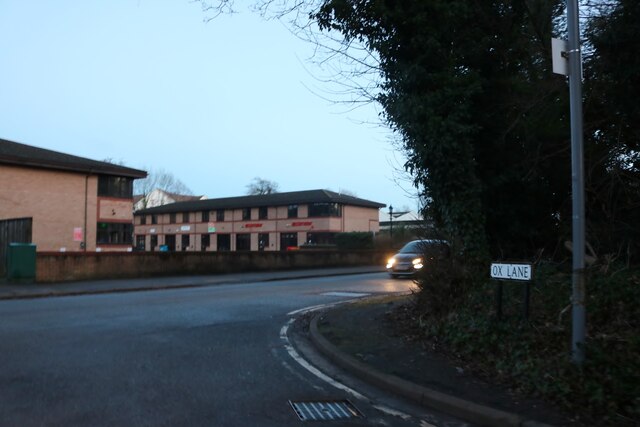
Ambrose Wood Images

Images are sourced within 2km of 51.827233/-0.36187568 or Grid Reference TL1215. Thanks to Geograph Open Source API. All images are credited.

Dalkeith Road c.1930s housing.
Dalkeith Road
c.1930s housing.
Connaught Road c.1930s housing.
Connaught Road
c.1930s housing.
Common Lane, Bower Heath
Chiltern Green Viaduct The second brick line has been replaced by the metal section just crossing the road.
Chiltern Green Viaduct
The second brick line has been replaced by the metal section just crossing the road.
Coldharbour Lane, Harpenden
Batford Road at the junction of Lower Luton Road
Houses on Pickford Hill, Batford
Pickford Hill, Batford
Traffic island on Pickford Hill, Batford
Pickford Hill, Batford
Houses on Finley Road, Batford
Westfield Avenue, Harpenden
Westfield Road, Harpenden The railway is behind the barrier
Westfield Road, Harpenden
The railway is behind the barrier
House on Ox Lane, Harpenden
Coldharbour Lane at the end of Ox Lane
Balti Village on Lower Luton Road, Batford
Show me another place!

Ambrose Wood is located at Grid Ref: TL1215 (Lat: 51.827233, Lng: -0.36187568)

Administrative County: Hertfordshire

District: St. Albans

Police Authority: Hertfordshire

What 3 Words

///firms.punks.fetch. Near Harpenden, Hertfordshire

Nearby Locations

Ambrose Wood

Related Wikis

The King's School (Harpenden)

The King's School, Harpenden is a co-educational independent school for pupils aged four to sixteen, located to the north of Harpenden in Hertfordshire...

St George's School, Harpenden

St George's School, Harpenden (also known as St George's) is a non-selective day and boarding school in Harpenden, Hertfordshire, England, educating students...

Lydekker Park

Lydekker Park is a 3-acre (1.2 ha) park in Harpenden, Hertfordshire. The land was formerly part of the garden of Harpenden Lodge, built in 1803, home...

Roundwood Halt railway station

Roundwood Halt railway station co-served the town of Harpenden, Hertfordshire, England from 1927 to 1949 on the Nickey Line. == History == The station...

Nearby Amenities

Located within 500m of 51.827233,-0.36187568
Traffic Signals
Lat/Long: 51.8251685/-0.3681039
Turning Circle
Lat/Long: 51.8241652/-0.3575408
Mini Roundabout
Lat/Long: 51.8258368/-0.3549703
Post Box
Collection Times: Mo-Fr 09:00, Sa 07:00
Post Box Type: pillar
Ref: AL5 24D
Royal Cypher: GR
Royal Cypher Wikidata: Q33102273
Lat/Long: 51.8238733/-0.3659145
Bus Stop
The Old Bell PH
Bench: yes
Bin: yes
Bus: yes
Naptan AtcoCode: 210021500040
Naptan Bearing: SE
Naptan CommonName: The Old Bell PH
Naptan Crossing: opp Roundwood Lane
Naptan Indicator: opp
Naptan Landmark: opp Roundwood Lane
Naptan NaptanCode: hrtdamjd
Naptan PlusbusZoneRef: HRPNDN
Naptan ShortCommonName: NA
Naptan Street: Luton Road
Naptan Verified: no
Public Transport: platform
Shelter: yes
Source: naptan_import
Lat/Long: 51.8254894/-0.3684004
Bus Stop
Park Mount
Bench: yes
Bin: yes
Bus: yes
Check Date Shelter: 2024-03-18
Lit: yes
Naptan AtcoCode: 210021500060
Naptan Bearing: SE
Naptan CommonName: Park Mount
Naptan Crossing: Hillside Road
Naptan Indicator: opp
Naptan Landmark: Hillside Road
Naptan NaptanCode: hrtdamjg
Naptan PlusbusZoneRef: HRPNDN
Naptan ShortCommonName: NA
Naptan Street: Luton Road
Naptan Verified: no
Public Transport: platform
Shelter: yes
Source: naptan_import
Tactile Paving: yes
Lat/Long: 51.8238819/-0.3654792
Bramble Close
Local Ref: NR
Naptan AtcoCode: 210021500075
Naptan Bearing: E
Naptan BusStopType: CUS
Naptan CommonName: Bramble Close
Naptan Crossing: Clarence Road
Naptan Indicator: nr
Naptan Landmark: Clarence Road
Naptan NaptanCode: hrtdamjm
Naptan PlusbusZoneRef: HRPNDN
Naptan ShortCommonName: NA
Naptan Street: Hollybush Lane
Naptan Verified: no
Source: naptan_import
Lat/Long: 51.8233007/-0.3618306
Bus Stop
Park Mount
Bench: no
Bin: no
Bus: yes
Check Date Shelter: 2023-07-14
Lit: yes
Naptan AtcoCode: 210021511680
Naptan Bearing: NW
Naptan CommonName: Park Mount
Naptan Crossing: Harpenden Rise
Naptan Indicator: nr
Naptan Landmark: Harpenden Rise
Naptan NaptanCode: hrtatgmt
Naptan PlusbusZoneRef: HRPNDN
Naptan ShortCommonName: NA
Naptan Street: Luton Road
Naptan Verified: no
Public Transport: platform
Shelter: no
Source: naptan_import
Tactile Paving: yes
Lat/Long: 51.8239437/-0.3660086
Bus Stop
The Old Bell PH
Bus: yes
Naptan AtcoCode: 210021511700
Naptan Bearing: NW
Naptan CommonName: The Old Bell PH
Naptan Crossing: Roundwood Lane
Naptan Indicator: nr
Naptan Landmark: Roundwood Lane
Naptan NaptanCode: hrtatgmw
Naptan PlusbusZoneRef: HRPNDN
Naptan ShortCommonName: NA
Naptan Street: Luton Road
Naptan Verified: no
Public Transport: platform
Shelter: yes
Source: naptan_import
Lat/Long: 51.8254369/-0.3685197
Bicycle Parking
Capacity: 6
Covered: no
Fee: no
Lat/Long: 51.8276711/-0.359782
Tesco Express
Addr City: Harpenden
Addr Housenumber: 95-101
Addr Postcode: AL5 3BB
Addr Street: Luton Road
Air Conditioning: yes
Brand: Tesco Express
Brand Wikidata: Q98456772
Brand Wikipedia: en:Tesco
Changing Table: no
Check Date Opening Hours: 2024-03-15
Contact Website: https://www.tesco.com/store-locator/harpenden/95-101-luton-rd
Fhrs Authority: St Albans City
Fhrs Id: 657386
Internet Access: no
Opening Hours: Mo-Su 07:00-23:00
Operator: Tesco Stores Ltd
Payment Coins: yes
Payment Credit Cards: yes
Payment Debit Cards: yes
Payment Notes: yes
Phone: +44 345 610 6309
Second Hand: no
Shop: convenience
Toilets: no
Toilets Access: private
Toilets Wheelchair: no
Wheelchair: yes
Lat/Long: 51.8237848/-0.3656934
Post Box
Collection Times: Mo-Fr 09:00, Sa 07:00
Post Box Type: pillar
Ref: AL5 130D
Royal Cypher: GR
Royal Cypher Wikidata: Q33102273
Lat/Long: 51.8253401/-0.3614161
Traffic Signals
Traffic Signals Direction: forward
Lat/Long: 51.8234247/-0.3647158
Traffic Signals
Traffic Signals Direction: backward
Lat/Long: 51.8232644/-0.3644254
Crossing
Button Operated: yes
Crossing: marked
Crossing Island: no
Crossing Markings: dots
Crossing Signals: yes
Crossing Ref: puffin
Tactile Paving: yes
Traffic Signals Sound: no
Traffic Signals Vibration: yes
Lat/Long: 51.8232633/-0.3646591
Traffic Signals
Traffic Signals Direction: backward
Lat/Long: 51.8232475/-0.3646856
Crossing
Button Operated: yes
Crossing: marked
Crossing Island: no
Crossing Markings: dots
Crossing Signals: yes
Crossing Ref: puffin
Tactile Paving: yes
Traffic Signals Sound: no
Traffic Signals Vibration: yes
Lat/Long: 51.8234068/-0.3646848
Clock
Date: no
Display: analog
Faces: 1
Indoor: no
Lit: yes
Support: wall
Visibility: area
Lat/Long: 51.8262702/-0.3583414
Access: private
Entrance: yes
Lat/Long: 51.8267302/-0.3582799
Bicycle Parking
Access: permissive
Bicycle Parking: wall_loops
Capacity: 6
Covered: no
Fee: no
Operator: Youth With A Mission Harpenden
Lat/Long: 51.8256465/-0.3572665
Access: permissive
Entrance: main
Lat/Long: 51.8259305/-0.3576818
Barrier: kissing_gate
Foot: designated
Lat/Long: 51.8268221/-0.3622477
Barrier: kissing_gate
Foot: designated
Lat/Long: 51.8268313/-0.3614844
Barrier: kissing_gate
Foot: designated
Lat/Long: 51.8272263/-0.3626698
Crossing
Crossing: marked
Crossing Island: no
Tactile Paving: yes
Lat/Long: 51.8266155/-0.3616978
Access: private
Barrier: swing_gate
Swing Gate Type: double
Vehicle: private
Lat/Long: 51.8274036/-0.3592687
Bench
Backrest: no
Colour: brown
Material: wood
Seats: 2
Lat/Long: 51.8249181/-0.3588557
Direction: 265
Generator Method: photovoltaic
Generator Output Electricity: yes
Generator Solar Modules: 12
Generator Source: solar
Generator Type: solar_photovoltaic_panel
Location: roof
Power: generator
Lat/Long: 51.8241259/-0.3593138
Direction: 265
Generator Method: photovoltaic
Generator Output Electricity: yes
Generator Solar Modules: 6
Generator Source: solar
Generator Type: solar_photovoltaic_panel
Location: roof
Power: generator
Lat/Long: 51.8244855/-0.3592358
Direction: 85
Generator Method: photovoltaic
Generator Output Electricity: yes
Generator Solar Modules: 10
Generator Source: solar
Generator Type: solar_photovoltaic_panel
Location: roof
Power: generator
Lat/Long: 51.8244825/-0.3591871
Turning Circle
Lat/Long: 51.823745/-0.3620213
Direction: 135
Generator Method: photovoltaic
Generator Output Electricity: yes
Generator Solar Modules: 16
Generator Source: solar
Generator Type: solar_photovoltaic_panel
Location: roof
Power: generator
Lat/Long: 51.8252591/-0.3643813
Direction: 135
Generator Method: photovoltaic
Generator Output Electricity: yes
Generator Solar Modules: 12
Generator Source: solar
Generator Type: solar_photovoltaic_panel
Location: roof
Power: generator
Lat/Long: 51.8267511/-0.362688
Bicycle Parking
Bicycle Parking: stands
Capacity: 2
Covered: no
Surface: metal
Lat/Long: 51.8237811/-0.3655646
Barrier: swing_gate
Bicycle: no
Foot: permissive
Horse: no
Motor Vehicle: no
Swing Gate Type: single
Lat/Long: 51.8261374/-0.3568827
Bench
Backrest: yes
Material: wood
Seats: 2
Lat/Long: 51.8270619/-0.357855
Defibrillator
Access: yes
Defibrillator Location: Inside vestibule
Emergency: defibrillator
Indoor: yes
Level: 0
Opening Hours: Mo-Sa 08:00-20:00; Su 08:00-13:00
Operator: Youth With A Mission Harpeden
Lat/Long: 51.8262681/-0.3583314
Access: private
Entrance: yes
Lat/Long: 51.8254717/-0.3615477
Access: permissive
Entrance: main
Lat/Long: 51.8249076/-0.3599269
Bench
Backrest: yes
Material: wood
Seats: 2
Lat/Long: 51.8271118/-0.358011
Man Made: cross
Material: wood
Lat/Long: 51.826745/-0.3579632
Bench
Backrest: yes
Material: wood
Seats: 2
Lat/Long: 51.8264614/-0.3562273
Street Lamp
Lamp Mount: straight_mast
Lat/Long: 51.8258343/-0.3586818
Board Type: notice
Information: board
Tourism: information
Lat/Long: 51.8262198/-0.3568894
Board Type: history
Information: board
Tourism: information
Lat/Long: 51.8264359/-0.3584937
Street Lamp
Lamp Mount: straight_mast
Lat/Long: 51.8263437/-0.3584504
Board Type: rules
Information: board
Tourism: information
Lat/Long: 51.8261228/-0.3583101
Street Lamp
Lamp Mount: straight_mast
Lat/Long: 51.8268144/-0.3591645
Street Lamp
Lamp Mount: straight_mast
Lat/Long: 51.826321/-0.3607993
Access: permissive
Door: hinged
Entrance: main
Lat/Long: 51.826269/-0.3583716
Entrance: emergency
Lat/Long: 51.8259364/-0.3572435
Access: private
Entrance: main
Lat/Long: 51.8268923/-0.3591121
Access: private
Entrance: yes
Lat/Long: 51.8266482/-0.3585008
Access: private
Entrance: yes
Lat/Long: 51.8265303/-0.358409
Traffic Calming: hump
Lat/Long: 51.8258961/-0.3578854
Traffic Calming: hump
Lat/Long: 51.8261487/-0.3583558
Traffic Calming: hump
Lat/Long: 51.8252847/-0.3583153
Traffic Calming: hump
Lat/Long: 51.825143/-0.3589592
Entrance: main
Lat/Long: 51.8260848/-0.3611562
Street Lamp
Lamp Mount: straight_mast
Lat/Long: 51.825541/-0.3598574
Street Lamp
Lamp Mount: straight_mast
Lat/Long: 51.8255572/-0.3613405
Street Lamp
Lamp Mount: straight_mast
Lat/Long: 51.8256359/-0.3592597
Access: private
Entrance: main
Lat/Long: 51.8266546/-0.3581156
Access: private
Entrance: main
Lat/Long: 51.8268428/-0.3586058
Access: private
Entrance: yes
Lat/Long: 51.8267206/-0.3581741
Access: private
Entrance: home
Lat/Long: 51.8254625/-0.3606032
Access: private
Entrance: home
Lat/Long: 51.8255139/-0.3608274
Access: private
Entrance: main
Lat/Long: 51.8251794/-0.3592612
Entrance: service
Lat/Long: 51.8269982/-0.3592471
Bench
Backrest: yes
Material: wood
Seats: 2
Lat/Long: 51.8262629/-0.358357
Traffic Calming: hump
Lat/Long: 51.8256359/-0.3609464
Street Lamp
Lamp Mount: straight_mast
Lat/Long: 51.8266242/-0.3600244
Information: board
Tourism: information
Lat/Long: 51.8255251/-0.3614981
Information: board
Tourism: information
Lat/Long: 51.8249395/-0.3599444
Information: board
Tourism: information
Lat/Long: 51.8249015/-0.359902
Information: board
Tourism: information
Lat/Long: 51.8254429/-0.3614185
Waste Basket
Waste: dog_excrement
Lat/Long: 51.8248469/-0.3598648
Waste Basket
Waste: trash
Lat/Long: 51.8263779/-0.3583494
Waste Basket
Waste: trash
Lat/Long: 51.8262795/-0.3583486
Access: private
Entrance: yes
Lat/Long: 51.8257032/-0.3575938
Bench
Backrest: yes
Material: wood
Seats: 2
Lat/Long: 51.8265764/-0.3585006
Bench
Backrest: yes
Material: wood
Seats: 2
Lat/Long: 51.8291832/-0.3571895
The data included in this document is from www.openstreetmap.org. The data is made available under ODbL.

Have you been to Ambrose Wood?

Leave your review of Ambrose Wood below (or comments, questions and feedback).