Furze Field
Wood, Forest in Surrey Mole Valley
England
Furze Field

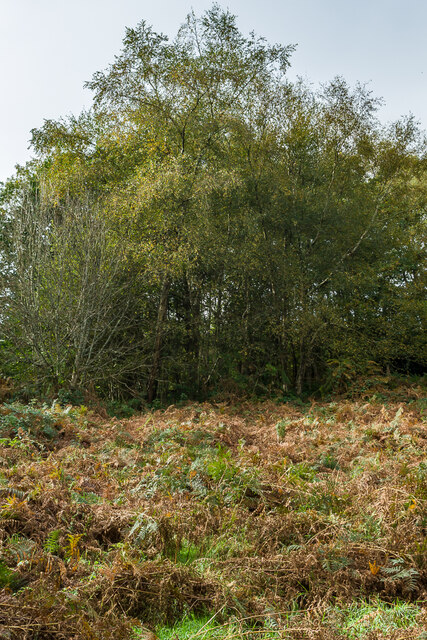
Furze Field, located in Surrey, England, is a picturesque wood and forest area that showcases the natural beauty of the region. Covering an expansive area, it is a popular destination for nature enthusiasts and locals seeking a peaceful retreat away from the hustle and bustle of the city.
The woodland of Furze Field is characterized by its diverse range of trees, including oak, beech, and birch, which provide a vibrant display of colors throughout the year. The forest floor is adorned with an array of flora, such as bluebells and foxgloves, creating a stunning carpet of wildflowers during the spring and summer months.
The forest is home to a variety of wildlife, making it an ideal spot for birdwatching and wildlife observation. Visitors may catch glimpses of native species like deer, squirrels, and rabbits, as well as a myriad of bird species that inhabit the area.
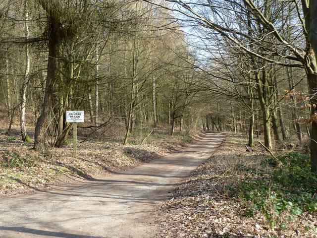
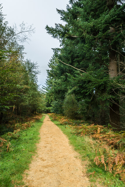
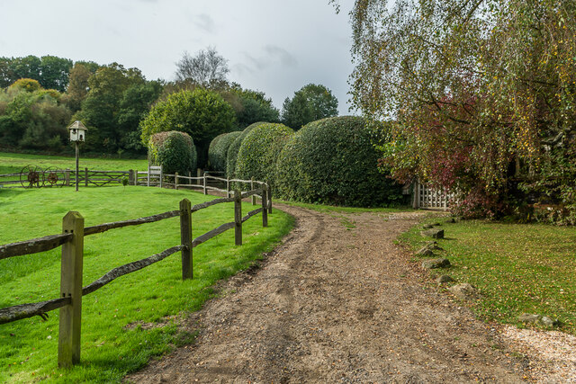
Furze Field offers numerous trails and pathways that wind through the woodland, allowing visitors to explore its natural wonders. These paths cater to both hikers and cyclists, offering a range of difficulty levels to accommodate different fitness levels and preferences.
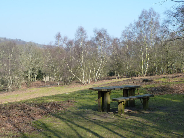
In addition to its natural charm, Furze Field provides several amenities for visitors' convenience. Adequate parking facilities are available, and there are picnic areas where visitors can relax and enjoy a meal surrounded by the serene beauty of the forest.
Overall, Furze Field in Surrey is a hidden gem that offers a peaceful and refreshing escape into nature, providing visitors with an opportunity to reconnect with the natural world and enjoy its breathtaking beauty.
If you have any feedback on the listing, please let us know in the comments section below.
Furze Field Images
Images are sourced within 2km of 51.216118/-0.38703686 or Grid Reference TQ1247. Thanks to Geograph Open Source API. All images are credited.


Furze Field is located at Grid Ref: TQ1247 (Lat: 51.216118, Lng: -0.38703686)
Administrative County: Surrey
District: Mole Valley
Police Authority: Surrey
What 3 Words
///drill.desk.create. Near Westcott, Surrey
Nearby Locations
Related Wikis

Wotton, Surrey
Wotton is a well-wooded parish with one main settlement, a small village mostly south of the A25 between Guildford in the west and Dorking in the east...

Wotton House, Surrey
Wotton House is a hotel, wedding venue, conference centre and former country house in Wotton near Dorking, Surrey, England. Originally the centre of the...
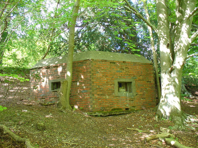
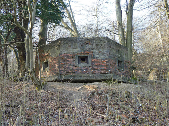
Outer London Defence Ring
The Outer London Defence Ring was a defensive ring built around London during the early part of the Second World War. It was intended as a defence against...

Abinger
Abinger is a large, well-wooded and mostly rural civil parish that lies between the settlements of Dorking, Shere and Ewhurst in the district of Mole Valley...

Hackhurst and White Downs
Hackhurst and White Downs is a 185.1-hectare (457-acre) biological Site of Special Scientific Interest west of Dorking in Surrey. White Downs is a Nature...

Westcott, Surrey
Westcott is a village in central Surrey, England, about 1.5 miles (2.5 km) west of the centre of Dorking. It is in the Mole Valley district and the Surrey...
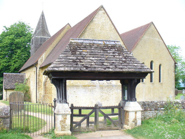
St James's Church, Abinger Common
St James's Church stands on Abinger Lane in Abinger Common, a small village within the civil parish of Abinger in Surrey, south-eastern England. The church...

Friday Street
Friday Street is a hamlet on the gentle lower north slope of Leith Hill in Surrey, England. It is in a wooded headwater ravine, just to the south of Wotton...
Nearby Amenities
Located within 500m of 51.216118,-0.38703686Have you been to Furze Field?
Leave your review of Furze Field below (or comments, questions and feedback).