Burnthouse Copse

Wood, Forest in Surrey Mole Valley

England

Burnthouse Copse

Leith Hill - Rhododendron A common shrub on Leith Hill, part of the Greensand Ridge.
Leith Hill - Rhododendron Credit: Colin Smith

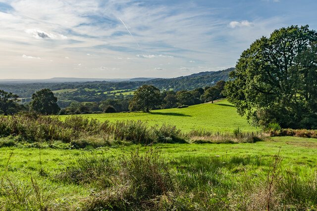
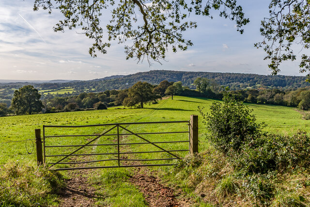
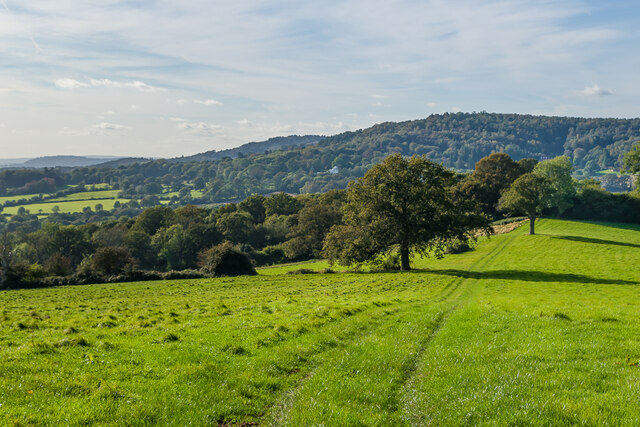
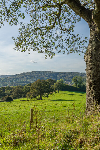
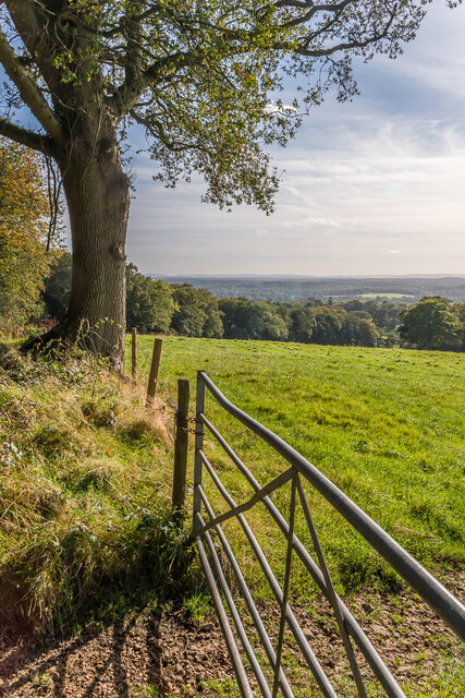
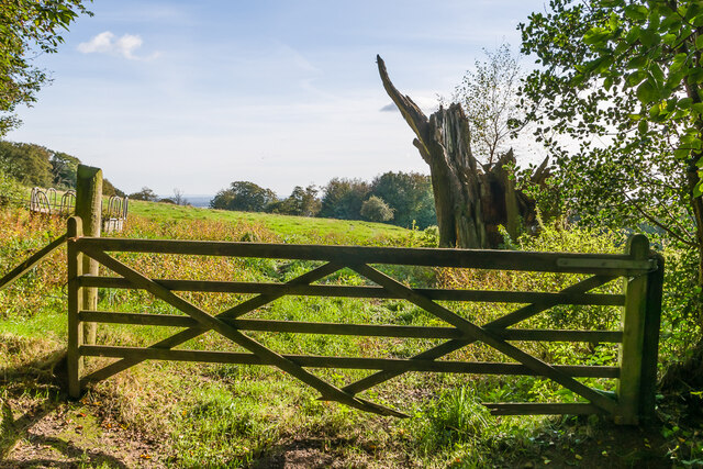
Burnthouse Copse is a picturesque woodland located in Surrey, England. Situated near the village of Shackleford, this charming forest covers an area of approximately 90 acres. The copse is primarily made up of deciduous trees, including oak, beech, and silver birch, creating a diverse and enchanting landscape.

As visitors enter Burnthouse Copse, they are immediately greeted by a tranquil atmosphere and a sense of seclusion. The woodland is crisscrossed with a network of well-maintained footpaths, allowing visitors to easily explore the area and enjoy the beauty of nature. Walking through the copse, one can experience the peacefulness of the surrounding environment, with the sounds of birdsong and rustling leaves filling the air.

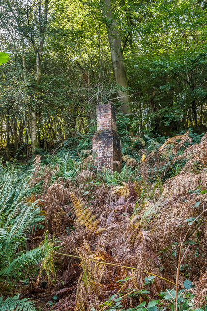
In addition to its natural beauty, Burnthouse Copse is also known for its rich biodiversity. The forest is home to a variety of wildlife, including deer, foxes, and a wide range of bird species. It is not uncommon to spot woodpeckers or hear the distinctive call of a tawny owl while exploring the woodland.

The copse is a popular destination for nature enthusiasts, walkers, and families seeking a peaceful retreat. The open meadows within the woodland provide ideal picnic spots, and there are designated areas for camping and barbecues. Additionally, the copse offers a variety of educational opportunities, with informative signs and boards placed throughout the area to guide visitors and provide insights into the local flora and fauna.

In conclusion, Burnthouse Copse is a natural gem in the heart of Surrey, offering visitors the chance to immerse themselves in the beauty of a well-preserved woodland. With its diverse tree species, abundant wildlife, and peaceful atmosphere, it is an ideal destination for anyone seeking solace and tranquility in nature.

If you have any feedback on the listing, please let us know in the comments section below.

Burnthouse Copse Images

Images are sourced within 2km of 51.178265/-0.39076173 or Grid Reference TQ1243. Thanks to Geograph Open Source API. All images are credited.

Leith Hill - Rhododendron A common shrub on Leith Hill, part of the Greensand Ridge.
Leith Hill - Rhododendron
A common shrub on Leith Hill, part of the Greensand Ridge.
West from near Tanhurst Looking west from near Tanhurst, on the western slopes of Leith Hill.  In the far distance is Black Down.
West from near Tanhurst
Looking west from near Tanhurst, on the western slopes of Leith Hill. In the far distance is Black Down.
West from near Tanhurst Looking west from near Tanhurst, on the western slopes of Leith Hill.  In the distance is Holmbury Hill.
West from near Tanhurst
Looking west from near Tanhurst, on the western slopes of Leith Hill. In the distance is Holmbury Hill.
West from near Tanhurst Looking west from near Tanhurst, on the western slopes of Leith Hill.  In the distance is Holmbury Hill.
West from near Tanhurst
Looking west from near Tanhurst, on the western slopes of Leith Hill. In the distance is Holmbury Hill.
West from near Tanhurst Looking west from near Tanhurst, on the western slopes of Leith Hill.  In the distance is Holmbury Hill.
West from near Tanhurst
Looking west from near Tanhurst, on the western slopes of Leith Hill. In the distance is Holmbury Hill.
South from near Tanhurst Looking south from near Tanhurst, on the western slopes of Leith Hill.  In the far distance are the South Downs.
South from near Tanhurst
Looking south from near Tanhurst, on the western slopes of Leith Hill. In the far distance are the South Downs.
South from above Tanhurst Looking south from above Tanhurst, on the western slopes of Leith Hill.
South from above Tanhurst
Looking south from above Tanhurst, on the western slopes of Leith Hill.
Drinking trough Drinking trough and fountain near the summit of Leith Hill.  Originally installed in Roehampton Vale, Wandsworth, by the Metropolitan Drinking Fountain and Cattle Trough Association, it was moved here in July 2018 with the support of the charity (now known as The Drinking Fountain Association).
Drinking trough
Drinking trough and fountain near the summit of Leith Hill. Originally installed in Roehampton Vale, Wandsworth, by the Metropolitan Drinking Fountain and Cattle Trough Association, it was moved here in July 2018 with the support of the charity (now known as The Drinking Fountain Association).
Leith Hill Tower Tower on the summit of Leith Hill, built in 1774-5 with the stair turret added in 1864.  Grade II listed - see <span class="nowrap"><a title="www.historicengland.org.uk/listing/the-list/list-entry/1028808" rel="nofollow ugc noopener" href="http://www.historicengland.org.uk/listing/the-list/list-entry/1028808">Link</a><img style="margin-left:2px;" alt="External link" title="External link - shift click to open in new window" src="https://s1.geograph.org.uk/img/external.png" width="10" height="10"/></span>.
Leith Hill Tower
Tower on the summit of Leith Hill, built in 1774-5 with the stair turret added in 1864. Grade II listed - see LinkExternal link.
Leith Hill summit The summit of Leith Hill, with the drinking trough installed in 2018 on the left (see <a href="https://www.geograph.org.uk/photo/6994981">TQ1343 : Drinking trough</a> and Leith Hill Tower in the background (see <a href="https://www.geograph.org.uk/photo/6994999">TQ1343 : Leith Hill Tower</a>).
Leith Hill summit
The summit of Leith Hill, with the drinking trough installed in 2018 on the left (see TQ1343 : Drinking trough and Leith Hill Tower in the background (see TQ1343 : Leith Hill Tower).
Bridleway Bridleway south of Broadmoor.
Bridleway
Bridleway south of Broadmoor.
Chimney What looks like the only remnant of a cottage or other building among bracken south of Broadmoor.  Current and old maps show the outline of a building here, with a small reservoir marked nearby and the 1914 1:2,500 map referring to two hydraulic rams, suggesting it may be connected with water supply.
Chimney
What looks like the only remnant of a cottage or other building among bracken south of Broadmoor. Current and old maps show the outline of a building here, with a small reservoir marked nearby and the 1914 1:2,500 map referring to two hydraulic rams, suggesting it may be connected with water supply.
Moss covered structure A moss covered block south of Broadmoor, by what is marked on large scale mapping  as a reservoir.  In the background is the chimney in <a href="https://www.geograph.org.uk/photo/7011396">TQ1344 : Chimney</a> and <a href="https://www.geograph.org.uk/photo/7011401">TQ1344 : Chimney</a>.
Moss covered structure
A moss covered block south of Broadmoor, by what is marked on large scale mapping as a reservoir. In the background is the chimney in TQ1344 : Chimney and TQ1344 : Chimney.
Track junction Track junction below Sheephouse Lane, with the one on the right leading to Shootlands Farm and that on the left to Broadmoor.
Track junction
Track junction below Sheephouse Lane, with the one on the right leading to Shootlands Farm and that on the left to Broadmoor.
Path junction Path junction below Sheephouse Lane.
Path junction
Path junction below Sheephouse Lane.
Wotton Barn House on Sheephouse Lane.
Wotton Barn
House on Sheephouse Lane.
Sheephouse Lane Looking along Sheephouse Lane with the entrance to Leyland's Farm on the left.
Sheephouse Lane
Looking along Sheephouse Lane with the entrance to Leyland's Farm on the left.
Show me another place!

Burnthouse Copse is located at Grid Ref: TQ1243 (Lat: 51.178265, Lng: -0.39076173)

Administrative County: Surrey

District: Mole Valley

Police Authority: Surrey

What 3 Words

///blunt.locals.union. Near Peaslake, Surrey

Related Wikis

Leith Hill SSSI

Leith Hill SSSI is a 337.9-hectare (835-acre) biological Site of Special Scientific Interest south-east of Dorking in Surrey. The SSSI consists of four...

Leith Hill

Leith Hill in southern England is the highest summit of the Greensand Ridge, approximately 6.7 km (4 mi) southwest of Dorking, Surrey and 40.5 km (30 mi...

Leith Hill multiple aircraft accident

On 26 November 1944, four C-47 transport aircraft of the 442nd Operations Group departed from Advanced Landing Ground "A-4 in Pays de la Loire, northern...

Belmont School, Surrey

Belmont is an independent co-educational school in Surrey which takes pupils from the ages of 3 to 16. The school is a charitable trust, administered...

Holmbury St Mary

Holmbury St Mary is a village in Surrey, England centered on shallow upper slopes of the Greensand Ridge. Its developed area is a nucleated village, 4...

Joldwynds

Joldwynds is a modernist style house in Holmbury St Mary, Surrey, England, designed by architect Oliver Hill for Wilfred Greene, 1st Baron Greene. Completed...

Greensand Ridge

The Greensand Ridge, also known as the Wealden Greensand, is an extensive, prominent, often wooded, mixed greensand/sandstone escarpment in south-east...

Holmbury Hill

Holmbury Hill is a wooded area of 261 metres (856 ft) above sea level in Surrey, England, and the site of an Iron Age-period hillfort. The Old Saxon word...

Nearby Amenities

Located within 500m of 51.178265,-0.39076173
Note: bridleway continues
Lat/Long: 51.1738875/-0.3904598
Highashes Farm
Landuse: farm
Note Retag: CS #48756035
Source: npe
Lat/Long: 51.1806989/-0.3888283
Parking
Operator: National Trust
Operator Type: charitable
Operator Wikidata: Q333515
Toilets Wheelchair: no
Wheelchair: no
Wheelchair Description: Small car park, usually very muddy and rutted.
Lat/Long: 51.1769889/-0.3840869
The data included in this document is from www.openstreetmap.org. The data is made available under ODbL.

Have you been to Burnthouse Copse?

Leave your review of Burnthouse Copse below (or comments, questions and feedback).