Buildings Copse

Wood, Forest in Surrey Mole Valley

England

Buildings Copse

Leith Hill - Rhododendron A common shrub on Leith Hill, part of the Greensand Ridge.
Leith Hill - Rhododendron Credit: Colin Smith

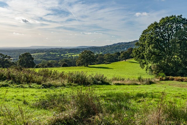
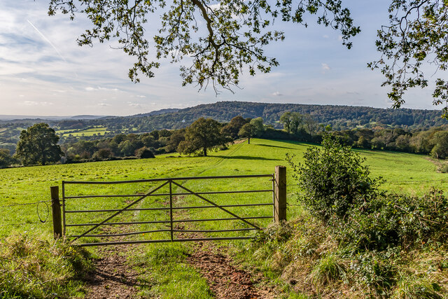
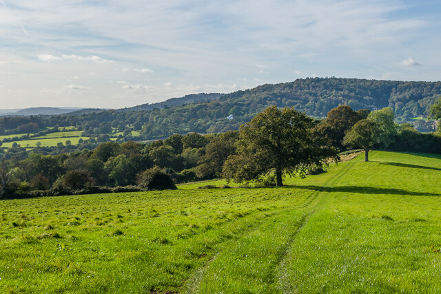
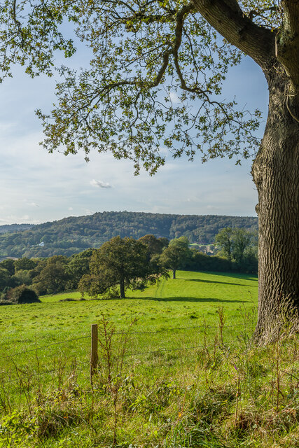
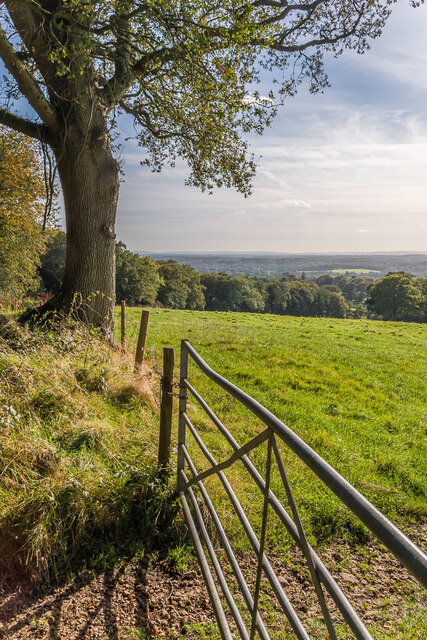
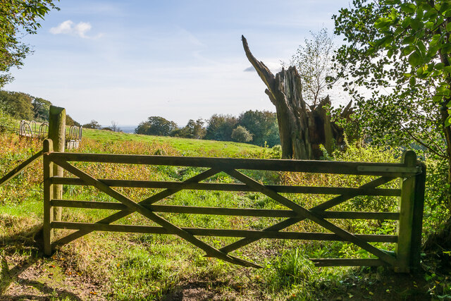
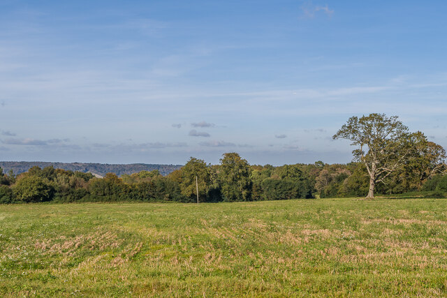
Buildings Copse is a picturesque woodland area located in Surrey, England. Situated amidst the stunning natural beauty of the county, it is a popular destination for nature enthusiasts and hikers alike. The copse is part of an extensive network of woodlands that form the Surrey Hills Area of Outstanding Natural Beauty.

With an area covering several hectares, Buildings Copse boasts a diverse range of flora and fauna. The woodland consists primarily of native tree species such as oak, beech, and ash, creating a dense canopy that provides ample shade and shelter for the various creatures that call this place home. Bluebells, wood sorrel, and wild garlic are some of the wildflowers that carpet the forest floor during spring, creating a stunning display of colors.

The copse is crisscrossed by a network of well-maintained footpaths and trails, making it easy for visitors to explore and enjoy the tranquil surroundings. The pathways wind their way through the woodland, offering glimpses of the nearby hills and valleys that make up the Surrey landscape.

Birdwatchers will find Buildings Copse a haven for avian species, as it attracts a wide variety of birds including woodpeckers, warblers, and owls. The dense foliage provides nesting sites, and the copse is a popular spot for migratory birds to rest and refuel during their journeys.

Overall, Buildings Copse is a haven of natural beauty and tranquility in the heart of Surrey. Its diverse ecosystem, scenic trails, and abundant wildlife make it a must-visit destination for anyone seeking solace in nature.

If you have any feedback on the listing, please let us know in the comments section below.

Buildings Copse Images

Images are sourced within 2km of 51.175898/-0.3919314 or Grid Reference TQ1243. Thanks to Geograph Open Source API. All images are credited.

Leith Hill - Rhododendron A common shrub on Leith Hill, part of the Greensand Ridge.
Leith Hill - Rhododendron
A common shrub on Leith Hill, part of the Greensand Ridge.
West from near Tanhurst Looking west from near Tanhurst, on the western slopes of Leith Hill.  In the far distance is Black Down.
West from near Tanhurst
Looking west from near Tanhurst, on the western slopes of Leith Hill. In the far distance is Black Down.
West from near Tanhurst Looking west from near Tanhurst, on the western slopes of Leith Hill.  In the distance is Holmbury Hill.
West from near Tanhurst
Looking west from near Tanhurst, on the western slopes of Leith Hill. In the distance is Holmbury Hill.
West from near Tanhurst Looking west from near Tanhurst, on the western slopes of Leith Hill.  In the distance is Holmbury Hill.
West from near Tanhurst
Looking west from near Tanhurst, on the western slopes of Leith Hill. In the distance is Holmbury Hill.
West from near Tanhurst Looking west from near Tanhurst, on the western slopes of Leith Hill.  In the distance is Holmbury Hill.
West from near Tanhurst
Looking west from near Tanhurst, on the western slopes of Leith Hill. In the distance is Holmbury Hill.
South from near Tanhurst Looking south from near Tanhurst, on the western slopes of Leith Hill.  In the far distance are the South Downs.
South from near Tanhurst
Looking south from near Tanhurst, on the western slopes of Leith Hill. In the far distance are the South Downs.
South from above Tanhurst Looking south from above Tanhurst, on the western slopes of Leith Hill.
South from above Tanhurst
Looking south from above Tanhurst, on the western slopes of Leith Hill.
Drinking trough Drinking trough and fountain near the summit of Leith Hill.  Originally installed in Roehampton Vale, Wandsworth, by the Metropolitan Drinking Fountain and Cattle Trough Association, it was moved here in July 2018 with the support of the charity (now known as The Drinking Fountain Association).
Drinking trough
Drinking trough and fountain near the summit of Leith Hill. Originally installed in Roehampton Vale, Wandsworth, by the Metropolitan Drinking Fountain and Cattle Trough Association, it was moved here in July 2018 with the support of the charity (now known as The Drinking Fountain Association).
Leith Hill Tower Tower on the summit of Leith Hill, built in 1774-5 with the stair turret added in 1864.  Grade II listed - see <span class="nowrap"><a title="www.historicengland.org.uk/listing/the-list/list-entry/1028808" rel="nofollow ugc noopener" href="http://www.historicengland.org.uk/listing/the-list/list-entry/1028808">Link</a><img style="margin-left:2px;" alt="External link" title="External link - shift click to open in new window" src="https://s1.geograph.org.uk/img/external.png" width="10" height="10"/></span>.
Leith Hill Tower
Tower on the summit of Leith Hill, built in 1774-5 with the stair turret added in 1864. Grade II listed - see LinkExternal link.
Leith Hill summit The summit of Leith Hill, with the drinking trough installed in 2018 on the left (see <a href="https://www.geograph.org.uk/photo/6994981">TQ1343 : Drinking trough</a> and Leith Hill Tower in the background (see <a href="https://www.geograph.org.uk/photo/6994999">TQ1343 : Leith Hill Tower</a>).
Leith Hill summit
The summit of Leith Hill, with the drinking trough installed in 2018 on the left (see TQ1343 : Drinking trough and Leith Hill Tower in the background (see TQ1343 : Leith Hill Tower).
Track junction Track junction below Sheephouse Lane, with the one on the right leading to Shootlands Farm and that on the left to Broadmoor.
Track junction
Track junction below Sheephouse Lane, with the one on the right leading to Shootlands Farm and that on the left to Broadmoor.
Path junction Path junction below Sheephouse Lane.
Path junction
Path junction below Sheephouse Lane.
Wotton Barn House on Sheephouse Lane.
Wotton Barn
House on Sheephouse Lane.
Sheephouse Lane Looking along Sheephouse Lane with the entrance to Leyland's Farm on the left.
Sheephouse Lane
Looking along Sheephouse Lane with the entrance to Leyland's Farm on the left.
Paddock Paddock north of Leyland's Farm.
Paddock
Paddock north of Leyland's Farm.
King George's Cottage Looking across a field to King George's Cottage, originally a terrace of 4 farmworkers' cottages, now a single house.  The name refers to the hamlet in which it is situated, known in the past as King George's Hill, itself named after a long gone pub (according to "A History of the County of Surrey" - Victoria County History, 1911).
King George's Cottage
Looking across a field to King George's Cottage, originally a terrace of 4 farmworkers' cottages, now a single house. The name refers to the hamlet in which it is situated, known in the past as King George's Hill, itself named after a long gone pub (according to "A History of the County of Surrey" - Victoria County History, 1911).
Lemon's Farm Looking across a field to Lemon's Farm, with the North Downs in the distance.
Lemon's Farm
Looking across a field to Lemon's Farm, with the North Downs in the distance.
Field Field west of Sheephouse Lane, with the North Downs in the distance.
Field
Field west of Sheephouse Lane, with the North Downs in the distance.
Show me another place!

Buildings Copse is located at Grid Ref: TQ1243 (Lat: 51.175898, Lng: -0.3919314)

Administrative County: Surrey

District: Mole Valley

Police Authority: Surrey

What 3 Words

///deck.loaded.muddy. Near Ewhurst, Surrey

Related Wikis

Greensand Way

The Greensand Way is a long-distance path of 108 miles (174 km) in southeast England, from Haslemere in Surrey to Hamstreet in Kent. It follows the Greensand...

Leith Hill SSSI

Leith Hill SSSI is a 337.9-hectare (835-acre) biological Site of Special Scientific Interest south-east of Dorking in Surrey. The SSSI consists of four...

Leith Hill

Leith Hill in southern England is the highest summit of the Greensand Ridge, approximately 6.7 km (4 mi) southwest of Dorking, Surrey and 40.5 km (30 mi...

Leith Hill multiple aircraft accident

On 26 November 1944, four C-47 transport aircraft of the 442nd Operations Group departed from Advanced Landing Ground "A-4 in Pays de la Loire, northern...

Joldwynds

Joldwynds is a modernist style house in Holmbury St Mary, Surrey, England, designed by architect Oliver Hill for Wilfred Greene, 1st Baron Greene. Completed...

Holmbury St Mary

Holmbury St Mary is a village in Surrey, England centered on shallow upper slopes of the Greensand Ridge. Its developed area is a nucleated village, 4...

Belmont School, Surrey

Belmont is an independent co-educational school in Surrey which takes pupils from the ages of 3 to 16. The school is a charitable trust, administered...

Greensand Ridge

The Greensand Ridge, also known as the Wealden Greensand, is an extensive, prominent, often wooded, mixed greensand/sandstone escarpment in south-east...

Nearby Amenities

Located within 500m of 51.175898,-0.3919314
Note: bridleway continues
Lat/Long: 51.1738875/-0.3904598
Tanhurst
Place: isolated_dwelling
Source: npe
Wikidata: Q26581905
Lat/Long: 51.1743149/-0.3867235
The data included in this document is from www.openstreetmap.org. The data is made available under ODbL.

Have you been to Buildings Copse?

Leave your review of Buildings Copse below (or comments, questions and feedback).