Fir Copse

Wood, Forest in Surrey Mole Valley

England

Fir Copse

North Downs bus at Forest Green - 1972 North Downs Rural Transport was a small company which ran a bus service between Guildford and Forest Green or Horsham. This view shows one of their buses at the company's operating base, consisting of a large shed to the rear of the house in the picture. It was undergoing maintenance and is missing its front panel and registration plate. It is an Albion Nimbus with Weymann body new to Western Welsh (reg.WKG34) in 1961.

This is one of a series of views featuring buses in the 60s, 70s, and 80s. <a title="https://www.geograph.org.uk/search.php?i=137652761" href="https://www.geograph.org.uk/search.php?i=137652761">Link</a>
North Downs bus at Forest Green - 1972 Credit: Alan Murray-Rust

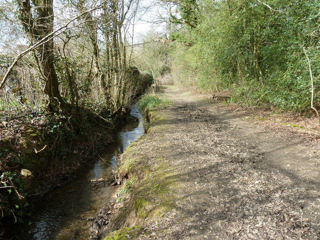
Fir Copse, located in Surrey, England, is a picturesque wood or forest that spans over a significant area. The copse is primarily composed of fir trees, which give it its name. These tall evergreen trees dominate the landscape and create a dense canopy that provides shade and shelter for various flora and fauna.

The forest floor of Fir Copse is covered with a carpet of lush green moss, adding to the enchanting ambiance. Beautiful wildflowers, such as bluebells and primroses, bloom among the undergrowth, creating a vibrant burst of colors during the spring and summer months.

The copse is also home to a diverse range of wildlife. The thick foliage and abundance of food sources attract a variety of bird species, including woodpeckers, jays, and thrushes. Small mammals like squirrels and rabbits can be spotted darting through the underbrush, while larger animals like deer and foxes occasionally make an appearance.

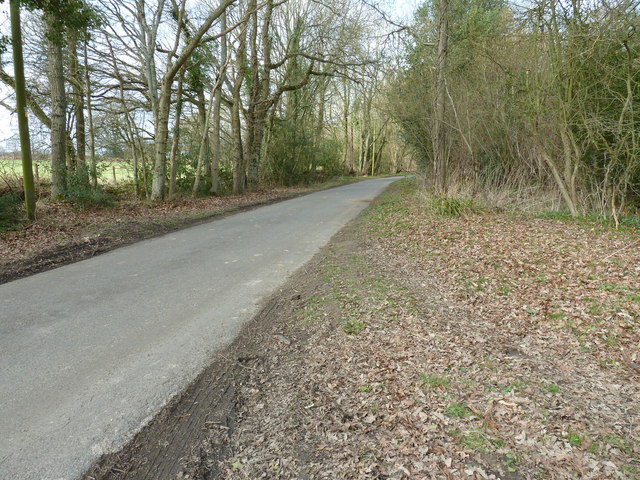
Visitors to Fir Copse can enjoy peaceful walks along the well-maintained trails that wind through the forest. The serenity of the surroundings makes it an ideal location for nature enthusiasts, hikers, and photographers. Additionally, the copse offers opportunities for educational activities and wildlife observation, making it a popular destination for school field trips and nature study groups.

Fir Copse is a true gem of Surrey, providing a tranquil escape from the bustling city life and offering a chance to connect with nature in its purest form.

If you have any feedback on the listing, please let us know in the comments section below.

Fir Copse Images

Images are sourced within 2km of 51.137816/-0.39665681 or Grid Reference TQ1238. Thanks to Geograph Open Source API. All images are credited.

North Downs bus at Forest Green - 1972 North Downs Rural Transport was a small company which ran a bus service between Guildford and Forest Green or Horsham. This view shows one of their buses at the company's operating base, consisting of a large shed to the rear of the house in the picture. It was undergoing maintenance and is missing its front panel and registration plate. It is an Albion Nimbus with Weymann body new to Western Welsh (reg.WKG34) in 1961.

This is one of a series of views featuring buses in the 60s, 70s, and 80s. <a title="https://www.geograph.org.uk/search.php?i=137652761" href="https://www.geograph.org.uk/search.php?i=137652761">Link</a>
North Downs bus at Forest Green - 1972
North Downs Rural Transport was a small company which ran a bus service between Guildford and Forest Green or Horsham. This view shows one of their buses at the company's operating base, consisting of a large shed to the rear of the house in the picture. It was undergoing maintenance and is missing its front panel and registration plate. It is an Albion Nimbus with Weymann body new to Western Welsh (reg.WKG34) in 1961. This is one of a series of views featuring buses in the 60s, 70s, and 80s. Link
Ives Farm, Forest Green. The country road to Forest Green from the south passes this farm sign which advertises a pedigree herd of Guernsey cows. These are prized for their milk.
Ives Farm, Forest Green.
The country road to Forest Green from the south passes this farm sign which advertises a pedigree herd of Guernsey cows. These are prized for their milk.
Lyefield Lane Looking up the hill just north of Little Ashes Copse.
Lyefield Lane
Looking up the hill just north of Little Ashes Copse.
Footpath to Forest Green Crossing a grassy field towards New Road houses off the Horsham Road.
Footpath to Forest Green
Crossing a grassy field towards New Road houses off the Horsham Road.
Woodland by Waterland Farm Deciduous wood with open undergrowth. Hawthorn hedge flowering on the right and some bluebells in the wood.
Woodland by Waterland Farm
Deciduous wood with open undergrowth. Hawthorn hedge flowering on the right and some bluebells in the wood.
Near Bridgham Farm Wealden landscape of grassy fields on clay soils interspersed with deciduous woodland.
Near Bridgham Farm
Wealden landscape of grassy fields on clay soils interspersed with deciduous woodland.
Bridgham Farm Wealden farm with several grassy paddocks and much horsieculture.
Bridgham Farm
Wealden farm with several grassy paddocks and much horsieculture.
By Lyefield Farm Footpath heading over a stile and across a grassy field lined by strips of woodland.
By Lyefield Farm
Footpath heading over a stile and across a grassy field lined by strips of woodland.
Near Lyefield Farm Sheep grazing on a clay soil field lined with deciduous woodland.
Near Lyefield Farm
Sheep grazing on a clay soil field lined with deciduous woodland.
Houses on New Road, Forest Green On the north side the somewhat older and smaller houses enjoyed an unrestricted southern aspect until a few larger houses were built on the south side.
Houses on New Road, Forest Green
On the north side the somewhat older and smaller houses enjoyed an unrestricted southern aspect until a few larger houses were built on the south side.
Steps Out of Line Holden Brook by Forest Green has been dammed here. However, after a long and dry spell, the stream is not flowing over the old cascading steps. These steps are now falling into a state of disrepair.
Steps Out of Line
Holden Brook by Forest Green has been dammed here. However, after a long and dry spell, the stream is not flowing over the old cascading steps. These steps are now falling into a state of disrepair.
Path to Gosterwood Manor Farm Well-surfaced and hedgerow-lined path leading east from the Horsham Road at Forest Green.
Path to Gosterwood Manor Farm
Well-surfaced and hedgerow-lined path leading east from the Horsham Road at Forest Green.
Woodland by the path to Forest Green
Footpath to Forest Green
Horsham Rd
Horsham Rd
The Old Police House, Forest Green
Stream beside bridleway to Castle Copse
Looking north on Mole Street Passing Castle Copse on the right, the road continues north to Leith Hill.
Looking north on Mole Street
Passing Castle Copse on the right, the road continues north to Leith Hill.
Show me another place!

Fir Copse is located at Grid Ref: TQ1238 (Lat: 51.137816, Lng: -0.39665681)

Administrative County: Surrey

District: Mole Valley

Police Authority: Surrey

What 3 Words

///maps.accompany.desk. Near Ewhurst, Surrey

Related Wikis

Wallis Wood

Wallis Wood is a 14-hectare (35-acre) nature reserve south-east of Ewhurst in Surrey. It is managed by the Surrey Wildlife Trust.A stream runs through...

Smokejack Clay Pit

Smokejack Clay Pit is a 56-hectare (140-acre) geological Site of Special Scientific Interest east of Cranleigh in Surrey. It is a Geological Conservation...

Ockley

Ockley is a rural village in Surrey. It lies astride the A29, the modern road using the alignment of Stane Street (Chichester). The A29 diverges from the...

Stane Street (Chichester)

Stane Street is the modern name of the 91 km-long (57 mi) Roman road in southern England that linked Londinium (London) to Noviomagus Reginorum (Chichester...

High Weald AONB

The High Weald Area of Outstanding Natural Beauty is in south-east England. Covering an area of 1,450 square kilometres (560 sq mi), it takes up parts...

Vann Lake and Ockley Woods

Vann Lake and Ockley Woods is a 57.8-hectare (143-acre) biological Site of Special Scientific Interest south of Ockley in Surrey. Vann Lake is part of...

Ewhurst, Surrey

Ewhurst is a rural village and civil parish in the borough of Waverley in Surrey, England. It is located 8.3 miles (13.4 km) south-east of Guildford,...

Greensand Ridge

The Greensand Ridge, also known as the Wealden Greensand, is an extensive, prominent, often wooded, mixed greensand/sandstone escarpment in south-east...

Nearby Amenities

Located within 500m of 51.137816,-0.39665681
Mayes Green
Bus: yes
Public Transport: stop_position
Lat/Long: 51.1418995/-0.3984378
Bus Stop
Mayes Green
Naptan AtcoCode: 40004408908A
Naptan Bearing: SW
Naptan CommonName: Mayes Green
Naptan Indicator: adj
Naptan Landmark: Mayes Green
Naptan NaptanCode: surdgjag
Naptan Street: Horsham Road
Naptan Verified: no
Physically Present: no
Public Transport: platform
Source: naptan_import
Lat/Long: 51.1418903/-0.3982793
Bus Stop
Mayes Green
Naptan AtcoCode: 40004408910A
Naptan Bearing: NE
Naptan CommonName: Mayes Green
Naptan Indicator: Opp
Naptan Landmark: Mayes Green
Naptan NaptanCode: surdgjam
Naptan Street: Horsham Road
Naptan Verified: no
Physically Present: no
Public Transport: platform
Source: naptan_import
Lat/Long: 51.1419032/-0.3985648
Barrier: stile
Lat/Long: 51.1366406/-0.3946069
Barrier: stile
Lat/Long: 51.1367144/-0.3944966
Barrier: stile
Lat/Long: 51.1364772/-0.4025526
Barrier: stile
Lat/Long: 51.1380064/-0.4025377
Barrier: stile
Lat/Long: 51.1393509/-0.4006151
Okewood Cottage
Place: isolated_dwelling
Source: OS_OpenData_StreetView
Lat/Long: 51.1355779/-0.3928474
Source: GPS
Tourism: information
Lat/Long: 51.1363076/-0.3950607
Post Box
Collection Times: Mo-Fr 09:00; Sa 07:00
Operator: Royal Mail
Post Box Mounting: pier
Post Box Type: lamp
Ref: RH5 35D
Royal Cypher: EIIR
Royal Cypher Wikidata: Q33102113
Lat/Long: 51.1420993/-0.3983603
Walliswood Green
Naptan AtcoCode: 40004408814F
Naptan NaptanCode: surdgdmt
Physically Present: no
Public Transport: platform
Lat/Long: 51.1354913/-0.4005128
Walliswood Green
Naptan AtcoCode: 40004408814E
Naptan NaptanCode: surdgdmp
Physically Present: no
Public Transport: platform
Lat/Long: 51.135408/-0.4004143
The data included in this document is from www.openstreetmap.org. The data is made available under ODbL.

Have you been to Fir Copse?

Leave your review of Fir Copse below (or comments, questions and feedback).