Lowen Wood

Wood, Forest in Huntingdonshire Huntingdonshire

England

Lowen Wood

Farm track alongside a barley field
Farm track alongside a barley field Credit: Jonathan Thacker

Lowen Wood, located in Huntingdonshire, is a serene and picturesque forest that spans over a vast area of land. The wood is known for its rich biodiversity and offers a plethora of natural delights for both nature enthusiasts and casual visitors alike.

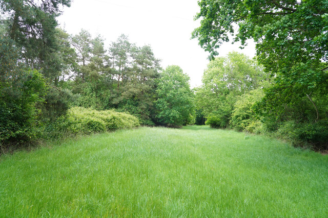
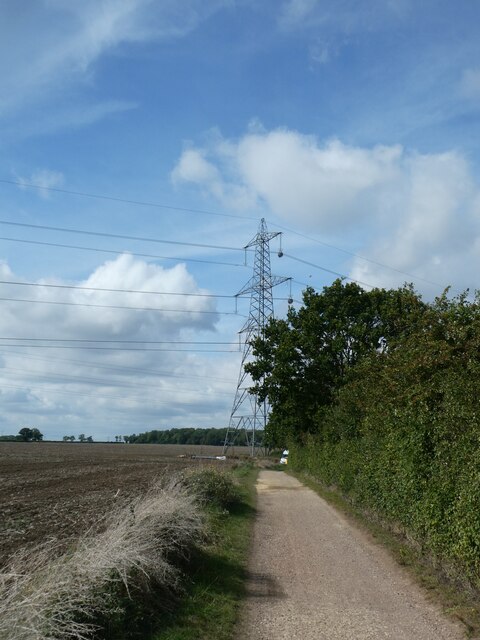
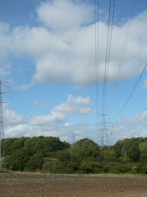
Covering an approximate area of 500 acres, Lowen Wood is predominantly made up of deciduous trees, including oak, ash, and birch. These trees create a dense canopy, providing a cool and shaded environment during the summer months. The forest floor is covered in a lush carpet of mosses, ferns, and wildflowers, adding to the beauty of the woodland.

The wood is home to a diverse range of wildlife, making it an ideal spot for birdwatching and animal spotting. Visitors may catch a glimpse of red deer, foxes, badgers, and various species of birds, including woodpeckers and owls. The tranquil atmosphere of Lowen Wood offers a peaceful escape from the hustle and bustle of everyday life, making it a popular destination for those seeking solitude and relaxation.

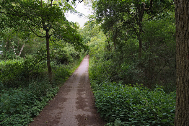
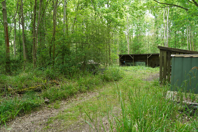
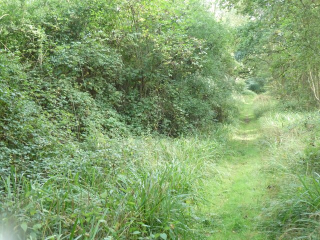
Several well-maintained walking trails wind their way through the wood, allowing visitors to explore its hidden gems. These trails vary in difficulty, catering to both casual strollers and avid hikers. Along the paths, there are numerous benches and picnic spots, providing opportunities to rest and take in the beauty of the surrounding nature.

Overall, Lowen Wood is a haven for nature lovers, offering a harmonious blend of captivating scenery and abundant wildlife. Its unique charm and tranquil ambiance make it a must-visit destination for anyone seeking solace in the heart of Huntingdonshire.

If you have any feedback on the listing, please let us know in the comments section below.

Lowen Wood Images

Images are sourced within 2km of 52.305359/-0.35502248 or Grid Reference TL1268. Thanks to Geograph Open Source API. All images are credited.

Farm track alongside a barley field
A woodland ride This may be a fire break or a woodland ride, but either way it does eventually lead to one of the many bird hides at this end of the reservoir.
A woodland ride
This may be a fire break or a woodland ride, but either way it does eventually lead to one of the many bird hides at this end of the reservoir.
Reeds in front of the hide The reed bed had a number of Dragon flies flitting back and forth but there were very few birds to be seen.
Reeds in front of the hide
The reed bed had a number of Dragon flies flitting back and forth but there were very few birds to be seen.
The cycle track aounf Grafham Water There were very few cyclists riding along the path / track which made for easier walking.
The cycle track aounf Grafham Water
There were very few cyclists riding along the path / track which made for easier walking.
Charcoal burners' huts We were surprised when we came across these huts which had two or three charcoal burning steel drums and lids. None of them was active as we walked by.
Charcoal burners' huts
We were surprised when we came across these huts which had two or three charcoal burning steel drums and lids. None of them was active as we walked by.
Cycle route in south-west corner of Grafham Water
Cycle route near Grafham Water and electricity pylon The pylon has temporary pulleys for new cables, which were being slowly pulled into place. See note at <a href="https://www.geograph.org.uk/photo/7649819">TL1366 : Replacing electricity cables west of Perry</a>
Cycle route near Grafham Water and electricity pylon
The pylon has temporary pulleys for new cables, which were being slowly pulled into place. See note at TL1366 : Replacing electricity cables west of Perry
Replacing electricity cables near Grafham Water See note at <a href="https://www.geograph.org.uk/photo/7649819">TL1366 : Replacing electricity cables west of Perry</a>
Replacing electricity cables near Grafham Water
Path into nature reserve, Littless Wood, Grafham Water
Pylons north of Littless Wood The pylon has temporary pulleys for new cables, which were being slowly pulled into place.
Pylons north of Littless Wood
The pylon has temporary pulleys for new cables, which were being slowly pulled into place.
Cycle route in Savage's Spinney, Grafham Water
Grafham Water
Grafham Water
Leaving Stonely on Easton Road
Spring in field near Kimbolton Of old there were three springs mapped in this field along a spring line. This, the easternmost, is the only one with visible remains, although it does not look very wet. There was also a 'fountain' further to the west which survives as a small building that looks recently renovated.
Spring in field near Kimbolton
Of old there were three springs mapped in this field along a spring line. This, the easternmost, is the only one with visible remains, although it does not look very wet. There was also a 'fountain' further to the west which survives as a small building that looks recently renovated.
Easton Road Bigram's Farm is ahead.
Easton Road
Bigram's Farm is ahead.
Hunts Kart Racing Club circuit A meeting was in progress.
Hunts Kart Racing Club circuit
A meeting was in progress.
Bigram's Lane meets Stow Road The roads are in the middle of what used to be RAF Kimbolton. The roads were here before the WWII airfield was built, but were reinstated on straighter routes afterwards.
Bigram's Lane meets Stow Road
The roads are in the middle of what used to be RAF Kimbolton. The roads were here before the WWII airfield was built, but were reinstated on straighter routes afterwards.
Path at Savage's Spinney, Grafham Water Grafham Water is a reservoir in Cambridgeshire. It was built in 1965 and has a 
Surface area of 6.28 km² (1,550 acres). It is the eighth largest reservoir in England by volume and the third largest by area. It was designated a Site of Special Scientific Interest (SSSI) in 1986.
The spinney is part of the Grafham Water Nature Reserve.
Path at Savage's Spinney, Grafham Water
Grafham Water is a reservoir in Cambridgeshire. It was built in 1965 and has a Surface area of 6.28 km² (1,550 acres). It is the eighth largest reservoir in England by volume and the third largest by area. It was designated a Site of Special Scientific Interest (SSSI) in 1986. The spinney is part of the Grafham Water Nature Reserve.
Show me another place!

Lowen Wood is located at Grid Ref: TL1268 (Lat: 52.305359, Lng: -0.35502248)

Administrative County: Cambridgeshire

District: Huntingdonshire

Police Authority: Cambridgeshire

What 3 Words

///blocks.kick.finishers. Near Kimbolton, Cambridgeshire

Nearby Locations

Lowen Wood

Related Wikis

Stonely Priory

Stonely Priory was an Augustinian priory in Cambridgeshire, England. It was dissolved in 1536. == History == A tradition recorded by Leland hold that the...

Kimbolton, Cambridgeshire

Kimbolton is a town and civil parish in the Huntingdonshire district of Cambridgeshire, England. Kimbolton is about 9 miles (14 km) west of Huntingdon...
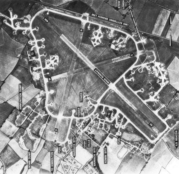
RAF Kimbolton

Royal Air Force Kimbolton or more simply RAF Kimbolton is a former Royal Air Force station located 8 miles (13 km) west of Huntingdon, Cambridgeshire,...

Stonely

Stonely is a hamlet next to Kimbolton in Cambridgeshire, England. It is part of the parish of Kimbolton and Stonely. The hamlet was formerly the site...

Shepherd's Close

Shepherd's Close is a 1.2-hectare (3.0-acre) nature reserve south of Spaldwick in Cambridgeshire. It is managed by the Wildlife Trust for Bedfordshire...

Kimbolton School

Kimbolton School is a British HMC co-educational private boarding and day school in the village of Kimbolton, Cambridgeshire, England. There are 1000...
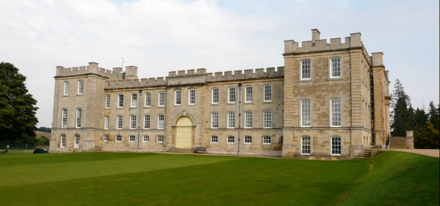
Kimbolton Castle

Kimbolton Castle is a country house in Kimbolton, Cambridgeshire, England. It was the final home of King Henry VIII's first wife, Catherine of Aragon....

Perry Woods

Perry Woods is a 67.9-hectare (168-acre) biological Site of Special Scientific Interest south-east of Kimbolton in Cambridgeshire. It is composed of three...

Nearby Amenities

Located within 500m of 52.305359,-0.35502248
Created By: Merkaartor 0.12
Lat/Long: 52.3084589/-0.360128
The data included in this document is from www.openstreetmap.org. The data is made available under ODbL.

Have you been to Lowen Wood?

Leave your review of Lowen Wood below (or comments, questions and feedback).