Grassy Copse

Wood, Forest in Sussex Horsham

England

Grassy Copse

Sharp bend on Wooddale Lane Alongside Duckmoor Copse.
Sharp bend on Wooddale Lane Credit: Dave Spicer

Grassy Copse is a picturesque woodland located in the county of Sussex, England. Nestled in the heart of the South Downs National Park, it covers an area of approximately 50 acres and is known for its lush green meadows and diverse range of trees.

The woodland is predominantly made up of deciduous trees, including oak, beech, and ash, which create a dense canopy overhead, providing shade and shelter for a variety of wildlife. The forest floor is covered in a thick carpet of grasses, hence the name "Grassy Copse," and is dotted with colorful wildflowers during the spring and summer months.

The woodland is crisscrossed by a network of well-maintained footpaths, allowing visitors to explore its natural beauty at their leisure. These paths lead to secluded glades and hidden clearings, perfect for picnics or simply enjoying the tranquility of the surroundings.

Grassy Copse is a haven for wildlife, attracting a wide range of species. Birdwatchers can spot woodpeckers, thrushes, and owls, while the more observant visitor may catch a glimpse of deer, foxes, or even the elusive badger. The woodland also boasts a diverse array of insect life, including butterflies and bees.

In addition to its natural beauty, Grassy Copse is also of historical significance. It is believed to have been used for timber production as far back as the medieval period, and remnants of old charcoal pits can still be found within the woodland.

Overall, Grassy Copse is a stunning woodland retreat, offering visitors the opportunity to immerse themselves in nature and experience the tranquility of the Sussex countryside.

If you have any feedback on the listing, please let us know in the comments section below.

Grassy Copse Images

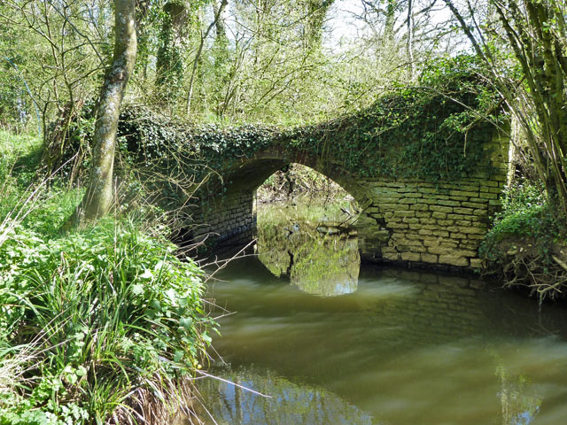
Images are sourced within 2km of 51.023567/-0.40754548 or Grid Reference TQ1126. Thanks to Geograph Open Source API. All images are credited.

Sharp bend on Wooddale Lane Alongside Duckmoor Copse.
Sharp bend on Wooddale Lane
Alongside Duckmoor Copse.
Footpath going east off Wooddale Lane
A Large ploughed field north of Rowfold Grange
A Large ploughed field north of Rowfold Grange (2)
A Large ploughed field north of Rowfold Grange (3)
Rowfold Grange Postbox, A272, entrance to Rowfold Grange Postbox No.RH14 19
Rowfold Grange Postbox, A272, entrance to Rowfold Grange
Postbox No.RH14 19
Garden Cottage, A272
A272 heading south
A272 heading south
Rowfold Lodge by the A272
View north across fields west of Madgeland Farm It had begun to rain lightly when I took this shot.
View north across fields west of Madgeland Farm
It had begun to rain lightly when I took this shot.
Crumbling bridge This bridge carrying a farm track and Bridleway 1911 over a young River Adur could be in better repair.
Crumbling bridge
This bridge carrying a farm track and Bridleway 1911 over a young River Adur could be in better repair.
An empty manger Over the hedge from West Chiltington Lane.
An empty manger
Over the hedge from West Chiltington Lane.
Pond near footpath 1466/2 There is another pond, just visible beyond the reedmace.
Pond near footpath 1466/2
There is another pond, just visible beyond the reedmace.
Bridleway 1476 heads south No dedicated bridleway gates are provided on this stretch, full farm gates have to be opened.
Bridleway 1476 heads south
No dedicated bridleway gates are provided on this stretch, full farm gates have to be opened.
Woodhouse Farm Clearly not the original farmhouse, and at some remove from the farm buildings.
Woodhouse Farm
Clearly not the original farmhouse, and at some remove from the farm buildings.
Blackthorn blossom by the junction Looking back from the start of the eastern section of footpath 1921, where it leaves bridleway 1918. The western section of 1921 leaves the bridleway just through the gate.
Blackthorn blossom by the junction
Looking back from the start of the eastern section of footpath 1921, where it leaves bridleway 1918. The western section of 1921 leaves the bridleway just through the gate.
Swifts Farm by the railway Viewed from bridge TBH1 371. TBH stands for Three Bridges to Havant, the 1 being the section prior to Arundel Junction North. The next station in this direction is Billingshurst.
Swifts Farm by the railway
Viewed from bridge TBH1 371. TBH stands for Three Bridges to Havant, the 1 being the section prior to Arundel Junction North. The next station in this direction is Billingshurst.
Private wind turbine at Rowfold Grange Ideally situated on a small knoll.
Private wind turbine at Rowfold Grange
Ideally situated on a small knoll.
Show me another place!

Grassy Copse is located at Grid Ref: TQ1126 (Lat: 51.023567, Lng: -0.40754548)

Administrative County: West Sussex

District: Horsham

Police Authority: Sussex

What 3 Words

///troll.breath.disco. Near Billingshurst, West Sussex

Related Wikis

Billingshurst (electoral division)

Billingshurst is an electoral division of West Sussex in the United Kingdom and returns one member to sit on West Sussex County Council. == Extent == The...

Barns Green

Barns Green is a village in the Horsham district of West Sussex, England. It lies on the Billingshurst to Itchingfield road 2+1⁄2 miles (4.0 km) north...

Brooks Green

Brooks Green is a hamlet in the Shipley civil parish of the Horsham District of West Sussex, England. It is in the north-west of the parish, approximately...

Parson's Brook

Parson's Brook is a minor river (brook) located in the Horsham District of West Sussex, England. It is a tributary to the River Adur. == Course == The...

Coneyhurst Cutting

Coneyhurst Cutting is a 0.2-hectare (0.49-acre) geological Site of Special Scientific Interest south-east of Billingshurst in West Sussex. It is a Geological...

Coneyhurst

Coneyhurst is a hamlet in the Horsham District of West Sussex, England. It lies on the A272 road 1.6 miles (2.5 km) southeast of Billingshurst (where the...

Newbuildings Place

Newbuildings Place is a 17th-century Artisan Mannerist house near Shipley, West Sussex. The house is a former home of Wilfrid Scawen Blunt, who is buried...

Itchingfield

Itchingfield is a small village and civil parish in the Horsham district of West Sussex, England. It lies on the Barns Green to Broadbridge Heath road...

Nearby Amenities

Located within 500m of 51.023567,-0.40754548
Duncan's Copse
Naptan AtcoCode: 4400HR0276
Naptan Bearing: S
Naptan BusStopType: CUS
Naptan CommonName: Duncan's Copse
Naptan Indicator: adj Vale Wood Lane
Naptan Landmark: Vale Wood Lane
Naptan NaptanCode: wsxawagd
Naptan Street: West Chiltington Lane
Naptan Verified: no
Source: naptan_import
Lat/Long: 51.0255743/-0.4133767
West Chiltington Lane
Naptan AtcoCode: 4400HR1072
Naptan Bearing: NE
Naptan BusStopType: CUS
Naptan CommonName: West Chiltington Lane
Naptan Indicator: HAR
Naptan Landmark: Hail & Ride
Naptan NaptanCode: wsxgdjdg
Naptan Street: West Chiltington Lane
Naptan Verified: no
Source: naptan_import
Lat/Long: 51.0243011/-0.4140859
Post Box
Operator: Royal Mail
Post Box Type: lamp
Ref: RH14 122
Royal Cypher: EIIR
Royal Cypher Wikidata: Q33102113
Lat/Long: 51.0251998/-0.4136671
Crossing Barrier: yes
Crossing Light: yes
Railway: level_crossing
Supervised: no
Lat/Long: 51.0251886/-0.4010353
Fixme: this footpath goes somewhere...
Lat/Long: 51.021272/-0.4054861
Barrier: stile
Lat/Long: 51.0213115/-0.4055327
Barrier: stile
Lat/Long: 51.0213678/-0.4055971
Fixme: best guess - needs survey
Railway: level_crossing
Lat/Long: 51.0232414/-0.4048145
Crossing Barrier: yes
Crossing Light: yes
Railway: level_crossing
Supervised: no
Lat/Long: 51.0251739/-0.4010075
Railway: level_crossing
Lat/Long: 51.0232131/-0.4047964
Crossing Barrier: yes
Crossing Light: yes
Railway: level_crossing
Supervised: no
Lat/Long: 51.0251741/-0.4010072
Bulbrook House Farm
Place: isolated_dwelling
Lat/Long: 51.0221841/-0.4026837
Kingfisher Farm
Place: farm
Lat/Long: 51.0276972/-0.4095441
Pratt's Farm
Place: farm
Lat/Long: 51.0210446/-0.4063083
Brooklands Farm
Place: farm
Lat/Long: 51.0255373/-0.4043217
Shelley's Farm
Place: farm
Lat/Long: 51.0250821/-0.4022117
Crossing
Lat/Long: 51.023822/-0.4085588
Hill Brow
Place: isolated_dwelling
Lat/Long: 51.0234896/-0.4133828
Clayfield Farm
Place: farm
Lat/Long: 51.027638/-0.406085
The data included in this document is from www.openstreetmap.org. The data is made available under ODbL.

Have you been to Grassy Copse?

Leave your review of Grassy Copse below (or comments, questions and feedback).