Duncan's Copse

Wood, Forest in Sussex Horsham

England

Duncan's Copse

Coneyhurst Road, Billingshurst
Coneyhurst Road, Billingshurst Credit: David Howard

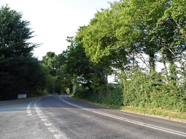
Duncan's Copse is a picturesque woodland located in the county of Sussex, England. Nestled in the heart of the South Downs National Park, this enchanting forest covers an area of approximately 300 acres, offering visitors a tranquil and idyllic escape from the hustle and bustle of daily life.

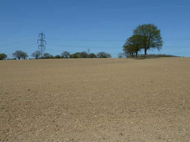
The copse is primarily composed of native tree species such as oak, beech, and ash, which create a rich and diverse ecosystem. These towering trees provide a dense canopy, allowing only dappled sunlight to filter through, casting a magical glow on the forest floor below. The woodland is also home to a variety of wildlife, including deer, badgers, and a plethora of bird species, making it a haven for nature enthusiasts and birdwatchers.

A network of well-maintained footpaths meanders through Duncan's Copse, inviting visitors to explore its hidden treasures. The paths lead to enchanting clearings, babbling brooks, and secluded ponds, where one can pause and immerse themselves in the natural beauty that surrounds them.

The copse is open to the public year-round, offering a different experience with each season. In spring, the forest bursts into a kaleidoscope of colors as wildflowers carpet the forest floor. Summer brings a vibrant green canopy that provides much-needed shade on hot days. Autumn paints the woodlands with fiery hues of red, orange, and gold, creating a breathtaking spectacle. And in winter, the copse takes on a mystical ambiance, as frost-covered branches glisten in the pale sunlight.

Overall, Duncan's Copse is a true gem of Sussex, offering a peaceful retreat for anyone seeking solace in nature's embrace.

If you have any feedback on the listing, please let us know in the comments section below.

Duncan's Copse Images

Images are sourced within 2km of 51.024578/-0.41314331 or Grid Reference TQ1126. Thanks to Geograph Open Source API. All images are credited.

Coneyhurst Road, Billingshurst
Cavendish Park Homes, Billingshurst Cavendish have a number of sites around the country, and Pettychar Court on the right has been added in the last year.
Cavendish Park Homes, Billingshurst
Cavendish have a number of sites around the country, and Pettychar Court on the right has been added in the last year.
Communication mast in middle of the square
Duckmoor Copse This corner of the copse has been cleared more due to the overhead power cables.
Duckmoor Copse
This corner of the copse has been cleared more due to the overhead power cables.
Sharp bend on Wooddale Lane Alongside Duckmoor Copse.
Sharp bend on Wooddale Lane
Alongside Duckmoor Copse.
Junction of Wooddale Lane and the A272
A272 north approaching rail bridge
Corner pylon near Billingshurst This line takes a curving course to avoid Billingshurst, but this is an additional perturbation, possibly to avoid some rural dwellings. Are power line routes laid out on a probability/cost basis, setting possible compensation against additional prime cost?
Corner pylon near Billingshurst
This line takes a curving course to avoid Billingshurst, but this is an additional perturbation, possibly to avoid some rural dwellings. Are power line routes laid out on a probability/cost basis, setting possible compensation against additional prime cost?
Looking towards Billingshurst on the A272 The camera is at the southern end of Wooddale Lane.
Looking towards Billingshurst on the A272
The camera is at the southern end of Wooddale Lane.
Footpath going east off Wooddale Lane
A Large ploughed field north of Rowfold Grange
A Large ploughed field north of Rowfold Grange (2)
A Large ploughed field north of Rowfold Grange (3)
Looking north along Wooddale Lane
Bend in the road, A272 at its junction with Wooddale Lane, East of Billingshurst
Rowfold Grange Postbox, A272, entrance to Rowfold Grange Postbox No.RH14 19
Rowfold Grange Postbox, A272, entrance to Rowfold Grange
Postbox No.RH14 19
Garden Cottage, A272
A272 heading south
A272 heading south
Show me another place!

Duncan's Copse is located at Grid Ref: TQ1126 (Lat: 51.024578, Lng: -0.41314331)

Administrative County: West Sussex

District: Horsham

Police Authority: Sussex

What 3 Words

///renewals.nightfall.surround. Near Billingshurst, West Sussex

Related Wikis

Billingshurst (electoral division)

Billingshurst is an electoral division of West Sussex in the United Kingdom and returns one member to sit on West Sussex County Council. == Extent == The...

Barns Green

Barns Green is a village in the Horsham district of West Sussex, England. It lies on the Billingshurst to Itchingfield road 2+1⁄2 miles (4.0 km) north...

Brooks Green

Brooks Green is a hamlet in the Shipley civil parish of the Horsham District of West Sussex, England. It is in the north-west of the parish, approximately...

Coneyhurst Cutting

Coneyhurst Cutting is a 0.2-hectare (0.49-acre) geological Site of Special Scientific Interest south-east of Billingshurst in West Sussex. It is a Geological...

Parson's Brook

Parson's Brook is a minor river (brook) located in the Horsham District of West Sussex, England. It is a tributary to the River Adur. == Course == The...

Coneyhurst

Coneyhurst is a hamlet in the Horsham District of West Sussex, England. It lies on the A272 road 1.6 miles (2.5 km) southeast of Billingshurst (where the...

Billingshurst

Billingshurst is a village and civil parish in the Horsham District of West Sussex, England. The village lies on the A29 road (the Roman Stane Street)...

Five Oaks

Five Oaks is a large hamlet in the Horsham District of West Sussex, England. It lies about 1.7 miles (2.8 km) north of Billingshurst on the Roman road...

Nearby Amenities

Located within 500m of 51.024578,-0.41314331
Duncan's Copse
Naptan AtcoCode: 4400HR0276
Naptan Bearing: S
Naptan BusStopType: CUS
Naptan CommonName: Duncan's Copse
Naptan Indicator: adj Vale Wood Lane
Naptan Landmark: Vale Wood Lane
Naptan NaptanCode: wsxawagd
Naptan Street: West Chiltington Lane
Naptan Verified: no
Source: naptan_import
Lat/Long: 51.0255743/-0.4133767
West Chiltington Lane
Naptan AtcoCode: 4400HR1072
Naptan Bearing: NE
Naptan BusStopType: CUS
Naptan CommonName: West Chiltington Lane
Naptan Indicator: HAR
Naptan Landmark: Hail & Ride
Naptan NaptanCode: wsxgdjdg
Naptan Street: West Chiltington Lane
Naptan Verified: no
Source: naptan_import
Lat/Long: 51.0243011/-0.4140859
Post Box
Operator: Royal Mail
Post Box Type: lamp
Ref: RH14 122
Royal Cypher: EIIR
Royal Cypher Wikidata: Q33102113
Lat/Long: 51.0251998/-0.4136671
Kynance Farm
Place: farm
Lat/Long: 51.0214374/-0.4158374
Lower Hook Farm
Place: farm
Lat/Long: 51.0209125/-0.4156419
Pear Tree Farm
Place: farm
Lat/Long: 51.0259214/-0.4168197
Kingfisher Farm
Place: farm
Lat/Long: 51.0276972/-0.4095441
Crossing
Lat/Long: 51.023822/-0.4085588
Hill Brow
Place: isolated_dwelling
Lat/Long: 51.0234896/-0.4133828
The data included in this document is from www.openstreetmap.org. The data is made available under ODbL.

Have you been to Duncan's Copse?

Leave your review of Duncan's Copse below (or comments, questions and feedback).