Fox Plantation

Wood, Forest in Yorkshire

England

Fox Plantation

Bransholme Fishing Lake, Hull Part of the Noddle Hill Nature Reserve <span class="nowrap"><a title="https://www.hcandl.co.uk/sport-and-leisure-and-parks/your-local-park/noddle-hill-nature-reserve" rel="nofollow ugc noopener" href="https://www.hcandl.co.uk/sport-and-leisure-and-parks/your-local-park/noddle-hill-nature-reserve">Link</a><img style="margin-left:2px;" alt="External link" title="External link - shift click to open in new window" src="https://s1.geograph.org.uk/img/external.png" width="10" height="10"/></span> on the north-eastern edge of the city. A couple of early morning anglers can be seen to the left of the picture.
Bransholme Fishing Lake, Hull Credit: Paul Harrop

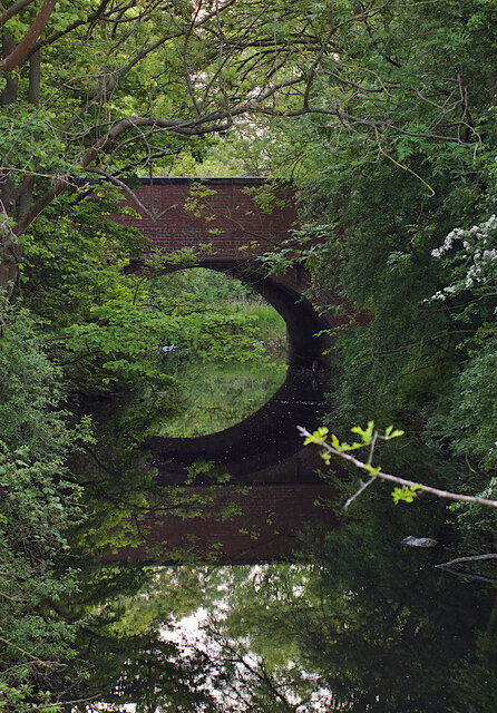
Fox Plantation is a picturesque woodland located in the majestic county of Yorkshire, England. Spanning over a vast area, this enchanting forest is an oasis of natural beauty and tranquility. The plantation is nestled within the rolling hills and valleys of the Yorkshire countryside, offering visitors breathtaking views and a serene escape from the bustling city life.

The woodland is predominantly comprised of a diverse range of tree species, including oak, beech, and birch, creating a rich and vibrant ecosystem. The dense canopy of trees provides a cool and shaded environment, making it a perfect destination for nature enthusiasts and hikers seeking respite from the summer heat.

The plantation is also home to a variety of wildlife. Foxes, as the name suggests, are known to inhabit the area, making it a popular spot for wildlife photographers and animal lovers. Other common sightings include deer, rabbits, and a plethora of bird species.

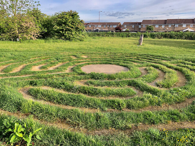
Visitors can explore the woodland through a network of well-marked trails and footpaths, allowing them to immerse themselves in the natural wonders of the forest. The plantation also offers picnic areas and camping facilities, enabling visitors to fully embrace the serene atmosphere and spend quality time with family and friends.

Fox Plantation is a true gem in Yorkshire's crown, offering visitors an opportunity to reconnect with nature and experience the beauty of the English countryside. With its idyllic scenery, diverse wildlife, and range of recreational activities, this woodland is a must-visit destination for anyone seeking a peaceful retreat in the heart of Yorkshire.

If you have any feedback on the listing, please let us know in the comments section below.

Fox Plantation Images

Images are sourced within 2km of 53.806179/-0.30993439 or Grid Reference TA1135. Thanks to Geograph Open Source API. All images are credited.

Bransholme Fishing Lake, Hull Part of the Noddle Hill Nature Reserve <span class="nowrap"><a title="https://www.hcandl.co.uk/sport-and-leisure-and-parks/your-local-park/noddle-hill-nature-reserve" rel="nofollow ugc noopener" href="https://www.hcandl.co.uk/sport-and-leisure-and-parks/your-local-park/noddle-hill-nature-reserve">Link</a><img style="margin-left:2px;" alt="External link" title="External link - shift click to open in new window" src="https://s1.geograph.org.uk/img/external.png" width="10" height="10"/></span> on the north-eastern edge of the city. A couple of early morning anglers can be seen to the left of the picture.
Bransholme Fishing Lake, Hull
Part of the Noddle Hill Nature Reserve LinkExternal link on the north-eastern edge of the city. A couple of early morning anglers can be seen to the left of the picture.
Ducks on the fishing lake, Hull The eastern side of the lake which forms part of the Noddle Hill Nature Reserve <span class="nowrap"><a title="https://www.hcandl.co.uk/sport-and-leisure-and-parks/your-local-park/noddle-hill-nature-reserve" rel="nofollow ugc noopener" href="https://www.hcandl.co.uk/sport-and-leisure-and-parks/your-local-park/noddle-hill-nature-reserve">Link</a><img style="margin-left:2px;" alt="External link" title="External link - shift click to open in new window" src="https://s1.geograph.org.uk/img/external.png" width="10" height="10"/></span> on the north-eastern edge of the city.
Ducks on the fishing lake, Hull
The eastern side of the lake which forms part of the Noddle Hill Nature Reserve LinkExternal link on the north-eastern edge of the city.
Drain clearing, Bransholme, Hull Environment Agency workers clearing undergrowth and debris from one of the many land drains around this low-lying area on the north-eastern edge of the city. This drain runs along the western edge of the Noddle Hill nature reserve.
Drain clearing, Bransholme, Hull
Environment Agency workers clearing undergrowth and debris from one of the many land drains around this low-lying area on the north-eastern edge of the city. This drain runs along the western edge of the Noddle Hill nature reserve.
Foredyke Bridge, Hull In the Bransholme/Kingswood area, the bridge carries Wawne Road over the Foredyke Stream (or Wawne Drain, depending on which OS map resolution you are looking at).
Foredyke Bridge, Hull
In the Bransholme/Kingswood area, the bridge carries Wawne Road over the Foredyke Stream (or Wawne Drain, depending on which OS map resolution you are looking at).
Bransholme bunny, Hull The plentiful green areas and parks which thread among the streets and houses of Bransholme are home to numerous rabbits, this one close to Wawne Road and, like all the others, about to disappear into the undergrowth.
Bransholme bunny, Hull
The plentiful green areas and parks which thread among the streets and houses of Bransholme are home to numerous rabbits, this one close to Wawne Road and, like all the others, about to disappear into the undergrowth.
Labyrinth, Foredyke Green, Hull Created in 2017 as part of a regeneration of the Foredyke Green Nature area, this labyrinth is based on a medieval original which once existed in the east Hull village of Marfleet.
Labyrinth, Foredyke Green, Hull
Created in 2017 as part of a regeneration of the Foredyke Green Nature area, this labyrinth is based on a medieval original which once existed in the east Hull village of Marfleet.
Angel sculpture, Kingswood, Hull One of a number of carved wooden figures around the Kesteven Green nature area. They were introduced as part of a 2017 regeneration of the green space near Kesteven Way and Bude Road, led by the Kingswood Residents Association.
Angel sculpture, Kingswood, Hull
One of a number of carved wooden figures around the Kesteven Green nature area. They were introduced as part of a 2017 regeneration of the green space near Kesteven Way and Bude Road, led by the Kingswood Residents Association.
Flood alleviation scheme, Hull A new body of water, built to store excess water from nearby land and drains to prevent flooding of nearby residential areas. Dubbed the Castlehill Aquagreen, it is part of the £28 million Holderness Drain Flood Alleviation Scheme (FAS) led by the Environment Agency and supported by Hull City Council, East Riding of Yorkshire Council, Highways England and the Humber Local Enterprise Partnership. <span class="nowrap"><a title="https://consult.environment-agency.gov.uk/yorkshire/holderness-drain-flood-alleviation-scheme/user_uploads/castlehill-consultation-summary-of-findings-final.pdf" rel="nofollow ugc noopener" href="https://consult.environment-agency.gov.uk/yorkshire/holderness-drain-flood-alleviation-scheme/user_uploads/castlehill-consultation-summary-of-findings-final.pdf">Link</a><img style="margin-left:2px;" alt="External link" title="External link - shift click to open in new window" src="https://s1.geograph.org.uk/img/external.png" width="10" height="10"/></span>
Flood alleviation scheme, Hull
A new body of water, built to store excess water from nearby land and drains to prevent flooding of nearby residential areas. Dubbed the Castlehill Aquagreen, it is part of the £28 million Holderness Drain Flood Alleviation Scheme (FAS) led by the Environment Agency and supported by Hull City Council, East Riding of Yorkshire Council, Highways England and the Humber Local Enterprise Partnership. LinkExternal link
Swine farmhouse Abbey Garth Farm, seen from the adjacent St Mary's churchyard
Swine farmhouse
Abbey Garth Farm, seen from the adjacent St Mary's churchyard
Turf laying, Hull These men were doing a spot of landscaping at the junction of Wawne Road and Diversity Drive, at the eastern edge of Kingswood Parks housing development.
Turf laying, Hull
These men were doing a spot of landscaping at the junction of Wawne Road and Diversity Drive, at the eastern edge of Kingswood Parks housing development.
Hudson Way near Castle Hill The Hornsea Rail Trail runs along the former Hull to Hornsea Railway Line and forms part of National Cycle Network route 65.
Hudson Way near Castle Hill
The Hornsea Rail Trail runs along the former Hull to Hornsea Railway Line and forms part of National Cycle Network route 65.
Holderness Drain Looking along Holderness Drain from the Hudson Way. The Environment Agency are currently carrying out flood prevention works along the drain.
Holderness Drain
Looking along Holderness Drain from the Hudson Way. The Environment Agency are currently carrying out flood prevention works along the drain.
Bridge over Holderness Drain The bridge is part of the Hornsea Rail Trail which runs along the former Hull to Hornsea Railway Line and forms part of National Cycle Network route 65.
Bridge over Holderness Drain
The bridge is part of the Hornsea Rail Trail which runs along the former Hull to Hornsea Railway Line and forms part of National Cycle Network route 65.
Rail trail west of Holderness Drain The Hornsea Rail Trail runs along the former Hull to Hornsea Railway Line and forms part of National Cycle Network route 65.
Rail trail west of Holderness Drain
The Hornsea Rail Trail runs along the former Hull to Hornsea Railway Line and forms part of National Cycle Network route 65.
New cycle path north of the Hornsea Rail Trail Looking along a cycle path heading north near Castle Hill.
New cycle path north of the Hornsea Rail Trail
Looking along a cycle path heading north near Castle Hill.
Cycle path north of the Hornsea Rail Trail A newly constructed cycle path near Castle Hill.
Cycle path north of the Hornsea Rail Trail
A newly constructed cycle path near Castle Hill.
Cycle path approaching the Hornsea Rail Trail A cycle path connecting with the rail trail which is just ahead.
Cycle path approaching the Hornsea Rail Trail
A cycle path connecting with the rail trail which is just ahead.
Kingswood High School Situated on the North Bransholme Housing Estate and is on the north edge of the grid square
Kingswood High School
Situated on the North Bransholme Housing Estate and is on the north edge of the grid square
Show me another place!

Fox Plantation is located at Grid Ref: TA1135 (Lat: 53.806179, Lng: -0.30993439)

Division: East Riding

Unitary Authority: East Riding of Yorkshire

Police Authority: Humberside

What 3 Words

///custom.watch.engage. Near Dunswell, East Yorkshire

Related Wikis

Kingswood Academy, Hull

Kingswood Academy is a secondary school on the northern fringe of the Bransholme housing estate in Kingston upon Hull, England. The school opened in 2013...

Lambwath Stream

Lambwath Stream (or Lambwath Drain), is a small beck in the Holderness area of the East Riding of Yorkshire, England. The stream is unusual in that despite...

Swine Priory

Swine Priory was a priory in the village of Swine in the East Riding of Yorkshire, England. The site of the Cistercian nunnery is a Scheduled Monument...

RAF Sutton on Hull

Royal Air Force Sutton on Hull or more simply RAF Sutton on Hull is a former Royal Air Force station situated in the suburb of Sutton-on-Hull (part of...

Nearby Amenities

Located within 500m of 53.806179,-0.30993439
Design: h-frame
Material: wood
Power: tower
Lat/Long: 53.8029537/-0.3068002
Design: h-frame
Material: wood
Power: tower
Lat/Long: 53.8039377/-0.3143539
Design: h-frame
Material: wood
Power: tower
Lat/Long: 53.8043745/-0.3075984
Design: h-frame
Material: wood
Power: tower
Lat/Long: 53.8046043/-0.3121294
Design: h-frame
Material: wood
Power: tower
Lat/Long: 53.8052335/-0.3100682
Design: h-frame
Line Management: branch
Material: wood
Power: tower
Lat/Long: 53.8057105/-0.3083975
Design: h-frame
Material: wood
Power: tower
Lat/Long: 53.8057383/-0.308299
Design: h-frame
Line Management: termination
Material: wood
Power: tower
Lat/Long: 53.8062122/-0.3068223
The data included in this document is from www.openstreetmap.org. The data is made available under ODbL.

Have you been to Fox Plantation?

Leave your review of Fox Plantation below (or comments, questions and feedback).