Eastland Copse

Wood, Forest in Surrey Waverley

England

Eastland Copse

Cricket Ground at Ewhurst Green
Cricket Ground at Ewhurst Green Credit: Chris Thomas-Atkin

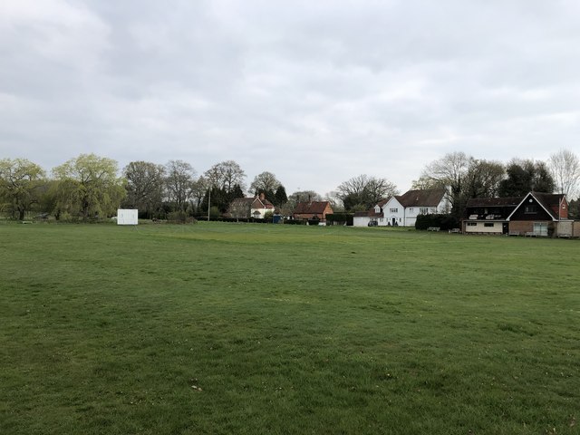
Eastland Copse is a serene wooded area located in Surrey, England. Covering an area of approximately 50 hectares, it is a haven for nature enthusiasts and a popular destination for outdoor activities. The copse is situated in the southeast region of Surrey, near the town of Dorking.

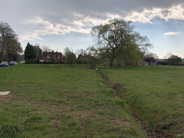
The woodland is predominantly composed of mature broadleaf trees, including oak, beech, and birch, creating a rich and diverse ecosystem. The canopy is thick and lush, providing ample shade and shelter for a variety of wildlife species. This makes Eastland Copse an ideal habitat for numerous bird species, small mammals, and insects.

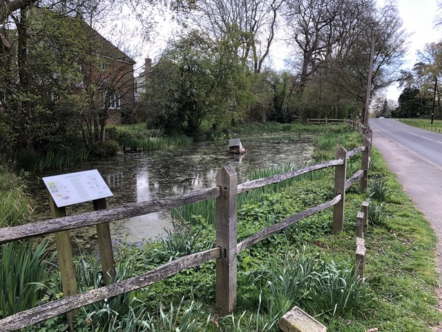
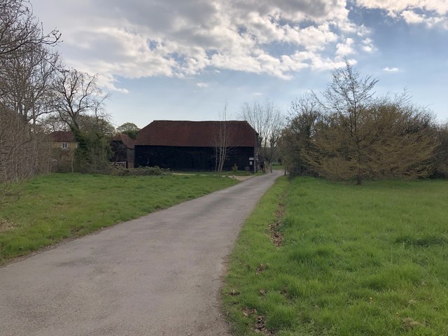
Visitors to Eastland Copse can explore a network of well-maintained footpaths that wind through the woodland, offering stunning views of the surrounding countryside. The copse is also intersected by a small stream, which adds to its natural beauty and tranquility. These paths provide a serene environment for walking, jogging, and cycling, allowing visitors to immerse themselves in the peaceful ambiance of the copse.

Additionally, Eastland Copse boasts several designated picnic areas and benches, making it an ideal spot for families and friends to gather and enjoy a day out in nature. The copse is carefully managed by local authorities to preserve its natural beauty and ensure the safety of visitors.

Eastland Copse is a cherished natural asset in Surrey, offering a peaceful retreat from the bustling city life. Whether it is for a leisurely stroll, wildlife observation, or a picnic with loved ones, this woodland sanctuary provides a welcome escape into nature's embrace.

If you have any feedback on the listing, please let us know in the comments section below.

Eastland Copse Images

Images are sourced within 2km of 51.156729/-0.41918192 or Grid Reference TQ1040. Thanks to Geograph Open Source API. All images are credited.

Cricket Ground at Ewhurst Green
Larkfield Pond A very well kept looking pond in Ewhurst
Larkfield Pond
A very well kept looking pond in Ewhurst
Pond near Ewhurst Cricket Ground In an earlier Geograph photo the pond was overgrown but it now seems to be cleared and being maintained.
Pond near Ewhurst Cricket Ground
In an earlier Geograph photo the pond was overgrown but it now seems to be cleared and being maintained.
Barn at Rumbeams Farm Rumbeams Farm is at Ewhurst Green and is visible from the passing road ‘The Green’.
Barn at Rumbeams Farm
Rumbeams Farm is at Ewhurst Green and is visible from the passing road ‘The Green’.
Old barn at Ewhurst To be found a short distance to the east of Ewhurst church.  Rather oddly, it stands in the grounds of the Old Rectory (now a care home), with no other farm buildings nearby.  Much of the surrounding area is now residential - 20th century development, for the most part.  

I'd guess that (with such huge doors) this was once a threshing barn.  The framing seems very regular and symmetrical - apparently all of one build.

I was going to suggest a Victorian date, but have since found a listing: <span class="nowrap"><a title="http://www.britishlistedbuildings.co.uk/en-291858-barn-in-the-grounds-of-the-old-rectory-e#.Vv3FPyghzo4" rel="nofollow ugc noopener" href="http://www.britishlistedbuildings.co.uk/en-291858-barn-in-the-grounds-of-the-old-rectory-e#.Vv3FPyghzo4">Link</a><img style="margin-left:2px;" alt="External link" title="External link - shift click to open in new window" src="https://s1.geograph.org.uk/img/external.png" width="10" height="10"/></span>    My guess would be that most of what can be seen externally dates from the 20th-century restoration.
Old barn at Ewhurst
To be found a short distance to the east of Ewhurst church. Rather oddly, it stands in the grounds of the Old Rectory (now a care home), with no other farm buildings nearby. Much of the surrounding area is now residential - 20th century development, for the most part. I'd guess that (with such huge doors) this was once a threshing barn. The framing seems very regular and symmetrical - apparently all of one build. I was going to suggest a Victorian date, but have since found a listing: LinkExternal link My guess would be that most of what can be seen externally dates from the 20th-century restoration.
Wealden farmland north of Ewhurst With the slopes of Holmbury Hill rising in the distance.

The tall trees are ashes - and very typical of this area.
Wealden farmland north of Ewhurst
With the slopes of Holmbury Hill rising in the distance. The tall trees are ashes - and very typical of this area.
Ewhurst church from the north-east
Grave-board under a yew tree, Ewhurst churchyard Wooden grave-boards are not uncommon in Surrey, and I've seen them elsewhere in the Home Counties (for instance, at Baldock).  But more often than not what you find are heavily restored boards - or frank replacements (as at Mickleham).

I hadn't explored this churchyard before and it came as a surprise to find a number of 'original' unrestored boards - albeit in various stages of decrepitude.  The inscriptions they once carried had weathered away without trace - as they would do, inevitably, if not repainted every few years.

This one, under its yew tree, was one of the more complete examples - sufficiently complete to give a fair idea as to original design and construction.

I can't claim to know anything of the history of grave-boards, but here in the Weald where timber was abundant (and local stone scarce) their use could stretch back many centuries, poorly documented.  The lack of suitable local stone means that cast-iron grave-markers, too, are fairly common in Surrey and Sussex.
Grave-board under a yew tree, Ewhurst churchyard
Wooden grave-boards are not uncommon in Surrey, and I've seen them elsewhere in the Home Counties (for instance, at Baldock). But more often than not what you find are heavily restored boards - or frank replacements (as at Mickleham). I hadn't explored this churchyard before and it came as a surprise to find a number of 'original' unrestored boards - albeit in various stages of decrepitude. The inscriptions they once carried had weathered away without trace - as they would do, inevitably, if not repainted every few years. This one, under its yew tree, was one of the more complete examples - sufficiently complete to give a fair idea as to original design and construction. I can't claim to know anything of the history of grave-boards, but here in the Weald where timber was abundant (and local stone scarce) their use could stretch back many centuries, poorly documented. The lack of suitable local stone means that cast-iron grave-markers, too, are fairly common in Surrey and Sussex.
18th-century headstone, Ewhurst churchyard: David Tidy, yeoman A good number of 18th-century headstones have survived in this churchyard.  This one, dated 1762, stands with other old stones in the south-eastern part of the yard.

To my eye this stone is an unusually fine piece of work.  The design is restrained - no mourning angels,no trumpets, no skulls or cross-bones (common in the mid-18th century) - it makes its impact by the use of finely executed lettering alone.  

The inscription reads:

IN
MEMORY of
DAVID TIDY Late of this
Parish Yeoman who departed
this Life August the 27th 1762
in the 53d Year of his Age

There is no riot of lettering styles (as became the norm 50 years later): only the words 'Year' and 'Age' are given fancy copper-plate treatment.
18th-century headstone, Ewhurst churchyard: David Tidy, yeoman
A good number of 18th-century headstones have survived in this churchyard. This one, dated 1762, stands with other old stones in the south-eastern part of the yard. To my eye this stone is an unusually fine piece of work. The design is restrained - no mourning angels,no trumpets, no skulls or cross-bones (common in the mid-18th century) - it makes its impact by the use of finely executed lettering alone. The inscription reads: IN MEMORY of DAVID TIDY Late of this Parish Yeoman who departed this Life August the 27th 1762 in the 53d Year of his Age There is no riot of lettering styles (as became the norm 50 years later): only the words 'Year' and 'Age' are given fancy copper-plate treatment.
Ewhurst church: Norman doorway On the south side of the church, at its west end.
Ewhurst church: Norman doorway
On the south side of the church, at its west end.
Weather-boarded cottage at the corner of Wykehurst Lane At the north end of the green, opposite the Bull's Head.  Wykehurst Lane leads west from the main village street.
Weather-boarded cottage at the corner of Wykehurst Lane
At the north end of the green, opposite the Bull's Head. Wykehurst Lane leads west from the main village street.
Wykehurst Lane, Ewhurst The lane leads westward from the main village street, giving access to residential development of a rather suburban character.
Wykehurst Lane, Ewhurst
The lane leads westward from the main village street, giving access to residential development of a rather suburban character.
View from the south-west flank of Holmbury Hill (1) Shot taken from a muddy bridleway in the north-east corner of the grid-square (the view from the Greensand Way is less open).

The view is roughly SSW.  In the foreground are the steep wooded slopes of Holt Copse.  Beyond (and in the next grid-square) the buildings at Radnor Place Farm are largely hidden among the trees.  Further off - and showing as a rather dark wooded area - is the village of Ewhurst (a couple of miles from my vantage point).  In the far distance is the ridge of the South Downs.
View from the south-west flank of Holmbury Hill (1)
Shot taken from a muddy bridleway in the north-east corner of the grid-square (the view from the Greensand Way is less open). The view is roughly SSW. In the foreground are the steep wooded slopes of Holt Copse. Beyond (and in the next grid-square) the buildings at Radnor Place Farm are largely hidden among the trees. Further off - and showing as a rather dark wooded area - is the village of Ewhurst (a couple of miles from my vantage point). In the far distance is the ridge of the South Downs.
View from the south-west flank of Holmbury Hill (2) Looking out over the tree-tops of Holt Copse.  Radnor Place Farm is hidden among the clump of trees  near the middle of the picture.  The short spire of Ewhurst church can be made out in the original (above the left-hand corner of the very noticeable green field on the right).

The ridge of the South Downs can be made out in the far distance.
View from the south-west flank of Holmbury Hill (2)
Looking out over the tree-tops of Holt Copse. Radnor Place Farm is hidden among the clump of trees near the middle of the picture. The short spire of Ewhurst church can be made out in the original (above the left-hand corner of the very noticeable green field on the right). The ridge of the South Downs can be made out in the far distance.
Farthingham Lane, Ewhurst
Looking from the church porch, past the war memorial towards the school
Third Time Lucky (1) The church of SS Peter & Paul, Ewhurst: late October 2017
Third Time Lucky (1)
The church of SS Peter & Paul, Ewhurst: late October 2017
Third Time Lucky (2) The font
Third Time Lucky (2)
The font
Show me another place!

Eastland Copse is located at Grid Ref: TQ1040 (Lat: 51.156729, Lng: -0.41918192)

Administrative County: Surrey

District: Waverley

Police Authority: Surrey

What 3 Words

///videos.regarding.courtyard. Near Ewhurst, Surrey

Related Wikis

Ewhurst, Surrey

Ewhurst is a rural village and civil parish in the borough of Waverley in Surrey, England. It is located 8.3 miles (13.4 km) south-east of Guildford,...

Mullard Space Science Laboratory

The UCL Mullard Space Science Laboratory (MSSL) is the United Kingdom's largest university space research group. MSSL is part of the Department of Space...

Joldwynds

Joldwynds is a modernist style house in Holmbury St Mary, Surrey, England, designed by architect Oliver Hill for Wilfred Greene, 1st Baron Greene. Completed...

Hurtwood House

Hurtwood House is an independent, co-educational boarding school and sixth form for pupils aged 15–19 in Surrey, England. == Synopsis == Founded in 1970...

Holmbury Hill

Holmbury Hill is a wooded area of 261 metres (856 ft) above sea level in Surrey, England, and the site of an Iron Age-period hillfort. The Old Saxon word...

Sayer's Croft LNR

Sayer's Croft is a 10.9-hectare (27-acre) Local Nature Reserve west of Ewhurst in Surrey. It is owned by the Sayer's Croft Environmental Education Trust...

Sayers Croft

Sayers Croft is a large outdoor 'learning camp' located in the village of Ewhurst, Surrey. It is one of the few remaining 'Camp schools' built by the National...

Wallis Wood

Wallis Wood is a 14-hectare (35-acre) nature reserve south-east of Ewhurst in Surrey. It is managed by the Surrey Wildlife Trust.A stream runs through...

Nearby Amenities

Located within 500m of 51.156729,-0.41918192
Coophurst Farm
Landuse: farm
Note Retag: CS #48756035
Source: npe
Lat/Long: 51.1594663/-0.4181482
Bus Stop
Stubbetts Corner
Bus: yes
Naptan AtcoCode: 40004408230A
Naptan Bearing: S
Naptan CommonName: Stubbetts Corner
Naptan Indicator: Opp
Naptan Landmark: Stubbetts Corner
Naptan NaptanCode: surdatdw
Naptan Street: Ockley Road
Naptan Verified: no
Public Transport: platform
Source: naptan_import
Lat/Long: 51.1581066/-0.4135919
Bus Stop
Stubbetts Corner
Bus: yes
Naptan AtcoCode: 40004408230B
Naptan Bearing: E
Naptan BusStopType: CUS
Naptan CommonName: Stubbetts Corner
Naptan Indicator: Just Before
Naptan Landmark: Stubbetts Corner
Naptan NaptanCode: surdatga
Naptan Street: Ockley Road
Naptan Verified: no
Physically Present: no
Public Transport: platform
Source: naptan_import
Lat/Long: 51.1582773/-0.4142439
Power: pole
Lat/Long: 51.1565074/-0.4137917
Power: pole
Lat/Long: 51.1562298/-0.4155378
Power: pole
Lat/Long: 51.1559658/-0.4171176
Power: pole
Lat/Long: 51.1556595/-0.4190086
Power: pole
Lat/Long: 51.1554257/-0.4205294
Power: pole
Lat/Long: 51.1551094/-0.4223802
Power: pole
Lat/Long: 51.1552406/-0.4244266
Fire Hydrant
Emergency: fire_hydrant
Fire Hydrant Type: underground
Lat/Long: 51.1580576/-0.4135194
Fire Hydrant
Emergency: fire_hydrant
Fire Hydrant Position: lane
Fire Hydrant Type: underground
Lat/Long: 51.1565763/-0.4243508
Maxwidth: 1.95
Lat/Long: 51.1576248/-0.4236905
Barrier: stile
Lat/Long: 51.1546309/-0.415788
Barrier: stile
Lat/Long: 51.1550387/-0.4135633
Barrier: stile
Lat/Long: 51.1550838/-0.4138349
Power: pole
Lat/Long: 51.1554234/-0.4260314
Power: pole
Lat/Long: 51.1553208/-0.4244274
Power: pole
Lat/Long: 51.1551912/-0.422456
Power: pole
Lat/Long: 51.1554941/-0.4206026
Power: pole
Lat/Long: 51.1557363/-0.4190522
Power: pole
Lat/Long: 51.1560307/-0.417164
Power: pole
Lat/Long: 51.1563058/-0.4155694
Power: pole
Lat/Long: 51.1565892/-0.4138112
Cobbetts Farm
Place: farm
Lat/Long: 51.1552928/-0.4127654
Post Box
Post Box Type: lamp
Ref: GU6 91D
Royal Cypher: EIIR
Royal Cypher Wikidata: Q33102113
Lat/Long: 51.1564992/-0.4242101
The data included in this document is from www.openstreetmap.org. The data is made available under ODbL.

Have you been to Eastland Copse?

Leave your review of Eastland Copse below (or comments, questions and feedback).