Oxhey Woods

Wood, Forest in Hertfordshire Three Rivers

England

Oxhey Woods

The Parade, Carpenders Park The Parade is a typical suburban row of shops located at the junction of Delta Gain and Carpenders Avenue. The businesses include Carpenders Park post office and a florist's shop.
The Parade, Carpenders Park Credit: Stephen McKay

Oxhey Woods is a captivating woodland located in Hertfordshire, England. Covering an area of approximately 165 acres, it is a cherished natural gem within the region. The woods are part of the larger Watford Woodlands, which include Oxhey Park and Whippendell Woods.

This ancient woodland boasts a diverse range of flora and fauna, making it a haven for nature lovers and wildlife enthusiasts. The dominant tree species in Oxhey Woods are oak and hornbeam, creating a dense canopy that provides shade and shelter for the woodland floor. Bluebells carpet the forest floor in spring, adding a vibrant burst of color to the surroundings.

The woods are crisscrossed by a network of well-maintained footpaths, allowing visitors to explore its beauty at their own pace. The paths meander through the trees, revealing hidden clearings and tranquil spots that are perfect for picnics or quiet contemplation. The woods are also home to a variety of wildlife, including deer, foxes, and a plethora of bird species. Birdwatchers can spot woodpeckers, owls, and nuthatches among the trees.

Oxhey Woods is not only a haven for nature but also a place of historical significance. Evidence of ancient settlements and human activity has been discovered within its boundaries. The woods have witnessed centuries of change, from medieval times to the present day, and remnants of the past can still be seen in the form of old boundary banks and ditches.

Overall, Oxhey Woods is a captivating and enchanting woodland that offers a peaceful escape from the hustle and bustle of everyday life. Its natural beauty, diverse wildlife, and historical significance make it a cherished destination for locals and visitors alike.

If you have any feedback on the listing, please let us know in the comments section below.
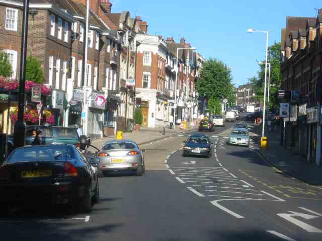
Oxhey Woods Images

Images are sourced within 2km of 51.623606/-0.40533579 or Grid Reference TQ1092. Thanks to Geograph Open Source API. All images are credited.

The Parade, Carpenders Park The Parade is a typical suburban row of shops located at the junction of Delta Gain and Carpenders Avenue. The businesses include Carpenders Park post office and a florist's shop.
The Parade, Carpenders Park
The Parade is a typical suburban row of shops located at the junction of Delta Gain and Carpenders Avenue. The businesses include Carpenders Park post office and a florist's shop.
Carpenders Avenue, Carpenders Park Carpenders Park is very much an outer London suburb although it is situated outside the Greater London area. The development took place either side of the Second World War and the housing is typical of its time including a significant number of bungalows. The name is derived from a local manor house that was demolished in 1960 but has perhaps survived because it was given to the nearby railway station.
Carpenders Avenue, Carpenders Park
Carpenders Park is very much an outer London suburb although it is situated outside the Greater London area. The development took place either side of the Second World War and the housing is typical of its time including a significant number of bungalows. The name is derived from a local manor house that was demolished in 1960 but has perhaps survived because it was given to the nearby railway station.
Path to The Mead, Carpenders Park Designated a public footpath, and signed accordingly, this route cuts through between the houses on Carpenders Avenue and The Mead at the bottom.
Path to The Mead, Carpenders Park
Designated a public footpath, and signed accordingly, this route cuts through between the houses on Carpenders Avenue and The Mead at the bottom.
The Partridge, Carpenders Park Not, in all honesty, a particularly prepossessing looking pub externally, the Partridge offers cask ales, Sky Sports and pub games and is a short walk from Carpenders Park station.
The Partridge, Carpenders Park
Not, in all honesty, a particularly prepossessing looking pub externally, the Partridge offers cask ales, Sky Sports and pub games and is a short walk from Carpenders Park station.
Carpenders Park Station Carpenders Park is a stop on the London Overground route between Euston and Watford Junction. The pedestrian tunnel passes under the West Coast Main Line and gives access to the island platform on the 'DC lines'. It also connects Carpenders Park to the east of the railway and South Oxhey to the west - two outer suburbs with very different characters. The original station here (located to the north of the current one) was opened in 1914 to serve a nearby golf course in what was then a very rural area. The modern structure was opened in 1952. Note the bewildering number of safety signs visible in this view: 'No rollerblading, skating or cycling'; 'No smoking'; 'No alcohol'; 'CCTV cameras in operation'; 'No cycling'; 'Bicycle restrictions'; 'No trespassing' (three in all); 'Danger electricity'; and 'Danger overhead live wires'.
Carpenders Park Station
Carpenders Park is a stop on the London Overground route between Euston and Watford Junction. The pedestrian tunnel passes under the West Coast Main Line and gives access to the island platform on the 'DC lines'. It also connects Carpenders Park to the east of the railway and South Oxhey to the west - two outer suburbs with very different characters. The original station here (located to the north of the current one) was opened in 1914 to serve a nearby golf course in what was then a very rural area. The modern structure was opened in 1952. Note the bewildering number of safety signs visible in this view: 'No rollerblading, skating or cycling'; 'No smoking'; 'No alcohol'; 'CCTV cameras in operation'; 'No cycling'; 'Bicycle restrictions'; 'No trespassing' (three in all); 'Danger electricity'; and 'Danger overhead live wires'.
Pearkes House, South Oxhey Pearkes House is part of a redevelopment project called South Oxhey Central, close to Carpenders Park station, that includes residential apartments, work spaces and retail units. The developer is Countryside Properties and work began in 2016.
Pearkes House, South Oxhey
Pearkes House is part of a redevelopment project called South Oxhey Central, close to Carpenders Park station, that includes residential apartments, work spaces and retail units. The developer is Countryside Properties and work began in 2016.
South Oxhey Central This construction is part of the South Oxhey Central development. The new apartment block is replacing a parade of shop units, with flats above, that certainly had a tired look but was perhaps on a more appropriate scale for this outer suburban location. Be that as it may, the new housing is being heavily marketed by the developer, Countryside Properties, and a huge representation of how prospective residents' bathrooms might look is displayed on the hoardings outside.
South Oxhey Central
This construction is part of the South Oxhey Central development. The new apartment block is replacing a parade of shop units, with flats above, that certainly had a tired look but was perhaps on a more appropriate scale for this outer suburban location. Be that as it may, the new housing is being heavily marketed by the developer, Countryside Properties, and a huge representation of how prospective residents' bathrooms might look is displayed on the hoardings outside.
Forfar House, South Oxhey Forfar House is an apartment block which, together with two similar blocks, overlooks a green off Oxhey Drive. Part of Filton House can be seen in this picture. The estate at South Oxhey was developed by the then London County Council (LCC) in the early 1950s, one of a number built on the fringes of London to help relieve overcrowding in the inner city area. It was not actually within the LCC's area and is still within the modern boundaries of Hertfordshire today. In 1980 the Greater London Council (which had absorbed the LCC) passed the ownership and management of the estate to Three Rivers District Council. Today, a large proportion of the housing stock is privately owned and the remaining social housing has been transferred to a housing association.
Forfar House, South Oxhey
Forfar House is an apartment block which, together with two similar blocks, overlooks a green off Oxhey Drive. Part of Filton House can be seen in this picture. The estate at South Oxhey was developed by the then London County Council (LCC) in the early 1950s, one of a number built on the fringes of London to help relieve overcrowding in the inner city area. It was not actually within the LCC's area and is still within the modern boundaries of Hertfordshire today. In 1980 the Greater London Council (which had absorbed the LCC) passed the ownership and management of the estate to Three Rivers District Council. Today, a large proportion of the housing stock is privately owned and the remaining social housing has been transferred to a housing association.
Oxhey Drive, South Oxhey The large London County Council development at South Oxhey was built in the early 1950s to relieve overcrowding in the inner city, where much of the housing stock had been lost due to wartime bombing. The houses here are typical of local authority estates of the era including this terrace on Oxhey Drive. The houses were generally well-built and relatively sizeable with decent gardens - in some ways better than their equivalents built for the private market. They must have seemed like paradise for many of their first residents. Today a majority of the houses at South Oxhey are privately owned.
Oxhey Drive, South Oxhey
The large London County Council development at South Oxhey was built in the early 1950s to relieve overcrowding in the inner city, where much of the housing stock had been lost due to wartime bombing. The houses here are typical of local authority estates of the era including this terrace on Oxhey Drive. The houses were generally well-built and relatively sizeable with decent gardens - in some ways better than their equivalents built for the private market. They must have seemed like paradise for many of their first residents. Today a majority of the houses at South Oxhey are privately owned.
Moortown Road, South Oxhey Moortown Road leads south off Maylands Road, part of the London County Council built estate at South Oxhey dating from the early 1950s.
Moortown Road, South Oxhey
Moortown Road leads south off Maylands Road, part of the London County Council built estate at South Oxhey dating from the early 1950s.
Oxhey Woods This area of the woods, to the north of Oxhey Drive, is referred to as the northern woodland, distinguishing it from the central woodland on the other side of the road.
Oxhey Woods
This area of the woods, to the north of Oxhey Drive, is referred to as the northern woodland, distinguishing it from the central woodland on the other side of the road.
Oxhey Woods There are a number of designated paths through Oxhey Woods including the 'Long Walk' seen here in the northern woodland.
Oxhey Woods
There are a number of designated paths through Oxhey Woods including the 'Long Walk' seen here in the northern woodland.
Oxhey Woods Showing part of the central woodland with a path leading to Oxhey Drive.
Oxhey Woods
Showing part of the central woodland with a path leading to Oxhey Drive.
Oxhey Woods Showing a clearing in the central woodland area.
Oxhey Woods
Showing a clearing in the central woodland area.
Oxhey Woods Looking into the central woodland along the path leading off Oxhey Drive.
Oxhey Woods
Looking into the central woodland along the path leading off Oxhey Drive.
Watford Road, Northwood The A4125 drops down towards the centre of Northwood in an area characterised by large gated properties set well back from the road.
Watford Road, Northwood
The A4125 drops down towards the centre of Northwood in an area characterised by large gated properties set well back from the road.
View from the Business Park towards Moor Park This demonstrates the abrupt change of scenery  from one side of a road to the other.
View from the Business Park towards Moor Park
This demonstrates the abrupt change of scenery from one side of a road to the other.
Town centre street scene  Northwood The railway station is at the top of the slope.
Town centre street scene Northwood
The railway station is at the top of the slope.
Show me another place!

Oxhey Woods is located at Grid Ref: TQ1092 (Lat: 51.623606, Lng: -0.40533579)

Administrative County: Hertfordshire

District: Three Rivers

Police Authority: Hertfordshire

What 3 Words

///exact.toned.complains. Near Watford, Hertfordshire

Related Wikis

Permanent Joint Headquarters

The Permanent Joint Headquarters (PJHQ) is the British tri-service headquarters from where all overseas military operations are planned and controlled...

Northwood Headquarters

Northwood Headquarters is a military headquarters facility of the British Armed Forces in Eastbury, Hertfordshire, England, adjacent to the London suburb...

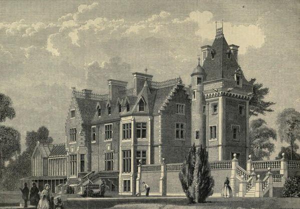
Eastbury Park, Northwood

Eastbury Park was an estate in Eastbury near Northwood, London. == History == The house was designed by David Bryce and built by a Mr Harding in the Scottish...

Oxhey Woods

Oxhey Woods is a 98 hectare Local Nature Reserve in South Oxhey in Hertfordshire, England. It is owned and managed by Three Rivers District Council.It...

Eastbury, Hertfordshire

Eastbury is a settlement in the Three Rivers district of Hertfordshire, adjacent to the Greater London suburb of Northwood in Hillingdon. Other settlements...

Oxhey Chapel

Oxhey Chapel is a redundant Anglican chapel in Oxhey, Hertfordshire, England. It is recorded in the National Heritage List for England as a designated...

South Oxhey

South Oxhey is a village in the Watford Rural parish of the Three Rivers district of Hertfordshire, England. It is located in the south western corner...

St Helen's School

St Helen's School London is a private day school for girls aged three to eighteen in Northwood, North West London. It is associated with the Merchant Taylors...

Nearby Amenities

Located within 500m of 51.623606,-0.40533579
Bus Stop
Batchworth Lane
Naptan AtcoCode: 210021803240
Naptan Bearing: SE
Naptan CommonName: Batchworth Lane
Naptan Indicator: opp
Naptan Landmark: Unknown
Naptan NaptanCode: hrtajdam
Naptan ShortCommonName: NA
Naptan Street: Sandy Lane
Naptan Verified: no
Public Transport: platform
Source: naptan_import
Lat/Long: 51.6243823/-0.4121163
Bus Stop
HMS Warrior
Bus: yes
Naptan AtcoCode: 210021803260
Naptan Bearing: S
Naptan CommonName: HMS Warrior
Naptan Indicator: opp
Naptan Landmark: Unknown
Naptan NaptanCode: hrtajdat
Naptan ShortCommonName: NA
Naptan Street: Sandy Lane
Naptan Verified: no
Public Transport: platform
Source: naptan_import
Lat/Long: 51.6205578/-0.4076044
Bus Stop
HMS Warrior
Bus: yes
Naptan AtcoCode: 210021803580
Naptan Bearing: N
Naptan CommonName: HMS Warrior
Naptan Indicator: nr
Naptan Landmark: Unknown
Naptan NaptanCode: hrtajawt
Naptan ShortCommonName: NA
Naptan Street: Sandy Lane
Naptan Verified: no
Public Transport: platform
Source: naptan_import
Lat/Long: 51.6208611/-0.4077208
Bus Stop
Blairhead Road
Naptan AtcoCode: 210021803655
Naptan Bearing: W
Naptan CommonName: Blairhead Road
Naptan Indicator: opp
Naptan Landmark: Unknown
Naptan NaptanCode: hrtajapw
Naptan PlusbusZoneRef: WATFDJ
Naptan ShortCommonName: NA
Naptan Street: Gosforth Lane
Naptan Verified: no
Public Transport: platform
Source: naptan_import
Lat/Long: 51.6272723/-0.4023131
Bus Stop
Longcliffe Path
Naptan AtcoCode: 210021803670
Naptan Bearing: W
Naptan CommonName: Longcliffe Path
Naptan Crossing: opp Embleton Road
Naptan Indicator: opp
Naptan Landmark: opp Embleton Road
Naptan NaptanCode: hrtajajm
Naptan PlusbusZoneRef: WATFDJ
Naptan ShortCommonName: NA
Naptan Street: Gosforth Lane
Naptan Verified: no
Public Transport: platform
Source: naptan_import
Lat/Long: 51.6269807/-0.4048887
Bus Stop
Muirfield Road
Local Ref: NR
Naptan AtcoCode: 210021803680
Naptan Bearing: W
Naptan BusStopType: CUS
Naptan CommonName: Muirfield Road
Naptan Crossing: Muirfield Road
Naptan Indicator: nr
Naptan Landmark: Muirfield Road
Naptan NaptanCode: hrtajajt
Naptan PlusbusZoneRef: WATFDJ
Naptan ShortCommonName: NA
Naptan Street: Oxhey Drive
Naptan Verified: no
Public Transport: platform
Source: naptan_import
Lat/Long: 51.6246783/-0.399479
Bus Stop
The Woods
Naptan AtcoCode: 210021803700
Naptan Bearing: S
Naptan BusStopType: CUS
Naptan CommonName: The Woods
Naptan Crossing: opp Oxhey Woods House
Naptan Indicator: S-bound
Naptan Landmark: opp Oxhey Woods House
Naptan NaptanCode: hrtgtgta
Naptan PlusbusZoneRef: WATFDJ
Naptan ShortCommonName: NA
Naptan Street: Oxhey Drive
Naptan Verified: no
Public Transport: platform
Source: naptan_import
Lat/Long: 51.6202012/-0.404187
Bus Stop
Oxhey Drive
Bus: yes
Naptan AtcoCode: 210021803765
Naptan Bearing: S
Naptan CommonName: Oxhey Drive
Naptan Indicator: nr
Naptan Landmark: Unknown
Naptan NaptanCode: hrtajadw
Naptan PlusbusZoneRef: WATFDJ
Naptan ShortCommonName: NA
Naptan Street: Muirfield Road
Naptan Verified: no
Public Transport: platform
Shelter: yes
Source: naptan_import
Lat/Long: 51.6244494/-0.3985405
Bus Stop
Longcliffe Path
Naptan AtcoCode: 210021804075
Naptan Bearing: E
Naptan CommonName: Longcliffe Path
Naptan Crossing: Embleton Road
Naptan Indicator: nr
Naptan Landmark: Embleton Road
Naptan NaptanCode: hrtagwpm
Naptan PlusbusZoneRef: WATFDJ
Naptan ShortCommonName: NA
Naptan Street: Gosforth Lane
Naptan Verified: no
Public Transport: platform
Source: naptan_import
Lat/Long: 51.6270612/-0.4051228
Bus Stop
Blairhead Road
Naptan AtcoCode: 210021804095
Naptan Bearing: E
Naptan CommonName: Blairhead Road
Naptan Indicator: adj
Naptan Landmark: Unknown
Naptan NaptanCode: hrtagwtd
Naptan PlusbusZoneRef: WATFDJ
Naptan ShortCommonName: NA
Naptan Street: Gosforth Lane
Naptan Verified: no
Public Transport: platform
Source: naptan_import
Lat/Long: 51.6274001/-0.4020394
050
Ele: 67.898315
Wpt Description: 050
Lat/Long: 51.626642/-0.4082518
Barrier: cycle_barrier
Bicycle: yes
Foot: yes
Lat/Long: 51.6216687/-0.4041523
Direction: 165
Generator Method: photovoltaic
Generator Output Electricity: yes
Generator Solar Modules: 10
Generator Source: solar
Generator Type: solar_photovoltaic_panel
Location: roof
Power: generator
Lat/Long: 51.6223118/-0.409913
Man Made: mast
Tower Construction: lattice
Tower Type: communication
Lat/Long: 51.6228482/-0.4038407
The data included in this document is from www.openstreetmap.org. The data is made available under ODbL.

Have you been to Oxhey Woods?

Leave your review of Oxhey Woods below (or comments, questions and feedback).