Round Spring
Wood, Forest in Hertfordshire Three Rivers
England
Round Spring
Round Spring is a small wooded area located in Hertfordshire, England. It is situated in the eastern part of the county, near the town of Hertford. The forest is known for its picturesque beauty and tranquil atmosphere, making it a popular destination for nature enthusiasts and hikers.
Covering an area of approximately 50 acres, Round Spring is characterized by its dense woodland, consisting mainly of oak, birch, and beech trees. The forest floor is adorned with a variety of wildflowers, creating a vibrant and colorful landscape during the spring and summer months. The diverse range of flora provides a habitat for numerous species of birds, butterflies, and small mammals.
The main attraction of Round Spring is its namesake, a natural spring that emerges from the forest floor and forms a small circular pool. The water from the spring is crystal clear and is believed to have healing properties. Visitors often come to the spring to relax, meditate, or simply enjoy the peacefulness of the surroundings.
Round Spring is crisscrossed by several well-maintained walking trails, allowing visitors to explore the forest and discover its hidden gems. The trails vary in difficulty, catering to both casual walkers and more experienced hikers. Along the paths, there are occasional benches and picnic areas, providing opportunities to rest and take in the beauty of the forest.
Overall, Round Spring in Hertfordshire offers a serene and idyllic escape from the bustling city life. With its lush woodland, enchanting spring, and well-marked trails, it provides a perfect setting for nature lovers to immerse themselves in the beauty of the natural world.
If you have any feedback on the listing, please let us know in the comments section below.
Round Spring Images
Images are sourced within 2km of 51.629637/-0.4110771 or Grid Reference TQ1093. Thanks to Geograph Open Source API. All images are credited.


Round Spring is located at Grid Ref: TQ1093 (Lat: 51.629637, Lng: -0.4110771)
Administrative County: Hertfordshire
District: Three Rivers
Police Authority: Hertfordshire
What 3 Words
///than.song.mute. Near Watford, Hertfordshire
Nearby Locations
Related Wikis

Hamper Mill House
Hamper Mill House is a grade II listed house in Hampermill Lane, near Watford in Hertfordshire, England. It was built in the late 18th-century and extended...
Eastbury, Hertfordshire
Eastbury is a settlement in the Three Rivers district of Hertfordshire, adjacent to the Greater London suburb of Northwood in Hillingdon. Other settlements...
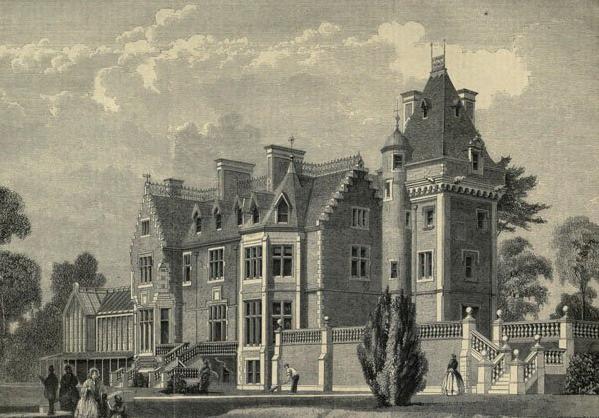
Eastbury Park, Northwood
Eastbury Park was an estate in Eastbury near Northwood, London. == History == The house was designed by David Bryce and built by a Mr Harding in the Scottish...
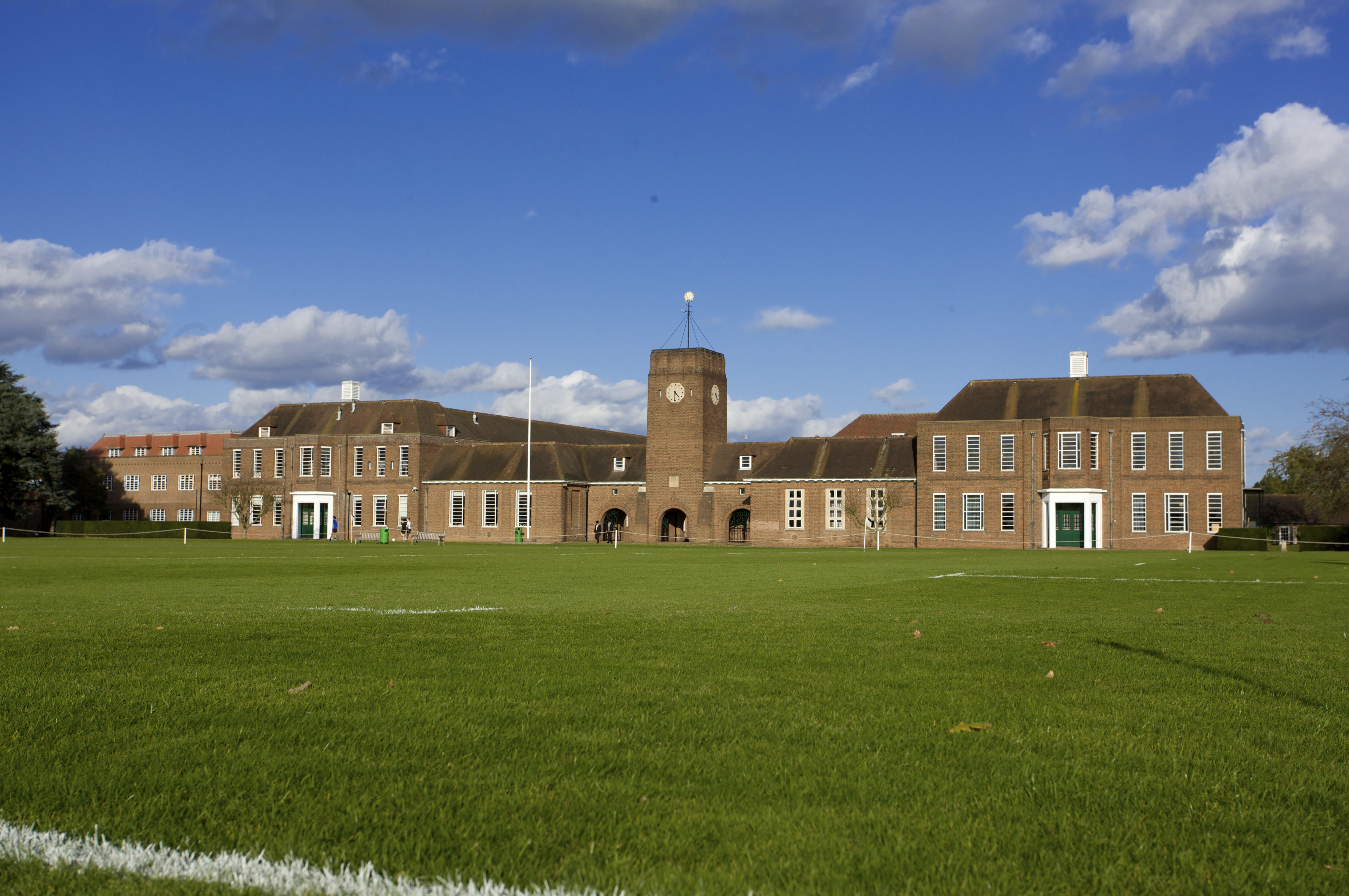
Merchant Taylors' School, Northwood
Merchant Taylors' School is an 11–18 boys public day school, founded in 1561 in London. The school has occupied various campuses over its lifetime. From...

Permanent Joint Headquarters
The Permanent Joint Headquarters (PJHQ) is the British tri-service headquarters from where all overseas military operations are planned and controlled...
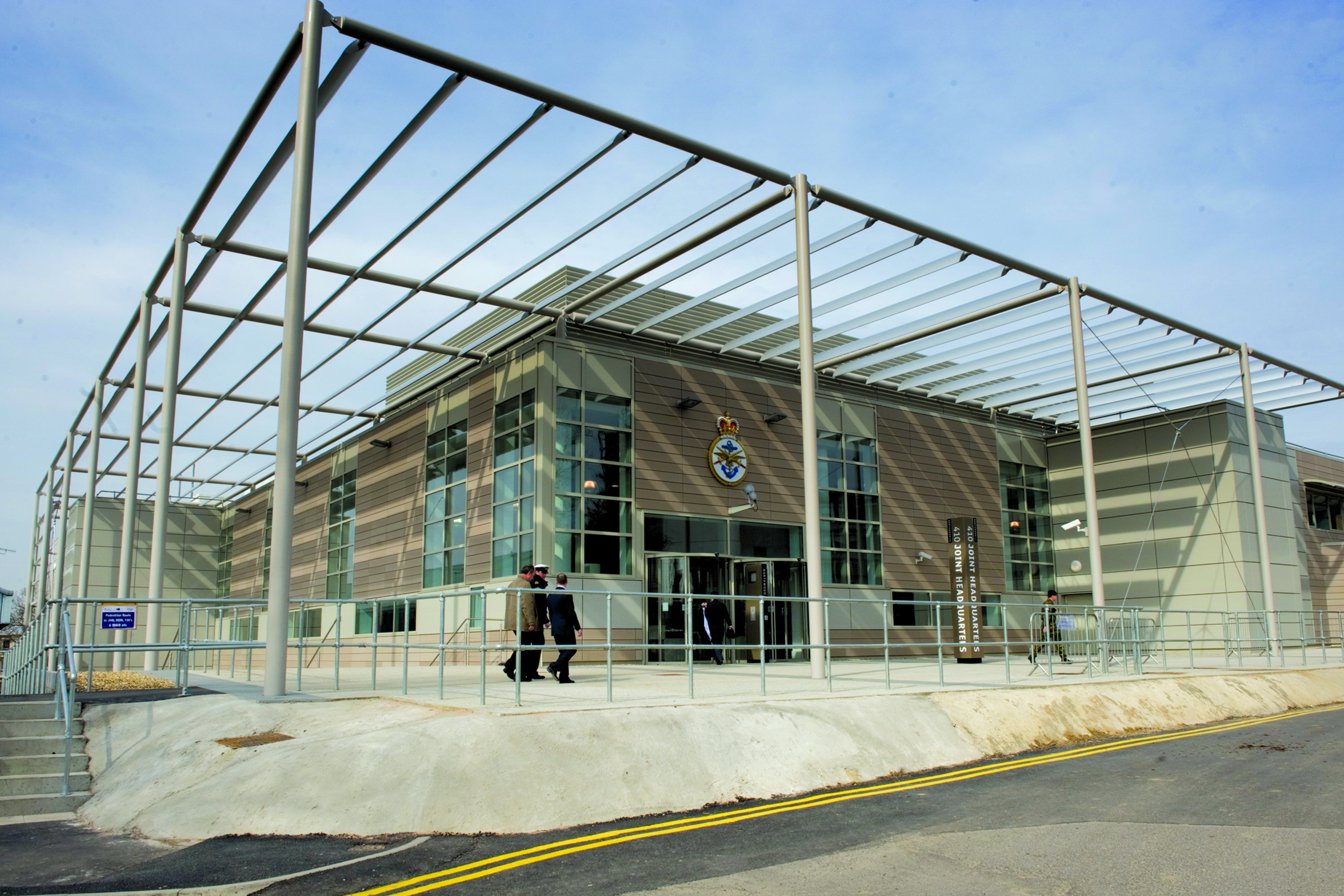
Northwood Headquarters
Northwood Headquarters is a military headquarters facility of the British Armed Forces in Eastbury, Hertfordshire, England, adjacent to the London suburb...

Oxhey Chapel
Oxhey Chapel is a redundant Anglican chapel in Oxhey, Hertfordshire, England. It is recorded in the National Heritage List for England as a designated...
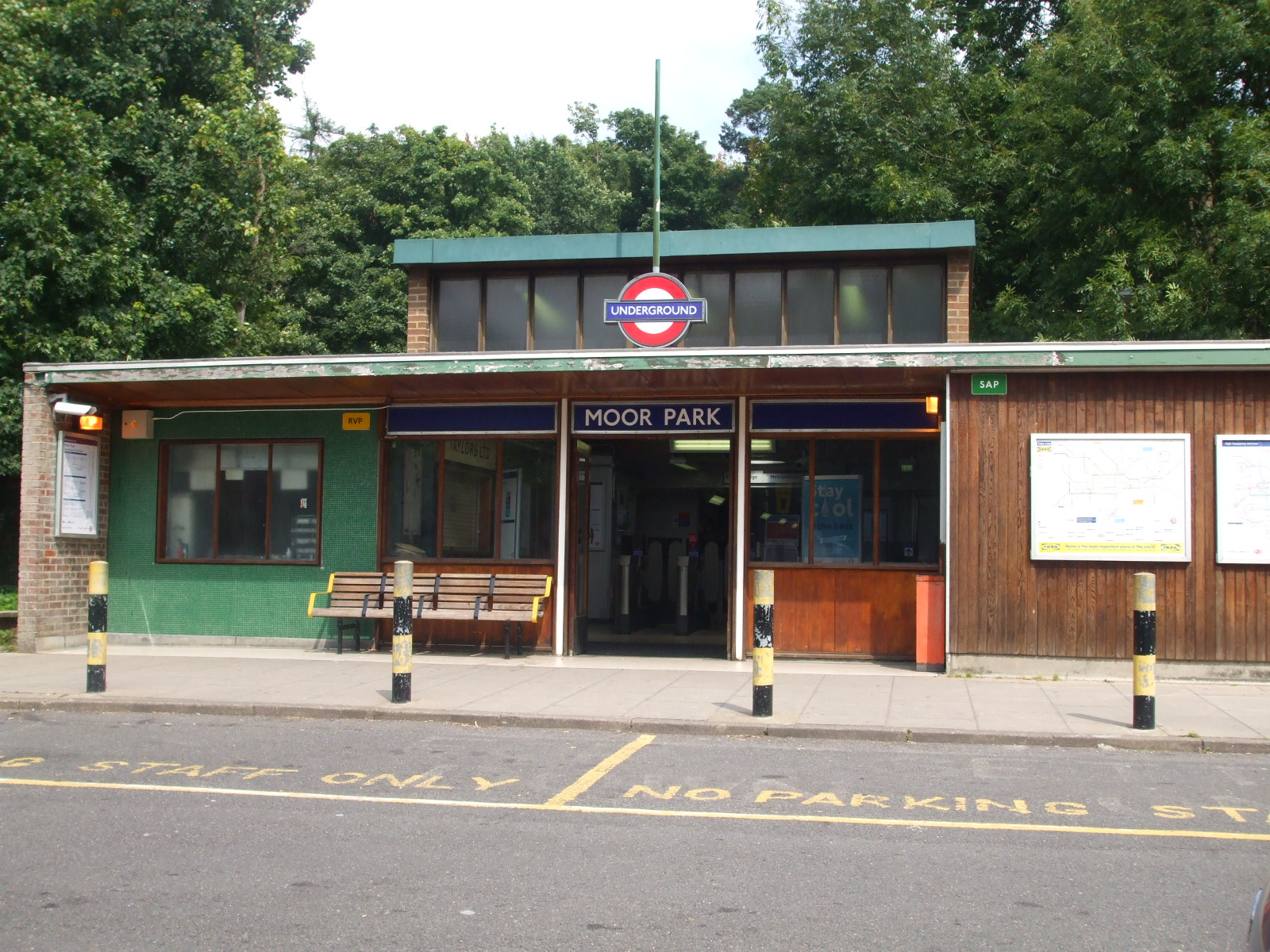
Moor Park tube station
Moor Park is a London Underground station in the Three Rivers district of Hertfordshire, serving those living on the Moor Park estate, and also on the...
Nearby Amenities
Located within 500m of 51.629637,-0.4110771Have you been to Round Spring?
Leave your review of Round Spring below (or comments, questions and feedback).