Blackwater Wood

Wood, Forest in Hertfordshire St. Albans

England

Blackwater Wood

Farmland, farmland... Looking NW from the track at TL107064 by Hill End Farm (buildings at right).
Farmland, farmland... Credit: Rob Hinkley

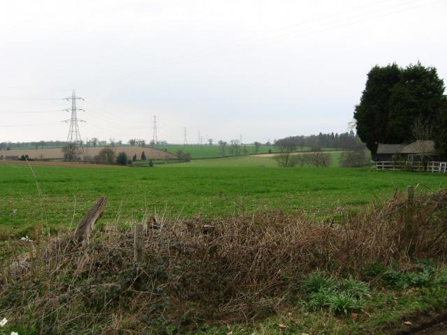
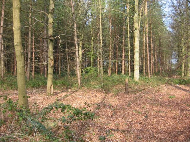
Blackwater Wood is a picturesque woodland located in Hertfordshire, England. Covering an area of approximately 100 acres, it is a popular destination for nature enthusiasts and hikers alike. The wood is situated near the town of Hertford and is easily accessible by road.

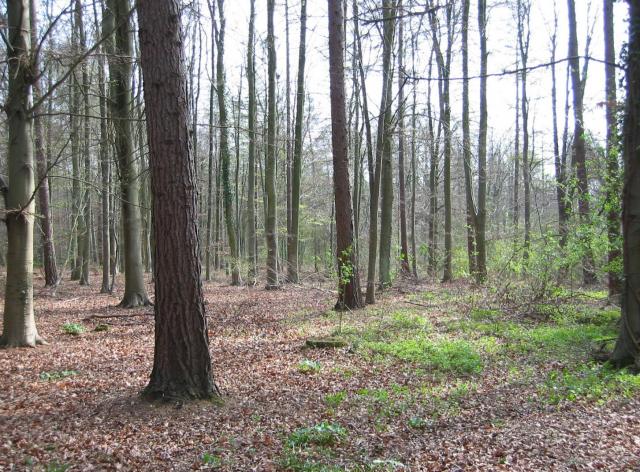
Blackwater Wood is characterized by its dense and diverse vegetation, consisting primarily of broadleaf trees such as oak, beech, and birch. The forest floor is rich in flora, with a variety of wildflowers, ferns, and mosses thriving in the moist and shaded environment. The wood is also home to numerous species of wildlife, including deer, rabbits, and a variety of bird species.

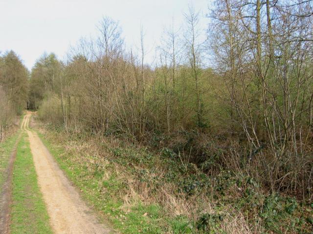
Several well-maintained trails wind through the wood, providing visitors with the opportunity to explore its natural beauty. These paths offer a peaceful and tranquil atmosphere, making it an ideal location for a leisurely stroll or a family picnic. Along the trails, there are also designated areas for birdwatching and photography.

Blackwater Wood is managed by the local authorities, ensuring its preservation and conservation. As a protected area, the wood serves as an important habitat for both flora and fauna, contributing to the overall biodiversity of the region.

Overall, Blackwater Wood offers a serene and idyllic escape from the bustling urban environment. Its natural beauty, diverse wildlife, and well-maintained trails make it a perfect destination for nature lovers and those seeking a peaceful retreat in the heart of Hertfordshire.

If you have any feedback on the listing, please let us know in the comments section below.

Blackwater Wood Images

Images are sourced within 2km of 51.740166/-0.41571939 or Grid Reference TL0905. Thanks to Geograph Open Source API. All images are credited.

Farmland, farmland... Looking NW from the track at TL107064 by Hill End Farm (buildings at right).
Farmland, farmland...
Looking NW from the track at TL107064 by Hill End Farm (buildings at right).
Corrugated tin church, Bedmond The Church Of The Ascension at Bedmond, in the NE corner of the grid square, is very small and seems to be built almost entirely from sheets of corrugated metal.
Corrugated tin church, Bedmond
The Church Of The Ascension at Bedmond, in the NE corner of the grid square, is very small and seems to be built almost entirely from sheets of corrugated metal.
Tin church, Bedmond Another photo of the little sheet-metal church in Bedmond.
Tin church, Bedmond
Another photo of the little sheet-metal church in Bedmond.
Potterscrouch Plantations Looking East from the forestry track in Potterscrouch Plantations at TL104047.
Potterscrouch Plantations
Looking East from the forestry track in Potterscrouch Plantations at TL104047.
Plantation Looking SW from the track through the woods at TL104047.
Plantation
Looking SW from the track through the woods at TL104047.
New growth in plantation Looking E along the track in the woods at about TL105053. Not the classiest woods, mind you - they seem to be a popular venue for fly-tipping and burning cars, to judge by patches of wreckage.
New growth in plantation
Looking E along the track in the woods at about TL105053. Not the classiest woods, mind you - they seem to be a popular venue for fly-tipping and burning cars, to judge by patches of wreckage.
The "Funny Farm"  Bedmond I presume that this farm is available for children
that hands on stuff
The "Funny Farm" Bedmond
I presume that this farm is available for children that hands on stuff
White Hart Inn Bedmond Just a confirmation that it exists.
White Hart Inn Bedmond
Just a confirmation that it exists.
The Swan Inn, Pimlico  Herts Evidence that the people of Pimlico get thirsty
The Swan Inn, Pimlico Herts
Evidence that the people of Pimlico get thirsty
Village welcome sign to Nash Mills The entrance is into Bunkers Lane but Nash Mills itself is some 4 kilometres away
Village welcome sign to Nash Mills
The entrance is into Bunkers Lane but Nash Mills itself is some 4 kilometres away
The composting facility This establishment with the huge piles of composting material implies that the stuff isn't 
getting into the commercial circuit.
The composting facility
This establishment with the huge piles of composting material implies that the stuff isn't getting into the commercial circuit.
Bridge over Beechtree Lane The design of this bridge carrying the M10 just before it merges with the M1 is typical of the period with the rustications
Bridge over Beechtree Lane
The design of this bridge carrying the M10 just before it merges with the M1 is typical of the period with the rustications
Westwick Row Farm The M1 motorway passes very close to the house
Westwick Row Farm
The M1 motorway passes very close to the house
Westwick Row Farm The farm yard has a neat and tidy appearance .perhaps due to its close proximity to the lane.
Westwick Row Farm
The farm yard has a neat and tidy appearance .perhaps due to its close proximity to the lane.
Leverstock Green Primary School Interesting to see the "Tiny Tots" sign as well
Leverstock Green Primary School
Interesting to see the "Tiny Tots" sign as well
Junior School Leverstock Green Seeing all the glass makes me wonder if it is double glazed {considering the age of the structure} if not it must be an ice box.
Junior School Leverstock Green
Seeing all the glass makes me wonder if it is double glazed {considering the age of the structure} if not it must be an ice box.
Petrol Station at Leverstock Green Being BP they operate the Nectar card loyalty scheme
Petrol Station at Leverstock Green
Being BP they operate the Nectar card loyalty scheme
Shops at Leverstock Green This area opposite the green has all the commercial
elements Petrol filling, shops, pub plus the cricket pitch
Shops at Leverstock Green
This area opposite the green has all the commercial elements Petrol filling, shops, pub plus the cricket pitch
Show me another place!

Blackwater Wood is located at Grid Ref: TL0905 (Lat: 51.740166, Lng: -0.41571939)

Administrative County: Hertfordshire

District: St. Albans

Police Authority: Hertfordshire

What 3 Words

///helps.pest.sticky. Near Hemel Hempstead, Hertfordshire

Nearby Locations

Pimlico Blackwater Wood

Related Wikis

Centurion Club

The Centurion Club is a golf club in Hemel Hempstead in Hertfordshire. The club opened in 2013. It has hosted the GolfSixes series in 2017 and 2018 and...

International Crown

The Hanwha LifePlus International Crown is a biennial women's professional team golf tournament on the LPGA Tour. Eight national teams of four players...

Westwick Row

Westwick Row is a place in Hertfordshire, in England. It is situated on the edge of Hemel Hempstead. Westwick Row today is a narrow rural lane in the village...

Leverstock Green F.C.

Leverstock Green Football Club is a football club based in the Leverstock Green suburb of Hemel Hempstead, Hertfordshire, England. They are currently members...

Leverstock Green

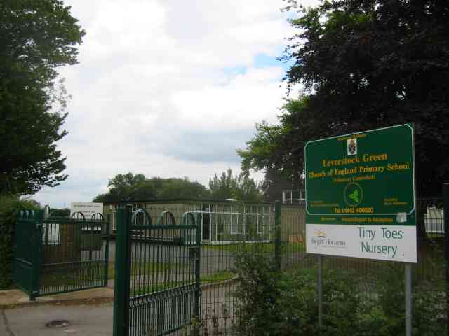
Leverstock Green is a village in the English county of Hertfordshire. It is located between Hemel Hempstead and St Albans Leverstock Green has a school...

Longdean School

Longdean School is a secondary school and sixth form with academy status, located in the southeast of Hemel Hempstead, Hertfordshire. The academy specialises...

Long Deans

Long Deans is a 15 hectare nature reserve managed by the Herts and Middlesex Wildlife Trust in Nash Mills, between Kings Langley and Hemel Hempstead in...

Bedmond

Bedmond is a village in the Three Rivers district of the English ceremonial county of Hertfordshire. It is located around one mile (1.6 km) north of the...

Nearby Amenities

Located within 500m of 51.740166,-0.41571939
Bus Stop
Bunkers Lane
Bus: yes
Local Ref: NR
Naptan AtcoCode: 210021401160
Naptan Bearing: NW
Naptan CommonName: Bunkers Lane
Naptan Crossing: opp Blackwater Lane
Naptan Indicator: nr
Naptan Landmark: opp Blackwater Lane
Naptan NaptanCode: hrtdmadp
Naptan ShortCommonName: NA
Naptan Street: Bedmond Road
Naptan Verified: no
Public Transport: platform
Source: naptan_import
Lat/Long: 51.7411875/-0.4225086
Bus Stop
Blackwater Lane
Naptan AtcoCode: 210021502760
Naptan Bearing: SE
Naptan CommonName: Blackwater Lane
Naptan Crossing: opp Blackwater Lane
Naptan Indicator: opp
Naptan Landmark: opp Blackwater Lane
Naptan NaptanCode: hrtawtwp
Naptan ShortCommonName: NA
Naptan Street: Hemel Hempstead Road
Naptan Verified: no
Public Transport: platform
Source: naptan_import
Lat/Long: 51.7435391/-0.4155028
Bus Stop
Corner Farm
Bench: no
Bin: no
Local Ref: NR
Naptan AtcoCode: 210021502780
Naptan Bearing: E
Naptan CommonName: Corner Farm
Naptan Crossing: Westwick Row
Naptan Indicator: nr
Naptan Landmark: Westwick Row
Naptan NaptanCode: hrtawtwt
Naptan ShortCommonName: NA
Naptan Street: Hemel Hempstead Road
Naptan Verified: no
Public Transport: platform
Shelter: no
Source: naptan_import
Lat/Long: 51.7426549/-0.4107494
Bus Stop
Bunkers Lane
Bus: yes
Naptan AtcoCode: 210021503120
Naptan Bearing: SE
Naptan CommonName: Bunkers Lane
Naptan Crossing: Blackwater Lane
Naptan Indicator: opp
Naptan Landmark: Blackwater Lane
Naptan NaptanCode: hrtgtjwm
Naptan ShortCommonName: NA
Naptan Street: Bedmond Road
Naptan Verified: no
Public Transport: platform
Source: naptan_import
Lat/Long: 51.7405/-0.4215332
Bus Stop
Corner Farm
Naptan AtcoCode: 210021508940
Naptan Bearing: W
Naptan CommonName: Corner Farm
Naptan Crossing: opp Westwick Row
Naptan Indicator: opp
Naptan Landmark: opp Westwick Row
Naptan NaptanCode: hrtatptp
Naptan ShortCommonName: NA
Naptan Street: Hemel Hempstead Road
Naptan Verified: no
Public Transport: platform
Shelter: no
Source: naptan_import
Lat/Long: 51.7427097/-0.4117495
Bus Stop
Blackwater Lane
Local Ref: NR
Naptan AtcoCode: 210021508960
Naptan Bearing: W
Naptan CommonName: Blackwater Lane
Naptan Crossing: Westwick Nurserys
Naptan Indicator: nr
Naptan Landmark: Westwick Nurserys
Naptan NaptanCode: hrtatptw
Naptan ShortCommonName: NA
Naptan Street: Hemel Hempstead Road
Naptan Verified: no
Public Transport: platform
Source: naptan_import
Lat/Long: 51.7437317/-0.4165793
Speed Camera
Lat/Long: 51.7432838/-0.4146849
Place Of Worship
Plymouth Bretheren Meeting Hall
Denomination: Plymouth Bretheren
Religion: christian
Lat/Long: 51.7434617/-0.417443
Power: pole
Lat/Long: 51.7440033/-0.4140982
Power: pole
Lat/Long: 51.7429408/-0.4137487
Traffic Calming: island
Lat/Long: 51.7431271/-0.4139936
Power: pole
Lat/Long: 51.7417801/-0.413534
Power: pole
Lat/Long: 51.7406435/-0.4133688
Power: pole
Lat/Long: 51.7394725/-0.4131551
Power: pole
Lat/Long: 51.738357/-0.4129719
Power: pole
Lat/Long: 51.7373183/-0.4127995
Power: pole
Lat/Long: 51.7363407/-0.4126361
Communication Mobile Phone: yes
Man Made: mast
Tower Construction: lattice
Tower Type: communication
Lat/Long: 51.7421762/-0.4114071
Colour: white
Marker: post
Material: concrete
Utility: oil
Lat/Long: 51.7367108/-0.4180385
Colour: white
Marker: post
Material: concrete
Utility: oil
Lat/Long: 51.7367058/-0.4180383
Colour: white
Marker: post
Material: concrete
Utility: oil
Lat/Long: 51.7367008/-0.4180347
Colour: white
Marker: aerial
Material: concrete
Utility: oil
Lat/Long: 51.7367042/-0.4180437
Colour: white
Marker: post
Material: plastic
Utility: oil
Lat/Long: 51.7367821/-0.4177804
Colour: white
Marker: post
Material: plastic
Utility: oil
Lat/Long: 51.7367871/-0.417784
The data included in this document is from www.openstreetmap.org. The data is made available under ODbL.

Have you been to Blackwater Wood?

Leave your review of Blackwater Wood below (or comments, questions and feedback).