Pedley Wood

Wood, Forest in Bedfordshire

England

Pedley Wood

River Flit, Beadlow, Clophill, Beds a tributary of the River Ivel; view E towards Chicksands.
River Flit, Beadlow, Clophill, Beds Credit: Rodney Burton

The requested URL returned error: 429 Too Many Requests

If you have any feedback on the listing, please let us know in the comments section below.
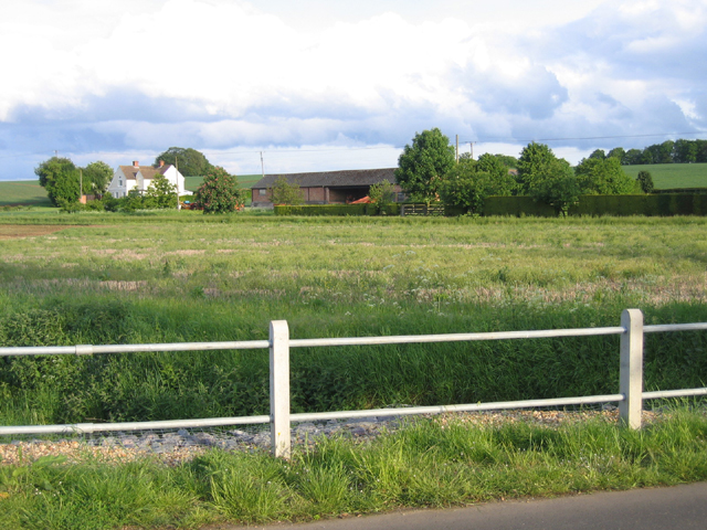
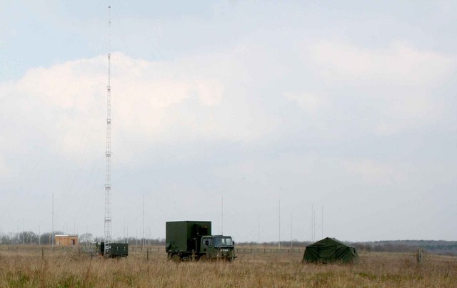
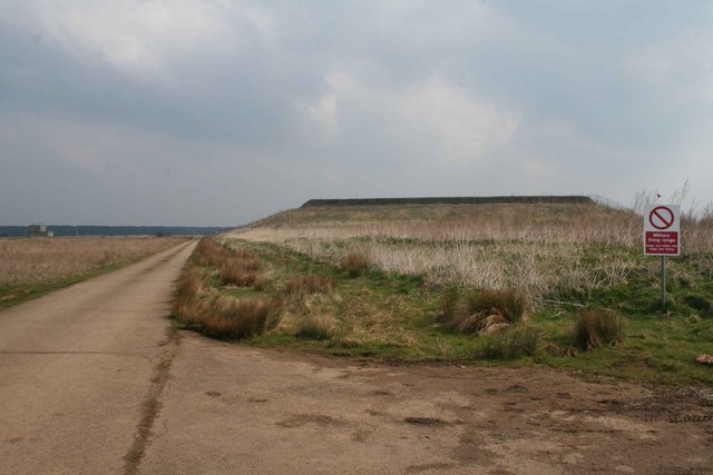
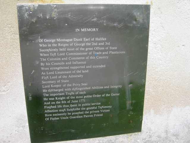
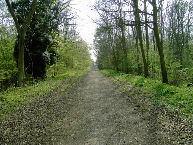
Pedley Wood Images

Images are sourced within 2km of 52.04468/-0.4058781 or Grid Reference TL0939. Thanks to Geograph Open Source API. All images are credited.

River Flit, Beadlow, Clophill, Beds a tributary of the River Ivel; view E towards Chicksands.
River Flit, Beadlow, Clophill, Beds
a tributary of the River Ivel; view E towards Chicksands.
Wood Farm, Appley Corner, Haynes, Beds – view from the Standalone Warren road.
Wood Farm, Appley Corner, Haynes, Beds
– view from the Standalone Warren road.
Ministry of Defence facility MOD generator truck, tent and radio transmitter masts 84m above sea level.  To the right is a firing range.
Ministry of Defence facility
MOD generator truck, tent and radio transmitter masts 84m above sea level. To the right is a firing range.
Firing Range Keep out when red flag is flying.  You can just see the flag behind and you could hear the gunfire.
Firing Range
Keep out when red flag is flying. You can just see the flag behind and you could hear the gunfire.
Footpath Sign Bedfordshire County Council Footpath sign
Footpath Sign
Bedfordshire County Council Footpath sign
Barn Conversions Barn conversions at Speedsdairy Farm.  Note the clay tiles on the main buildings and the black timber weatherboarding and pantiles on the subservient buildings.  No chimneys, not many windows and conservation rooflights - keep the planners content.
Barn Conversions
Barn conversions at Speedsdairy Farm. Note the clay tiles on the main buildings and the black timber weatherboarding and pantiles on the subservient buildings. No chimneys, not many windows and conservation rooflights - keep the planners content.
Disused farmland
Disused farmland
Obelisk In Chicksands Wood
Detail On the Obelisk At Chicksands Wood
Along Greensands Ridge Walk
Looking SSW in Chicksands Wood
The Obelisk in Chicksands Wood from the NE
Entering Chicksands Wood From Appley Corner
Cottage At Appley Corner
John Bunyan Trail Viewed from appley corner
John Bunyan Trail
Viewed from appley corner
Greensand Ridge Walk Sign post showing the path heading north towards Haynes and eastish.
Greensand Ridge Walk
Sign post showing the path heading north towards Haynes and eastish.
Greensand Ridge Walk The GRW path heading north into Haynes.
Greensand Ridge Walk
The GRW path heading north into Haynes.
Obelisk for George Montagu-Dunk  Chicksands Woods As you walk down the Long Drive in Chicksands Woods you discover this Obelisk shown on the OS map.  It has a plaque visible in this image, I have also submitted a close up of it.  The Obelisk is in memory of George Montagu-Dunk, 2nd Earl of Halifax, (6 October 1716 – 8 June 1771) who was a British statesman of the Georgian era.

There is an article about him via the

<span class="nowrap"><a title="http://en.wikipedia.org/wiki/George_Montagu-Dunk,_2nd_Earl_of_Halifax" rel="nofollow ugc noopener" href="http://en.wikipedia.org/wiki/George_Montagu-Dunk,_2nd_Earl_of_Halifax">Link</a><img style="margin-left:2px;" alt="External link" title="External link - shift click to open in new window" src="https://s1.geograph.org.uk/img/external.png" width="10" height="10"/></span>
Obelisk for George Montagu-Dunk Chicksands Woods
As you walk down the Long Drive in Chicksands Woods you discover this Obelisk shown on the OS map. It has a plaque visible in this image, I have also submitted a close up of it. The Obelisk is in memory of George Montagu-Dunk, 2nd Earl of Halifax, (6 October 1716 – 8 June 1771) who was a British statesman of the Georgian era. There is an article about him via the LinkExternal link
Show me another place!

Pedley Wood is located at Grid Ref: TL0939 (Lat: 52.04468, Lng: -0.4058781)

Unitary Authority: Central Bedfordshire

Police Authority: Bedfordshire

What 3 Words

///repeats.pimples.tilts. Near Clophill, Bedfordshire

Nearby Locations

Pedley Wood

Related Wikis

St Mary's Church, Clophill

The present St Mary's Church is located in the centre of the small village of Clophill, between Bedford and Luton in the South Midlands of England. The...

Haynes, Bedfordshire

Haynes is a village and civil parish in Bedfordshire, England, about seven miles (11 km) south of Bedford. It includes the small hamlet of Haynes Church...

Woburn Sands Formation

The Woburn Sands Formation is a geological formation in England. Part of the Lower Greensand Group, it is the only unit of the group where it occurs, and...

Beadlow Priory

Beadlow Priory was a monastic foundation established between 1140 and 1146 by Robert D'Albini for a community of Benedictine monks. == History == Around...

Nearby Amenities

Located within 500m of 52.04468,-0.4058781
Barrier: kissing_gate
Foot: yes
Lat/Long: 52.0454001/-0.4083971
Historic: memorial
Note: to Henry John Robert Osborn
Lat/Long: 52.0434972/-0.4013411
The data included in this document is from www.openstreetmap.org. The data is made available under ODbL.

Have you been to Pedley Wood?

Leave your review of Pedley Wood below (or comments, questions and feedback).