Hacconby Spinney

Wood, Forest in Lincolnshire South Kesteven

England

Hacconby Spinney

St.John the Baptist's church, Morton, Lincs. A grand cruciform church looking down on the village of Morton. Perpendicular tower, decorated chancel and south arcade, but the 4 bay north arcade is late 13th century Early English and has particularly good capitals.
St.John the Baptist's church, Morton, Lincs. Credit: Richard Croft

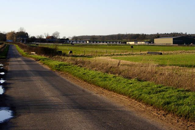
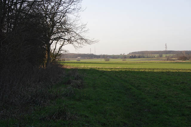
Hacconby Spinney is a small woodland located in the county of Lincolnshire, England. Situated near the village of Hacconby, it covers an area of approximately 10 acres and is renowned for its natural beauty and biodiversity.

The spinney is predominantly composed of deciduous trees, including oak, ash, and birch, which provide a diverse habitat for a wide variety of wildlife. The dense vegetation and leaf litter on the forest floor create a rich ecosystem, supporting numerous plant species, such as bluebells, primroses, and wild garlic.

The woodland is a popular destination for nature enthusiasts and walkers, who can explore its network of narrow footpaths and trails. These pathways wind through the trees, offering visitors a peaceful and tranquil environment to enjoy the sights and sounds of nature.

Hacconby Spinney is also home to a range of wildlife, including squirrels, badgers, and a variety of bird species, such as woodpeckers and tawny owls. The woodland provides an important habitat for these creatures, offering shelter, food, and nesting sites.

The management of Hacconby Spinney is overseen by local conservation groups and the Forestry Commission, ensuring the preservation of its natural qualities. Efforts are made to maintain the balance between conservation and human activities to protect the delicate ecosystem.

Overall, Hacconby Spinney is a picturesque and ecologically valuable woodland, providing a haven for wildlife and offering visitors a chance to connect with nature in the heart of Lincolnshire.

If you have any feedback on the listing, please let us know in the comments section below.

Hacconby Spinney Images

Images are sourced within 2km of 52.812549/-0.37926644 or Grid Reference TF0925. Thanks to Geograph Open Source API. All images are credited.

St.John the Baptist's church, Morton, Lincs. A grand cruciform church looking down on the village of Morton. Perpendicular tower, decorated chancel and south arcade, but the 4 bay north arcade is late 13th century Early English and has particularly good capitals.
St.John the Baptist's church, Morton, Lincs.
A grand cruciform church looking down on the village of Morton. Perpendicular tower, decorated chancel and south arcade, but the 4 bay north arcade is late 13th century Early English and has particularly good capitals.
Hanthorpe The farm building in the foreground is built of the local Jurassic limestone.
Hanthorpe
The farm building in the foreground is built of the local Jurassic limestone.
Morton Village On the junction with the A15 trunk road.
Morton Village
On the junction with the A15 trunk road.
Footpath to Stainfield This footpath leads from the A15 to Stainfield.
Footpath to Stainfield
This footpath leads from the A15 to Stainfield.
Morton church Morton church on a sunny November afternoon
Morton church
Morton church on a sunny November afternoon
Stainfield Spa In 1720 a Dr Edward Greathead of Lincoln discovered the existence of mineral springs in the vicinity and a well house was built for the convenience of the many visitors, but nothing of this exists now apart from the name Spa Farm: a livery stable. The gap in the hedge is where the footpath exits onto the Kirky Underwood road.
Stainfield Spa
In 1720 a Dr Edward Greathead of Lincoln discovered the existence of mineral springs in the vicinity and a well house was built for the convenience of the many visitors, but nothing of this exists now apart from the name Spa Farm: a livery stable. The gap in the hedge is where the footpath exits onto the Kirky Underwood road.
Elsthorpe Road, Stainfield
Kirkby Underwood Road Looking towards Stainfield with Ringstone Wood to the left and Dunsby Wood straight ahead.
Kirkby Underwood Road
Looking towards Stainfield with Ringstone Wood to the left and Dunsby Wood straight ahead.
Stainfield Spa from the footpath access Standing on the stile on Kirkby Underwood Road.
Stainfield Spa from the footpath access
Standing on the stile on Kirkby Underwood Road.
Farmland near Stainfield Dunsby Wood is on the horizon.
Farmland near Stainfield
Dunsby Wood is on the horizon.
Public footpath Looking towards Dunsby from the stile on the A15. Standing in the shadow of Dunsby Wood on a bright January afternoon.
Public footpath
Looking towards Dunsby from the stile on the A15. Standing in the shadow of Dunsby Wood on a bright January afternoon.
Looking towards Bourne on the A15 Dunsby Wood on the right.
Looking towards Bourne on the A15
Dunsby Wood on the right.
Dunsby Wood This large mixed woodland is part of a string of woodland across this part of Lincolnshire. It is commercially managed for timber and this section is mainly oak. Taken from the public bridleway.
Dunsby Wood
This large mixed woodland is part of a string of woodland across this part of Lincolnshire. It is commercially managed for timber and this section is mainly oak. Taken from the public bridleway.
Looking towards Spa Farm Spa Farm is a thriving riding centre. The row of white buildings is a stable block.
Looking towards Spa Farm
Spa Farm is a thriving riding centre. The row of white buildings is a stable block.
In the shadow of Dunsby Wood The low January afternoon sun casts long shadows from the trees. The houses on the horizon are at Littleworth Barn in <a href="https://www.geograph.org.uk/gridref/TF0828">TF0828</a>.
In the shadow of Dunsby Wood
The low January afternoon sun casts long shadows from the trees. The houses on the horizon are at Littleworth Barn in TF0828.
Farmland by Dunsby Wood There are several woods along the East Glrn River valley northwest of Bourne. Dunsby Wood is privately owned while <a href="https://www.geograph.org.uk/photo/312134">TF0720 : Bourne Woods, Lincolnshire</a> to the south of this square, <a href="https://www.geograph.org.uk/photo/312154">TF0626 : Callan's Lane Wood at dusk</a> in the distance to the left, and Temple Wood on the horizon to the right, (<a href="https://www.geograph.org.uk/gridref/TF0528">TF0528</a>, <a href="https://www.geograph.org.uk/gridref/TF0529">TF0529</a> and <a href="https://www.geograph.org.uk/gridref/TF0628">TF0628</a>), are owned by the Forestry Commission and have public access.
Farmland by Dunsby Wood
There are several woods along the East Glrn River valley northwest of Bourne. Dunsby Wood is privately owned while TF0720 : Bourne Woods, Lincolnshire to the south of this square, TF0626 : Callan's Lane Wood at dusk in the distance to the left, and Temple Wood on the horizon to the right, (TF0528, TF0529 and TF0628), are owned by the Forestry Commission and have public access.
Dunsby Wood Low winter sunshine streaming through the conifers in this part felled area in the centre of Dunsby Wood, a mixed private woodland north of Stainfield. Younger trees can be seen beyond.
Taken from the private gated entrance off the public bridleway which skirts the woodland on its way to Glebe Farm.
Dunsby Wood
Low winter sunshine streaming through the conifers in this part felled area in the centre of Dunsby Wood, a mixed private woodland north of Stainfield. Younger trees can be seen beyond. Taken from the private gated entrance off the public bridleway which skirts the woodland on its way to Glebe Farm.
Farmland at Hanthorpe The houses in the distance are on Stanfield Road in <a href="https://www.geograph.org.uk/gridref/TF0824">TF0824</a>.
Farmland at Hanthorpe
The houses in the distance are on Stanfield Road in TF0824.
Show me another place!

Hacconby Spinney is located at Grid Ref: TF0925 (Lat: 52.812549, Lng: -0.37926644)

Administrative County: Lincolnshire

District: South Kesteven

Police Authority: Lincolnshire

What 3 Words

///direction.nation.zoned. Near Bourne, Lincolnshire

Related Wikis

Morton and Hanthorpe

Morton and Hanthorpe is a civil parish, formerly known as Morton by Bourne in the South Kesteven district of Lincolnshire, England. It is situated 2 miles...

Haconby

Haconby is a village and civil parish in the South Kesteven district of Lincolnshire, England. The population of the civil parish at the 2001 census was...

Stainfield near Bourne

Stainfield is a hamlet in the South Kesteven district of Lincolnshire, England. It is 3 miles (5 km) north from Bourne and 1 mile (1.6 km) west from the...

Morton Road railway station

Morton Road railway station was a station serving the village of Morton, Lincolnshire on the Great Northern Railway Bourne and Sleaford railway. It opened...

Dunsby

Dunsby is a small village and civil parish in the South Kesteven district of in Lincolnshire, England. It is 4 miles (6.4 km) north from Bourne, just east...

St Andrew's Church, Rippingale

The Church of St Andrew in Rippingale, Lincolnshire, England, is a Grade Iā€“listed Anglican church. The earliest phase of the church dates back to the mid...

Rippingale

Rippingale is a village and civil parish in the South Kesteven district of Lincolnshire, England. The population of the civil parish was 929 at the 2011...

Dyke, Lincolnshire

Dyke is a village in the South Kesteven district of Lincolnshire, England. It is situated less than 1 mile (1.6 km) east from the A15 road, and approximately...

Nearby Amenities

Located within 500m of 52.812549,-0.37926644
Bus Stop
A15 Crossroads
Bus: yes
Naptan AtcoCode: 270000008716
Naptan Bearing: E
Naptan CommonName: A15 Crossroads
Naptan Indicator: E - bound
Naptan Landmark: A15 Crossroads
Naptan NaptanCode: lingtpmg
Naptan Street: Stainfield Lane
Naptan Verified: no
Public Transport: platform
Source: naptan_import
Lat/Long: 52.814346/-0.3779494
Bus Stop
A15 Crossroads
Bus: yes
Naptan AtcoCode: 270000008717
Naptan Bearing: W
Naptan CommonName: A15 Crossroads
Naptan Indicator: W - bound
Naptan Landmark: A15 Crossroads
Naptan NaptanCode: lingtpmj
Naptan Street: Stainfield Lane
Naptan Verified: no
Public Transport: platform
Source: naptan_import
Lat/Long: 52.8142502/-0.3781755
Hacconby Grange
Place: farm
Source: Bing
Lat/Long: 52.8140003/-0.3810379
Haakon House
Building: residential
Source: Bing
Lat/Long: 52.8139707/-0.3767657
Give Way
Direction: backward
Source: Bing
Lat/Long: 52.8156935/-0.3768952
Give Way
Direction: backward
Source: Bing
Lat/Long: 52.8161375/-0.376824
Give Way
Direction: forward
Source: Bing
Lat/Long: 52.8161008/-0.3766347
Haakon House
Place: isolated_dwelling
Lat/Long: 52.8140136/-0.3767645
The Bungalow
Place: isolated_dwelling
Lat/Long: 52.8146555/-0.3767967
The data included in this document is from www.openstreetmap.org. The data is made available under ODbL.

Have you been to Hacconby Spinney?

Leave your review of Hacconby Spinney below (or comments, questions and feedback).