Wood's Plantation

Wood, Forest in Surrey Guildford

England

Wood's Plantation

Access to Hermitage Plantation
Access to Hermitage Plantation Credit: James Emmans

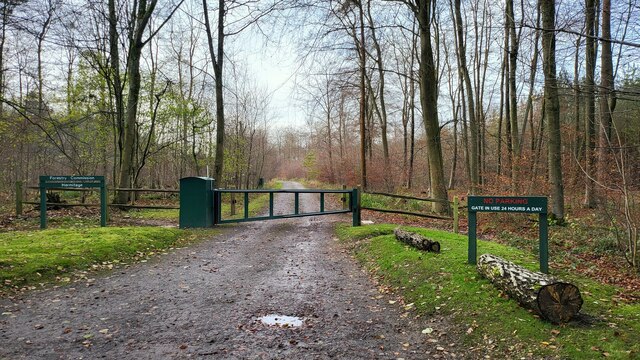
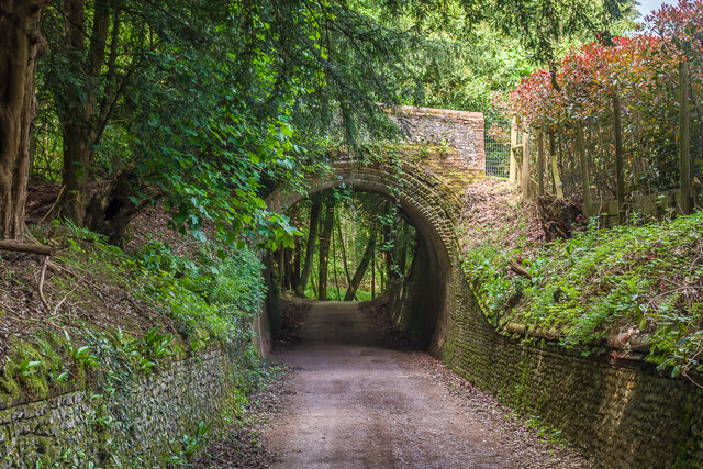
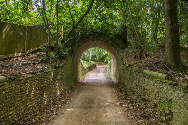
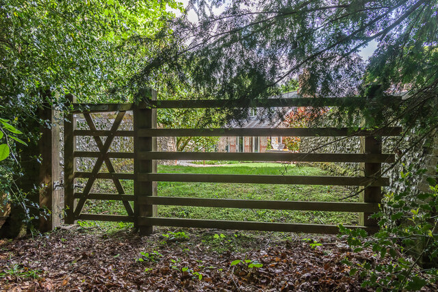
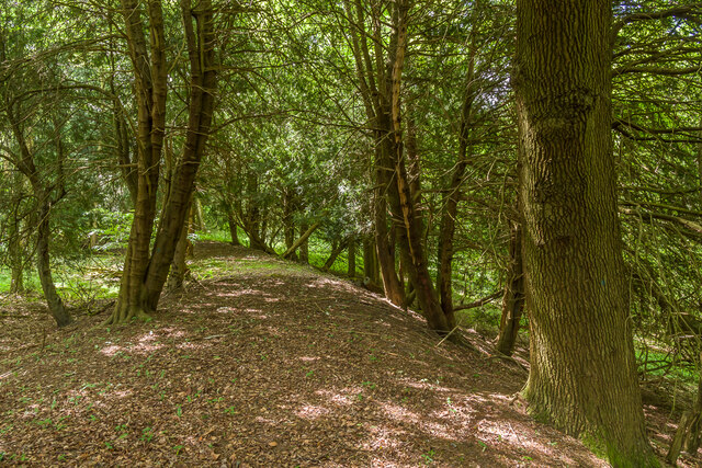
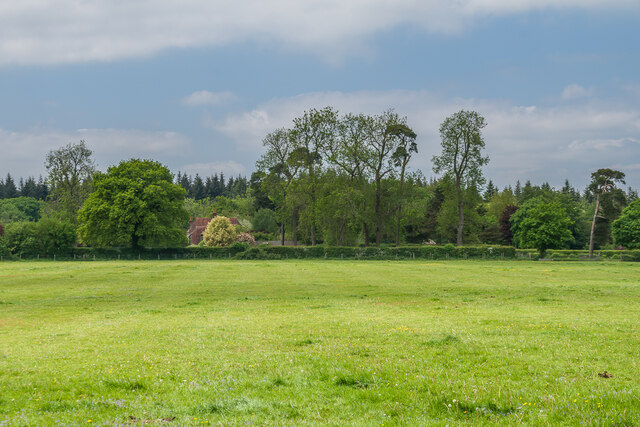
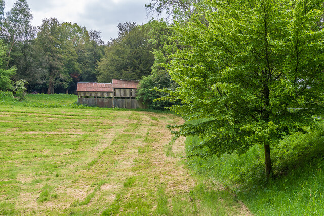
Wood's Plantation, also known as Wood's Forest, is a historical estate located in Surrey, England. Situated in the heart of the county, it spans over a vast area of lush greenery and is known for its picturesque landscapes and rich history.

The plantation dates back to the 18th century and was originally established as a private estate by the Wood family, who were prominent landowners in the area. The family played a significant role in the agricultural and industrial development of Surrey, making Wood's Plantation a center of economic activity.

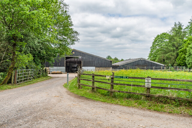
The estate features a grand manor house, which serves as the centerpiece of the property. Built in a traditional Georgian style, the house is known for its elegant architecture and stunning interior design. It is surrounded by well-maintained gardens and a sprawling parkland, offering visitors a serene and tranquil atmosphere.

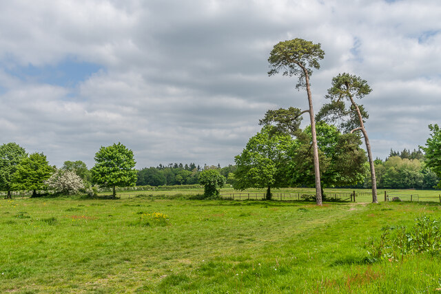
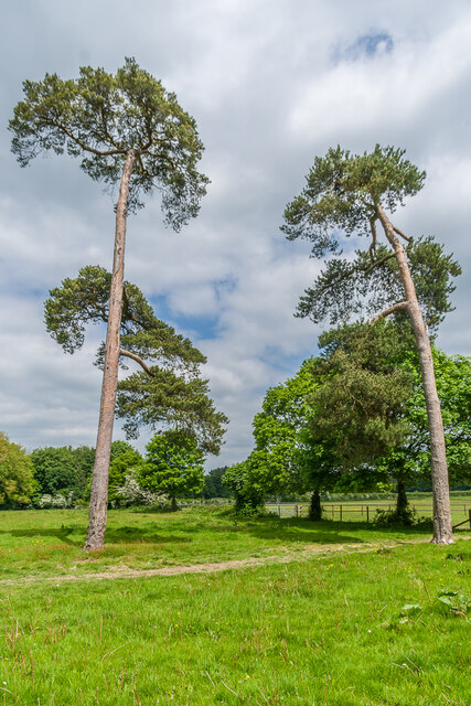
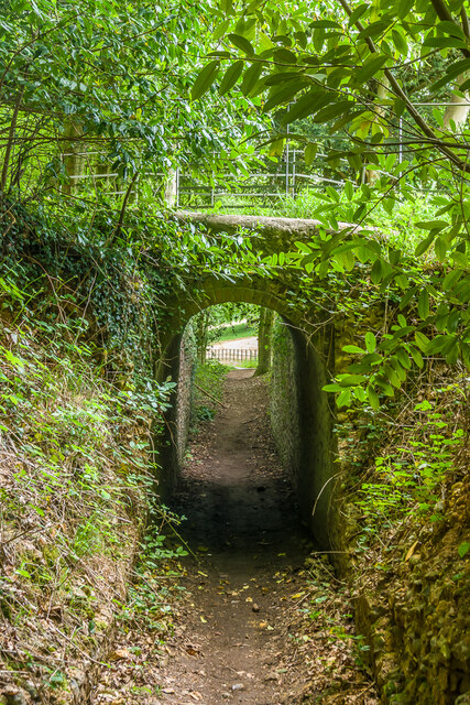
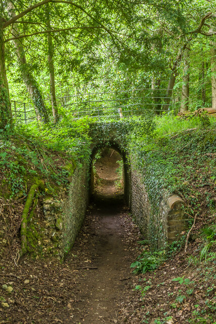
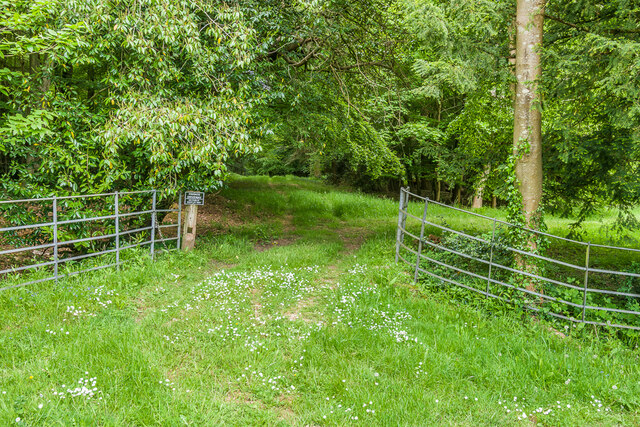
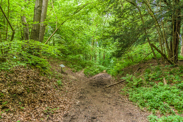
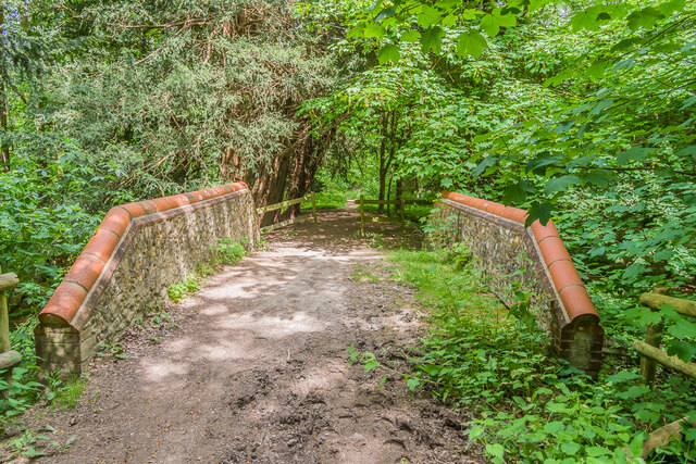
Wood's Plantation is also home to a diverse range of flora and fauna, with its woodland areas providing a habitat for various species of plants and animals. The estate is known for its conservation efforts, with regular initiatives to protect and preserve the natural environment.

Today, Wood's Plantation is open to the public, allowing visitors to explore its vast grounds and enjoy recreational activities such as walking, picnicking, and birdwatching. The estate also hosts various events throughout the year, including garden tours, art exhibitions, and cultural festivals.

Overall, Wood's Plantation is a captivating destination that combines natural beauty, historical significance, and a commitment to environmental conservation, making it a must-visit location in Surrey.

If you have any feedback on the listing, please let us know in the comments section below.

Wood's Plantation Images

Images are sourced within 2km of 51.254401/-0.43751655 or Grid Reference TQ0951. Thanks to Geograph Open Source API. All images are credited.

Access to Hermitage Plantation
Hermitage Bridge Bridge over Sheepwalk Lane, one of the Lovelace Bridges (see below).  Grade II listed - see <span class="nowrap"><a title="https://historicengland.org.uk/listing/the-list/list-entry/1377858?section=official-list-entry" rel="nofollow ugc noopener" href="https://historicengland.org.uk/listing/the-list/list-entry/1377858?section=official-list-entry">Link</a><img style="margin-left:2px;" alt="External link" title="External link - shift click to open in new window" src="https://s1.geograph.org.uk/img/external.png" width="10" height="10"/></span>.
Hermitage Bridge
Bridge over Sheepwalk Lane, one of the Lovelace Bridges (see below). Grade II listed - see LinkExternal link.
Hermitage Bridge Looking across Hermitage Bridge, a bridge over Sheepwalk Lane, one of the Lovelace Bridges (see below), with this being the route of one of the forestry tracks.  Grade II listed - see <span class="nowrap"><a title="https://historicengland.org.uk/listing/the-list/list-entry/1377858?section=official-list-entry" rel="nofollow ugc noopener" href="https://historicengland.org.uk/listing/the-list/list-entry/1377858?section=official-list-entry">Link</a><img style="margin-left:2px;" alt="External link" title="External link - shift click to open in new window" src="https://s1.geograph.org.uk/img/external.png" width="10" height="10"/></span>.  See <a href="https://www.geograph.org.uk/photo/7646909">TQ1050 : Hermitage Bridge</a> and <a href="https://www.geograph.org.uk/photo/7646910">TQ1050 : Hermitage Bridge</a> for photos of the bridge from below.  The house in the background is The Hermitage, built by Lovelace at around the same time, possibly for a gamekeeper or forester.
Hermitage Bridge
Looking across Hermitage Bridge, a bridge over Sheepwalk Lane, one of the Lovelace Bridges (see below), with this being the route of one of the forestry tracks. Grade II listed - see LinkExternal link. See TQ1050 : Hermitage Bridge and TQ1050 : Hermitage Bridge for photos of the bridge from below. The house in the background is The Hermitage, built by Lovelace at around the same time, possibly for a gamekeeper or forester.
Embankment, Hermitage Bridge Embankment south of Hermitage Bridge, a bridge over Sheepwalk Lane, one of the Lovelace Bridges (see below), with this being the route of one of the forestry tracks.
Embankment, Hermitage Bridge
Embankment south of Hermitage Bridge, a bridge over Sheepwalk Lane, one of the Lovelace Bridges (see below), with this being the route of one of the forestry tracks.
Crocknorth Farm Barns at Crocknorth Farm, off Crocknorth Lane.
Crocknorth Farm
Barns at Crocknorth Farm, off Crocknorth Lane.
Near Crocknorth Farm A field edge near Crocknorth Farm, off Crocknorth Lane.
Near Crocknorth Farm
A field edge near Crocknorth Farm, off Crocknorth Lane.
Near Crocknorth Farm Two Scots Pines by a field edge near Crocknorth Farm, off Crocknorth Lane.
Near Crocknorth Farm
Two Scots Pines by a field edge near Crocknorth Farm, off Crocknorth Lane.
Towards Crocknorth House Looking across a field to the partly hidden Crocknorth House.
Towards Crocknorth House
Looking across a field to the partly hidden Crocknorth House.
Meadow Plat Bridge Bridge over a bridleway near Meadow Plat, one of the Lovelace Bridges (see below).  This is the narrowest of all the bridges, with a span of only 6'.  It is also the only one of the extant which is not grade II listed.
Meadow Plat Bridge
Bridge over a bridleway near Meadow Plat, one of the Lovelace Bridges (see below). This is the narrowest of all the bridges, with a span of only 6'. It is also the only one of the extant which is not grade II listed.
Meadow Plat Bridge Looking across Meadow Plat Bridge, a bridge over a bridleway near Meadow Plat, one of the Lovelace Bridges (see below), with this being the route of one of the forestry tracks.  See <a href="https://www.geograph.org.uk/photo/7647792">TQ1050 : Meadow Plat Bridge</a> and <a href="https://www.geograph.org.uk/photo/7647793">TQ1050 : Meadow Plat Bridge</a> for photos of the bridge from the bridleway underneath.
Meadow Plat Bridge
Looking across Meadow Plat Bridge, a bridge over a bridleway near Meadow Plat, one of the Lovelace Bridges (see below), with this being the route of one of the forestry tracks. See TQ1050 : Meadow Plat Bridge and TQ1050 : Meadow Plat Bridge for photos of the bridge from the bridleway underneath.
Barn A barn near Meadow Plat.
Barn
A barn near Meadow Plat.
Site of Horseclose Bridge The site of Horseclose Bridge, one of the Lovelace Bridges (see below), where it crossed a bridleway in Kiln Field Coppice.  Although there are no obvious remains of the bridge, the embankments either side are apparent.
Site of Horseclose Bridge
The site of Horseclose Bridge, one of the Lovelace Bridges (see below), where it crossed a bridleway in Kiln Field Coppice. Although there are no obvious remains of the bridge, the embankments either side are apparent.
Stony Dene Bridge Bridge over a bridleway in Stony Dene Plantation, one of the Lovelace Bridges (see below).  This one has been fully restored.  The plaque on the side gives the name of the bridge, Stony Dene.  Grade II listed - see <span class="nowrap"><a title="https://historicengland.org.uk/listing/the-list/list-entry/1246731?section=official-list-entry" rel="nofollow ugc noopener" href="https://historicengland.org.uk/listing/the-list/list-entry/1246731?section=official-list-entry">Link</a><img style="margin-left:2px;" alt="External link" title="External link - shift click to open in new window" src="https://s1.geograph.org.uk/img/external.png" width="10" height="10"/></span>.
Stony Dene Bridge
Bridge over a bridleway in Stony Dene Plantation, one of the Lovelace Bridges (see below). This one has been fully restored. The plaque on the side gives the name of the bridge, Stony Dene. Grade II listed - see LinkExternal link.
Stony Dene Bridge Bridge over a bridleway in Stony Dene Plantation, one of the Lovelace Bridges (see below).  This one has been fully restored.  The plaque on the side gives a date, 1871.  Grade II listed - see <span class="nowrap"><a title="https://historicengland.org.uk/listing/the-list/list-entry/1246731?section=official-list-entry" rel="nofollow ugc noopener" href="https://historicengland.org.uk/listing/the-list/list-entry/1246731?section=official-list-entry">Link</a><img style="margin-left:2px;" alt="External link" title="External link - shift click to open in new window" src="https://s1.geograph.org.uk/img/external.png" width="10" height="10"/></span>.
Stony Dene Bridge
Bridge over a bridleway in Stony Dene Plantation, one of the Lovelace Bridges (see below). This one has been fully restored. The plaque on the side gives a date, 1871. Grade II listed - see LinkExternal link.
Stony Dene Bridge Looking across Stony Dene Bridge, a bridge over a bridleway in Stony Dene Plantation, one of the Lovelace Bridges (see below), with this being the route of one of the forestry tracks.  This one has been fully restored.  Grade II listed - see <span class="nowrap"><a title="https://historicengland.org.uk/listing/the-list/list-entry/1246731?section=official-list-entry" rel="nofollow ugc noopener" href="https://historicengland.org.uk/listing/the-list/list-entry/1246731?section=official-list-entry">Link</a><img style="margin-left:2px;" alt="External link" title="External link - shift click to open in new window" src="https://s1.geograph.org.uk/img/external.png" width="10" height="10"/></span>.
Stony Dene Bridge
Looking across Stony Dene Bridge, a bridge over a bridleway in Stony Dene Plantation, one of the Lovelace Bridges (see below), with this being the route of one of the forestry tracks. This one has been fully restored. Grade II listed - see LinkExternal link.
Stony Dene Bridge Looking towards Stony Dene Bridge, a bridge over a bridleway in Stony Dene Plantation, one of the Lovelace Bridges (see below), with this being the route of one of the forestry tracks.  This one has been fully restored.  Grade II listed - see <span class="nowrap"><a title="https://historicengland.org.uk/listing/the-list/list-entry/1246731?section=official-list-entry" rel="nofollow ugc noopener" href="https://historicengland.org.uk/listing/the-list/list-entry/1246731?section=official-list-entry">Link</a><img style="margin-left:2px;" alt="External link" title="External link - shift click to open in new window" src="https://s1.geograph.org.uk/img/external.png" width="10" height="10"/></span>.
Stony Dene Bridge
Looking towards Stony Dene Bridge, a bridge over a bridleway in Stony Dene Plantation, one of the Lovelace Bridges (see below), with this being the route of one of the forestry tracks. This one has been fully restored. Grade II listed - see LinkExternal link.
Show me another place!

Wood's Plantation is located at Grid Ref: TQ0951 (Lat: 51.254401, Lng: -0.43751655)

Administrative County: Surrey

District: Guildford

Police Authority: Surrey

What 3 Words

///sushi.covers.quit. Near West Horsley, Surrey

Related Wikis

Sheepleas

Sheepleas is a 99.9-hectare (247-acre) biological and geological Site of Special Scientific Interest east of Guildford in Surrey. It is a Geological Conservation...

East Horsley

East Horsley is a village and civil parish in Surrey, England, 21 miles southwest of London, on the A246 between Leatherhead and Guildford. Horsley and...

Surrey

Surrey () is a ceremonial county in South East England and one of the home counties. It is bordered by Greater London to the northeast, Kent to the east...

West Horsley Place

West Horsley Place is a Grade I listed building in West Horsley, to the east of Guildford in Surrey. There are eight further Grade II buildings on the...

West Horsley

West Horsley is a semi-rural village between Guildford and Leatherhead in Surrey, England. It lies on the A246, and south of the M25 and the A3. Its civil...

Horsley Towers

Horsley Towers, East Horsley, Surrey, England is a country house dating from the 19th century. The house was designed by Charles Barry for the banker William...

Stockbroker Belt

The Stockbroker Belt is a loosely defined region overlapping the borders of the London metropolitan area and the commuter region surrounding Greater London...

List of local nature reserves in Surrey

Local nature reserves are designated by local authorities under the National Parks and Access to the Countryside Act 1949. The local authority must have...

Related Videos

Abinger Roughs

A walk through Abinger Roughs in Surrey, United Kingdom 3 June 2017 http://ukadventure.swiftynz.com.

Did we see a ghost? | The mysterious red velvet bag & Raleigh's beheading. | Happy Halloween!

Travel vlog 11 | West Horsely Place | Filmed August 29th 2022 We have been working and traveling the world together since 2016 ...

COVID secure at Cranmore school

A video walking you through the changes we have made to be COVID secure at Cranmore school.

Nearby Amenities

Located within 500m of 51.254401,-0.43751655
Man Made: survey_point
Source: npe
Lat/Long: 51.2539891/-0.4442166
Sheepleas
Place: locality
Source: npe
Wikidata: Q7492452
Wikipedia: en:Sheepleas
Lat/Long: 51.2560156/-0.4405948
Was Barrier: gate
Lat/Long: 51.2574519/-0.4405327
Bench
Backrest: no
Direction: 324
Material: wood
Seats: 3
Lat/Long: 51.2559245/-0.4397511
Information: guidepost
Tourism: information
Lat/Long: 51.2572916/-0.4414817
Bench
Backrest: no
Direction: 104
Material: wood
Seats: 3
Lat/Long: 51.2574548/-0.4405831
Bench
Backrest: no
Direction: 341
Material: wood
Seats: 3
Lat/Long: 51.258047/-0.4405049
Millennium Viewpoint
Description: https://viewsoflondon.uk/Sheepleas.html
Tourism: viewpoint
Lat/Long: 51.253134/-0.4433276
The data included in this document is from www.openstreetmap.org. The data is made available under ODbL.

Have you been to Wood's Plantation?

Leave your review of Wood's Plantation below (or comments, questions and feedback).