Firtree Copse

Wood, Forest in Surrey Waverley

England

Firtree Copse

Downs Link, near Rudgwick The Downs Link path follows a dismantled railway line for almost all of its length.  It also forms part of route 223 of the National Cycle Network.

Here, there used to be a bridge carrying the railway across the A281 road.  The bridge was demolished after the railway closed, and the Downs Link path therefore descends to road level to cross the road.  There has been a long-running campaign to reinstate a bridge here.  Sadly, a 20-year-old cyclist was killed in 2020 whilst crossing the road at this point.
Downs Link, near Rudgwick Credit: Malc McDonald

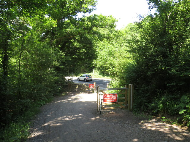
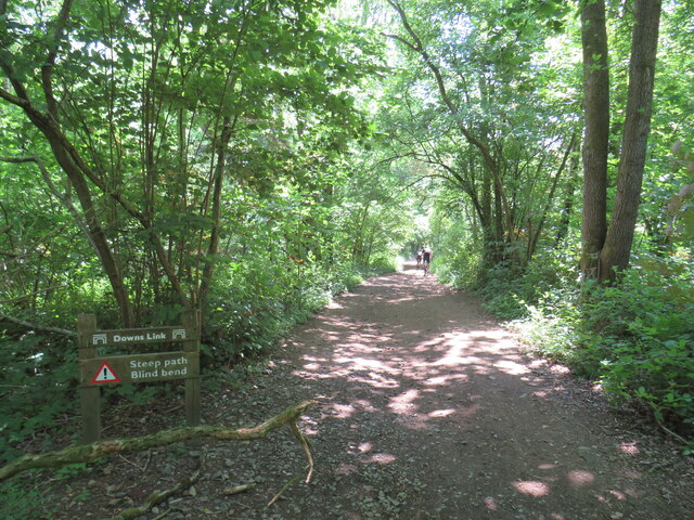
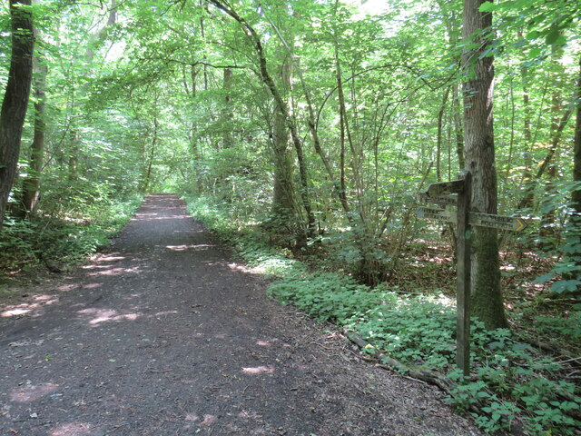
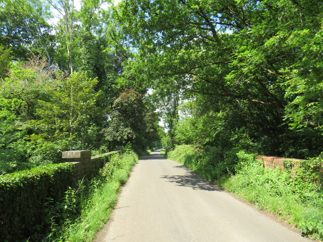
Firtree Copse is a picturesque woodland located in Surrey, England. Covering an area of approximately 50 acres, it is a popular destination for nature enthusiasts and outdoor enthusiasts alike. The copse is nestled within the larger Surrey Hills Area of Outstanding Natural Beauty, ensuring its preservation and protection.

The woodland is primarily composed of deciduous trees, with a variety of species including oak, beech, and birch. These trees create a lush and vibrant canopy, providing shade and shelter for a diverse range of flora and fauna. The forest floor is carpeted with a rich undergrowth of ferns, bluebells, and wildflowers, creating a beautiful tapestry of colors throughout the year.

Firtree Copse is not only a haven for plant life, but also a sanctuary for a wide array of wildlife. Squirrels, foxes, and badgers are commonly sighted, while birdwatchers can observe species such as woodpeckers, jays, and tawny owls. The copse is also home to a number of rare and protected species, making it an important site for conservation efforts.

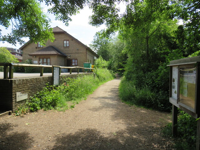
Visitors to Firtree Copse can enjoy a variety of activities. There are several well-maintained trails that meander through the woodland, providing opportunities for leisurely walks and hikes. The copse also features picnic areas and benches, allowing visitors to relax and appreciate the natural surroundings.

Overall, Firtree Copse is a tranquil and enchanting woodland, offering a peaceful retreat from the hustle and bustle of everyday life. With its diverse flora and fauna, it provides a valuable habitat for wildlife and a serene setting for visitors to connect with nature.

If you have any feedback on the listing, please let us know in the comments section below.

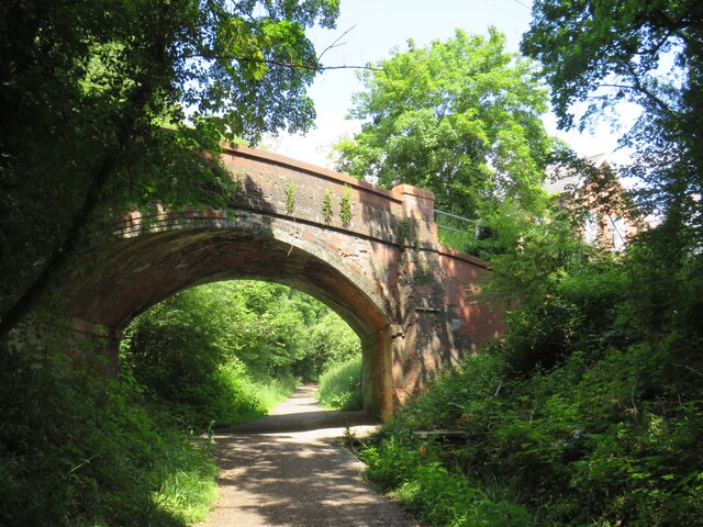
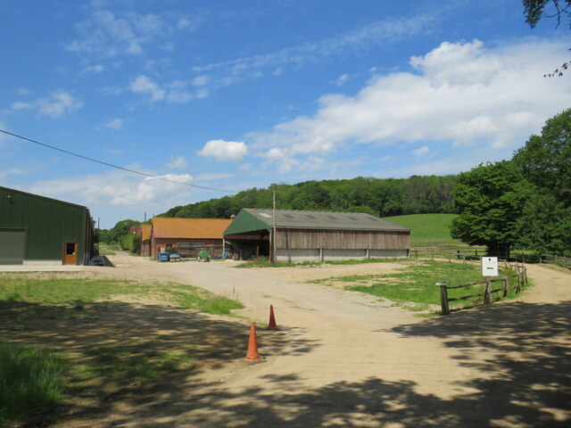
Firtree Copse Images

Images are sourced within 2km of 51.101814/-0.44972197 or Grid Reference TQ0834. Thanks to Geograph Open Source API. All images are credited.

Downs Link, near Rudgwick The Downs Link path follows a dismantled railway line for almost all of its length.  It also forms part of route 223 of the National Cycle Network.

Here, there used to be a bridge carrying the railway across the A281 road.  The bridge was demolished after the railway closed, and the Downs Link path therefore descends to road level to cross the road.  There has been a long-running campaign to reinstate a bridge here.  Sadly, a 20-year-old cyclist was killed in 2020 whilst crossing the road at this point.
Downs Link, near Rudgwick
The Downs Link path follows a dismantled railway line for almost all of its length. It also forms part of route 223 of the National Cycle Network. Here, there used to be a bridge carrying the railway across the A281 road. The bridge was demolished after the railway closed, and the Downs Link path therefore descends to road level to cross the road. There has been a long-running campaign to reinstate a bridge here. Sadly, a 20-year-old cyclist was killed in 2020 whilst crossing the road at this point.
Downs Link, Rudgwick A view of the Downs Link path at Rudgwick in West Sussex.  The path follows a dismantled railway line.  It also forms part of route 223 of the National Cycle Network.  The bridge in this photo carries a road across the former railway line.
Downs Link, Rudgwick
A view of the Downs Link path at Rudgwick in West Sussex. The path follows a dismantled railway line. It also forms part of route 223 of the National Cycle Network. The bridge in this photo carries a road across the former railway line.
Downs Link, Rudgwick A view of the Downs Link path at Rudgwick in West Sussex.  The path follows a dismantled railway line.  It also forms part of route 223 of the National Cycle Network.

Here, the path passes through the site of Rudgwick station.  The station and railway line closed in 1965, and very little trace of the station remains.  The block of flats to the right of the path has been built on the site of the station's goods yard.  More information about Rudgwick station, including photographs, can be found on the Disused Stations website: <span class="nowrap"><a title="http://www.disused-stations.org.uk/r/rudgwick/" rel="nofollow ugc noopener" href="http://www.disused-stations.org.uk/r/rudgwick/">Link</a><img style="margin-left:2px;" alt="External link" title="External link - shift click to open in new window" src="https://s1.geograph.org.uk/img/external.png" width="10" height="10"/></span>
Downs Link, Rudgwick
A view of the Downs Link path at Rudgwick in West Sussex. The path follows a dismantled railway line. It also forms part of route 223 of the National Cycle Network. Here, the path passes through the site of Rudgwick station. The station and railway line closed in 1965, and very little trace of the station remains. The block of flats to the right of the path has been built on the site of the station's goods yard. More information about Rudgwick station, including photographs, can be found on the Disused Stations website: LinkExternal link
Houses on Station Road, Rudgwick Houses close to the site of Rudgwick station, which closed in 1965.
Houses on Station Road, Rudgwick
Houses close to the site of Rudgwick station, which closed in 1965.
Site of railway station, Rudgwick near Horsham This was the site of Rudgwick's railway station, which closed in 1965.  Little trace of the station remains, with the site put to new uses.  The building to the left of the image is a health centre.
Site of railway station, Rudgwick near Horsham
This was the site of Rudgwick's railway station, which closed in 1965. Little trace of the station remains, with the site put to new uses. The building to the left of the image is a health centre.
The Sidings, Rudgwick The Sidings is a small residential development on the site of the former station goods yard at Rudgwick, in West Sussex.
The Sidings, Rudgwick
The Sidings is a small residential development on the site of the former station goods yard at Rudgwick, in West Sussex.
The Sidings, Rudgwick The Sidings is a small residential development on the site of the former station goods yard at Rudgwick, in West Sussex.  The building to the left of the image is a health centre.
The Sidings, Rudgwick
The Sidings is a small residential development on the site of the former station goods yard at Rudgwick, in West Sussex. The building to the left of the image is a health centre.
Downs Link at Rudgwick station site The Downs Link path follows a dismantled railway line for most of its length.  It also forms part of route 223 of the National Cycle Network.

Here, the path passes through the site of Rudgwick railway station.  More information about Rudgwick station can be found on the Disused Stations website: <span class="nowrap"><a title="http://www.disused-stations.org.uk/r/rudgwick/" rel="nofollow ugc noopener" href="http://www.disused-stations.org.uk/r/rudgwick/">Link</a><img style="margin-left:2px;" alt="External link" title="External link - shift click to open in new window" src="https://s1.geograph.org.uk/img/external.png" width="10" height="10"/></span>
Downs Link at Rudgwick station site
The Downs Link path follows a dismantled railway line for most of its length. It also forms part of route 223 of the National Cycle Network. Here, the path passes through the site of Rudgwick railway station. More information about Rudgwick station can be found on the Disused Stations website: LinkExternal link
Bridge over the Downs Link path near Rudgwick A view of the Downs Link path near Rudgwick in West Sussex.  The path follows a dismantled railway line.  It also forms part of route 223 of the National Cycle Network.

The bridge carries a road over the former railway line.
Bridge over the Downs Link path near Rudgwick
A view of the Downs Link path near Rudgwick in West Sussex. The path follows a dismantled railway line. It also forms part of route 223 of the National Cycle Network. The bridge carries a road over the former railway line.
Woodsomes Farm, near Rudgwick Woodsomes Farm in countryside close to the West Sussex/Surrey border.
Woodsomes Farm, near Rudgwick
Woodsomes Farm in countryside close to the West Sussex/Surrey border.
Downs Link, near Rudgwick A view of the Downs Link path near Rudgwick in West Sussex.  The path also forms part of route 223 of the National Cycle Network.

For most of its length, the path follows the course of a dismantled railway.  Between Cranleigh and Rudgwick, however, the railway passed through a tunnel.  The path avoids the tunnel, instead climbing over the hill.  This view looks downhill towards Rudgwick.  A sign warns cyclists of a steep gradient and a blind bend.
Downs Link, near Rudgwick
A view of the Downs Link path near Rudgwick in West Sussex. The path also forms part of route 223 of the National Cycle Network. For most of its length, the path follows the course of a dismantled railway. Between Cranleigh and Rudgwick, however, the railway passed through a tunnel. The path avoids the tunnel, instead climbing over the hill. This view looks downhill towards Rudgwick. A sign warns cyclists of a steep gradient and a blind bend.
Downs Link and Sussex Border Path near Rudgwick A view of the Downs Link path near Rudgwick in West Sussex.  The path also forms part of route 223 of the National Cycle Network.

For most of its length, the path follows the course of a dismantled railway.  Between Cranleigh and Rudgwick, however, the railway passed through a tunnel.  The path avoids the tunnel, instead climbing through woodland over a hill.  Here, the Downs Link path meets the Sussex Border Path.  Both paths take the path ahead for a short distance.  This location is also the county boundary between West Sussex and Surrey.
Downs Link and Sussex Border Path near Rudgwick
A view of the Downs Link path near Rudgwick in West Sussex. The path also forms part of route 223 of the National Cycle Network. For most of its length, the path follows the course of a dismantled railway. Between Cranleigh and Rudgwick, however, the railway passed through a tunnel. The path avoids the tunnel, instead climbing through woodland over a hill. Here, the Downs Link path meets the Sussex Border Path. Both paths take the path ahead for a short distance. This location is also the county boundary between West Sussex and Surrey.
Cox Green Road, near Rudgwick Cox Green Road near Rudgwick, on the borders of Surrey and West Sussex.  Here, a bridge carries the road over the course of a dismantled railway.

Much of the dismantled railway forms the route of the Downs Link path and route 223 of the National Cycle Network.  A short distance south of this location, however, the railway passed through a tunnel.  The tunnel is closed, therefore the path and cycle route climb up to the road, crossing the bridge then passing through woodland before rejoining the railway route.
Cox Green Road, near Rudgwick
Cox Green Road near Rudgwick, on the borders of Surrey and West Sussex. Here, a bridge carries the road over the course of a dismantled railway. Much of the dismantled railway forms the route of the Downs Link path and route 223 of the National Cycle Network. A short distance south of this location, however, the railway passed through a tunnel. The tunnel is closed, therefore the path and cycle route climb up to the road, crossing the bridge then passing through woodland before rejoining the railway route.
Downs Link near Rudgwick The Downs Link path descending into a railway cutting where it will pass beneath the bridge visible ahead.  The path also forms part of route 223 of the National Cycle Network.

Much of the Downs Link path follows the course of a dismantled railway.  The tunnel is closed, therefore the path and cycle route climb through woodland to avoid the tunnel before rejoining the railway route.
Downs Link near Rudgwick
The Downs Link path descending into a railway cutting where it will pass beneath the bridge visible ahead. The path also forms part of route 223 of the National Cycle Network. Much of the Downs Link path follows the course of a dismantled railway. The tunnel is closed, therefore the path and cycle route climb through woodland to avoid the tunnel before rejoining the railway route.
Baynards station building, near Horsham Baynards station was situated in Surrey countryside close to the Sussex border.  The station closed in 1965, along with the railway which passed through it.  The building survives, however, and is used as a private house.

The driveway past the station forms part of the route of the Downs Link path, which itself forms part of route 223 of the National Cycle Network.

For more information about Baynards station, including photographs taken when it was still operating as a station, see the Disused Stations website: <span class="nowrap"><a title="http://www.disused-stations.org.uk/b/baynards/index.shtml" rel="nofollow ugc noopener" href="http://www.disused-stations.org.uk/b/baynards/index.shtml">Link</a><img style="margin-left:2px;" alt="External link" title="External link - shift click to open in new window" src="https://s1.geograph.org.uk/img/external.png" width="10" height="10"/></span>
Baynards station building, near Horsham
Baynards station was situated in Surrey countryside close to the Sussex border. The station closed in 1965, along with the railway which passed through it. The building survives, however, and is used as a private house. The driveway past the station forms part of the route of the Downs Link path, which itself forms part of route 223 of the National Cycle Network. For more information about Baynards station, including photographs taken when it was still operating as a station, see the Disused Stations website: LinkExternal link
Firebird Brewery Firebird <span class="nowrap"><a title="https://firebirdbrewing.com/about/" rel="nofollow ugc noopener" href="https://firebirdbrewing.com/about/">Link</a><img style="margin-left:2px;" alt="External link" title="External link - shift click to open in new window" src="https://s1.geograph.org.uk/img/external.png" width="10" height="10"/></span>  have been brewing since the summer of 2013. The site was formerly a brickworks. You can see <a href="https://www.geograph.org.uk/photo/7735844">TQ0834 : Inside Firebird Brewery</a>
Firebird Brewery
Firebird LinkExternal link have been brewing since the summer of 2013. The site was formerly a brickworks. You can see TQ0834 : Inside Firebird Brewery
Inside Firebird Brewery The brewing kit of <a href="https://www.geograph.org.uk/photo/7735839">TQ0834 : Firebird Brewery</a> <span class="nowrap"><a title="https://firebirdbrewing.com/about/" rel="nofollow ugc noopener" href="https://firebirdbrewing.com/about/">Link</a><img style="margin-left:2px;" alt="External link" title="External link - shift click to open in new window" src="https://s1.geograph.org.uk/img/external.png" width="10" height="10"/></span> .
Inside Firebird Brewery
The brewing kit of TQ0834 : Firebird Brewery LinkExternal link .
Show me another place!

Firtree Copse is located at Grid Ref: TQ0834 (Lat: 51.101814, Lng: -0.44972197)

Administrative County: Surrey

District: Waverley

Police Authority: Surrey

What 3 Words

///sized.surprises.often. Near Rudgwick, West Sussex

Related Wikis

Holy Trinity Church, Rudgwick

Holy Trinity Church is the Anglican parish church of Rudgwick, a village in the Horsham district of West Sussex, England. The oldest part of the church...

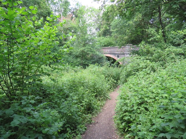
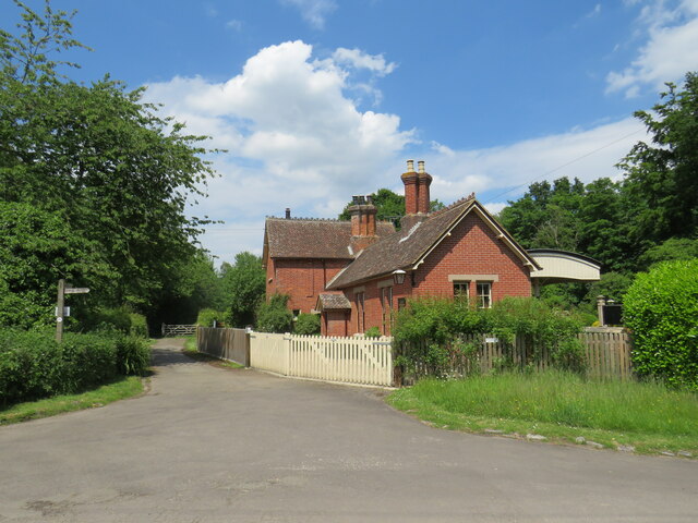
Baynards railway station

Baynards was a railway station on the Cranleigh Line, between Guildford, Surrey and Horsham, West Sussex, England. The station opened with the line on...

Rudgwick

Rudgwick is a village and civil parish in the Horsham District of West Sussex, England. The village is 6 miles (10 km) west from Horsham on the north...

Rudgwick railway station

Rudgwick railway station was on the Cranleigh Line. It served the village of Rudgwick in West Sussex until June, 1965. == History == Rudgwick station opened...

Nearby Amenities

Located within 500m of 51.101814,-0.44972197
Fire Hydrant
Emergency: fire_hydrant
Fire Hydrant Diameter: 100
Fire Hydrant Type: underground
Lat/Long: 51.0999219/-0.4433026
Barrier: stile
Lat/Long: 51.1002987/-0.4507256
Barrier: stile
Lat/Long: 51.0997114/-0.4448189
Barrier: stile
Lat/Long: 51.0999957/-0.445097
Barrier: stile
Lat/Long: 51.1050424/-0.4497468
Barrier: stile
Lat/Long: 51.101437/-0.4460515
Barrier: stile
Lat/Long: 51.106127/-0.4506158
Barrier: stile
Lat/Long: 51.1022567/-0.4480409
Barrier: stile
Lat/Long: 51.1015734/-0.4463588
Moat
Historic: archaeological_site
Lat/Long: 51.1039963/-0.4494611
Man Made: water_well
Lat/Long: 51.1040987/-0.4492752
Fir Tree Farm
Place: isolated_dwelling
Lat/Long: 51.1013032/-0.450528
Addr Housename: Delmore
Lat/Long: 51.0993443/-0.4439774
Addr Housename: Grenofen
Lat/Long: 51.0994294/-0.4439117
Addr Housenumber: 1
Lat/Long: 51.0977816/-0.4499145
Addr Housenumber: 2
Lat/Long: 51.097739/-0.4500393
The data included in this document is from www.openstreetmap.org. The data is made available under ODbL.

Have you been to Firtree Copse?

Leave your review of Firtree Copse below (or comments, questions and feedback).