Burton Plantation

Wood, Forest in Lincolnshire North Kesteven

England

Burton Plantation

Footpath to Whitecross Lane A wide uncultivated verge accommodates both the footpath and a wildlife refuge.
Footpath to Whitecross Lane Credit: Jonathan Thacker

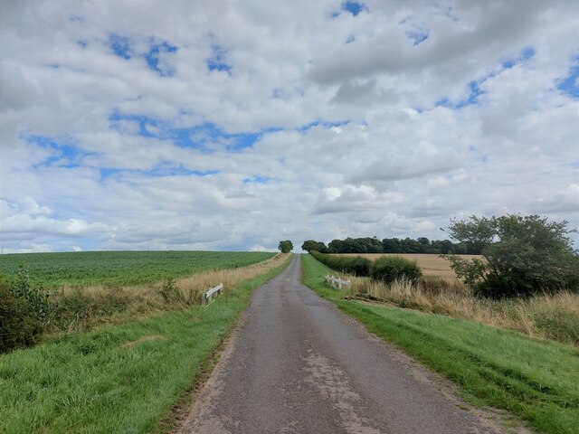
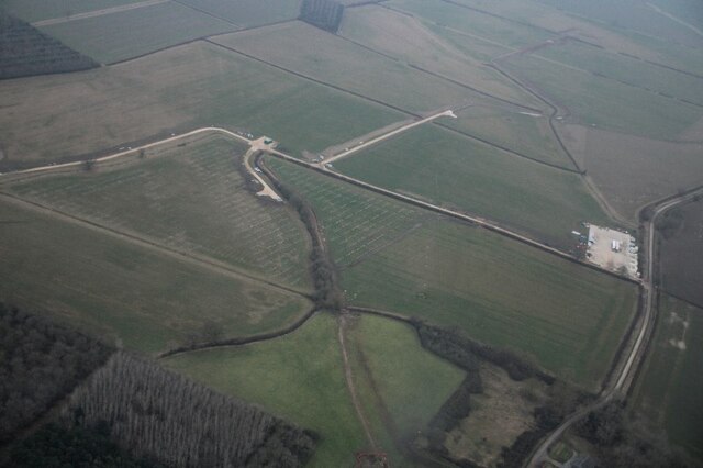
Burton Plantation is a picturesque woodland located in the county of Lincolnshire, England. Spanning over a vast area, it is known for its serene atmosphere and diverse plant and animal life. The plantation is situated on the outskirts of the village of Burton, nestled amidst the rolling countryside.

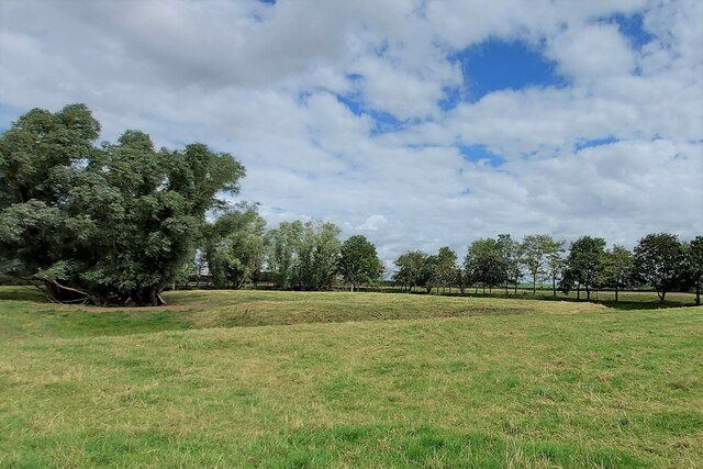
The woodland features a variety of tree species, including oak, beech, and birch, which create a dense canopy that provides shelter and shade. The forest floor is adorned with vibrant wildflowers, such as bluebells and primroses, adding a burst of color to the landscape during spring.

Burton Plantation is not only an aesthetic marvel but also serves as an important habitat for numerous wildlife species. Birdwatchers can spot a range of avian species, including woodpeckers, owls, and various songbirds, making it a haven for bird enthusiasts. The woodland is also inhabited by small mammals like squirrels, rabbits, and foxes, which can often be seen foraging for food or darting through the undergrowth.

The plantation offers a tranquil escape for nature lovers and avid hikers, with several well-maintained trails crisscrossing the area. These paths guide visitors through the woodland, allowing them to immerse themselves in the natural beauty and tranquility of their surroundings.

Overall, Burton Plantation in Lincolnshire, with its lush vegetation, diverse wildlife, and peaceful ambiance, is a revered destination for those seeking solace in nature's embrace.

If you have any feedback on the listing, please let us know in the comments section below.

Burton Plantation Images

Images are sourced within 2km of 52.967654/-0.38483227 or Grid Reference TF0842. Thanks to Geograph Open Source API. All images are credited.

Footpath to Whitecross Lane A wide uncultivated verge accommodates both the footpath and a wildlife refuge.
Footpath to Whitecross Lane
A wide uncultivated verge accommodates both the footpath and a wildlife refuge.
Scredington Road approaching Burton Cliff The slight rise ahead is called 'Burton Cliff'. It has a height of 15 metres above sea level - which perhaps constitutes a cliff in this part of Lincolnshire.
Scredington Road approaching Burton Cliff
The slight rise ahead is called 'Burton Cliff'. It has a height of 15 metres above sea level - which perhaps constitutes a cliff in this part of Lincolnshire.
Bridleway descending from Burton Cliff Passing a field of maize en route to the junction with Whitecross Lane
Bridleway descending from Burton Cliff
Passing a field of maize en route to the junction with Whitecross Lane
Hall Close moated site, Scredington: aerial 2022 Moated enclosure now in pasture, the moat mainly drained. Originally the principal moat in a village with five. The others have been excavated and/or destroyed. Surrounding the moat in the remainder of Hall Close are the platforms and enclosures of the original village settlement.

There were several important families in the village during the Middle Ages. The most prominent, the Pylets, occupied Hall Close from the late 12th to the mid 15th century.

The earthworks include the remains of fish ponds and a boundary ditch which would have enclosed the whole manorial complex. 

See: <span class="nowrap"><a title="https://www.heritagegateway.org.uk/Gateway/Results_Single.aspx?uid=MLI60728&resourceID=1006" rel="nofollow ugc noopener" href="https://www.heritagegateway.org.uk/Gateway/Results_Single.aspx?uid=MLI60728&resourceID=1006">Link</a><img style="margin-left:2px;" alt="External link" title="External link - shift click to open in new window" src="https://s1.geograph.org.uk/img/external.png" width="10" height="10"/></span>
Hall Close moated site, Scredington: aerial 2022
Moated enclosure now in pasture, the moat mainly drained. Originally the principal moat in a village with five. The others have been excavated and/or destroyed. Surrounding the moat in the remainder of Hall Close are the platforms and enclosures of the original village settlement. There were several important families in the village during the Middle Ages. The most prominent, the Pylets, occupied Hall Close from the late 12th to the mid 15th century. The earthworks include the remains of fish ponds and a boundary ditch which would have enclosed the whole manorial complex. See: LinkExternal link
Wind turbine bases (?) SE of Silk Willoughby: aerial 2022
Thorns Farm Listed Grade II. Built in 1852 for the Whichcote family of Aswarby Park <span class="nowrap"><a title="https://historicengland.org.uk/listing/the-list/list-entry/1308506?section=official-list-entry" rel="nofollow ugc noopener" href="https://historicengland.org.uk/listing/the-list/list-entry/1308506?section=official-list-entry">Link</a><img style="margin-left:2px;" alt="External link" title="External link - shift click to open in new window" src="https://s1.geograph.org.uk/img/external.png" width="10" height="10"/></span> . An identical building to <a href="https://www.geograph.org.uk/photo/7555283">TF0740 : The Elms</a>
Thorns Farm
Listed Grade II. Built in 1852 for the Whichcote family of Aswarby Park LinkExternal link . An identical building to TF0740 : The Elms
Mareham Lane  A footpath to Scredington leads off to the right
Mareham Lane
A footpath to Scredington leads off to the right
Northbeck Packhorse Bridge, Scredington Medieval, possibly 15th century in origin, with 20th century restoration <span class="nowrap"><a title="https://heritage-explorer.lincolnshire.gov.uk/Monument/MLI60721" rel="nofollow ugc noopener" href="https://heritage-explorer.lincolnshire.gov.uk/Monument/MLI60721">Link</a><img style="margin-left:2px;" alt="External link" title="External link - shift click to open in new window" src="https://s1.geograph.org.uk/img/external.png" width="10" height="10"/></span> . The 3 metre width, however, suggests it may have been built for carts. This would imply a later, 17th century date (ref. local information board)
Northbeck Packhorse Bridge, Scredington
Medieval, possibly 15th century in origin, with 20th century restoration LinkExternal link . The 3 metre width, however, suggests it may have been built for carts. This would imply a later, 17th century date (ref. local information board)
Ford and old packhorse bridge across North Beck, Northbeck, Scredington For another view of the bridge see <a href="https://www.geograph.org.uk/photo/7556242">TF0940 : Northbeck Packhorse Bridge, Scredington</a>
Ford and old packhorse bridge across North Beck, Northbeck, Scredington
For another view of the bridge see TF0940 : Northbeck Packhorse Bridge, Scredington
Thorny Close moated site, Northbeck, Scredington Scheduled Monument. One of five moated sites that used to exist in a small area around Scredington. For details <span class="nowrap"><a title="https://heritage-explorer.lincolnshire.gov.uk/Monument/MLI60260" rel="nofollow ugc noopener" href="https://heritage-explorer.lincolnshire.gov.uk/Monument/MLI60260">Link</a><img style="margin-left:2px;" alt="External link" title="External link - shift click to open in new window" src="https://s1.geograph.org.uk/img/external.png" width="10" height="10"/></span>
Thorny Close moated site, Northbeck, Scredington
Scheduled Monument. One of five moated sites that used to exist in a small area around Scredington. For details LinkExternal link
Whitecross Lane Reynolds Cottage in the distance
Whitecross Lane
Reynolds Cottage in the distance
Entrance to Whitecross Lane solar farm Under construction with a planned capacity of 25 MW <span class="nowrap"><a title="http://intelligent-alternatives.co.uk/whitecross.html" rel="nofollow ugc noopener" href="http://intelligent-alternatives.co.uk/whitecross.html">Link</a><img style="margin-left:2px;" alt="External link" title="External link - shift click to open in new window" src="https://s1.geograph.org.uk/img/external.png" width="10" height="10"/></span>
Entrance to Whitecross Lane solar farm
Under construction with a planned capacity of 25 MW LinkExternal link
The Old Gatehouse, Whitecross Lane Presumably built at a gated railway crossing. The former Bourne to Sleaford line used to cross the road just behind the house.
The Old Gatehouse, Whitecross Lane
Presumably built at a gated railway crossing. The former Bourne to Sleaford line used to cross the road just behind the house.
Mareham Lane at the junction with Whitecross Lane Flower Pot House on the corner
Mareham Lane at the junction with Whitecross Lane
Flower Pot House on the corner
Mareham Lane The modern Mareham Lane runs from near Graby, Lincolnshire, due north for about 10.5 miles to Sleaford. Much of its length follows the route of a Roman road, Margary number 260, which ran for about 16 miles from Bourne to Sleaford (Margary, I.D., 1955. Roman roads in Britain, volume 1)
Mareham Lane
The modern Mareham Lane runs from near Graby, Lincolnshire, due north for about 10.5 miles to Sleaford. Much of its length follows the route of a Roman road, Margary number 260, which ran for about 16 miles from Bourne to Sleaford (Margary, I.D., 1955. Roman roads in Britain, volume 1)
Corrugated iron barns, Gorse Lane Older OS maps mark this as the site of Gorse Farm
Corrugated iron barns, Gorse Lane
Older OS maps mark this as the site of Gorse Farm
Gorse Lane heading towards Silk Willoughby
Mareham Lane passing Aswarby Thorns The modern Mareham Lane runs from near Graby, Lincolnshire, due north for about 10.5 miles to Sleaford. Much of its length follows the route of a Roman road, Margary number 260, which ran for about 16 miles from Bourne to Sleaford (Margary, I.D., 1955. Roman roads in Britain, volume 1)
Mareham Lane passing Aswarby Thorns
The modern Mareham Lane runs from near Graby, Lincolnshire, due north for about 10.5 miles to Sleaford. Much of its length follows the route of a Roman road, Margary number 260, which ran for about 16 miles from Bourne to Sleaford (Margary, I.D., 1955. Roman roads in Britain, volume 1)
Show me another place!

Burton Plantation is located at Grid Ref: TF0842 (Lat: 52.967654, Lng: -0.38483227)

Administrative County: Lincolnshire

District: North Kesteven

Police Authority: Lincolnshire

What 3 Words

///create.counts.piano. Near Sleaford, Lincolnshire

Related Wikis

Aswarby and Scredington railway station

Aswarby and Scredington railway station was a station close to Scredington, Lincolnshire on the Great Northern Railway Bourne and Sleaford railway. It...

Scredington

Scredington is a village and civil parish in the North Kesteven district of Lincolnshire, England. The population of the civil parish at the 2011 census...

Silk Willoughby

Silk Willoughby is a village and civil parish in the North Kesteven district of Lincolnshire, England. The population of the civil parish at the 2011 census...

Aswarby and Swarby

Aswarby and Swarby is a civil parish in the North Kesteven district of Lincolnshire, England. Aswarby (pronounced locally as "as-r-bee") is the ecclesiastical...

Bass Maltings, Sleaford

The Bass Maltings in Sleaford, England are a large group of eight disused malt houses originally owned by the Bass Brewery of Burton upon Trent. Constructed...

Aswarby

Aswarby () is a village in the North Kesteven district of Lincolnshire, England. It is 3.5 miles (5.6 km) south of Sleaford and 750 yards (690 m) east...

Burton Pedwardine

Burton Pedwardine is a hamlet and civil parish in the district of North Kesteven, Lincolnshire, England. The population at the 2011 census was 187. The...

London Road, Sleaford

London Road is a cricket ground in Sleaford, Lincolnshire. It is the home of Sleaford Cricket Club and an occasional venue for Lincolnshire County Cricket...

Nearby Amenities

Located within 500m of 52.967654,-0.38483227
Bus Stop
Flower Pot Corner
Naptan AtcoCode: 270002700325
Naptan Bearing: N
Naptan CommonName: Flower Pot Corner
Naptan Indicator: N - bound
Naptan Landmark: Flower Pot Corner
Naptan NaptanCode: linapamp
Naptan Street: Mareham Lane
Naptan Verified: no
Source: naptan_import
Lat/Long: 52.9703941/-0.3871233
Bus Stop
Flower Pot Corner
Naptan AtcoCode: 2700LFPC1994
Naptan Bearing: S
Naptan CommonName: Flower Pot Corner
Naptan Indicator: S - bound
Naptan Landmark: Flower Pot Corner
Naptan Street: Mareham Lane
Naptan Verified: no
Source: naptan_import
Lat/Long: 52.9704195/-0.3870032
Reynolds Cottage
Place: isolated_dwelling
Source: Bing
Lat/Long: 52.9695341/-0.3783666
The Gatehouse
Place: isolated_dwelling
Source: Bing
Lat/Long: 52.9704116/-0.3819283
Flowerpot House
Place: isolated_dwelling
Lat/Long: 52.9701998/-0.386805
The data included in this document is from www.openstreetmap.org. The data is made available under ODbL.

Have you been to Burton Plantation?

Leave your review of Burton Plantation below (or comments, questions and feedback).