Eastgate Wood

Wood, Forest in Surrey Waverley

England

Eastgate Wood

Farm track near Cranleigh A track leading to a farm in the Surrey countryside near Cranleigh.
Farm track near Cranleigh Credit: Malc McDonald

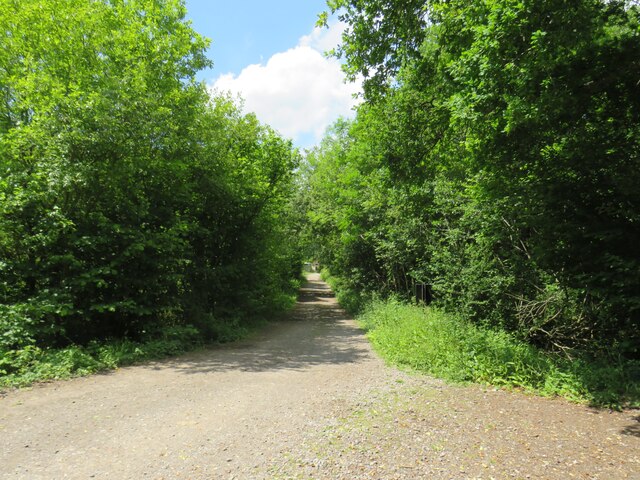
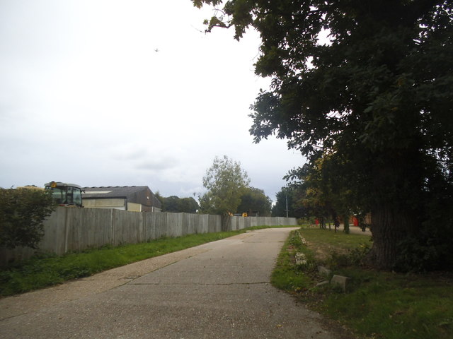
Eastgate Wood is a serene and enchanting forest located in the picturesque county of Surrey, England. Spanning over an area of approximately 100 acres, this woodland gem is nestled amidst the rolling hills and verdant countryside, offering a haven of tranquility and natural beauty.

The wood is predominantly made up of broad-leaved trees such as oak, beech, and ash, which create a dense canopy providing shade and shelter for a diverse range of flora and fauna. Bluebells carpet the forest floor in the spring, painting the landscape with vibrant hues of blue, while ferns, mosses, and wildflowers add to the woodland's charm.

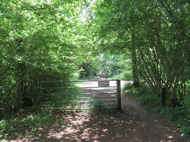
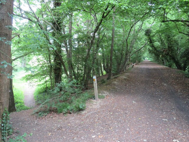
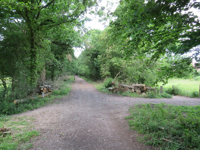
A network of well-maintained footpaths meander through Eastgate Wood, allowing visitors to explore its magical surroundings at their own pace. The trails wind through towering trees, crossing babbling brooks and passing by ancient stone walls, creating a sense of adventure and discovery.

The forest is not only a haven for nature enthusiasts but also offers recreational opportunities for all ages. Visitors can indulge in activities such as hiking, birdwatching, and photography, immersing themselves in the sights and sounds of the woodland.

Eastgate Wood is also home to a rich variety of wildlife, including deer, foxes, rabbits, and an array of bird species. Nature lovers can catch glimpses of these creatures in their natural habitat, making it a haven for wildlife enthusiasts and photographers alike.

In conclusion, Eastgate Wood in Surrey is a captivating woodland oasis that offers a peaceful retreat from the hustle and bustle of everyday life. Its lush vegetation, well-maintained trails, and diverse wildlife make it a must-visit destination for those seeking solace in nature's embrace.

If you have any feedback on the listing, please let us know in the comments section below.

Eastgate Wood Images

Images are sourced within 2km of 51.124905/-0.45359346 or Grid Reference TQ0837. Thanks to Geograph Open Source API. All images are credited.

Farm track near Cranleigh A track leading to a farm in the Surrey countryside near Cranleigh.
Farm track near Cranleigh
A track leading to a farm in the Surrey countryside near Cranleigh.
Downs Link near Cranleigh The Downs Link path follows a dismantled railway line for most of its length.  It also forms part of route 223 of the National Cycle Network.
Downs Link near Cranleigh
The Downs Link path follows a dismantled railway line for most of its length. It also forms part of route 223 of the National Cycle Network.
Downs Link near Cranleigh The Downs Link path follows a dismantled railway line for most of its length.  It also forms part of route 223 of the National Cycle Network.  Here, the former railway line ran along an embankment.  A footpath descends to the left.
Downs Link near Cranleigh
The Downs Link path follows a dismantled railway line for most of its length. It also forms part of route 223 of the National Cycle Network. Here, the former railway line ran along an embankment. A footpath descends to the left.
Downs Link near Cranleigh The Downs Link path follows a dismantled railway line for most of its length.  It also forms part of route 223 of the National Cycle Network.
Downs Link near Cranleigh
The Downs Link path follows a dismantled railway line for most of its length. It also forms part of route 223 of the National Cycle Network.
Gateway on Horsham Road, Cranleigh
Entrance to private road on Longhurst Hill This leads to various parks and Baynard's Park
Entrance to private road on Longhurst Hill
This leads to various parks and Baynard's Park
The entrance to Baynard's Park Estate
The entrance to Pollingfold Farm
Horsham Road, Cranleigh Leaving the village going SE
Horsham Road, Cranleigh
Leaving the village going SE
Lodge to Baynard's Park A grade II listed building, built in 1850s, disused and closed up when listed in 1989.  Here, it appears to be being overhauled and possibly extended.
Lodge to Baynard's Park
A grade II listed building, built in 1850s, disused and closed up when listed in 1989. Here, it appears to be being overhauled and possibly extended.
Bridleway, Baynard's Park Passing through Eastgate Wood.
Bridleway, Baynard's Park
Passing through Eastgate Wood.
Bridge on drive from Home Farm, Baynard's Park Cobbler's Brook is crossed.
Bridge on drive from Home Farm, Baynard's Park
Cobbler's Brook is crossed.
New Cottages Home Farm, Baynard's Park.
New Cottages
Home Farm, Baynard's Park.
Footbridge over stream The stream is the outfall from an ornamental lake in Baynard's Park.
Footbridge over stream
The stream is the outfall from an ornamental lake in Baynard's Park.
Clock tower, Baynard's Park Just about the only surviving part of the mansion here, which burnt down in 1979. Grade II listed, 19th century. The outbuildings, just visible here, also survived.
Clock tower, Baynard's Park
Just about the only surviving part of the mansion here, which burnt down in 1979. Grade II listed, 19th century. The outbuildings, just visible here, also survived.
Trees, Baynard's Park Home Farm is beyond.
Trees, Baynard's Park
Home Farm is beyond.
Woodland path, Baynard's Park Public footpath towards Kennels Cottages and onwards to Rudgwick.
Woodland path, Baynard's Park
Public footpath towards Kennels Cottages and onwards to Rudgwick.
Bluebells by woodland path A public footpath to Rudgwick.
Bluebells by woodland path
A public footpath to Rudgwick.
Show me another place!

Eastgate Wood is located at Grid Ref: TQ0837 (Lat: 51.124905, Lng: -0.45359346)

Administrative County: Surrey

District: Waverley

Police Authority: Surrey

What 3 Words

///hook.resolves.agents. Near Cranleigh, Surrey

Related Wikis

Longhurst Lodge

Longhurst Lodge is a Grade II listed building in Cranleigh, Surrey, England. It is located on the former Baynards Park estate, about a quarter of a mile...

Baynards Park

Baynards Park is a 2,000 acres (810 ha) estate and site of a demolished country house with extant outbuildings, privately owned, in the south of the parishes...

Cranleigh

Cranleigh is a village and civil parish, about 8 miles (13 km) southeast of Guildford in Surrey, England. It lies on a minor road east of the A281, which...

Baynards railway station

Baynards was a railway station on the Cranleigh Line, between Guildford, Surrey, and Horsham, West Sussex, England. The station opened with the line on...

Smokejack Clay Pit

Smokejack Clay Pit is a 56-hectare (140-acre) geological Site of Special Scientific Interest east of Cranleigh in Surrey. It is a Geological Conservation...

Holy Trinity Church, Rudgwick

Holy Trinity Church is the Anglican parish church of Rudgwick, a village in the Horsham district of West Sussex, England. The oldest part of the church...

Sayer's Croft LNR

Sayer's Croft is a 10.9-hectare (27-acre) Local Nature Reserve west of Ewhurst in Surrey. It is owned by the Sayer's Croft Environmental Education Trust...

Sayers Croft

Sayers Croft is a large outdoor 'learning camp' located in the village of Ewhurst, Surrey. It is one of the few remaining 'Camp schools' built by the National...

Nearby Amenities

Located within 500m of 51.124905,-0.45359346
Baynards Park
Historic: archaeological_site
Lat/Long: 51.1207737/-0.4510529
Norley Farm
Place: farm
Lat/Long: 51.1292253/-0.4548725
Eastgate Wood
Natural: wood
Lat/Long: 51.1250406/-0.4531353
Kiln Copse
Natural: wood
Lat/Long: 51.1232819/-0.4537237
The data included in this document is from www.openstreetmap.org. The data is made available under ODbL.

Have you been to Eastgate Wood?

Leave your review of Eastgate Wood below (or comments, questions and feedback).