Barnstake Copse
Wood, Forest in Sussex Arun
England
Barnstake Copse

Barnstake Copse is a picturesque woodland area located in Sussex, England. Covering an area of approximately 50 acres, it is a popular destination for nature lovers and outdoor enthusiasts alike.
The copse is characterized by its dense canopy of trees, predominantly consisting of oak, beech, and chestnut, which provide a haven for a wide variety of wildlife. Visitors can expect to spot various bird species, including woodpeckers and owls, as well as small mammals such as squirrels and foxes.
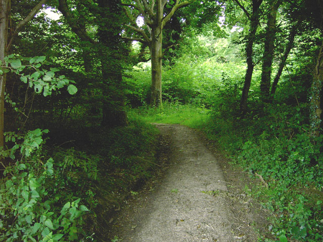
Tranquility is a defining feature of Barnstake Copse, with its peaceful atmosphere and secluded pathways offering a sense of escape from the hustle and bustle of everyday life. The woodland is crisscrossed by well-maintained footpaths, allowing visitors to explore the area at their own pace. These paths lead to open clearings, where visitors can take a break and enjoy a picnic amidst the natural beauty.
The copse also boasts a rich history, dating back centuries. It has been used as a source of timber for local communities and has provided shelter for generations of wildlife. Today, the area is managed by a local conservation trust, which ensures the preservation of its unique ecosystem.
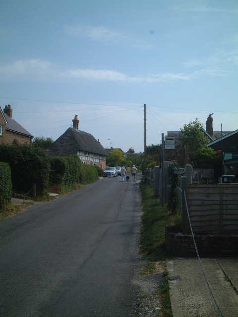
Barnstake Copse is easily accessible, located just a short drive from nearby towns and villages. Its natural beauty and peaceful ambiance make it an ideal destination for those seeking a tranquil and immersive experience in the heart of Sussex's countryside.
If you have any feedback on the listing, please let us know in the comments section below.
Barnstake Copse Images
Images are sourced within 2km of 50.855282/-0.46953187 or Grid Reference TQ0707. Thanks to Geograph Open Source API. All images are credited.


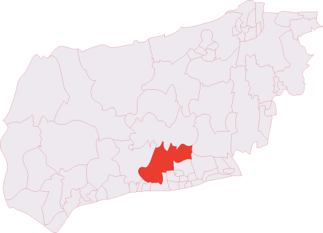
Barnstake Copse is located at Grid Ref: TQ0707 (Lat: 50.855282, Lng: -0.46953187)
Administrative County: West Sussex
District: Arun
Police Authority: Sussex
What 3 Words
///snapping.verifying.sourced. Near Findon, West Sussex
Nearby Locations
Related Wikis

Worthing Rural District
Worthing Rural District was a rural district in West Sussex, England from 1933 to 1974. It comprised an area to the north, west and east, but did not...

Patching
Patching is a small village and civil parish that lies amid the fields and woods of the southern slopes of the South Downs in the National Park in the...
Angmering & Findon (electoral division)
Angmering & Findon is an electoral division of West Sussex in the United Kingdom and returns one member to sit on West Sussex County Council. The current...
Clapham, West Sussex
Clapham is a rural village and civil parish in the Arun District of West Sussex, England. It lies on varying downslopes and escarpment of the South Downs...
Phun City
Phun City was a rock festival held at Ecclesden Common near Worthing, England, from 24 July to 26 July 1970. Excluding the one-day free concerts in London...

Oval Raceway
The Oval Raceway, also known as the Angmering Motor Sports Centre or Angmering Raceway is a motor racing circuit on the outskirts of Angmering, near Worthing...
Clapham Wood
Clapham Wood is a woodland area in Clapham, West Sussex, England, which Fortean authors and paranormal enthusiasts believe to be a locus of UFO sightings...
Blackpatch
Blackpatch is an archaeological site in West Sussex, England, about 2 miles (3.2 km) west of the village of Findon and about 3 miles (4.8 km) north-west...
Nearby Amenities
Located within 500m of 50.855282,-0.46953187Have you been to Barnstake Copse?
Leave your review of Barnstake Copse below (or comments, questions and feedback).