Foxholm Covert

Wood, Forest in Surrey Elmbridge

England

Foxholm Covert

Brooklands - Original Aston Martin logo The now-famous spread-wings Aston Martin logo dates from 1927 whereas this was the original merged A & M logo first adopted in 1921.
For more details, see <span class="nowrap"><a title="https://www.carlogos.org/car-brands/aston-martin-logo.html" rel="nofollow ugc noopener" href="https://www.carlogos.org/car-brands/aston-martin-logo.html">Link</a><img style="margin-left:2px;" alt="External link" title="External link - shift click to open in new window" src="https://s1.geograph.org.uk/img/external.png" width="10" height="10"/></span>
Brooklands - Original Aston Martin logo Credit: Rob Farrow

Foxholm Covert is a picturesque wood located in the county of Surrey, England. Situated within the larger area of Surrey Hills, this forested area covers an approximate area of 100 acres, providing a verdant haven for nature enthusiasts and wildlife alike.

The woodland is predominantly composed of native broadleaf trees, such as oak, beech, and birch, creating a dense canopy that filters sunlight and provides a soothing ambiance. The forest floor is adorned with a rich tapestry of ferns, bluebells, and other wildflowers, adding splashes of color throughout the seasons.

Foxholm Covert boasts a diverse range of flora and fauna, making it a haven for biodiversity. The woodland is home to a variety of bird species, including woodpeckers, nightingales, and tawny owls, filling the air with their melodious songs. Mammals such as deer, foxes, and squirrels can also be spotted roaming the forest floor or darting through the undergrowth.

The wood is crisscrossed by a network of well-maintained trails, allowing visitors to explore its natural wonders on foot or by bike. These paths wind through the woods, providing opportunities to admire the ancient trees, encounter hidden streams, and discover secluded clearings.

Foxholm Covert offers a tranquil escape from the hustle and bustle of modern life and provides a perfect setting for outdoor activities such as picnicking, photography, or simply immersing oneself in the beauty of nature. Its proximity to nearby villages and towns also makes it easily accessible for day trips, attracting both locals and tourists seeking solace in its serene surroundings.

If you have any feedback on the listing, please let us know in the comments section below.

Foxholm Covert Images

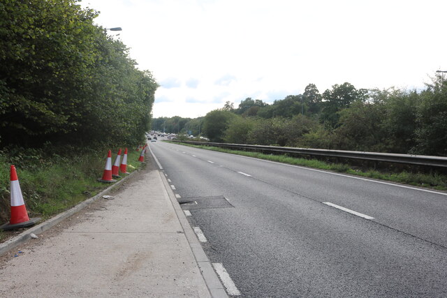
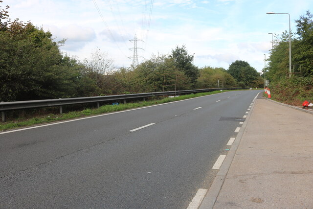
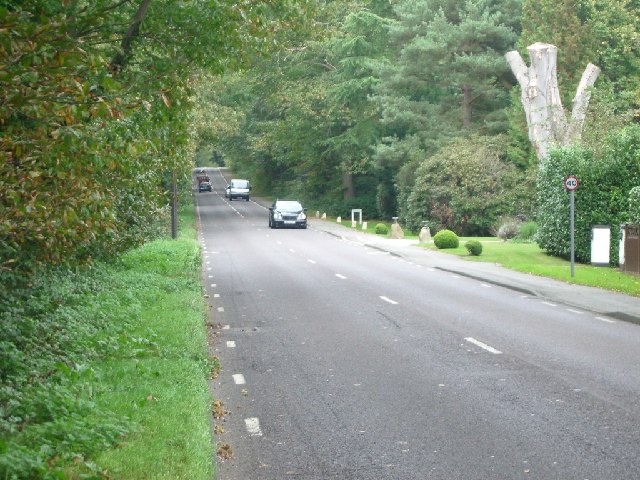
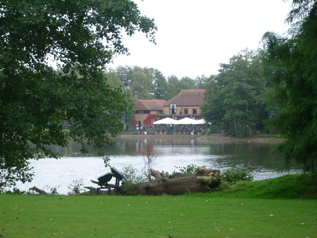
Images are sourced within 2km of 51.338227/-0.45364761 or Grid Reference TQ0761. Thanks to Geograph Open Source API. All images are credited.

Brooklands - Original Aston Martin logo The now-famous spread-wings Aston Martin logo dates from 1927 whereas this was the original merged A & M logo first adopted in 1921.
For more details, see <span class="nowrap"><a title="https://www.carlogos.org/car-brands/aston-martin-logo.html" rel="nofollow ugc noopener" href="https://www.carlogos.org/car-brands/aston-martin-logo.html">Link</a><img style="margin-left:2px;" alt="External link" title="External link - shift click to open in new window" src="https://s1.geograph.org.uk/img/external.png" width="10" height="10"/></span>
Brooklands - Original Aston Martin logo
The now-famous spread-wings Aston Martin logo dates from 1927 whereas this was the original merged A & M logo first adopted in 1921. For more details, see LinkExternal link
Brooklands - Stratosphere Chamber door & Plant Room Looking over the Plant Room for the Stratosphere Chamber designed by the great engineer and military designer Barnes Wallis. Filling the far end of the room is the giant sliding 'door' of the chamber which could be slid (from right to left) to cover the front of the main chamber (off to the left in this image).
It was built just after WWII in 1946 to investigate high-speed flight at very high altitudes (up to 70,000ft) by creating the conditions of the stratosphere in a laboratory environment allowing testing and measurement. Large vacuum pumps in the plant room reduced the pressure within the chamber to 1/20 (5% or 0.05bar) of that at Sea Level.
The chamber is 50' (15m) long with an internal diameter of 25' (7.5m) creating in internal space of 40,000 cubic ft (1,135 cubic metres)
For a closer look at the enormous door, see <a href="https://www.geograph.org.uk/photo/7121224">TQ0762 : Brooklands - Stratosphere Chamber - Great Door</a>
Brooklands - Stratosphere Chamber door & Plant Room
Looking over the Plant Room for the Stratosphere Chamber designed by the great engineer and military designer Barnes Wallis. Filling the far end of the room is the giant sliding 'door' of the chamber which could be slid (from right to left) to cover the front of the main chamber (off to the left in this image). It was built just after WWII in 1946 to investigate high-speed flight at very high altitudes (up to 70,000ft) by creating the conditions of the stratosphere in a laboratory environment allowing testing and measurement. Large vacuum pumps in the plant room reduced the pressure within the chamber to 1/20 (5% or 0.05bar) of that at Sea Level. The chamber is 50' (15m) long with an internal diameter of 25' (7.5m) creating in internal space of 40,000 cubic ft (1,135 cubic metres) For a closer look at the enormous door, see TQ0762 : Brooklands - Stratosphere Chamber - Great Door
Brooklands - Stratosphere Chamber - Great Door The huge sliding door of the Barnes Wallis Stratosphere Chamber at Brooklands. See <a href="https://www.geograph.org.uk/photo/7121221">TQ0762 : Brooklands - Stratosphere Chamber door & Plant Room</a> for more details and wider view.
Brooklands - Stratosphere Chamber - Great Door
The huge sliding door of the Barnes Wallis Stratosphere Chamber at Brooklands. See TQ0762 : Brooklands - Stratosphere Chamber door & Plant Room for more details and wider view.
The Brooklands Clubhouse This was taken at the Centenary Celebration of the famous Brooklands Race Track.
The Brooklands Clubhouse
This was taken at the Centenary Celebration of the famous Brooklands Race Track.
Sliproad on Portsmouth Road, Cobham
Autumn at The Heights Seasonal colours on The Heights business park at Brooklands.
Autumn at The Heights
Seasonal colours on The Heights business park at Brooklands.
220 Brooklands Road, Weybridge A large old property recently on the market for around £1.5 million.
<span class="nowrap"><a title="https://themovemarket.com/tools/propertyprices/220-brooklands-road-weybridge-kt13-0rj" rel="nofollow ugc noopener" href="https://themovemarket.com/tools/propertyprices/220-brooklands-road-weybridge-kt13-0rj">Link</a><img style="margin-left:2px;" alt="External link" title="External link - shift click to open in new window" src="https://s1.geograph.org.uk/img/external.png" width="10" height="10"/></span>
220 Brooklands Road, Weybridge
A large old property recently on the market for around £1.5 million. LinkExternal link
View over Brooklands Museum A view from outside the museum on the other side of the River Wey, looking across the site up to one of the office buildings on The Heights business park.
View over Brooklands Museum
A view from outside the museum on the other side of the River Wey, looking across the site up to one of the office buildings on The Heights business park.
Byfleet Manor Byfleet Manor was originally a royal hunting lodge which was given by Edward II to Piers Gaveston, his reputed lover. It was rebuilt in 1619 by Anne of Denmark, wife of King James I at the house's last royal owner, but she died before it was finished. The massive front walls and gate piers date from that time. It was then rebuilt again in 1685 because it was reported to be in ruinous condition! This resulted in a much smaller building. It was restored in 1905 when it was again enlarged by adding asymmetrical wings.
Byfleet Manor
Byfleet Manor was originally a royal hunting lodge which was given by Edward II to Piers Gaveston, his reputed lover. It was rebuilt in 1619 by Anne of Denmark, wife of King James I at the house's last royal owner, but she died before it was finished. The massive front walls and gate piers date from that time. It was then rebuilt again in 1685 because it was reported to be in ruinous condition! This resulted in a much smaller building. It was restored in 1905 when it was again enlarged by adding asymmetrical wings.
Bus stop in Brooklands Road looking north
Bus stop in Brooklands Road
looking north
Houses in Brooklands Road looking north-west
Houses in Brooklands Road
looking north-west
Bus stop in High Road looking north
Bus stop in High Road
looking north
Church Road, Byfleet looking south
Church Road, Byfleet
looking south
The approach to Byfleet from the west along Parvis Road  
The approach to Byfleet from the west along Parvis Road
 
Byfleet Road looking west
Byfleet Road
looking west
Silvermere looking east
Silvermere
looking east
Seven Hills Road Looking north.
Seven Hills Road
Looking north.
Show me another place!

Foxholm Covert is located at Grid Ref: TQ0761 (Lat: 51.338227, Lng: -0.45364761)

Administrative County: Surrey

District: Elmbridge

Police Authority: Surrey

What 3 Words

///menu.length.fats. Near Cobham, Surrey

Nearby Locations

Foxholm Covert

Related Wikis

Silvermere

Silvermere is an estate in Surrey, England named after its mere – a shallow lake of about ten acres which has a silvery appearance when seen from the surrounding...

Hamstone House

Hamstone House is a large detached house on the St George's Hill estate in the English county of Surrey. The house stands in 8 acres of grounds that are...

Byfleet Manor

Byfleet Manor is a Grade II* listed house in Byfleet, Surrey, England. Byfleet Manor has been used as a filming location in three television series, most...

Foxwarren Park

Foxwarren Park, at Wisley in Surrey, is a Victorian country house and estate. On sandstone Ockham and Wisley Commons, it was designed in 1860 by the railway...

Nearby Amenities

Located within 500m of 51.338227,-0.45364761
Power: tower
Lat/Long: 51.3367677/-0.4598929
Power: tower
Lat/Long: 51.3351911/-0.455773
Power: tower
Lat/Long: 51.3340758/-0.4529148
Bus Stop
Redhill Road
Naptan AtcoCode: 40004405014A
Naptan Bearing: W
Naptan CommonName: Redhill Road
Naptan Indicator: Just Before
Naptan Landmark: Redhill Road
Naptan NaptanCode: suradtma
Naptan Street: Byfleet Road
Naptan Verified: no
Public Transport: platform
Source: naptan_import
Lat/Long: 51.338731/-0.4507651
Bus Stop
Redhill Road
Naptan AtcoCode: 40004405014B
Naptan Bearing: E
Naptan BusStopType: CUS
Naptan CommonName: Redhill Road
Naptan Indicator: Just after
Naptan Landmark: Redhill Road
Naptan NaptanCode: surgpapg
Naptan Street: Byfleet Road
Naptan Verified: no
Public Transport: platform
Source: naptan_import
Lat/Long: 51.3389346/-0.4512034
Sherwood
Place: locality
Lat/Long: 51.3404612/-0.4546886
Access: private
Barrier: lift_gate
Lat/Long: 51.3389235/-0.4508036
Social Facility
Silvermere Care Home
Addr City: Cobham
Addr Housename: Silvermere Care Home
Addr Postcode: KT11 1EF
Addr Street: Redhill Road
Description: Residential and dementia care home
Email: enquiries.silvermere@averyhealthcare.co.uk
Opening Hours: 24/7
Operator: Avery Healthcare
Social Facility: group_home
Social Facility For: senior
Wheelchair: yes
Lat/Long: 51.338309/-0.4512908
The data included in this document is from www.openstreetmap.org. The data is made available under ODbL.

Have you been to Foxholm Covert?

Leave your review of Foxholm Covert below (or comments, questions and feedback).