Home Wood

Wood, Forest in Surrey Waverley

England

Home Wood

Downs Link near Cranleigh The Downs Link path follows a dismantled railway line for most of its length.  It also forms part of route 223 of the National Cycle Network.
Downs Link near Cranleigh Credit: Malc McDonald

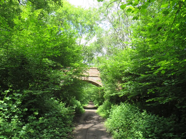
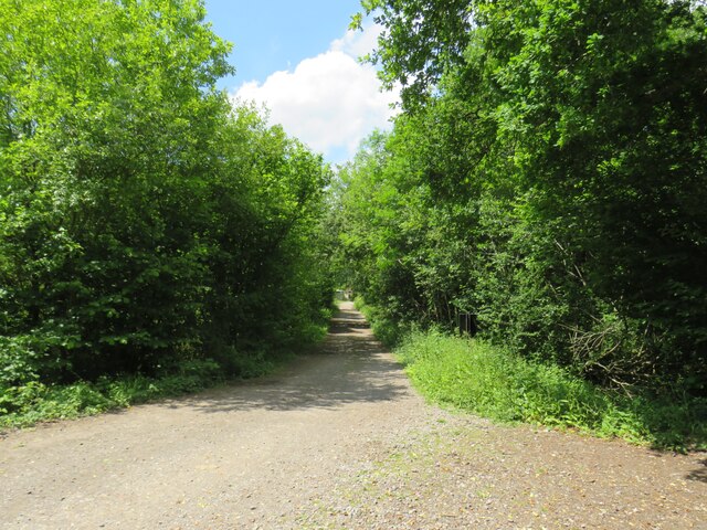
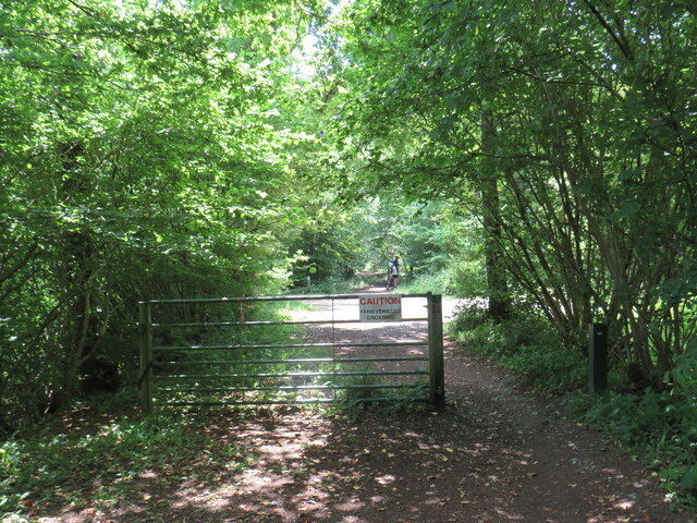
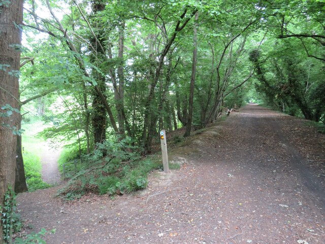
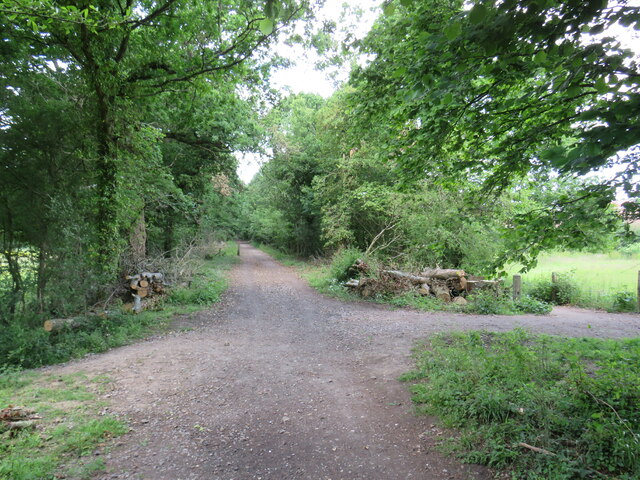
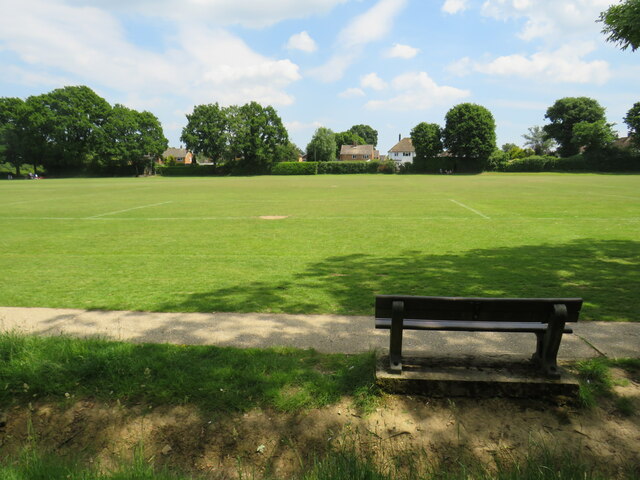
Home Wood is a picturesque and serene forest located in Surrey, England. Covering an area of approximately 50 acres, it is a popular destination for nature enthusiasts and hikers alike. The wood is known for its dense canopy of trees, which provide ample shade and a sense of tranquility.

One of the defining features of Home Wood is its diverse range of tree species. Visitors can find a mix of both deciduous and coniferous trees, including oak, beech, birch, and pine. This creates a vibrant and ever-changing landscape throughout the seasons, with stunning displays of autumn colors and a lush green canopy in the summer.

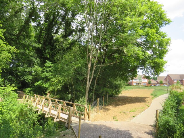
Within the wood, there are several well-maintained trails that wind through the forest, offering visitors the opportunity to explore and appreciate the natural beauty of the area. These paths vary in length and difficulty, catering to both casual strollers and more experienced hikers. Along the way, visitors may encounter a variety of wildlife, including squirrels, birds, and occasionally deer.

Home Wood is also home to a small pond, which adds to the charm of the area. The pond provides a habitat for various aquatic plants and animals, and is a peaceful spot for visitors to sit and enjoy the surroundings.

Overall, Home Wood in Surrey offers a tranquil and scenic escape from the hustle and bustle of everyday life. Its natural beauty and diverse ecosystem make it a must-visit destination for nature lovers and those seeking a peaceful retreat in the heart of Surrey.

If you have any feedback on the listing, please let us know in the comments section below.

Home Wood Images

Images are sourced within 2km of 51.122985/-0.4696477 or Grid Reference TQ0737. Thanks to Geograph Open Source API. All images are credited.

Downs Link near Cranleigh The Downs Link path follows a dismantled railway line for most of its length.  It also forms part of route 223 of the National Cycle Network.
Downs Link near Cranleigh
The Downs Link path follows a dismantled railway line for most of its length. It also forms part of route 223 of the National Cycle Network.
Farm track near Cranleigh A track leading to a farm in the Surrey countryside near Cranleigh.
Farm track near Cranleigh
A track leading to a farm in the Surrey countryside near Cranleigh.
Downs Link near Cranleigh The Downs Link path follows a dismantled railway line for most of its length.  It also forms part of route 223 of the National Cycle Network.
Downs Link near Cranleigh
The Downs Link path follows a dismantled railway line for most of its length. It also forms part of route 223 of the National Cycle Network.
Downs Link near Cranleigh The Downs Link path follows a dismantled railway line for most of its length.  It also forms part of route 223 of the National Cycle Network.  Here, the former railway line ran along an embankment.  A footpath descends to the left.
Downs Link near Cranleigh
The Downs Link path follows a dismantled railway line for most of its length. It also forms part of route 223 of the National Cycle Network. Here, the former railway line ran along an embankment. A footpath descends to the left.
Downs Link near Cranleigh The Downs Link path follows a dismantled railway line for most of its length.  It also forms part of route 223 of the National Cycle Network.
Downs Link near Cranleigh
The Downs Link path follows a dismantled railway line for most of its length. It also forms part of route 223 of the National Cycle Network.
Path to Dapples Lane, Cranleigh A path leading into a new housing development in Cranleigh, in Surrey.  The wooden bridge to the left takes another path across a stream.
Path to Dapples Lane, Cranleigh
A path leading into a new housing development in Cranleigh, in Surrey. The wooden bridge to the left takes another path across a stream.
Bridge over a stream, Cranleigh The bridge was built to carry a railway line across a stream on the outskirts of Cranleigh.  The railway closed in 1965 and was dismantled, but the Downs Link path now follows the railway alignment, crossing the bridge.  Downs Link also forms part of route 223 of the National Cycle Network.
Bridge over a stream, Cranleigh
The bridge was built to carry a railway line across a stream on the outskirts of Cranleigh. The railway closed in 1965 and was dismantled, but the Downs Link path now follows the railway alignment, crossing the bridge. Downs Link also forms part of route 223 of the National Cycle Network.
Footpath to Dapples Lane, Cranleigh A path leading into a new housing development on the outskirts of Cranleigh, in Surrey.
Footpath to Dapples Lane, Cranleigh
A path leading into a new housing development on the outskirts of Cranleigh, in Surrey.
Recreation ground in Cranleigh A bench seat looking out across a recreation ground in Cranleigh, in Surrey.
Recreation ground in Cranleigh
A bench seat looking out across a recreation ground in Cranleigh, in Surrey.
Bungalow on Lawns Road, Baynards This appears to be a holiday chalet and has a sports field next to it.
Bungalow on Lawns Road, Baynards
This appears to be a holiday chalet and has a sports field next to it.
Lawns Road, Baynards
Horsham Road, Cranleigh
Houses on Horsham Road, Cranleigh
Gateway on Horsham Road, Cranleigh
Entrance to private road on Longhurst Hill This leads to various parks and Baynard's Park
Entrance to private road on Longhurst Hill
This leads to various parks and Baynard's Park
The entrance to Baynard's Park Estate
Horsham Road, Cranleigh Leaving the village going SE
Horsham Road, Cranleigh
Leaving the village going SE
Lodge to Baynard's Park A grade II listed building, built in 1850s, disused and closed up when listed in 1989.  Here, it appears to be being overhauled and possibly extended.
Lodge to Baynard's Park
A grade II listed building, built in 1850s, disused and closed up when listed in 1989. Here, it appears to be being overhauled and possibly extended.
Show me another place!

Home Wood is located at Grid Ref: TQ0737 (Lat: 51.122985, Lng: -0.4696477)

Administrative County: Surrey

District: Waverley

Police Authority: Surrey

What 3 Words

///peroxide.paid.spun. Near Cranleigh, Surrey

Related Wikis

Longhurst Lodge

Longhurst Lodge is a Grade II listed building in Cranleigh, Surrey, England. It is located on the former Baynards Park estate, about a quarter of a mile...

Baynards Park

Baynards Park is a 2,000 acres (810 ha) estate and site of a demolished country house with extant outbuildings, privately owned, in the south of the parishes...

Cranleigh

Cranleigh is a village and civil parish, about 8 miles (13 km) southeast of Guildford in Surrey, England. It lies on a minor road east of the A281, which...

Baynards railway station

Baynards was a railway station on the Cranleigh Line, between Guildford, Surrey, and Horsham, West Sussex, England. The station opened with the line on...

Cranleigh railway station

Cranleigh was a railway station on the Cranleigh Line between Guildford and Horsham. It served the village of Cranleigh, Surrey in southern England....

Glebelands School

Glebelands School is a county-funded and charity-supported secondary school in Cranleigh, Surrey, England. It is co-educational and takes students aged...

Holy Trinity Church, Rudgwick

Holy Trinity Church is the Anglican parish church of Rudgwick, a village in the Horsham district of West Sussex, England. The oldest part of the church...

Rikkyo School in England

Rikkyo School in England (立教英国学院, Rikkyō Eikoku Gakuin) is a Japanese boarding primary and secondary school in Rudgwick, Horsham District, West Sussex...

Nearby Amenities

Located within 500m of 51.122985,-0.4696477
Moat
Historic: archaeological_site
Source: npe
Lat/Long: 51.1201717/-0.4750909
Vachery House
Building: yes
Source: npe
Lat/Long: 51.1228048/-0.4704797
The data included in this document is from www.openstreetmap.org. The data is made available under ODbL.

Have you been to Home Wood?

Leave your review of Home Wood below (or comments, questions and feedback).