Edgworth

Settlement in Lancashire

England

Edgworth

Chapeltown Road Approaching Chapeltown.
Chapeltown Road Credit: Phil and Juliette Platt

Edgworth is a picturesque village located in the borough of Blackburn with Darwen, Lancashire, England. Situated on the West Pennine Moors, it is surrounded by stunning natural beauty and offers a peaceful retreat from the hustle and bustle of city life.

With a population of around 3,000 residents, Edgworth maintains a close-knit community atmosphere. The village is known for its charming stone cottages, well-manicured gardens, and traditional architecture, which give it a timeless feel. The local landscape is dominated by rolling hills, open fields, and scenic reservoirs, making it a haven for nature lovers and outdoor enthusiasts.

Edgworth is well-served by a range of amenities, including a post office, village store, and several cozy pubs and restaurants that offer a variety of cuisine options. The village is also home to a primary school, providing education for local children. For recreational activities, there are numerous walking and cycling routes, as well as opportunities for fishing in the nearby reservoirs.

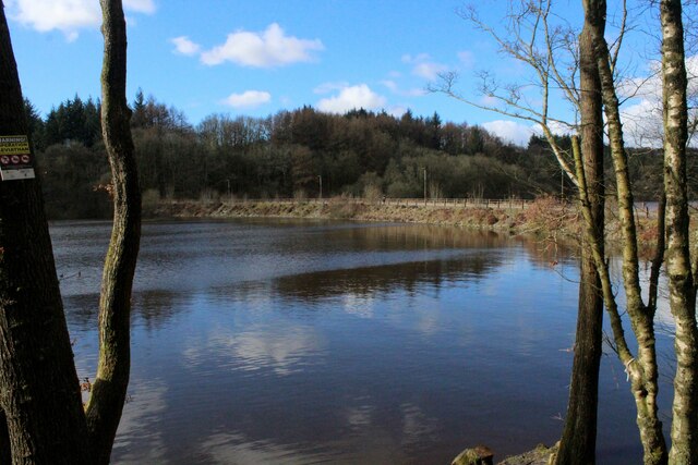
The village hosts several annual events, such as the Edgworth Beer Festival, attracting visitors from far and wide. Additionally, the nearby Wayoh and Entwistle Reservoirs offer opportunities for water sports and birdwatching.

Overall, Edgworth offers a tranquil and idyllic setting, making it an ideal place for both residents and visitors seeking a peaceful retreat amidst breathtaking natural beauty.

If you have any feedback on the listing, please let us know in the comments section below.
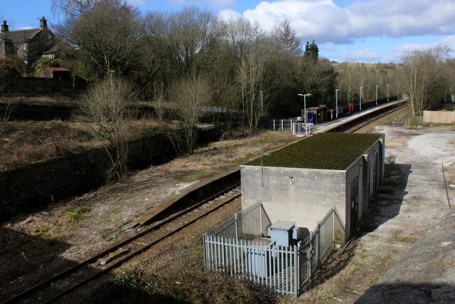
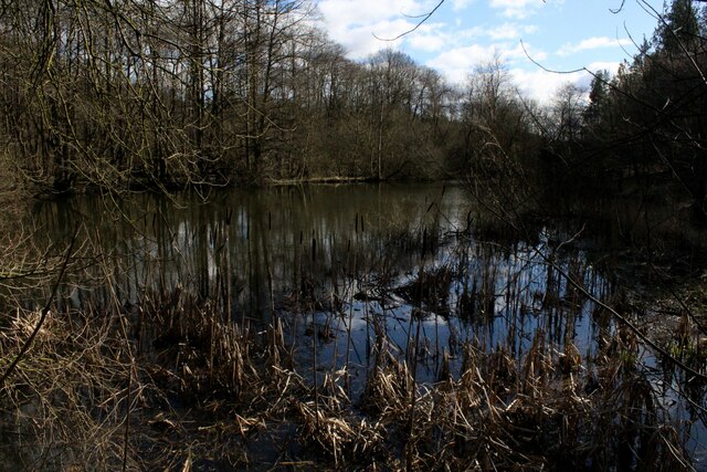
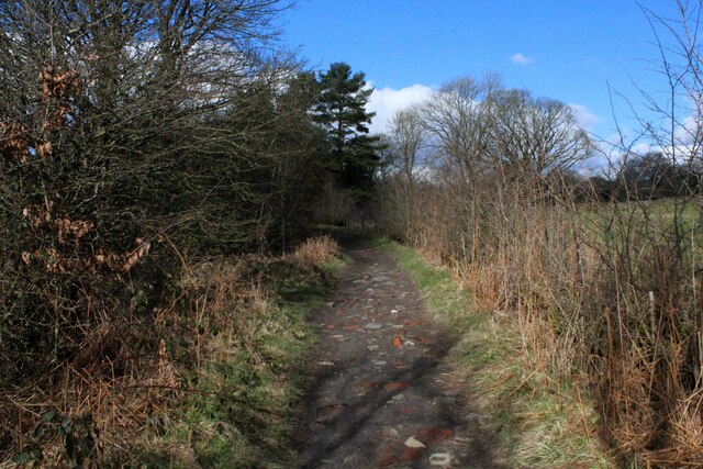
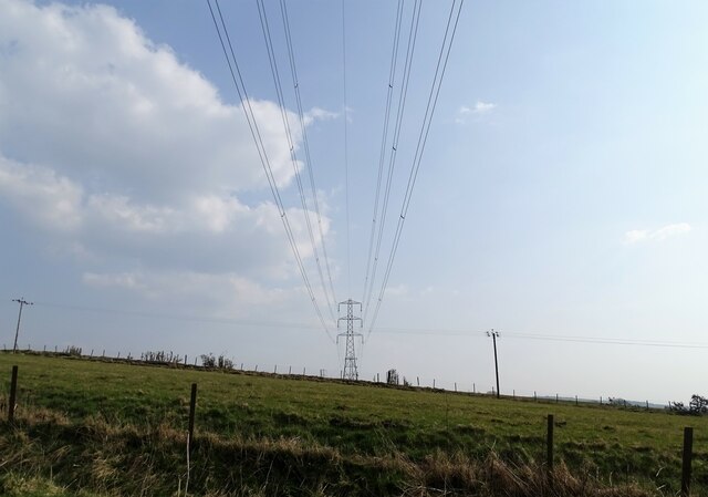
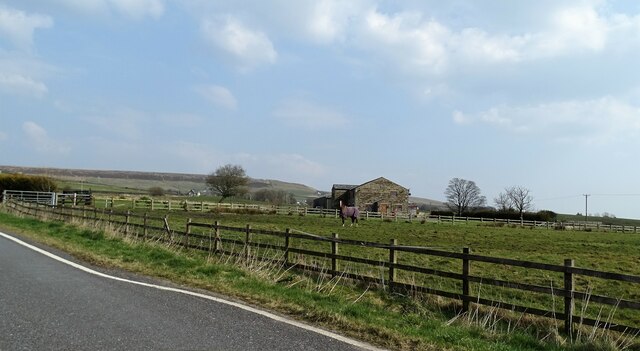
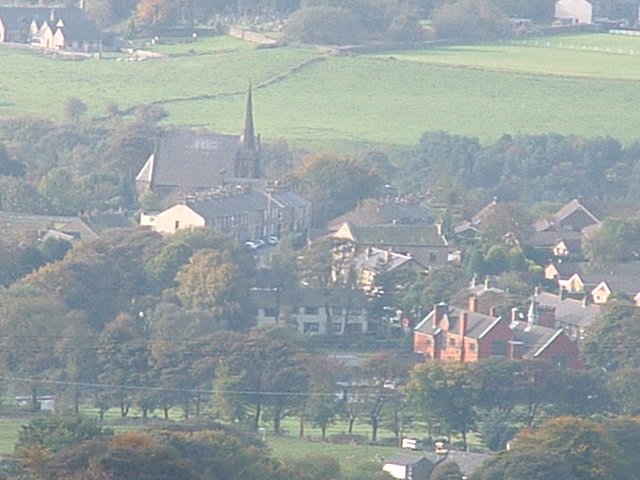
Edgworth Images

Images are sourced within 2km of 53.647411/-2.3926918 or Grid Reference SD7416. Thanks to Geograph Open Source API. All images are credited.

Chapeltown Road Approaching Chapeltown.
Chapeltown Road
Approaching Chapeltown.
Chapeltown, Turton St. Anne's church is on the right.
Chapeltown, Turton
St. Anne's church is on the right.
Wayoh Reservoir near Edgworth as seen from the dam
Entwistle Station East Lancashire Line that operates between Manchester and Clitheroe, via Blackburn - single track at this point.
Entwistle Station
East Lancashire Line that operates between Manchester and Clitheroe, via Blackburn - single track at this point.
Top End of Wayoh Reservoir Furthest from the dam, this part of the reservoir is choked with a variety of interesting vegetation
Top End of Wayoh Reservoir
Furthest from the dam, this part of the reservoir is choked with a variety of interesting vegetation
Causeway across Wayoh Reservoir This causeway carries Cross Trees Lane across the still waters of Wayoh Reservoir.
Completed in 1876, and extended in 1962 to provide drinking water to nearby Bolton.
Causeway across Wayoh Reservoir
This causeway carries Cross Trees Lane across the still waters of Wayoh Reservoir. Completed in 1876, and extended in 1962 to provide drinking water to nearby Bolton.
Footpath beside Wayoh Reservoir Adopted by the Witton Weavers Way long distance footpath
Footpath beside Wayoh Reservoir
Adopted by the Witton Weavers Way long distance footpath
Wayoh Reservoir Completed in 1876 and extended in 1962, this reservoir contributes to the water supply of nearby Bolton.
Wayoh Reservoir
Completed in 1876 and extended in 1962, this reservoir contributes to the water supply of nearby Bolton.
Flight of Steps beside the Wayoh Reservoir Embankment Adopted by the Witton Weavers Way long distance footpath, these steps take the walker to the site of Edgworth Quarries - there is now no trace of the former workings.
The steps also form part of a walk that circumnavigates the reservoir.
Flight of Steps beside the Wayoh Reservoir Embankment
Adopted by the Witton Weavers Way long distance footpath, these steps take the walker to the site of Edgworth Quarries - there is now no trace of the former workings. The steps also form part of a walk that circumnavigates the reservoir.
Entering Chapeltown from the North Following Greens Arms Road into Chapeltown
Entering Chapeltown from the North
Following Greens Arms Road into Chapeltown
Nabbs Farm Farm on Greens Arms Road, the B6391
Nabbs Farm
Farm on Greens Arms Road, the B6391
Batridge Road No through road leading to Entwistle Reservoir from the B6391, Greens Arms Road.
Batridge Road
No through road leading to Entwistle Reservoir from the B6391, Greens Arms Road.
B6391 crossing the East Lancashire Railway The crossing causes the B6391, Greens Arms Road to execute a severe double bend. In the cutting below is a single track railway line - the East Lancashire between Manchester and Clitheroe, via Blackburn.
B6391 crossing the East Lancashire Railway
The crossing causes the B6391, Greens Arms Road to execute a severe double bend. In the cutting below is a single track railway line - the East Lancashire between Manchester and Clitheroe, via Blackburn.
Dam Wall holding back the Waters of Turton and Entwistle Reservoir Most of the signage hereabouts refer to Entwistle Reservoir - dropping the Turton bit.
The water is destined for the inhabitants of Bolton.
Dam Wall holding back the Waters of Turton and Entwistle Reservoir
Most of the signage hereabouts refer to Entwistle Reservoir - dropping the Turton bit. The water is destined for the inhabitants of Bolton.
Pasture and pylon Rough grazing off Moorside Road.
Pasture and pylon
Rough grazing off Moorside Road.
Pasture at Moorside Farm The horse poses for the photographer.
Pasture at Moorside Farm
The horse poses for the photographer.
Turton Tower This view from 1985 perhaps has more trees and a two figured statue in front of the ground floor window of the tower appears to have since gone
Turton Tower
This view from 1985 perhaps has more trees and a two figured statue in front of the ground floor window of the tower appears to have since gone
Turton Tower A grade I listed building near Chapeltown village.
Turton Tower
A grade I listed building near Chapeltown village.
Show me another place!

Edgworth is located at Grid Ref: SD7416 (Lat: 53.647411, Lng: -2.3926918)

Unitary Authority: Blackburn with Darwen

Police Authority: Lancashire

What 3 Words

///sniff.closets.flanked. Near Edgworth, Lancashire

Nearby Locations

Edgworth

Related Wikis

Turton F.C.

Turton Football Club is a football club based in Edgworth, in the North Turton district of Blackburn with Darwen, Lancashire, England. They are currently...

Edgworth

Edgworth is a small village within the borough of Blackburn with Darwen, Lancashire, England. It is north east of North Turton between Broadhead Brook...
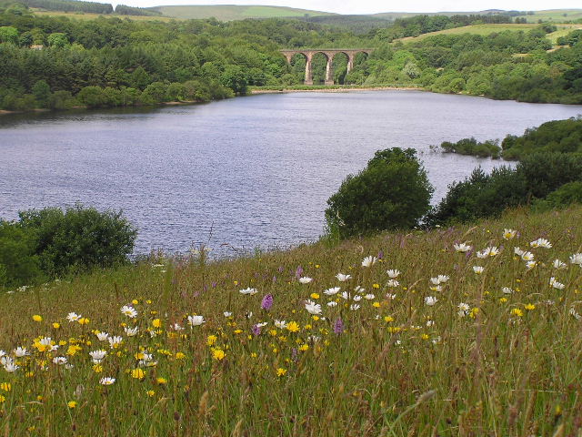
Wayoh Reservoir

Wayoh Reservoir is a water reservoir in the town of Edgworth, Lancashire, England. It was completed on 28 April 1876 to supply water to Bolton. Wayoh,...

North Turton

North Turton is a civil parish of the unitary authority of Blackburn with Darwen in Lancashire, England. According to the United Kingdom Census 2001 the...

Nearby Amenities

Located within 500m of 53.647411,-2.3926918
Edgworth
Is In: Blackburn with Darwen, Lancashire, England, UK
Place: village
Source: npe
Wikidata: Q5337968
Lat/Long: 53.6474767/-2.3925744
Turning Circle
Lat/Long: 53.6477524/-2.3959722
Turning Circle
Lat/Long: 53.6472777/-2.3937122
Turning Circle
Lat/Long: 53.6474026/-2.3947073
Turning Circle
Lat/Long: 53.6465295/-2.3955197
Turning Circle
Lat/Long: 53.6492075/-2.3935944
Turning Circle
Lat/Long: 53.64626/-2.3956095
Turning Circle
Lat/Long: 53.6469578/-2.3894956
Community Centre
The Barlow
Addr City: Bolton
Addr Housenumber: 216
Addr Postcode: BL7 0AP
Addr Street: Bolton Road
Alt Name: The Barlow Institute
Building: public
Fhrs Id: 212187
Opening Hours: Mo-Fr 10:00-15:00
Operator: The Barlow Institute Trustees
Lat/Long: 53.6452135/-2.3933355
Library
The Barlow
Lat/Long: 53.6451558/-2.3933374
Cafe
The Barlow
Addr City: Bolton
Addr Housenumber: 216
Addr Postcode: BL7 0AP
Addr Street: Bolton Road
Cuisine: sandwich
Internet Access: wlan
Lat/Long: 53.645283/-2.393273
Barrier: kissing_gate
Foot: yes
Lat/Long: 53.6444226/-2.3970135
Mini Roundabout
Direction: clockwise
Lat/Long: 53.6474803/-2.3927918
Mini Roundabout
Direction: clockwise
Lat/Long: 53.6473753/-2.3926385
Post Box
Collection Times: Mo-Fr 16:45; Sa 11:45
Operator: Royal Mail
Post Box Type: pillar
Ref: BL7 178
Royal Cypher: GR
Royal Cypher Wikidata: Q33102273
Lat/Long: 53.6475723/-2.3929065
Barrier: stile
Lat/Long: 53.6456917/-2.3900769
Barrier: stile
Lat/Long: 53.6449227/-2.3894622
Generator Method: photovoltaic
Generator Output Electricity: yes
Generator Source: solar
Generator Type: solar_photovoltaic_panel
Location: roof
Power: generator
Lat/Long: 53.6502188/-2.3922767
Direction: E
Generator Method: photovoltaic
Generator Output Electricity: yes
Generator Solar Modules: 15
Generator Source: solar
Generator Type: solar_photovoltaic_panel
Location: roof
Power: generator
Lat/Long: 53.6474211/-2.3939178
Generator Method: photovoltaic
Generator Output Electricity: yes
Generator Source: solar
Generator Type: solar_photovoltaic_panel
Location: roof
Power: generator
Lat/Long: 53.6448067/-2.3958152
Generator Method: photovoltaic
Generator Output Electricity: yes
Generator Source: solar
Generator Type: solar_photovoltaic_panel
Location: roof
Power: generator
Lat/Long: 53.644092/-2.393595
Generator Method: photovoltaic
Generator Output Electricity: yes
Generator Source: solar
Generator Type: solar_photovoltaic_panel
Location: roof
Power: generator
Lat/Long: 53.6441144/-2.3939399
Turning Circle
Lat/Long: 53.6476913/-2.3919077
Pharmacy
The Village Pharmacy
Addr City: Bolton
Addr Housenumber: 365
Addr Place: Edgeworth
Addr Postcode: BL7 0AZ
Addr Street: Bolton Road
Dispensing: yes
Fhrs Id: 211274
Operator: Geloo Brothers
Ref: 1033131
Wheelchair: yes
Lat/Long: 53.6468729/-2.3929911
Turning Circle
Lat/Long: 53.6449889/-2.3957493
Turning Circle
Lat/Long: 53.6444027/-2.3952019
Turning Circle
Lat/Long: 53.6455761/-2.3955
Generator Method: photovoltaic
Generator Output Electricity: yes
Generator Source: solar
Generator Type: solar_photovoltaic_panel
Location: roof
Power: generator
Lat/Long: 53.6436848/-2.3946836
Generator Method: photovoltaic
Generator Output Electricity: yes
Generator Source: solar
Generator Type: solar_photovoltaic_panel
Location: roof
Power: generator
Lat/Long: 53.6437766/-2.3941076
Generator Method: photovoltaic
Generator Output Electricity: yes
Generator Source: solar
Generator Type: solar_photovoltaic_panel
Location: roof
Power: generator
Lat/Long: 53.6436164/-2.3948051
Power: pole
Lat/Long: 53.646288/-2.3914499
Power: pole
Lat/Long: 53.6457386/-2.3910551
Power: pole
Lat/Long: 53.6451581/-2.3906376
Power: pole
Lat/Long: 53.6445719/-2.3902141
Power: pole
Lat/Long: 53.6451609/-2.3898193
Power: pole
Lat/Long: 53.6439984/-2.3898241
Power: pole
Lat/Long: 53.6435423/-2.3897931
Traffic Calming: chicane
Lat/Long: 53.6513568/-2.3928258
Generator Method: photovoltaic
Generator Output Electricity: yes
Generator Source: solar
Generator Type: solar_photovoltaic_panel
Location: roof
Power: generator
Lat/Long: 53.6462067/-2.3960754
Waste Basket
Lat/Long: 53.6475511/-2.3928592
Crossing
Crossing: unmarked
Crossing Island: no
Tactile Paving: yes
Lat/Long: 53.6475274/-2.3929505
Waste Basket
Lat/Long: 53.646973/-2.3926338
Power: pole
Lat/Long: 53.6511067/-2.3935386
Power: pole
Lat/Long: 53.6516871/-2.3935308
Power: pole
Lat/Long: 53.6504898/-2.3935456
Power: pole
Lat/Long: 53.6499083/-2.3935729
The data included in this document is from www.openstreetmap.org. The data is made available under ODbL.

Have you been to Edgworth?

Leave your review of Edgworth below (or comments, questions and feedback).