Newton Gorse

Wood, Forest in Lincolnshire North Kesteven

England

Newton Gorse

Road junction, Walcot A 17th century barn at Manor Farm behind the fingerpost
Road junction, Walcot Credit: Tim Heaton

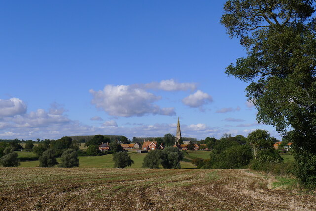
Newton Gorse is a small village located in the county of Lincolnshire, England. Situated in the heart of the county, the village is known for its picturesque woodlands and serene forest landscapes. With a population of around 500 residents, Newton Gorse offers a peaceful and tight-knit community.

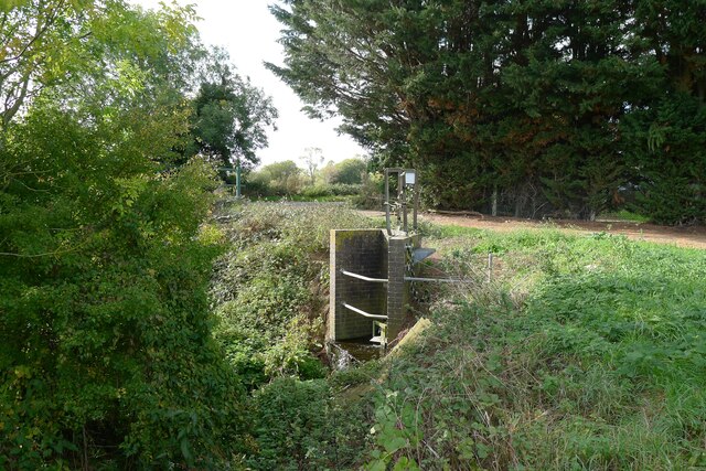
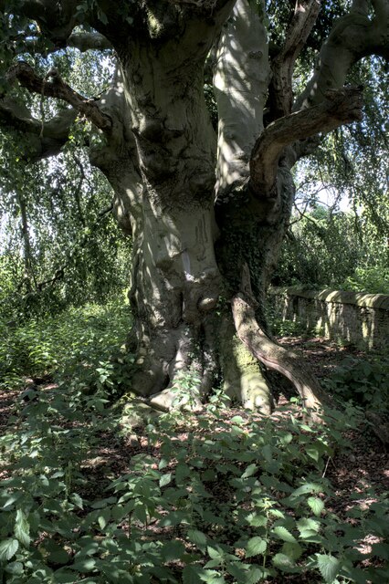
The village is surrounded by lush greenery, including dense woodlands that create a natural border around the settlement. The forested areas are home to a variety of tree species, including oak, beech, and birch, providing a beautiful backdrop to the village. These woodlands offer an ideal setting for leisurely walks, picnics, and nature exploration.

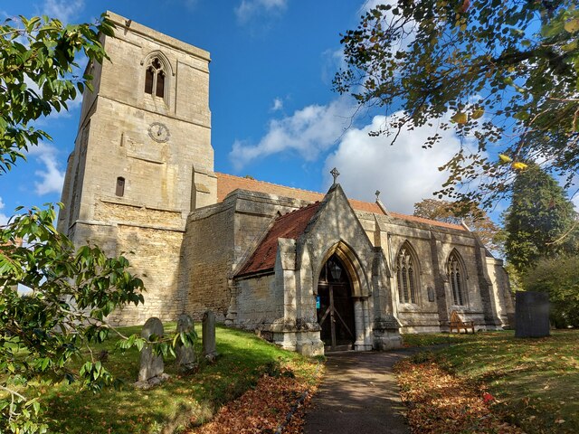
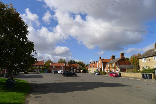
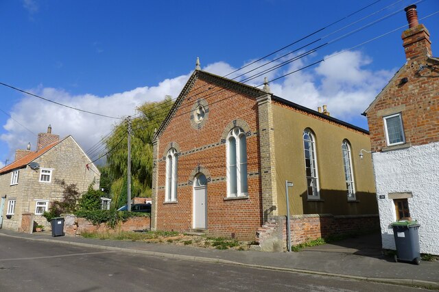
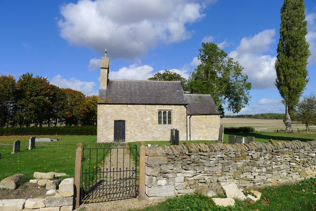
In addition to its natural beauty, Newton Gorse boasts a rich history. The village dates back to medieval times and still retains some of its historic charm. Visitors can admire the village's traditional architecture, with several well-preserved cottages and buildings showcasing the local heritage.

Despite its small size, Newton Gorse offers a range of amenities to its residents. The village has a primary school, a community center, and a quaint village pub, where locals often gather to socialize. The nearby town of Lincoln provides additional facilities and services, including shops, supermarkets, and healthcare facilities.

Overall, Newton Gorse, Lincolnshire is a quiet and idyllic village, offering a peaceful escape from the hustle and bustle of city life. Its woodlands and forested areas provide a natural haven for outdoor enthusiasts and nature lovers, while its close-knit community fosters a strong sense of belonging.

If you have any feedback on the listing, please let us know in the comments section below.
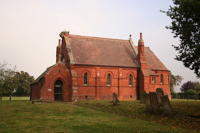
Newton Gorse Images

Images are sourced within 2km of 52.916677/-0.41269856 or Grid Reference TF0636. Thanks to Geograph Open Source API. All images are credited.

Road junction, Walcot A 17th century barn at Manor Farm behind the fingerpost
Road junction, Walcot
A 17th century barn at Manor Farm behind the fingerpost
Church of St Nicholas, Walcot Grade I listed.
Dating from the 12th century onwards, and restored in 1907 & 1926.
It has a 2 stage west tower with a tall crocketed broached spire from 14th Century. The tower arch is also from this period. Entered through a 17th C door in the south porch, the nave arcades are 13th C. but rest on even older bases. The font is Norman but recut in 18th C. The clerestory windows are 15th Century. The carved pew ends are 500 years old.
There is a double hagioscope. In the south aisle is a C13 trefoil headed piscina. The roof is a 14th C braced tie beam.
Church of St Nicholas, Walcot
Grade I listed. Dating from the 12th century onwards, and restored in 1907 & 1926. It has a 2 stage west tower with a tall crocketed broached spire from 14th Century. The tower arch is also from this period. Entered through a 17th C door in the south porch, the nave arcades are 13th C. but rest on even older bases. The font is Norman but recut in 18th C. The clerestory windows are 15th Century. The carved pew ends are 500 years old. There is a double hagioscope. In the south aisle is a C13 trefoil headed piscina. The roof is a 14th C braced tie beam.
Walcot from the south The tall, 14th century spire of St Nicholas easily visible
Walcot from the south
The tall, 14th century spire of St Nicholas easily visible
Sewage works outfall into South Beck, Osbournby
The A15 entering Osbournby The busy Peterborough to Lincoln route bisects the village
The A15 entering Osbournby
The busy Peterborough to Lincoln route bisects the village
Church of St Peter and St Paul, Osbournby Grade I listed

The Domesday Survey records a church on this site in 1086 in the possession of Gilbert of Ghent the wealthiest landowner on the county at that time.
The present church dates from the twelfth century onwards and consists of a western tower, nave with north and south aisles, chancel, and south porch.
The west end of the church is probably the oldest part dating from 12th or early 13th century with walls made of rubble which is 8ft thick in places. The South aisle once extended to embrace the tower but this section was demolished. Most of the church was constructed in 1320 with the nave, south aisle chancel and porch being rebuilt at this time.
The western tower is from the thirteenth century and is of three stages with a plain parapet. The belfry stage has fourteenth century windows.
The south porch, dating from the fourteenth century has arcading above the side benches with ogee headed panels.
The nave has four bay arcades with thirteenth century octagonal piers. At the east end of the south aisle there is a door which once led to the rood loft. Only the lower portion of the rood screen remains at Osbournby.
There is one modern stained-glass window to the north wall.
The chancel has a fine fourteenth century sedilia with ogee arched heads and Crocketts with human head stops. There is also a piscina and aumbry.

The nave has a number of good fourteenth century bench ends with various subjects including Adam and Eve, and St George and the Dragon.
There is a twelfth century tub font with intersecting blank arcading, presumably from an earlier church.
At the south west end of the nave there are commandment boards.
There is a small organ by Harston of Newark, circa 1890.
The church was restored in 1873 by Charles Kirk when the roof was replaced and the east window and pews were installed (cost £1,460).
In 1965 the tower was found to be dangerously cracked and bulging and had to be strengthened. The clock which was removed from the tower face dates from 1740 and now resides in the North Aisle.
Church of St Peter and St Paul, Osbournby
Grade I listed The Domesday Survey records a church on this site in 1086 in the possession of Gilbert of Ghent the wealthiest landowner on the county at that time. The present church dates from the twelfth century onwards and consists of a western tower, nave with north and south aisles, chancel, and south porch. The west end of the church is probably the oldest part dating from 12th or early 13th century with walls made of rubble which is 8ft thick in places. The South aisle once extended to embrace the tower but this section was demolished. Most of the church was constructed in 1320 with the nave, south aisle chancel and porch being rebuilt at this time. The western tower is from the thirteenth century and is of three stages with a plain parapet. The belfry stage has fourteenth century windows. The south porch, dating from the fourteenth century has arcading above the side benches with ogee headed panels. The nave has four bay arcades with thirteenth century octagonal piers. At the east end of the south aisle there is a door which once led to the rood loft. Only the lower portion of the rood screen remains at Osbournby. There is one modern stained-glass window to the north wall. The chancel has a fine fourteenth century sedilia with ogee arched heads and Crocketts with human head stops. There is also a piscina and aumbry. The nave has a number of good fourteenth century bench ends with various subjects including Adam and Eve, and St George and the Dragon. There is a twelfth century tub font with intersecting blank arcading, presumably from an earlier church. At the south west end of the nave there are commandment boards. There is a small organ by Harston of Newark, circa 1890. The church was restored in 1873 by Charles Kirk when the roof was replaced and the east window and pews were installed (cost £1,460). In 1965 the tower was found to be dangerously cracked and bulging and had to be strengthened. The clock which was removed from the tower face dates from 1740 and now resides in the North Aisle.
Centre of Osbournby A huge area of tarmac. One feels there should be a green.
Centre of Osbournby
A huge area of tarmac. One feels there should be a green.
Former Wesleyan Methodist Chapel, Osbournby Founded 1839, rebuilt 1871 <span class="nowrap"><a title="https://heritage-explorer.lincolnshire.gov.uk/Monument/MLI90246" rel="nofollow ugc noopener" href="https://heritage-explorer.lincolnshire.gov.uk/Monument/MLI90246">Link</a><img style="margin-left:2px;" alt="External link" title="External link - shift click to open in new window" src="https://s1.geograph.org.uk/img/external.png" width="10" height="10"/></span> . Current status?
Former Wesleyan Methodist Chapel, Osbournby
Founded 1839, rebuilt 1871 LinkExternal link . Current status?
Willoughby Road leaving Osbournby The footpath on the right leads to Aunsby
Willoughby Road leaving Osbournby
The footpath on the right leads to Aunsby
Church of St Andrew, Scott Willoughby "10th century parish church with alterations or additions in the 12th and 17th centuries, repaired 1826, chancel renewed 1826, walls restored 1882" <span class="nowrap"><a title="https://heritage-explorer.lincolnshire.gov.uk/Monument/MLI90870" rel="nofollow ugc noopener" href="https://heritage-explorer.lincolnshire.gov.uk/Monument/MLI90870">Link</a><img style="margin-left:2px;" alt="External link" title="External link - shift click to open in new window" src="https://s1.geograph.org.uk/img/external.png" width="10" height="10"/></span>
"The smallest church still in use in the county of Lincolnshire" <span class="nowrap"><a title="https://www.parishofsouthlafford.org/scott-willoughby-st-andrew-s-church" rel="nofollow ugc noopener" href="https://www.parishofsouthlafford.org/scott-willoughby-st-andrew-s-church">Link</a><img style="margin-left:2px;" alt="External link" title="External link - shift click to open in new window" src="https://s1.geograph.org.uk/img/external.png" width="10" height="10"/></span>
Church of St Andrew, Scott Willoughby
"10th century parish church with alterations or additions in the 12th and 17th centuries, repaired 1826, chancel renewed 1826, walls restored 1882" LinkExternal link "The smallest church still in use in the county of Lincolnshire" LinkExternal link
Restricted byway running due east from Newton Heading towards Horse Close Plantation
Restricted byway running due east from Newton
Heading towards Horse Close Plantation
Restricted byway east of Newton This pleasant cycling byway, extending 1¼ miles east from Newton, ends abruptly at Newton Gorse woodland, ahead.
Restricted byway east of Newton
This pleasant cycling byway, extending 1¼ miles east from Newton, ends abruptly at Newton Gorse woodland, ahead.
Footpath north from Newton Grange Farm The path passes Newton Gorse woodland, ahead, crosses the A52, and continues to Osbournby.
Footpath north from Newton Grange Farm
The path passes Newton Gorse woodland, ahead, crosses the A52, and continues to Osbournby.
Site of gallows by the Sleaford-Bourne road (A15) "The gallows apparently stood by the roadside where the Threekingham-Newton footpath crossed the Sleaford-Bourne road (the modern A15). The area around this site was known as Galley (from Gallows) Hill. During the early 20th century, some large stones were uncovered at this site which were interpreted as the remains of the holdfasts of the wooden gallows." <span class="nowrap"><a title="https://heritage-explorer.lincolnshire.gov.uk/Monument/MLI90643" rel="nofollow ugc noopener" href="https://heritage-explorer.lincolnshire.gov.uk/Monument/MLI90643">Link</a><img style="margin-left:2px;" alt="External link" title="External link - shift click to open in new window" src="https://s1.geograph.org.uk/img/external.png" width="10" height="10"/></span>
The site, on a road and parish boundary, was typical for gallows. The mentioned footpath, crossing the road and following the track to the right, is clearly shown on pre-1950s OS maps, but is absent on the current map.
Site of gallows by the Sleaford-Bourne road (A15)
"The gallows apparently stood by the roadside where the Threekingham-Newton footpath crossed the Sleaford-Bourne road (the modern A15). The area around this site was known as Galley (from Gallows) Hill. During the early 20th century, some large stones were uncovered at this site which were interpreted as the remains of the holdfasts of the wooden gallows." LinkExternal link The site, on a road and parish boundary, was typical for gallows. The mentioned footpath, crossing the road and following the track to the right, is clearly shown on pre-1950s OS maps, but is absent on the current map.
Walcot Bar, Sleaford Road (A15) The name suggests that there used to be a toll gate (barrier) on this former turnpike road?
Walcot Bar, Sleaford Road (A15)
The name suggests that there used to be a toll gate (barrier) on this former turnpike road?
Saint Nicholas, Walcot: Fagus sylvatica pendula The Weeping Beech at Walcot remains one of my favourite trees in England
Saint Nicholas, Walcot: Fagus sylvatica pendula
The Weeping Beech at Walcot remains one of my favourite trees in England
The trunk of the tree Under the canopy of <a href="https://www.geograph.org.uk/photo/7522956">TF0635 : Saint Nicholas, Walcot: Fagus sylvatica pendula</a>.  This is the trunk of the Weeping Beech, Fagus sylvatica pendula.
The trunk of the tree
Under the canopy of TF0635 : Saint Nicholas, Walcot: Fagus sylvatica pendula. This is the trunk of the Weeping Beech, Fagus sylvatica pendula.
Bark of the beech tree This is a look at the bark texture of <a href="https://www.geograph.org.uk/photo/7522956">TF0635 : Saint Nicholas, Walcot: Fagus sylvatica pendula</a>, a weeping Beech.  It is gettin g on for 200 years old.
Bark of the beech tree
This is a look at the bark texture of TF0635 : Saint Nicholas, Walcot: Fagus sylvatica pendula, a weeping Beech. It is gettin g on for 200 years old.
Show me another place!

Newton Gorse is located at Grid Ref: TF0636 (Lat: 52.916677, Lng: -0.41269856)

Administrative County: Lincolnshire

District: North Kesteven

Police Authority: Lincolnshire

What 3 Words

///stopped.overgrown.beeline. Near Billingborough, Lincolnshire

Related Wikis

Threekingham Bar

Threekingham Bar is the name given to interception of the A52 (Grantham to Boston) and A15 (Peterborough to Lincoln and Hull) roads, 1 mile (1.6 km) to...

Osbournby

Osbournby (locally pronounced Ozzenby or Ossenby) is a small village and civil parish in the North Kesteven district of Lincolnshire, England. The population...

Walcot, Lincolnshire

Walcot is a village and civil parish in the North Kesteven district of Lincolnshire, England. It lies 1 mile (1.6 km) west from the A15, 7 miles (11 km...

Newton, Lincolnshire

Newton is a hamlet in the North Kesteven district of Lincolnshire, England. The hamlet is situated approximately 8 miles (13 km) east from the town of...

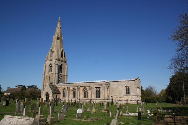
St Peter's Church, Threekingham

St Peter's Church is a church in Threekingham, Lincolnshire. It is dedicated to St. Peter ad Vincula (St Peter in chains). It became a Grade I listed building...

Threekingham

Threekingham (sometimes Threckingham or Tricengham) is a village in the North Kesteven district of Lincolnshire, England. The population of the civil parish...

Newton and Haceby

Newton and Haceby is a civil parish in North Kesteven, Lincolnshire, England. It includes the separate hamlets of Newton and Haceby. The population of...

Spanby

Spanby is a village and former civil parish in the North Kesteven district of Lincolnshire, England, about 5 miles (8 km) south from the town of Sleaford...

Nearby Amenities

Located within 500m of 52.916677,-0.41269856
Threekingham Bar
Place: locality
Source: Bing
Lat/Long: 52.9184239/-0.4062983
Newton Gorse
Place: locality
Source: Bing
Lat/Long: 52.9178929/-0.4128866
Street Lamp
Lat/Long: 52.9176084/-0.4060839
Street Lamp
Lat/Long: 52.9178901/-0.4060521
Street Lamp
Lat/Long: 52.9181167/-0.4062241
Street Lamp
Lat/Long: 52.9181685/-0.406635
Street Lamp
Lat/Long: 52.9182037/-0.4059449
Street Lamp
Lat/Long: 52.9183881/-0.4071881
Street Lamp
Lat/Long: 52.9184009/-0.4068133
Street Lamp
Lat/Long: 52.9184233/-0.4058281
Street Lamp
Lat/Long: 52.9185507/-0.4076053
Street Lamp
Lat/Long: 52.9186459/-0.4066703
Street Lamp
Lat/Long: 52.9187119/-0.4063932
Street Lamp
Lat/Long: 52.9189317/-0.4064401
Parking
Parking: layby
Lat/Long: 52.9185774/-0.4085699
The data included in this document is from www.openstreetmap.org. The data is made available under ODbL.

Have you been to Newton Gorse?

Leave your review of Newton Gorse below (or comments, questions and feedback).