Braceborough Little Wood

Wood, Forest in Lincolnshire South Kesteven

England

Braceborough Little Wood

St. Margaret of Antioch Church, Braceborough Grade 1 Listed 

14th Century Church.  <span class="nowrap"><a title="https://historicengland.org.uk/listing/the-list/list-entry/1360151" rel="nofollow ugc noopener" href="https://historicengland.org.uk/listing/the-list/list-entry/1360151">Link</a><img style="margin-left:2px;" alt="External link" title="External link - shift click to open in new window" src="https://s1.geograph.org.uk/img/external.png" width="10" height="10"/></span>

Braceborough >> <span class="nowrap"><a title="https://en.wikipedia.org/wiki/Braceborough_and_Wilsthorpe" rel="nofollow ugc noopener" href="https://en.wikipedia.org/wiki/Braceborough_and_Wilsthorpe">Link</a><img style="margin-left:2px;" alt="External link" title="External link - shift click to open in new window" src="https://s1.geograph.org.uk/img/external.png" width="10" height="10"/></span>
St. Margaret of Antioch Church, Braceborough Credit: Brian Deegan

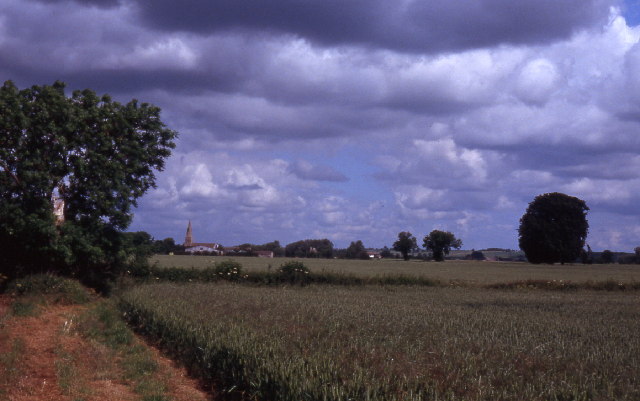
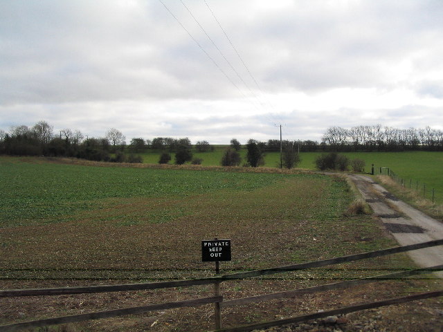
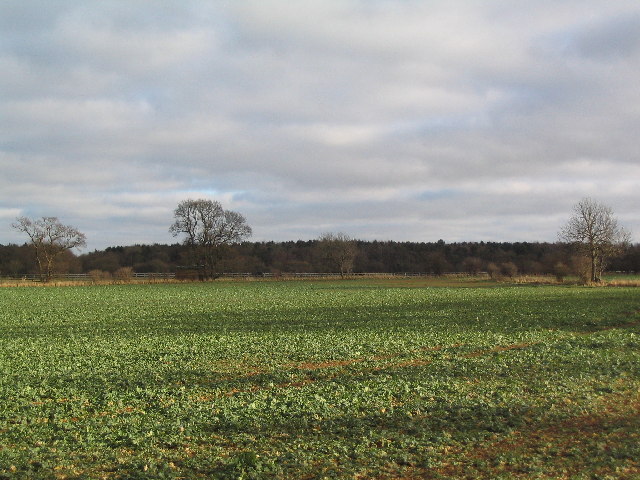
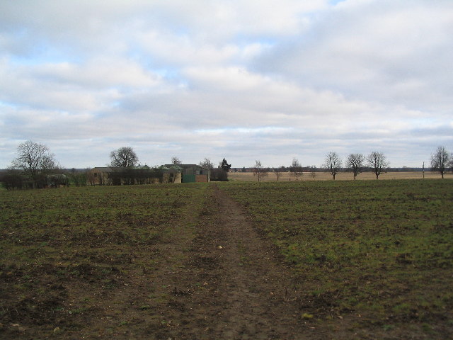
Braceborough Little Wood, located in Lincolnshire, is a small but enchanting woodland area that spans across a modest area of land. This tranquil forest is nestled in the picturesque countryside, offering visitors a peaceful retreat away from the hustle and bustle of city life.

Covered in a dense canopy of trees, including oak, beech, and birch, Braceborough Little Wood boasts a rich biodiversity. The woodland floor is carpeted with a variety of wildflowers, adding a burst of color to the surroundings during the spring and summer months. The wood is also home to several species of birds, such as woodpeckers and owls, making it a paradise for birdwatchers and nature enthusiasts.

The wood offers several walking trails that wind through the trees, providing visitors with an opportunity to explore and immerse themselves in the beauty of nature. These paths are well-maintained and suitable for all ages and abilities, making it an ideal destination for families and individuals alike.

In addition to its natural beauty, Braceborough Little Wood also holds historical significance. It is believed to have been part of the ancient Forest of Kesteven, which covered a large portion of Lincolnshire in medieval times. This connection to the past adds a sense of mystique to the wood, making it even more intriguing to explore.

Overall, Braceborough Little Wood is a hidden gem in Lincolnshire, offering a peaceful haven for nature lovers. Whether one seeks solitude, a leisurely stroll, or an opportunity to spot wildlife, this woodland is a must-visit destination for anyone looking to reconnect with nature in a serene and captivating setting.

If you have any feedback on the listing, please let us know in the comments section below.

Braceborough Little Wood Images

Images are sourced within 2km of 52.706833/-0.42084226 or Grid Reference TF0613. Thanks to Geograph Open Source API. All images are credited.

St. Margaret of Antioch Church, Braceborough Grade 1 Listed 

14th Century Church.  <span class="nowrap"><a title="https://historicengland.org.uk/listing/the-list/list-entry/1360151" rel="nofollow ugc noopener" href="https://historicengland.org.uk/listing/the-list/list-entry/1360151">Link</a><img style="margin-left:2px;" alt="External link" title="External link - shift click to open in new window" src="https://s1.geograph.org.uk/img/external.png" width="10" height="10"/></span>

Braceborough >> <span class="nowrap"><a title="https://en.wikipedia.org/wiki/Braceborough_and_Wilsthorpe" rel="nofollow ugc noopener" href="https://en.wikipedia.org/wiki/Braceborough_and_Wilsthorpe">Link</a><img style="margin-left:2px;" alt="External link" title="External link - shift click to open in new window" src="https://s1.geograph.org.uk/img/external.png" width="10" height="10"/></span>
St. Margaret of Antioch Church, Braceborough
Grade 1 Listed 14th Century Church. LinkExternal link Braceborough >> LinkExternal link
Saponaria officinalis Common Soapwort growing in a verge.  There is an extensive patch of it - see <a href="https://www.geograph.org.uk/photo/6946317">TF0513 : A flowering verge</a>.

The plant has a list of common names as long as my arm - have a look at <span class="nowrap"><a title="https://www.rhs.org.uk/plants/16441/Saponaria-officinalis/Details" rel="nofollow ugc noopener" href="https://www.rhs.org.uk/plants/16441/Saponaria-officinalis/Details">Link</a><img style="margin-left:2px;" alt="External link" title="External link - shift click to open in new window" src="https://s1.geograph.org.uk/img/external.png" width="10" height="10"/></span> .  The only other name I recognise on there is "Jill-run-by-the-street".
Saponaria officinalis
Common Soapwort growing in a verge. There is an extensive patch of it - see TF0513 : A flowering verge. The plant has a list of common names as long as my arm - have a look at LinkExternal link . The only other name I recognise on there is "Jill-run-by-the-street".
A flowering verge A patch of Common Soapwort in the grass verge beside Carlby Road.  See <a href="https://www.geograph.org.uk/photo/6946315">TF0513 : Saponaria officinalis</a>.
A flowering verge
A patch of Common Soapwort in the grass verge beside Carlby Road. See TF0513 : Saponaria officinalis.
East Lodge This field is known as East Lodge, after a building that once stood there.  The crop is of field beans, drying rapidly but not yet ready for harvest.  Diagonally across the left the row of trees is the trackbed of the former railway from Bourne to Essendine.
East Lodge
This field is known as East Lodge, after a building that once stood there. The crop is of field beans, drying rapidly but not yet ready for harvest. Diagonally across the left the row of trees is the trackbed of the former railway from Bourne to Essendine.
Carlby Road A simple lane between Carlby and Greatford, here looking toward Greatford.  The trees have mostly been planted since I got married, historically this was an open heathland landscape.  The wide verges might hint at an ancient route - it does head toward one of the places called Stowe - but it is likely to be an enclosure-era adoption of an earlier track on high ground that granted the width.
Carlby Road
A simple lane between Carlby and Greatford, here looking toward Greatford. The trees have mostly been planted since I got married, historically this was an open heathland landscape. The wide verges might hint at an ancient route - it does head toward one of the places called Stowe - but it is likely to be an enclosure-era adoption of an earlier track on high ground that granted the width.
The West Glen River at Essendine Looking downstream.
The West Glen River at Essendine
Looking downstream.
Essendine Church St Mary's Church was originally the chapel for the nearby castle (of which only earthworks survive). The chancel is unusual in being taller than the nave, due to it having been rebuilt in the early 19C.  The south doorway has a Norman arch with a carved tympanum showing a demi-figure of Christ and two angels, a motif more usual in France than in England.
Essendine Church
St Mary's Church was originally the chapel for the nearby castle (of which only earthworks survive). The chancel is unusual in being taller than the nave, due to it having been rebuilt in the early 19C. The south doorway has a Norman arch with a carved tympanum showing a demi-figure of Christ and two angels, a motif more usual in France than in England.
Field path near Braceborough
Church of St Stephen, Carlby
Carlby, with Church of St Stephen
Keep out of TF0512
Keep out of TF0512
Bridge on footpath from Carlby to Braceborough
Braceborough Great Wood
Braceborough Lodge
Braceborough Lodge
Church of St Margaret, Braceborough
Braceborough village Hall Originally the village school
Braceborough village Hall
Originally the village school
Old farm buildings and church of St Margaret, Braceborough
Farmhouse
Farmhouse
Show me another place!

Braceborough Little Wood is located at Grid Ref: TF0613 (Lat: 52.706833, Lng: -0.42084226)

Administrative County: Lincolnshire

District: South Kesteven

Police Authority: Lincolnshire

What 3 Words

///filer.initiated.cape. Near Essendine, Rutland

Related Wikis

Braceborough Spa Halt railway station

Braceborough Spa railway station was a station in Braceborough Spa, Lincolnshire on the Bourn and Essendine Railway between Essendine and Bourne. It was...

Braceborough

Braceborough is a village in the South Kesteven district of Lincolnshire, England. It is situated off the Stamford to Bourne A6121 road, just west of the...

Carlby

Carlby is a small village and civil parish in the district of South Kesteven in Lincolnshire, England. The population of the civil parish at the 2011 census...

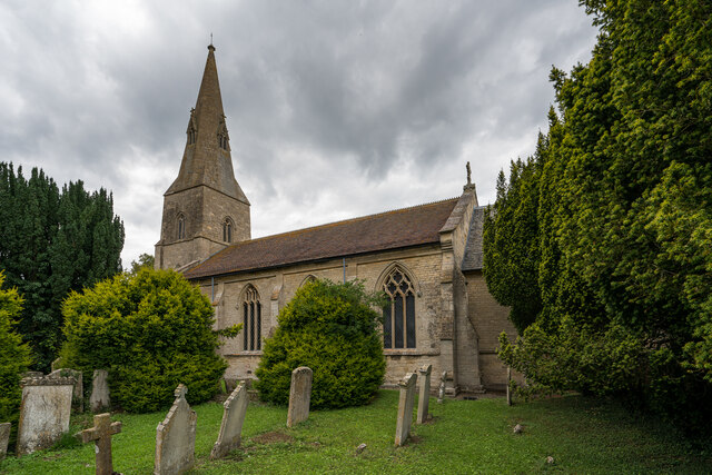
Church of St Mary Magdalene, Essendine

The Church of St Mary Magdalene is a church in Essendine, Rutland. It is a Grade II* listed building. == History == The small church is built within the...

Bowthorpe Oak

Bowthorpe Oak in Manthorpe near Bourne, Lincolnshire, is a gigantic and ancient pedunculate oak in England. The tree has a circumference of about 44 feet...

Braceborough and Wilsthorpe

Braceborough and Wilsthorpe is a civil parish in the South Kesteven district of Lincolnshire, England. Braceborough and Wilsthorpe are less than 1 mile...

Wilsthorpe Crossing Halt railway station

Wilsthorpe Crossing Halt railway station was on the branch line between Bourne and Essendine, Lincolnshire, England. == History == The line of the Bourn...

Essendine railway station

Essendine railway station was a station in Essendine, Rutland. It was situated on the East Coast Main Line of the Great Northern Railway. == Overview... ==

Nearby Amenities

Located within 500m of 52.706833,-0.42084226
Braceborough Grange
Place: farm
Source: Bing
Lat/Long: 52.7049841/-0.4216879
Braceborough Lodge
Place: isolated_dwelling
Source: Bing
Lat/Long: 52.7081178/-0.4159992
Building: yes
Lat/Long: 52.705307/-0.4255463
Grange Farm Cottage
Place: isolated_dwelling
Lat/Long: 52.7053981/-0.4257202
Redroofs
Place: isolated_dwelling
Lat/Long: 52.7056971/-0.4168153
Barrier: stile
Material: wood
Stile: stepover
Lat/Long: 52.7076893/-0.4265147
The data included in this document is from www.openstreetmap.org. The data is made available under ODbL.

Have you been to Braceborough Little Wood?

Leave your review of Braceborough Little Wood below (or comments, questions and feedback).