Grange Wood

Wood, Forest in Lincolnshire South Kesteven

England

Grange Wood

St.Mary & All Saints' church, Kirkby Underwood, Lincs. Slightly away from the village, up a narrow lane and surrounded by open farmland. Early English and Perpendicular.
St.Mary & All Saints' church, Kirkby Underwood, Lincs. Credit: Richard Croft

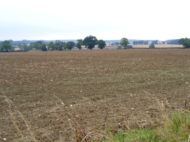
Grange Wood, located in Lincolnshire, is a picturesque woodland that covers an area of approximately 100 acres. Situated on the outskirts of a rural village, it is known for its tranquil and serene atmosphere, making it a popular destination for nature enthusiasts and walkers alike.

The woodland is primarily composed of a diverse range of deciduous trees, including oak, beech, and ash, creating a rich and vibrant canopy that provides a haven for various bird species. The forest floor is adorned with a carpet of wildflowers during spring and summer, adding a burst of color to the landscape.

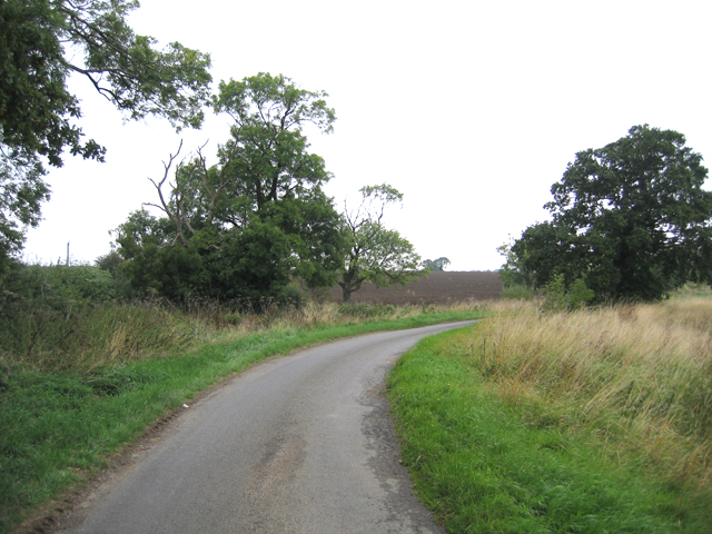
Grange Wood is crisscrossed by a network of well-maintained footpaths, allowing visitors to explore its beauty at their own pace. The paths wind through the wood, leading to secluded clearings, babbling brooks, and small ponds that provide a habitat for an array of wildlife, such as deer, squirrels, and rabbits.

The wood also holds historical significance, as remnants of an ancient Roman road can be found within its borders. These historical artifacts add an extra layer of intrigue and fascination to the woodland, attracting history enthusiasts and archaeology buffs.

Managed by a local conservation organization, Grange Wood is carefully preserved to protect its natural habitat and biodiversity. Regular maintenance activities, such as tree thinning and path upkeep, are carried out to ensure the longevity of this precious woodland.

Overall, Grange Wood offers a tranquil escape from the hustle and bustle of everyday life, providing visitors with a chance to immerse themselves in the beauty of nature while enjoying the rich history and biodiversity that the wood has to offer.

If you have any feedback on the listing, please let us know in the comments section below.

Grange Wood Images

Images are sourced within 2km of 52.838065/-0.42005004 or Grid Reference TF0627. Thanks to Geograph Open Source API. All images are credited.

St.Mary & All Saints' church, Kirkby Underwood, Lincs. Slightly away from the village, up a narrow lane and surrounded by open farmland. Early English and Perpendicular.
St.Mary & All Saints' church, Kirkby Underwood, Lincs.
Slightly away from the village, up a narrow lane and surrounded by open farmland. Early English and Perpendicular.
Village Hall, Kirkby Underwood, Lincs beside The Green.
Village Hall, Kirkby Underwood, Lincs
beside The Green.
Ye Olde Three Tuns cottage, Kirkby Underwood, Lincs a former pub, on the corner of Rippingale Road and Aslackby Road.
Ye Olde Three Tuns cottage, Kirkby Underwood, Lincs
a former pub, on the corner of Rippingale Road and Aslackby Road.
Entrance to the village, Kirkby Underwood, Lincs
Rippingale Road, Kirkby Underwood, Lincs
Farmland view, Aslackby, Lincs looking S towards Kirkby Underwood.
Farmland view, Aslackby, Lincs
looking S towards Kirkby Underwood.
Farm entrance, Aslackby, Lincs with sign for Victoria Farm.
Farm entrance, Aslackby, Lincs
with sign for Victoria Farm.
Country lane, Aslackby, Lincs
Communications mast near Kirkby Underwood Communications mast, bristling with dishes for collecting and relaying data, sited north of Callan's Lane Wood near Kirkby Underwood
Communications mast near Kirkby Underwood
Communications mast, bristling with dishes for collecting and relaying data, sited north of Callan's Lane Wood near Kirkby Underwood
Staddle stone base at Rookery Farm This looks like a staddle stone base, but no sign of the top stone. Located right by the footpath from Callan's Lane, close to Rookery Farm Hawthorpe
Staddle stone base at Rookery Farm
This looks like a staddle stone base, but no sign of the top stone. Located right by the footpath from Callan's Lane, close to Rookery Farm Hawthorpe
Transco gas station Transco high pressure gas station: location 191700 Kirkby Underwood
Transco gas station
Transco high pressure gas station: location 191700 Kirkby Underwood
Dead tree in foreground and communications mast behind Dead tree, with evidence of lightning strikes on trunk, in the foreground with  a many-dish communications mast 500m behind.
Dead tree in foreground and communications mast behind
Dead tree, with evidence of lightning strikes on trunk, in the foreground with a many-dish communications mast 500m behind.
King Street Roman Road course of, no surface evidence left This image shows no surface evidence of the Roman Road King Street which crossed this field, at this position, in a northwest--southeast direction. Perhaps the farmer finds too many stones when cultivating here, or is it a 6 metre strip round the field that he receives payment to leave uncultivated?
King Street Roman Road course of, no surface evidence left
This image shows no surface evidence of the Roman Road King Street which crossed this field, at this position, in a northwest--southeast direction. Perhaps the farmer finds too many stones when cultivating here, or is it a 6 metre strip round the field that he receives payment to leave uncultivated?
Row Wood from Stainfield Road This deciduous woodland is mainly oak.
Row Wood from Stainfield Road
This deciduous woodland is mainly oak.
Callan's Lane Wood at dusk This is owned by the Forestry Commission and there is a network of surfaced and unsurfaced forest walks. The wood is a popular place with walkers and dog owners. There is a small carpark on Callan's Lane.
Callan's Lane Wood at dusk
This is owned by the Forestry Commission and there is a network of surfaced and unsurfaced forest walks. The wood is a popular place with walkers and dog owners. There is a small carpark on Callan's Lane.
Bracket fungus on a fallen branch In Callan's Lane Wood.
Bracket fungus on a fallen branch
In Callan's Lane Wood.
In Callan's Lane Wood This ancient woodland is part of the Kesteven Forest, see <span class="nowrap"><a title="http://www.forestry.gov.uk/kestevenforest" rel="nofollow ugc noopener" href="http://www.forestry.gov.uk/kestevenforest">Link</a><img style="margin-left:2px;" alt="External link" title="External link - shift click to open in new window" src="https://s1.geograph.org.uk/img/external.png" width="10" height="10"/></span>
In Callan's Lane Wood
This ancient woodland is part of the Kesteven Forest, see LinkExternal link
Farmland near Temple Wood
Show me another place!

Grange Wood is located at Grid Ref: TF0627 (Lat: 52.838065, Lng: -0.42005004)

Administrative County: Lincolnshire

District: South Kesteven

Police Authority: Lincolnshire

What 3 Words

///cackling.bricks.kinks. Near Corby Glen, Lincolnshire

Related Wikis

Kirkby Underwood

Kirkby Underwood is a village and civil parish in the South Kesteven district of Lincolnshire, England. The population of the civil parish was 200 at the...

Aveland

Aveland was a Wapentake of Kesteven from the time of the Danelaw until the Local Government Act 1888. Its meeting place was The Aveland at grid reference...

Hawthorpe, Lincolnshire

Hawthorpe is a hamlet in the South Kesteven district of Lincolnshire, England, and the civil parish of Irnham, Bulby and Hawthorpe. It is west from the...

Bulby

Bulby is a hamlet in the South Kesteven district of Lincolnshire, England, and in the civil parish of Irnham, Bulby and Hawthorpe. The village is situated...

Have you been to Grange Wood?

Leave your review of Grange Wood below (or comments, questions and feedback).