Black Plantation
Wood, Forest in Yorkshire
England
Black Plantation

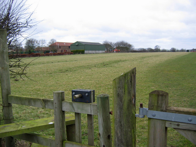
Black Plantation is a woodland area located in the county of Yorkshire, England. Nestled within the picturesque landscape of the Yorkshire Dales, this woodland is a popular destination for nature enthusiasts and outdoor adventurers alike. The plantation is situated in the village of Wood, just a short distance from the town of Forest.
Covering an expansive area, Black Plantation is characterized by its dense and diverse vegetation. The woodland is predominantly composed of towering oak trees, which provide a majestic canopy that stretches overhead. The forest floor is adorned with a carpet of ferns, wildflowers, and mosses, creating a vibrant and enchanting atmosphere.
The plantation is crisscrossed by a network of walking trails, allowing visitors to explore the natural beauty at their own pace. Hikers can choose from various routes that cater to different levels of difficulty, ensuring there is something for everyone. Along these trails, one can encounter a plethora of wildlife, including deer, rabbits, and a wide array of bird species.
Black Plantation is not only a haven for nature lovers but also serves as an important habitat for local flora and fauna. The woodland plays a vital role in maintaining the ecological balance of the region, providing a home for numerous endangered and rare species.
Visitors to Black Plantation can also indulge in recreational activities such as picnicking, photography, and birdwatching. The serene ambiance of the woodland, coupled with its scenic beauty, makes it an ideal spot for relaxation and rejuvenation.
In conclusion, Black Plantation in Yorkshire is a captivating woodland that offers a tranquil escape from the hustle and bustle of everyday life. With its diverse flora and fauna, scenic trails, and recreational opportunities, it is a destination that appeals to both nature enthusiasts and those seeking solace in the great outdoors.
If you have any feedback on the listing, please let us know in the comments section below.
Black Plantation Images
Images are sourced within 2km of 54.097071/-0.37668905 or Grid Reference TA0668. Thanks to Geograph Open Source API. All images are credited.


Black Plantation is located at Grid Ref: TA0668 (Lat: 54.097071, Lng: -0.37668905)
Division: East Riding
Unitary Authority: East Riding of Yorkshire
Police Authority: Humberside
What 3 Words
///occupations.riverbank.clay. Near Thwing, East Yorkshire
Nearby Locations
Related Wikis

Dickering Wapentake
Dickering was a wapentake (which is an administrative division) of the historic East Riding of Yorkshire in England, consisting of the north-east part...
Thwing, East Riding of Yorkshire
Thwing is a village and civil parish in the Yorkshire Wolds, in the East Riding of Yorkshire, England. == Description == Thwing is located in the Yorkshire...
Rudston Roman villa
Rudston Roman villa is a Roman villa and scheduled monument near Rudston, East Riding of Yorkshire. == Villa == The site was first discovered in 1838 by...

Rudston
Rudston is a small village and civil parish in the East Riding of Yorkshire, England. It is situated between Driffield and Bridlington approximately 6...

Octon, East Riding of Yorkshire
Octon is a hamlet, and shrunken medieval village in the East Riding of Yorkshire, England. == History == Octon is recorded in the 11th-century Domesday...

Rudston Monolith
The Rudston Monolith at over 25 feet (7.6 m) is the tallest megalith (standing stone) in the United Kingdom. It is situated in the churchyard in the village...

Kilham, East Riding of Yorkshire
Kilham is a village and civil parish in the East Riding of Yorkshire, England. It is situated about 5 miles (8 km) north-east of Driffield town centre...

Willy Howe
Willy Howe (also Willey-Hou) is a tumulus in the Yorkshire Wolds, East Riding of Yorkshire, England. == History and description == Willy Howe is a large...
Nearby Amenities
Located within 500m of 54.097071,-0.37668905Have you been to Black Plantation?
Leave your review of Black Plantation below (or comments, questions and feedback).