Callan's Lane Wood

Wood, Forest in Lincolnshire South Kesteven

England

Callan's Lane Wood

St.Mary & All Saints' church, Kirkby Underwood, Lincs. Slightly away from the village, up a narrow lane and surrounded by open farmland. Early English and Perpendicular.
St.Mary & All Saints' church, Kirkby Underwood, Lincs. Credit: Richard Croft

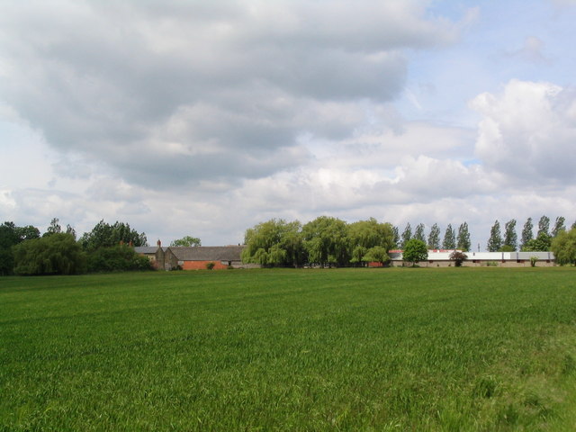
Callan's Lane Wood is a picturesque woodland located in Lincolnshire, England. Covering an area of approximately 20 acres, this woodland is known for its natural beauty and diverse range of flora and fauna.

The woodland is predominantly composed of native tree species, including oak, birch, and beech, which create a dense canopy, providing a sheltered and tranquil environment for visitors. The forest floor is adorned with an array of wildflowers, such as bluebells and primroses, which bloom in vibrant colors during the spring.

Callan's Lane Wood is a haven for wildlife enthusiasts, as it is home to a variety of animal species. Birdwatchers can spot species like woodpeckers, owls, and thrushes, while small mammals like rabbits, squirrels, and foxes can be observed scurrying through the undergrowth.

The woodland offers a network of well-maintained footpaths, allowing visitors to explore its beauty at their own pace. These paths wind through the trees and offer glimpses of a small stream that runs through the wood, adding to its charm.

Callan's Lane Wood is a popular destination for nature lovers, walkers, and families looking to enjoy a peaceful day out in nature. The tranquil atmosphere, coupled with the stunning natural surroundings, makes it an ideal spot for picnics, photography, and simply immersing oneself in the beauty of the woodland.

Overall, Callan's Lane Wood is a hidden gem in Lincolnshire, offering a serene escape from the hustle and bustle of daily life, and providing an opportunity to reconnect with nature and appreciate the wonders of the British countryside.

If you have any feedback on the listing, please let us know in the comments section below.

Callan's Lane Wood Images

Images are sourced within 2km of 52.828218/-0.42589926 or Grid Reference TF0626. Thanks to Geograph Open Source API. All images are credited.

St.Mary & All Saints' church, Kirkby Underwood, Lincs. Slightly away from the village, up a narrow lane and surrounded by open farmland. Early English and Perpendicular.
St.Mary & All Saints' church, Kirkby Underwood, Lincs.
Slightly away from the village, up a narrow lane and surrounded by open farmland. Early English and Perpendicular.
Entrance to village of Bulby
Ford and bridge, entrance to Bulby
Elsthorpe Grange
Elsthorpe Grange
Village Hall, Kirkby Underwood, Lincs beside The Green.
Village Hall, Kirkby Underwood, Lincs
beside The Green.
Ye Olde Three Tuns cottage, Kirkby Underwood, Lincs a former pub, on the corner of Rippingale Road and Aslackby Road.
Ye Olde Three Tuns cottage, Kirkby Underwood, Lincs
a former pub, on the corner of Rippingale Road and Aslackby Road.
Entrance to the village, Kirkby Underwood, Lincs
Rippingale Road, Kirkby Underwood, Lincs
Communications mast near Kirkby Underwood Communications mast, bristling with dishes for collecting and relaying data, sited north of Callan's Lane Wood near Kirkby Underwood
Communications mast near Kirkby Underwood
Communications mast, bristling with dishes for collecting and relaying data, sited north of Callan's Lane Wood near Kirkby Underwood
Staddle stone base at Rookery Farm This looks like a staddle stone base, but no sign of the top stone. Located right by the footpath from Callan's Lane, close to Rookery Farm Hawthorpe
Staddle stone base at Rookery Farm
This looks like a staddle stone base, but no sign of the top stone. Located right by the footpath from Callan's Lane, close to Rookery Farm Hawthorpe
Transco gas station Transco high pressure gas station: location 191700 Kirkby Underwood
Transco gas station
Transco high pressure gas station: location 191700 Kirkby Underwood
Dead tree in foreground and communications mast behind Dead tree, with evidence of lightning strikes on trunk, in the foreground with  a many-dish communications mast 500m behind.
Dead tree in foreground and communications mast behind
Dead tree, with evidence of lightning strikes on trunk, in the foreground with a many-dish communications mast 500m behind.
King Street Roman Road course of, no surface evidence left This image shows no surface evidence of the Roman Road King Street which crossed this field, at this position, in a northwest--southeast direction. Perhaps the farmer finds too many stones when cultivating here, or is it a 6 metre strip round the field that he receives payment to leave uncultivated?
King Street Roman Road course of, no surface evidence left
This image shows no surface evidence of the Roman Road King Street which crossed this field, at this position, in a northwest--southeast direction. Perhaps the farmer finds too many stones when cultivating here, or is it a 6 metre strip round the field that he receives payment to leave uncultivated?
Row Wood from Stainfield Road This deciduous woodland is mainly oak.
Row Wood from Stainfield Road
This deciduous woodland is mainly oak.
Callan's Lane Wood at dusk This is owned by the Forestry Commission and there is a network of surfaced and unsurfaced forest walks. The wood is a popular place with walkers and dog owners. There is a small carpark on Callan's Lane.
Callan's Lane Wood at dusk
This is owned by the Forestry Commission and there is a network of surfaced and unsurfaced forest walks. The wood is a popular place with walkers and dog owners. There is a small carpark on Callan's Lane.
Bracket fungus on a fallen branch In Callan's Lane Wood.
Bracket fungus on a fallen branch
In Callan's Lane Wood.
In Callan's Lane Wood This ancient woodland is part of the Kesteven Forest, see <span class="nowrap"><a title="http://www.forestry.gov.uk/kestevenforest" rel="nofollow ugc noopener" href="http://www.forestry.gov.uk/kestevenforest">Link</a><img style="margin-left:2px;" alt="External link" title="External link - shift click to open in new window" src="https://s1.geograph.org.uk/img/external.png" width="10" height="10"/></span>
In Callan's Lane Wood
This ancient woodland is part of the Kesteven Forest, see LinkExternal link
Gate into a field
Gate into a field
Show me another place!

Callan's Lane Wood is located at Grid Ref: TF0626 (Lat: 52.828218, Lng: -0.42589926)

Administrative County: Lincolnshire

District: South Kesteven

Police Authority: Lincolnshire

What 3 Words

///spoke.obligated.splits. Near Corby Glen, Lincolnshire

Nearby Locations

Callan's Lane Wood

Related Wikis

Bulby

Bulby is a hamlet in the South Kesteven district of Lincolnshire, England, and in the civil parish of Irnham, Bulby and Hawthorpe. The village is situated...

Kirkby Underwood

Kirkby Underwood is a village and civil parish in the South Kesteven district of Lincolnshire, England. The population of the civil parish was 200 at the...

Hawthorpe, Lincolnshire

Hawthorpe is a hamlet in the South Kesteven district of Lincolnshire, England, and the civil parish of Irnham, Bulby and Hawthorpe. It is west from the...

Aveland

Aveland was a Wapentake of Kesteven from the time of the Danelaw until the Local Government Act 1888. Its meeting place was The Aveland at grid reference...

Nearby Amenities

Located within 500m of 52.828218,-0.42589926
The Kennels
Place: isolated_dwelling
Source: Bing
Lat/Long: 52.8296601/-0.4197841
The data included in this document is from www.openstreetmap.org. The data is made available under ODbL.

Have you been to Callan's Lane Wood?

Leave your review of Callan's Lane Wood below (or comments, questions and feedback).