Winterfold Heath

Wood, Forest in Surrey Waverley

England

Winterfold Heath

Ewhurst Windmill
Ewhurst Windmill Credit: Alex McGregor

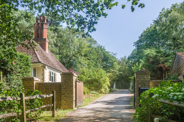
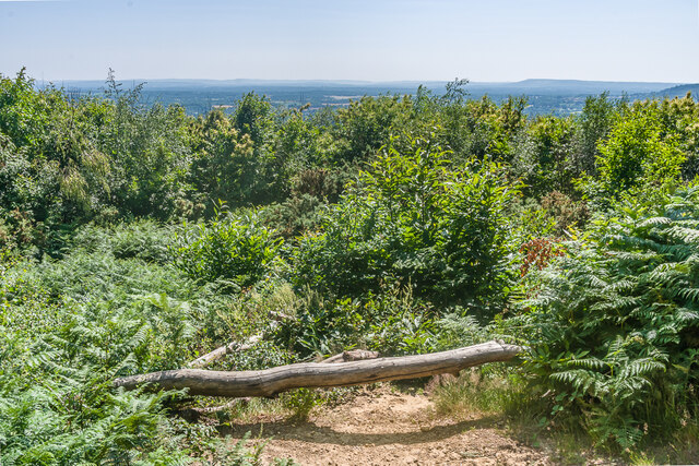
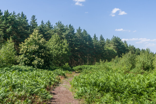
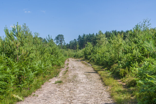
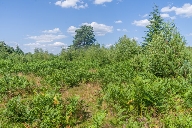
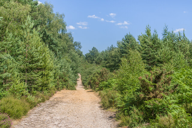
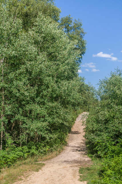
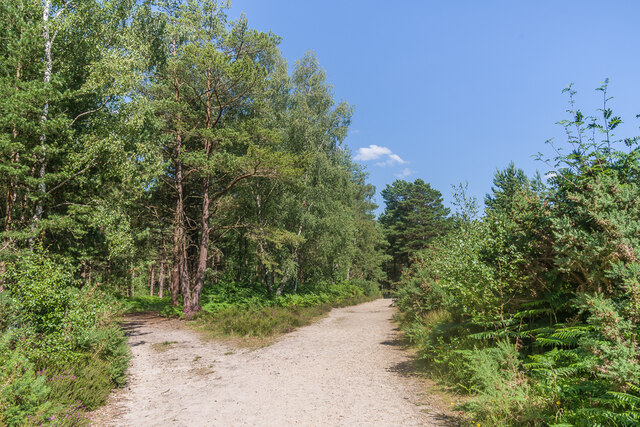
Winterfold Heath is a vast and picturesque expanse of woodland located in Surrey, England. Covering an area of approximately 500 acres, it is situated within the larger Winterfold Forest, which spans over 1,000 acres. The heath is known for its stunning natural beauty, consisting of a mixture of heathland, open grassland, and dense woodlands.

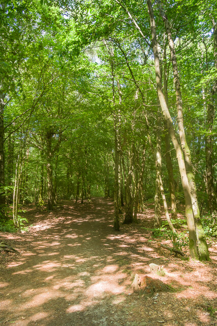
The heath is primarily composed of oak and beech trees, creating a rich and diverse habitat for a wide range of wildlife. It is home to various bird species, including woodpeckers, nightjars, and tawny owls, making it a popular spot for birdwatchers. The forest floor is adorned with an array of wildflowers during the spring and summer months, creating a vibrant and colorful landscape.

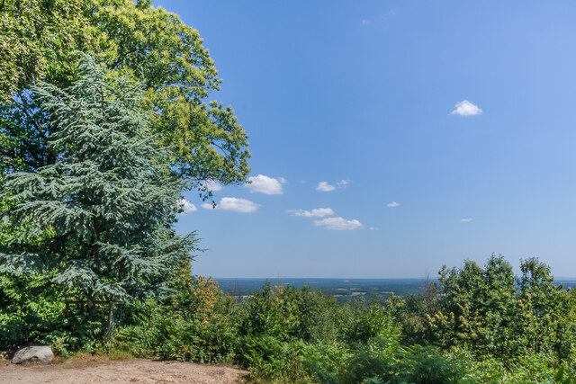
Visitors to Winterfold Heath can enjoy a range of activities, such as walking, cycling, and horse riding. There are numerous trails and paths that wind through the woodland, allowing visitors to explore the area at their own pace. The heath offers breathtaking views of the surrounding countryside, with glimpses of the South Downs in the distance.

The heath is also steeped in history, with evidence of human habitation dating back to the Bronze Age. There are several ancient burial mounds and hill forts scattered throughout the area, providing a glimpse into the past. Today, the heath is carefully managed by conservation organizations to preserve its natural beauty and protect its ecological significance.

Overall, Winterfold Heath is a tranquil and captivating destination for nature lovers and outdoor enthusiasts, offering a peaceful retreat from the hustle and bustle of everyday life.

If you have any feedback on the listing, please let us know in the comments section below.

Winterfold Heath Images

Images are sourced within 2km of 51.176278/-0.48435038 or Grid Reference TQ0642. Thanks to Geograph Open Source API. All images are credited.

Ewhurst Windmill
Ewhurst Windmill
Stroud Lane, near Shamley Green Stroud Lane is a minor lane near the village of Shamley Green in Surrey.  The signs indicate that the road has a width restriction of 6 feet, 6 inches.
Stroud Lane, near Shamley Green
Stroud Lane is a minor lane near the village of Shamley Green in Surrey. The signs indicate that the road has a width restriction of 6 feet, 6 inches.
Farley Heath Road, Woodhill, near Shamley Green Farley Heath Road passing through the hamlet of Woodhill in Surrey.  This road is on route 22 of the National Cycle Network.
Farley Heath Road, Woodhill, near Shamley Green
Farley Heath Road passing through the hamlet of Woodhill in Surrey. This road is on route 22 of the National Cycle Network.
Rhododendrons by the roadside, Farley Heath, near Guildford Rhododendrons in bloom alongside Farley Heath Road in Surrey.  This road forms part of route 22 of the National Cycle Network.
Rhododendrons by the roadside, Farley Heath, near Guildford
Rhododendrons in bloom alongside Farley Heath Road in Surrey. This road forms part of route 22 of the National Cycle Network.
Ewhurst Windmill Windmill built in 1845, replacing an earlier post mill on the site.  It ceased to operate c.1885 and was converted to residential use c.1901.  The current sails dated from 1937.  Grade II listed - see <span class="nowrap"><a title="https://historicengland.org.uk/listing/the-list/list-entry/1190554?section=official-list-entry" rel="nofollow ugc noopener" href="https://historicengland.org.uk/listing/the-list/list-entry/1190554?section=official-list-entry">Link</a><img style="margin-left:2px;" alt="External link" title="External link - shift click to open in new window" src="https://s1.geograph.org.uk/img/external.png" width="10" height="10"/></span>.
Ewhurst Windmill
Windmill built in 1845, replacing an earlier post mill on the site. It ceased to operate c.1885 and was converted to residential use c.1901. The current sails dated from 1937. Grade II listed - see LinkExternal link.
Summerfold Lodge Lodge to Summerfold, an early 20th Century mansion built for a railway engineer named William Clarke, designed by Reginald Cuthbert Fry.  Originally named The Warren, work started in 1913 but the building wasn't completed until after the end of the First World War.  In 1924 it was bought by the Duke Of Sutherland and was renamed Summerfold.  Its most famous resident was Edward, Prince of Wales, later Edward VIII, who leased it in 1927.
Summerfold Lodge
Lodge to Summerfold, an early 20th Century mansion built for a railway engineer named William Clarke, designed by Reginald Cuthbert Fry. Originally named The Warren, work started in 1913 but the building wasn't completed until after the end of the First World War. In 1924 it was bought by the Duke Of Sutherland and was renamed Summerfold. Its most famous resident was Edward, Prince of Wales, later Edward VIII, who leased it in 1927.
 Reynards Hill A shaded path on Reynards Hill.
Reynards Hill
A shaded path on Reynards Hill.
Reynards Hill The view east from Reynards Hill.
Reynards Hill
The view east from Reynards Hill.
 Reynards Hill The view southwest from Reynards Hill.
Reynards Hill
The view southwest from Reynards Hill.
Reynards Hill The summit clearing on Reynards Hill.  The seat was installed in 2016.  Created by the artist Russell Jakubowski, and entitled Contour, it is made from a lamination of recycled plastic and marine grade stainless steel - see <span class="nowrap"><a title="https://www.axisweb.org/p/russelljakubowski/workset/226591-contour-seat/" rel="nofollow ugc noopener" href="https://www.axisweb.org/p/russelljakubowski/workset/226591-contour-seat/">Link</a><img style="margin-left:2px;" alt="External link" title="External link - shift click to open in new window" src="https://s1.geograph.org.uk/img/external.png" width="10" height="10"/></span>.  For a close up of the plaque on the seat see <a href="https://www.geograph.org.uk/photo/7645999">TQ0742 : Plaque on "Contour", Reynards Hill</a>].
Reynards Hill
The summit clearing on Reynards Hill. The seat was installed in 2016. Created by the artist Russell Jakubowski, and entitled Contour, it is made from a lamination of recycled plastic and marine grade stainless steel - see LinkExternal link. For a close up of the plaque on the seat see TQ0742 : Plaque on "Contour", Reynards Hill].
Plaque on "Contour", Reynards Hill The plaque on the seat at the summit of Reynards Hill, installed in 2016 - see <a href="https://www.geograph.org.uk/photo/7645988">TQ0742 : Reynards Hill</a>.  Created by the artist Russell Jakubowski, and entitled Contour, the seat is made from a lamination of recycled plastic and marine grade stainless steel.  The plaque reads: 

"Reynards Hill

The woods of the Weald wander beneath their many names, gates and fences as nothing to what cannot be owned up here, the earth raw from unspeakable needs to view our journey in this ancient moment's gaze.

John Wedgwood Clarke

This seat was designed and made from recycled plastic by the artist Russell Jakubowski.  It has been created for you to enjoy this inspiring view."

The logo is that of the Surrey Hills AONB.
Plaque on "Contour", Reynards Hill
The plaque on the seat at the summit of Reynards Hill, installed in 2016 - see TQ0742 : Reynards Hill. Created by the artist Russell Jakubowski, and entitled Contour, the seat is made from a lamination of recycled plastic and marine grade stainless steel. The plaque reads: "Reynards Hill The woods of the Weald wander beneath their many names, gates and fences as nothing to what cannot be owned up here, the earth raw from unspeakable needs to view our journey in this ancient moment's gaze. John Wedgwood Clarke This seat was designed and made from recycled plastic by the artist Russell Jakubowski. It has been created for you to enjoy this inspiring view." The logo is that of the Surrey Hills AONB.
Winterfold Forest A path through a part of the southern section of Winterfold Forest.
Winterfold Forest
A path through a part of the southern section of Winterfold Forest.
Winterfold Forest A track through a part of the southern section of Winterfold Forest.
Winterfold Forest
A track through a part of the southern section of Winterfold Forest.
Winterfold Forest An area of heathland in the southern section of Winterfold Forest.
Winterfold Forest
An area of heathland in the southern section of Winterfold Forest.
Winterfold Forest A track in Winterfold Forest.  This route marks the divide between the open access southern section and the largely private northern section.
Winterfold Forest
A track in Winterfold Forest. This route marks the divide between the open access southern section and the largely private northern section.
Show me another place!

Winterfold Heath is located at Grid Ref: TQ0642 (Lat: 51.176278, Lng: -0.48435038)

Administrative County: Surrey

District: Waverley

Police Authority: Surrey

What 3 Words

///bucked.dockers.shields. Near Peaslake, Surrey

Related Wikis

Winterfold Forest

Winterfold Forest is a wooded area of the broadest plateau of the western Greensand Ridge in Surrey, England. It blends seamlessly into the Hurt Wood...

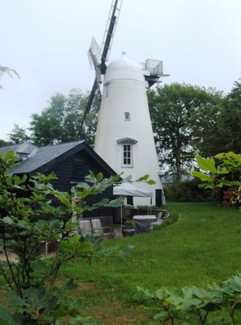
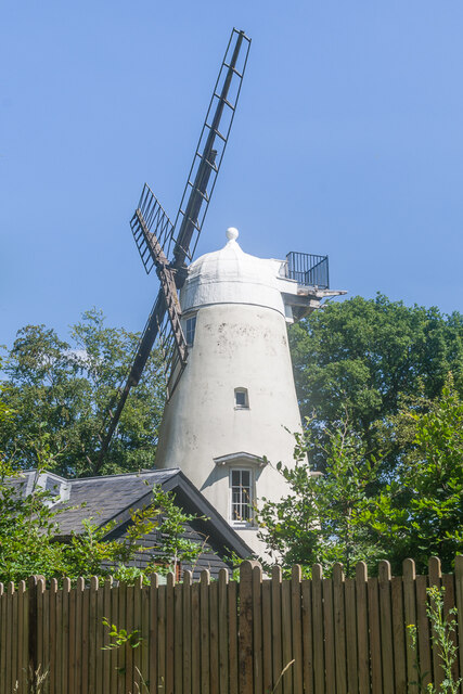
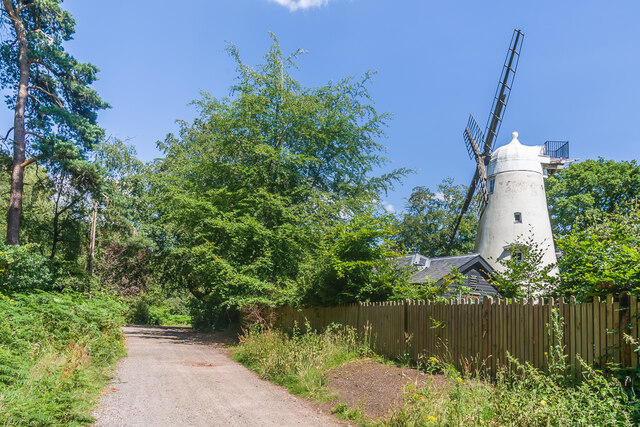
Hurt Wood Mill, Ewhurst

Hurt Wood Mill is a grade II* listed tower mill at Ewhurst, Surrey, England, which has been converted to residential use. == History == Hurt Wood Mill...

Cucknell's Wood

Cucknell's Wood is a 11-hectare (27-acre) nature reserve south-east of Shamley Green in Surrey. It is managed by the Surrey Wildlife Trust.Birds in this...

Marylands

Marylands is a Spanish-style country house on Pitch Hill, a rural part of Ewhurst, Surrey, England. It is a Grade II* listed building, designed during...

Farley Green, Surrey

Farley Green is a small hamlet of Albury in the Greensand Ridge where it forms the south of the Surrey Hills AONB, to the south east of Guildford. �...

Duke of Kent School

Duke of Kent School is a 3–16 mixed private school in Ewhurst, Surrey, England. The school was originally founded in 1920 at Vanbrugh Castle to provide...

Christ Church, Shamley Green

Christ Church is a Church of England parish church in Shamley Green, Surrey, England. It was constructed in 1863 as a chapel of ease and became a parish...

Surrey Hills AONB

The Surrey Hills is a 422 km2 (163 sq mi) Area of Outstanding Natural Beauty (AONB) in Surrey, England, which principally covers parts of the North Downs...

Nearby Amenities

Located within 500m of 51.176278,-0.48435038
Winterfold Heath
Place: locality
Source: npe
Lat/Long: 51.1734552/-0.4827093
Winterfold Heath
Natural: wood
Lat/Long: 51.1753769/-0.4835214
Bench
Backrest: yes
Check Date: 2022-09-04
Seats: 3
Lat/Long: 51.1729909/-0.4868377
Keepers Cottage
Building: yes
Lat/Long: 51.1792216/-0.4857812
Direction: 205
Tourism: viewpoint
Wheelchair: yes
Lat/Long: 51.1730084/-0.4799789
Bench
Backrest: no
Lat/Long: 51.1730341/-0.4799517
Direction: 195
Tourism: viewpoint
Wheelchair: yes
Lat/Long: 51.1734349/-0.4803254
Tourism: viewpoint
Wheelchair: yes
Lat/Long: 51.173141/-0.4869836
Winterfold Hill
Natural: peak
Lat/Long: 51.1739445/-0.4806211
Communication Mobile Phone: yes
Man Made: mast
Tower Type: communication
Lat/Long: 51.1777562/-0.4901652
The data included in this document is from www.openstreetmap.org. The data is made available under ODbL.

Have you been to Winterfold Heath?

Leave your review of Winterfold Heath below (or comments, questions and feedback).