Norfolk Clump

Wood, Forest in Sussex Arun

England

Norfolk Clump

Bridleway 2249 Parham leaves bridleway 2191 Burpham
Bridleway 2249 Parham leaves bridleway 2191 Burpham Credit: Robin Webster

Norfolk Clump, located in Sussex, is a stunning wood and forest area that offers an enchanting and peaceful escape from the hustle and bustle of everyday life. Spread over a sprawling area, Norfolk Clump is known for its diverse range of flora and fauna, making it a paradise for nature enthusiasts and wildlife lovers.

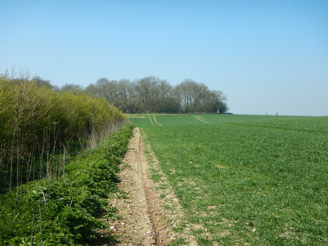
The woodlands in Norfolk Clump are predominantly composed of native British trees such as oak, ash, and beech, creating a rich and vibrant ecosystem. These ancient trees provide a habitat for numerous species of birds, mammals, and insects, making it an ideal spot for birdwatching and wildlife photography.

The forest floor of Norfolk Clump is adorned with a carpet of bluebells during the spring season, transforming the landscape into a sea of vibrant colors. Additionally, visitors can also spot a variety of wildflowers, ferns, and mushrooms throughout the year, adding to the natural beauty of the area.

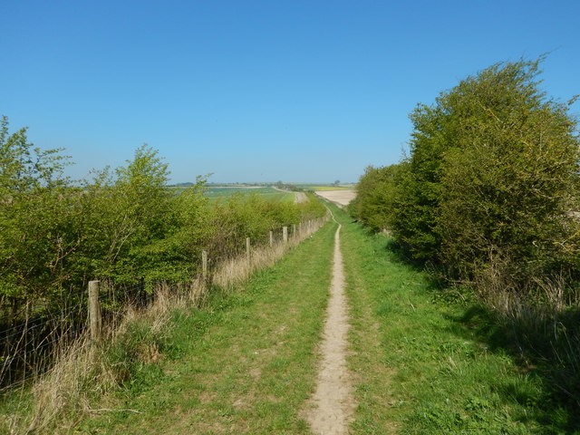
The woodlands are crisscrossed with well-maintained walking trails, allowing visitors to explore and immerse themselves in the tranquil surroundings. The peaceful atmosphere and the sound of birdsong make it an ideal location for a leisurely stroll, picnic, or even a family day out.

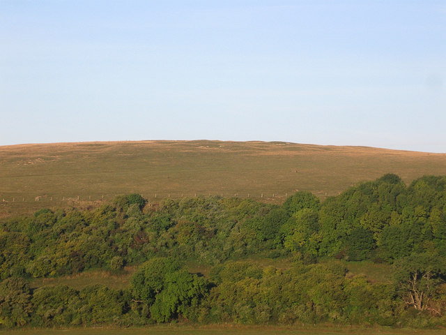
Norfolk Clump is also home to several species of deer, including roe deer and fallow deer, which can be spotted grazing in the open meadows. These majestic creatures add to the charm and allure of the forest, providing an opportunity for visitors to observe them in their natural habitat.

Overall, Norfolk Clump in Sussex is a picturesque and biodiverse wood and forest area that offers a splendid escape for nature lovers, providing a haven of tranquillity and natural beauty.

If you have any feedback on the listing, please let us know in the comments section below.

Norfolk Clump Images

Images are sourced within 2km of 50.873845/-0.50147237 or Grid Reference TQ0509. Thanks to Geograph Open Source API. All images are credited.

Bridleway 2249 Parham leaves bridleway 2191 Burpham
Bridleway 2249 Parham reaches bridleway 2191 Burpham
Track towards Burpham High Barn The track leads SSW towards Burpham High Barn. In the original image, buildings there are visible - close to the lowest point on the skyline, near the right-hand margin.  On the left-hand side of the picture, the clump of trees on the skyline is known as Norfolk Clump.

Photo taken on the last day of September, 2015.  I stood on much the same spot four years earlier, and pointed my camera in much the same direction to take: <a href="https://www.geograph.org.uk/photo/2710486">TQ0510 : A foggy day on the Downs (1)</a>
Track towards Burpham High Barn
The track leads SSW towards Burpham High Barn. In the original image, buildings there are visible - close to the lowest point on the skyline, near the right-hand margin. On the left-hand side of the picture, the clump of trees on the skyline is known as Norfolk Clump. Photo taken on the last day of September, 2015. I stood on much the same spot four years earlier, and pointed my camera in much the same direction to take: TQ0510 : A foggy day on the Downs (1)
Downland arable south-east of the Burgh, late September View south-east from the track which runs ESE from the Burgh towards Wepham Down.  The highest point on the skyline is occupied by Norfolk Clump.

The photo was taken across a newly-drilled field on the last day of September 2015, and shows a later stage in the farming cycle than: <a href="https://www.geograph.org.uk/photo/3123372">TQ0410 : After the harvest</a>  The view as it is in November can be seen in:  <a href="https://www.geograph.org.uk/photo/2713779">TQ0510 : A foggy day on the Downs (2)</a>
Downland arable south-east of the Burgh, late September
View south-east from the track which runs ESE from the Burgh towards Wepham Down. The highest point on the skyline is occupied by Norfolk Clump. The photo was taken across a newly-drilled field on the last day of September 2015, and shows a later stage in the farming cycle than: TQ0410 : After the harvest The view as it is in November can be seen in: TQ0510 : A foggy day on the Downs (2)
Landscape south-east of the Burgh in late September A wider view of the scene shown in <a href="https://www.geograph.org.uk/photo/4684072">TQ0510 : Downland arable south-east of the Burgh, late September</a>  On the last day of September the low evening sun casts shadows across a newly-drilled field.
Landscape south-east of the Burgh in late September
A wider view of the scene shown in TQ0510 : Downland arable south-east of the Burgh, late September On the last day of September the low evening sun casts shadows across a newly-drilled field.
A lingering chicory flower On the last day of September 2015 there weren't many chicory flowers still to be found on the downs.
A lingering chicory flower
On the last day of September 2015 there weren't many chicory flowers still to be found on the downs.
Bridleway towards Wepham Down Beyond the dip the bridleway climbs to Wepham Down.  From down in the dip a track leads south (right) to Burpham High Barn.
Bridleway towards Wepham Down
Beyond the dip the bridleway climbs to Wepham Down. From down in the dip a track leads south (right) to Burpham High Barn.
Fields on Wepham Downs Poor lighting across the downs.
Fields on Wepham Downs
Poor lighting across the downs.
Bridleway on Wepham Down
Wepham Down Edge of large field.
Wepham Down
Edge of large field.
View SSW from the path towards Burpham
View WNW from a junction of paths on Wepham Down
View north along the track on Wepham Down
Junction of paths on Wepham Down - and view towards Lee Farm
View north from the east side of Wepham Down
View north from the track west of Lee Farm
Gate - and view towards Barpham Hill
Path heading up to Kithurst Hill car park
Show me another place!

Norfolk Clump is located at Grid Ref: TQ0509 (Lat: 50.873845, Lng: -0.50147237)

Administrative County: West Sussex

District: Arun

Police Authority: Sussex

What 3 Words

///hamper.morphing.squeaking. Near Arundel, West Sussex

Related Wikis

Burpham

Burpham is a rural village and civil parish in the Arun District of West Sussex, England. The village is on an arm of the River Arun slightly less than...

Harrow Hill, West Sussex

Harrow Hill is an archaeological site in West Sussex, England. It is on the South Downs about 3 miles (5 km) north of the village of Angmering and 5 miles...

Worthing Rural District

Worthing Rural District was a rural district in West Sussex, England from 1933 to 1974. It comprised an area to the north, west and east, but did not...

South Downs

The South Downs are a range of chalk hills in the south-eastern coastal counties of England that extends for about 260 sq mi (670 km2) across the south...

Nearby Amenities

Located within 500m of 50.873845,-0.50147237
Barrier: stile
Lat/Long: 50.8741637/-0.5024742
Bench
Lat/Long: 50.8740057/-0.5020649
Bench
Backrest: yes
Seats: 2
Lat/Long: 50.8742364/-0.5025011
Barrier: stile
Lat/Long: 50.8719343/-0.5061668
The data included in this document is from www.openstreetmap.org. The data is made available under ODbL.

Have you been to Norfolk Clump?

Leave your review of Norfolk Clump below (or comments, questions and feedback).