Brickyard Plantation
Wood, Forest in Lincolnshire North Kesteven
England
Brickyard Plantation

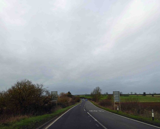
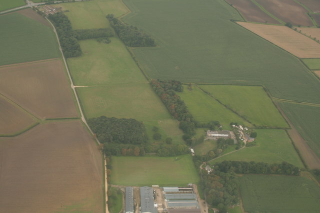
Brickyard Plantation, located in Lincolnshire, is a picturesque wooded area renowned for its thriving forest ecosystem. Situated in the heart of the county, this plantation spans over an expansive area of land, offering visitors a glimpse into the region's natural beauty. The plantation is predominantly characterized by dense woodlands, with towering trees and an abundance of wildlife.
The forest canopy of Brickyard Plantation consists of various tree species, including oak, beech, and birch, which provide a diverse habitat for numerous animal species. This woodland haven attracts a wide range of birdlife, making it a popular destination for birdwatchers and nature enthusiasts. Visitors can expect to spot species such as woodpeckers, owls, and finches amid the rustling leaves and serene atmosphere.
The plantation also features well-maintained trails, allowing visitors to explore the area at their own pace. These paths wind through the forest, offering glimpses of tranquil ponds and stunning vistas. Additionally, informative signposts along the trails provide interesting facts about the local flora and fauna, enhancing the educational experience.
Brickyard Plantation is a haven for those seeking solace in nature, as well as an ideal location for outdoor activities such as hiking and picnicking. With its rich biodiversity and scenic landscapes, this woodland gem offers an escape from the hustle and bustle of everyday life, allowing visitors to immerse themselves in the beauty of Lincolnshire's natural heritage.
If you have any feedback on the listing, please let us know in the comments section below.
Brickyard Plantation Images
Images are sourced within 2km of 53.039806/-0.43167182 or Grid Reference TF0550. Thanks to Geograph Open Source API. All images are credited.


Brickyard Plantation is located at Grid Ref: TF0550 (Lat: 53.039806, Lng: -0.43167182)
Administrative County: Lincolnshire
District: North Kesteven
Police Authority: Lincolnshire
What 3 Words
///flukes.pollution.downsize. Near Leasingham, Lincolnshire
Nearby Locations
Related Wikis

Leasingham
Leasingham is a village and civil parish in the North Kesteven district of Lincolnshire, England. It is situated less than 2 miles (3 km) north from Sleaford...
Cranwell
Cranwell is a village in the North Kesteven district of Lincolnshire, England. It is part of the civil parish of Cranwell and Byard's Leap and is situated...

Deanery of Lafford
The Deanery of Lafford is an historic deanery in the Anglican Diocese of Lincoln in England. Located around the market town of Sleaford, it covers an area...
Ruskington
Ruskington is a large village and civil parish in the North Kesteven district of Lincolnshire, England, located approximately 4 miles (6.4 km) north of...

No. 16 Squadron RAF
Number 16 Squadron Royal Air Force, nicknamed 'the Saints', is a flying squadron of the Royal Air Force (RAF) who currently provide elementary flying training...

Bloxholm
Bloxholm is a hamlet, and part of the civil parish of Ashby de la Launde and Bloxholm, in the North Kesteven district of Lincolnshire, England. It is situated...

Ruskington railway station
Ruskington railway station serves the village of Ruskington in Lincolnshire, England. It opened in 1882 as part of the Great Northern and Great Eastern...
Ashby de la Launde and Bloxholm
Ashby de la Launde and Bloxholm is a civil parish in the North Kesteven district of Lincolnshire, England. According to the 2001 Census it had a population...
Nearby Amenities
Located within 500m of 53.039806,-0.43167182Have you been to Brickyard Plantation?
Leave your review of Brickyard Plantation below (or comments, questions and feedback).