Knowle Wood

Wood, Forest in Surrey Waverley

England

Knowle Wood

Cranleigh Bowling Club: late August 2021 That great bowls exponent Francis Drake is joined this month on the great green in the sky by: August 15th, my first footballing hero, Gerd Muller; August 20th, Peter Corby, inventor of the legendary Trouser Press; 21st, Don Everly, one half of the famous brothers; 24th, Charlie Watts, the most sensible Rolling Stone; and on the 29th Reggae’s Lee "Scratch" Perry
Cranleigh Bowling Club: late August 2021 Credit: Basher Eyre

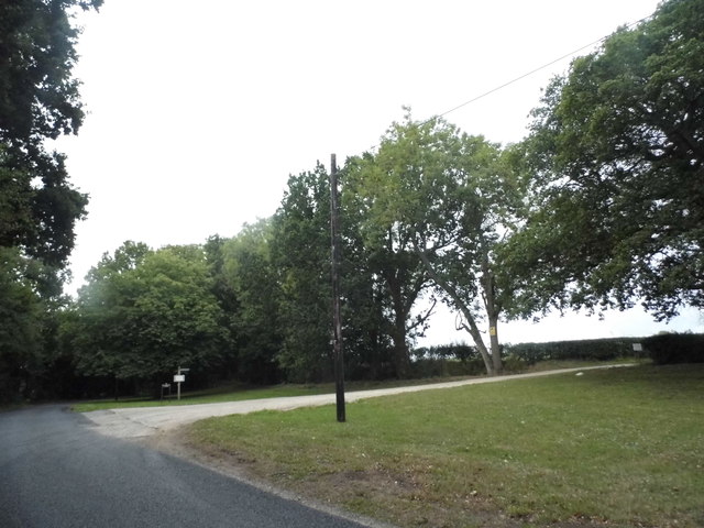
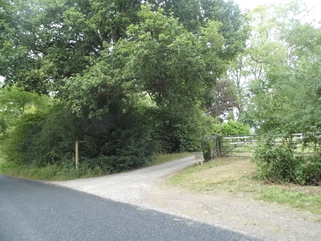
Knowle Wood is a picturesque woodland located in the county of Surrey, England. Situated in the southern part of the county, it covers an area of approximately 100 acres. The wood is part of the larger Surrey Hills Area of Outstanding Natural Beauty, renowned for its stunning landscapes and rich biodiversity.

Knowle Wood is predominantly composed of oak trees, although there is also a variety of other species such as beech, birch, and hazel. The diverse tree population creates a vibrant and colorful canopy, particularly during the autumn months when the leaves change to vivid hues of red, orange, and gold.

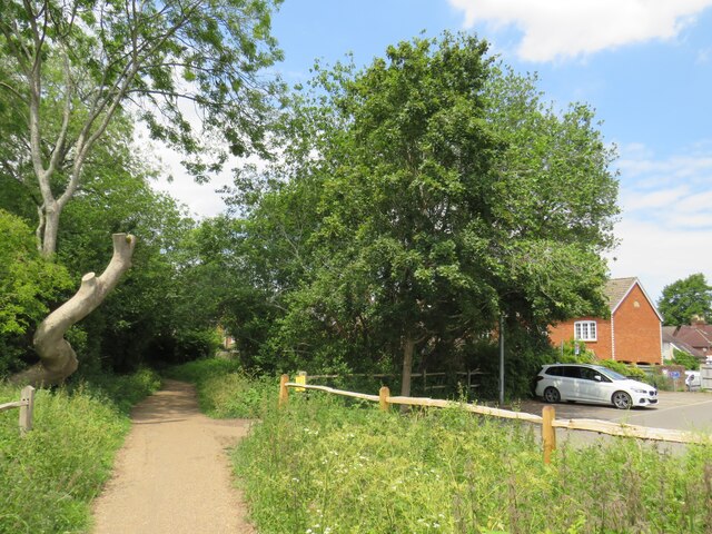
The wood is crisscrossed with a network of footpaths, making it a popular destination for walkers, joggers, and nature enthusiasts. These pathways wind through the woodland, offering visitors the opportunity to explore its hidden corners and discover the many natural wonders it holds.

Wildlife thrives in Knowle Wood, with numerous species making it their home. Deer can often be spotted grazing in the clearing, while squirrels dart through the trees in search of food. The wood's diverse ecosystem also attracts a wide range of bird species, making it a haven for birdwatchers.

Knowle Wood is managed and protected by the Surrey Wildlife Trust, ensuring the conservation of its natural beauty for future generations. The wood provides a peaceful retreat from the hustle and bustle of everyday life, with its tranquil atmosphere and breathtaking scenery making it a true gem of Surrey.

If you have any feedback on the listing, please let us know in the comments section below.
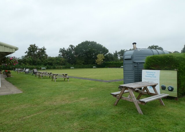
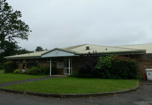
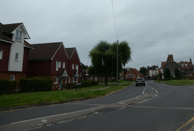
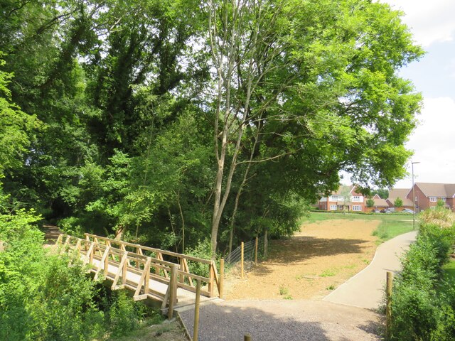
Knowle Wood Images

Images are sourced within 2km of 51.140013/-0.50273491 or Grid Reference TQ0438. Thanks to Geograph Open Source API. All images are credited.

Cranleigh Bowling Club: late August 2021 That great bowls exponent Francis Drake is joined this month on the great green in the sky by: August 15th, my first footballing hero, Gerd Muller; August 20th, Peter Corby, inventor of the legendary Trouser Press; 21st, Don Everly, one half of the famous brothers; 24th, Charlie Watts, the most sensible Rolling Stone; and on the 29th Reggae’s Lee "Scratch" Perry
Cranleigh Bowling Club: late August 2021
That great bowls exponent Francis Drake is joined this month on the great green in the sky by: August 15th, my first footballing hero, Gerd Muller; August 20th, Peter Corby, inventor of the legendary Trouser Press; 21st, Don Everly, one half of the famous brothers; 24th, Charlie Watts, the most sensible Rolling Stone; and on the 29th Reggae’s Lee "Scratch" Perry
Cranleigh Sports & Social Club: late August 2021 The news here in Cranleigh is that sport is back. Elsewhere: August 4th 2020 Belarusian sprinter Krystsina Tsimanouskaya is given political asylum in Poland after claims her Olympic Committee wanted to repatriate her against her will; August 9th, the Intergovernmental Panel on Climate Change releases the first part of its Sixth Assessment Report, which concludes that the effects of human-caused climate change are now "widespread, rapid, and intensifying";  14th, a 7.2-magnitude earthquake strikes Haiti, killing more than 2,100 people; 15th to 30th, 2021 the Taliban capture Kabul and the Afghan government surrenders;  30 the USA withdraws its last remaining troops ending 20 years of operations in Afghanistan; August 31st, Dame Sarah Storey equals the all time Paralympic medal haul!
Cranleigh Sports & Social Club: late August 2021
The news here in Cranleigh is that sport is back. Elsewhere: August 4th 2020 Belarusian sprinter Krystsina Tsimanouskaya is given political asylum in Poland after claims her Olympic Committee wanted to repatriate her against her will; August 9th, the Intergovernmental Panel on Climate Change releases the first part of its Sixth Assessment Report, which concludes that the effects of human-caused climate change are now "widespread, rapid, and intensifying"; 14th, a 7.2-magnitude earthquake strikes Haiti, killing more than 2,100 people; 15th to 30th, 2021 the Taliban capture Kabul and the Afghan government surrenders; 30 the USA withdraws its last remaining troops ending 20 years of operations in Afghanistan; August 31st, Dame Sarah Storey equals the all time Paralympic medal haul!
Another dull August day in 2021 Elsewhere, there were record temperatures but here in the UK it was pretty mild. That night Meridian Weather announced the monthly average temperature was 20.6, rainfall 51.6mm, cloud cover 67% and hours of sunshine 136.7. The Met Office summaries for August 2021 and Summer 2021 can be found here <span class="nowrap"><a title="https://www.metoffice.gov.uk/binaries/content/assets/metofficegovuk/pdf/weather/learn-about/uk-past-events/summaries/uk_monthly_climate_summary_202108.pdf" rel="nofollow ugc noopener" href="https://www.metoffice.gov.uk/binaries/content/assets/metofficegovuk/pdf/weather/learn-about/uk-past-events/summaries/uk_monthly_climate_summary_202108.pdf">Link</a><img style="margin-left:2px;" alt="External link" title="External link - shift click to open in new window" src="https://s1.geograph.org.uk/img/external.png" width="10" height="10"/></span> and here <span class="nowrap"><a title="https://www.metoffice.gov.uk/binaries/content/assets/metofficegovuk/pdf/weather/learn-about/uk-past-events/summaries/uk_monthly_climate_summary_summer_2021.pdf" rel="nofollow ugc noopener" href="https://www.metoffice.gov.uk/binaries/content/assets/metofficegovuk/pdf/weather/learn-about/uk-past-events/summaries/uk_monthly_climate_summary_summer_2021.pdf">Link</a><img style="margin-left:2px;" alt="External link" title="External link - shift click to open in new window" src="https://s1.geograph.org.uk/img/external.png" width="10" height="10"/></span>
Another dull August day in 2021
Elsewhere, there were record temperatures but here in the UK it was pretty mild. That night Meridian Weather announced the monthly average temperature was 20.6, rainfall 51.6mm, cloud cover 67% and hours of sunshine 136.7. The Met Office summaries for August 2021 and Summer 2021 can be found here LinkExternal link and here LinkExternal link
Path to Dapples Lane, Cranleigh A path leading into a new housing development in Cranleigh, in Surrey.  The wooden bridge to the left takes another path across a stream.
Path to Dapples Lane, Cranleigh
A path leading into a new housing development in Cranleigh, in Surrey. The wooden bridge to the left takes another path across a stream.
Bridge over a stream, Cranleigh The bridge was built to carry a railway line across a stream on the outskirts of Cranleigh.  The railway closed in 1965 and was dismantled, but the Downs Link path now follows the railway alignment, crossing the bridge.  Downs Link also forms part of route 223 of the National Cycle Network.
Bridge over a stream, Cranleigh
The bridge was built to carry a railway line across a stream on the outskirts of Cranleigh. The railway closed in 1965 and was dismantled, but the Downs Link path now follows the railway alignment, crossing the bridge. Downs Link also forms part of route 223 of the National Cycle Network.
Footpath to Dapples Lane, Cranleigh A path leading into a new housing development on the outskirts of Cranleigh, in Surrey.
Footpath to Dapples Lane, Cranleigh
A path leading into a new housing development on the outskirts of Cranleigh, in Surrey.
Recreation ground in Cranleigh A bench seat looking out across a recreation ground in Cranleigh, in Surrey.
Recreation ground in Cranleigh
A bench seat looking out across a recreation ground in Cranleigh, in Surrey.
Downs Link, Cranleigh The Downs Link path follows a dismantled railway line for most of its length.  It also forms part of route 223 of the National Cycle Network.

In this view, the path is passing through the town of Cranleigh.  The building to the right is a sports pavilion.
Downs Link, Cranleigh
The Downs Link path follows a dismantled railway line for most of its length. It also forms part of route 223 of the National Cycle Network. In this view, the path is passing through the town of Cranleigh. The building to the right is a sports pavilion.
Downs Link, Cranleigh The Downs Link path follows a dismantled railway line for most of its length.  It also forms part of route 223 of the National Cycle Network.

Here in Cranleigh a very short section of the route is also an access road to a car park.
Downs Link, Cranleigh
The Downs Link path follows a dismantled railway line for most of its length. It also forms part of route 223 of the National Cycle Network. Here in Cranleigh a very short section of the route is also an access road to a car park.
Downs Link, Cranleigh The Downs Link path follows a dismantled railway line for most of its length.  It also forms part of route 223 of the National Cycle Network.
Downs Link, Cranleigh
The Downs Link path follows a dismantled railway line for most of its length. It also forms part of route 223 of the National Cycle Network.
Downs Link, Cranleigh The Downs Link path follows a dismantled railway line for most of its length.  It also forms part of route 223 of the National Cycle Network.

Here in Cranleigh, a supermarket and car park occupy the site of the town's railway station.  The path skirts the site then rejoins the former railway alignment.
Downs Link, Cranleigh
The Downs Link path follows a dismantled railway line for most of its length. It also forms part of route 223 of the National Cycle Network. Here in Cranleigh, a supermarket and car park occupy the site of the town's railway station. The path skirts the site then rejoins the former railway alignment.
Supermarket car park, Cranleigh A supermarket car park now occupies the site of Cranleigh station's goods yard.  The station and the railway line which passed through it closed in 1965.
Supermarket car park, Cranleigh
A supermarket car park now occupies the site of Cranleigh station's goods yard. The station and the railway line which passed through it closed in 1965.
The Common, Cranleigh Houses along a lane on Cranleigh Common.
The Common, Cranleigh
Houses along a lane on Cranleigh Common.
Downs Link, near Cranleigh The Downs Link path follows a dismantled railway line for most of its length.  It also forms part of route 223 of the National Cycle Network.

Here, a bridge carries a 'B' road over the former railway line.
Downs Link, near Cranleigh
The Downs Link path follows a dismantled railway line for most of its length. It also forms part of route 223 of the National Cycle Network. Here, a bridge carries a 'B' road over the former railway line.
Bungalows at the top of Church Lane
Alfold Road south of Cranleigh
Farm entrance on Alfold Road
Alfold Road south of Cranleigh
Show me another place!

Knowle Wood is located at Grid Ref: TQ0438 (Lat: 51.140013, Lng: -0.50273491)

Administrative County: Surrey

District: Waverley

Police Authority: Surrey

What 3 Words

///earl.pheasants.relay. Near Cranleigh, Surrey

Related Wikis

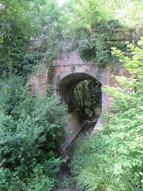
Cranleigh railway station

Cranleigh was a railway station on the Cranleigh Line between Guildford and Horsham. It served the village of Cranleigh, Surrey in southern England....

Glebelands School

Glebelands School is a county-funded and charity-supported secondary school in Cranleigh, Surrey, England. It is co-educational and takes students aged...

Cranleigh School

Cranleigh School is a public school (English fee-charging boarding and day school) in the village of Cranleigh, Surrey. == History == It was opened on...

Cranleigh

Cranleigh is a village and civil parish, about 8 miles (13 km) southeast of Guildford in Surrey, England. It lies on a minor road east of the A281, which...

London to Portsmouth canal

The London to Portsmouth canal was a concept for the construction of a secure inland canal route from the British capital of London to the headquarters...

Wey and Arun Canal

The Wey and Arun Canal is a partially open, 23-mile-long (37 km) canal in the southeast of England. It runs southwards from the River Wey at Gunsmouth...

Dunsfold Aerodrome

Dunsfold Aerodrome (former ICAO code EGTD) is an unlicensed airfield in Surrey, England, near the village of Cranleigh. It extends across land in the villages...

Longhurst Lodge

Longhurst Lodge is a Grade II listed building in Cranleigh, Surrey, England. It is located on the former Baynards Park estate, about a quarter of a mile...

Nearby Amenities

Located within 500m of 51.140013,-0.50273491
Bus Stop
Alfold Road
Naptan AtcoCode: 40004411051A
Naptan Bearing: W
Naptan CommonName: Alfold Road
Naptan Indicator: Just after
Naptan Landmark: Alfold Road
Naptan NaptanCode: surdtjam
Naptan Street: Elmbridge Road
Naptan Verified: no
Public Transport: platform
Source: naptan_import
Lat/Long: 51.142395/-0.5070222
Bus Stop
Alfold Road
Naptan AtcoCode: 40004411051B
Naptan Bearing: E
Naptan CommonName: Alfold Road
Naptan Indicator: Just Before
Naptan Landmark: Alfold Road
Naptan NaptanCode: surdtjap
Naptan Street: Elmbridge Road
Naptan Verified: no
Public Transport: platform
Source: naptan_import
Lat/Long: 51.1424609/-0.5077261
Traffic Signals
Traffic Signals Direction: forward
Lat/Long: 51.1432522/-0.5052254
Traffic Signals
Traffic Signals Direction: forward
Lat/Long: 51.1438358/-0.5031309
Post Box
Operator: Royal Mail
Post Box Type: pillar
Ref: GU6 71
Royal Cypher: EIIR
Royal Cypher Wikidata: Q33102113
Lat/Long: 51.1422928/-0.5064453
Man Made: street_cabinet
Lat/Long: 51.1422502/-0.5064713
Shelter
Shelter Type: public_transport
Lat/Long: 51.1423562/-0.5069634
Charging Station
Chip-Vern PG-86038
Operator: Pod Point
Operator Wikidata: Q42888154
Lat/Long: 51.1381042/-0.5047947
Charging Station
Rory-Duke PG-102311
Operator: Pod Point
Operator Wikidata: Q42888154
Lat/Long: 51.1399871/-0.5050687
Traffic Calming: yes
Lat/Long: 51.1377299/-0.5046735
Bench
Material: wood
Lat/Long: 51.1437051/-0.5057448
Bench
Backrest: yes
Material: wood
Seats: 3
Lat/Long: 51.1429939/-0.5060196
Waste Basket
Lat/Long: 51.1423299/-0.506533
Waste Basket
Waste: mixed
Lat/Long: 51.1430406/-0.5059424
Waste Basket
Waste: mixed
Lat/Long: 51.1434076/-0.5056297
Bench
Backrest: yes
Colour: brown
Direction: 166
Material: wood
Seats: 3
Lat/Long: 51.1394599/-0.4971781
Bench
Backrest: yes
Colour: brown
Material: wood
Seats: 2
Lat/Long: 51.1388794/-0.499821
Bench
Backrest: yes
Colour: brown
Direction: 8
Material: wood
Seats: 3
Lat/Long: 51.1396551/-0.496383
Crossing
Lat/Long: 51.1381401/-0.5037638
Bench
Backrest: yes
Colour: brown
Material: wood
Seats: 2
Lat/Long: 51.1391003/-0.4966278
Bench
Backrest: yes
Colour: brown
Direction: 179
Material: wood
Seats: 3
Lat/Long: 51.1391364/-0.4969868
Bench
Backrest: yes
Colour: brown
Direction: 1
Material: wood
Seats: 3
Lat/Long: 51.1387508/-0.4966243
Bench
Backrest: yes
Material: wood
Seats: 3
Lat/Long: 51.1422544/-0.5071098
Waste Basket
Lat/Long: 51.1423526/-0.5070161
Bench
Backrest: yes
Material: wood
Seats: 3
Lat/Long: 51.1422558/-0.5066446
Place Of Worship
Dr.Kon
Religion: jaranie_zielska
Lat/Long: 51.1429621/-0.5049575
Life Ring
Emergency: life_ring
Lat/Long: 51.138833/-0.4963633
Bench
Backrest: yes
Direction: 352
Inscription: Take the weight off, rest your weary bones Enjoy this peaceful space In Memory of Chrissy Matthews 22.08.1956-22.03.2014 You are missed more than words can say But you will live on in our hearts forever
Material: wood
Seats: 4
Lat/Long: 51.1389234/-0.4960342
Bench
Backrest: yes
Direction: 80
Material: wood
Seats: 3
Lat/Long: 51.1385862/-0.499836
Bench
Backrest: yes
Direction: 177
Material: wood
Seats: 3
Lat/Long: 51.1394256/-0.4985584
Waste Basket
Material: wood
Waste: litter;recycling
Lat/Long: 51.1396721/-0.4965249
Information: board
Tourism: information
Lat/Long: 51.1382987/-0.4997409
Playground: slide
Lat/Long: 51.1395161/-0.5041683
The data included in this document is from www.openstreetmap.org. The data is made available under ODbL.

Have you been to Knowle Wood?

Leave your review of Knowle Wood below (or comments, questions and feedback).