Dark Plantation

Wood, Forest in Lincolnshire West Lindsey

England

Dark Plantation

North Owersby junction turn right to Brigg
North Owersby junction turn right to Brigg Credit: Steve Fareham

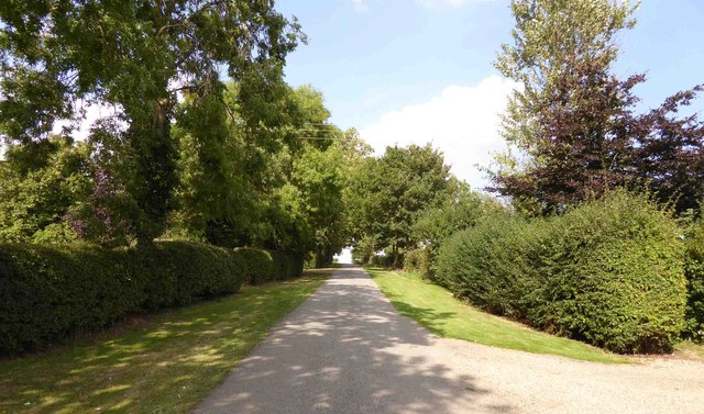
Dark Plantation is a woodland area located in Lincolnshire, England. It is known for its dense and diverse vegetation, creating a dark and mysterious atmosphere that gives the area its name. The woodland covers an expansive area, providing a natural habitat for various species of plants and animals.

The woodland is predominantly composed of broadleaf trees, including oak, beech, and birch. These trees form a thick canopy that filters sunlight, resulting in limited light penetration and contributing to the dark ambiance. The forest floor is covered with a carpet of rich green moss and ferns, adding to the enchanting atmosphere.

Dark Plantation is home to a variety of wildlife, including a diverse range of bird species such as woodpeckers, owls, and thrushes. Mammals like squirrels, foxes, and deer can also be found within the woodland, taking advantage of the dense cover provided by the trees.

The woodland is a popular destination for nature enthusiasts, hikers, and photographers seeking to capture its unique beauty. It offers various walking trails that meander through the forest, allowing visitors to explore the serene surroundings and experience the tranquility of nature.

Dark Plantation is managed by local authorities to ensure the preservation of its natural beauty and ecological balance. Conservation efforts are in place to protect the woodland's biodiversity and maintain its integrity for future generations to enjoy.

Overall, Dark Plantation in Lincolnshire is a captivating woodland that offers a glimpse into the enchanting beauty of nature, providing a haven for wildlife and a serene escape for visitors.

If you have any feedback on the listing, please let us know in the comments section below.

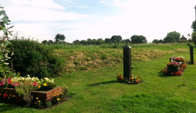
Dark Plantation Images

Images are sourced within 2km of 53.445815/-0.42452665 or Grid Reference TF0495. Thanks to Geograph Open Source API. All images are credited.

North Owersby junction turn right to Brigg
Bridleway and farm road to Fieldhouse Farm
Farm track and stack
Cater Lane
Cater Lane
Cater Lane junction
Cater Lane junction
St Martin's Church
St Martin's Church
Village Green A small patch of ground affectionately known as the village green. On this site are Stocks, Bench and water Pump (not working), a brick made trough and a framed Honeysuckle. A relaxing place to rest after a hike.
Village Green
A small patch of ground affectionately known as the village green. On this site are Stocks, Bench and water Pump (not working), a brick made trough and a framed Honeysuckle. A relaxing place to rest after a hike.
St Martin's Church Pictured on a lovely August afternoon.
St Martin's Church
Pictured on a lovely August afternoon.
Ridge and furrow in Kingerby Beck Nature Reserve: aerial 2019 See also <a href="https://www.geograph.org.uk/photo/6202165">TF0593 : Kingerby Beck Nature Reserve and South Owersby: aerial 2019</a>.
Ridge and furrow in Kingerby Beck Nature Reserve: aerial 2019
Kingerby Beck Nature Reserve and South Owersby: aerial 2019 See also <a href="https://www.geograph.org.uk/photo/6202157">TF0593 : Ridge and furrow in Kingerby Beck Nature Reserve: aerial 2019</a>.
Kingerby Beck Nature Reserve and South Owersby: aerial 2019
St.Martin's church, North Owersby, Lincs. Rebuilt 1762-3 with medieval masonry but still with its Perpendicular font
St.Martin's church, North Owersby, Lincs.
Rebuilt 1762-3 with medieval masonry but still with its Perpendicular font
St.Martin's church, North Owersby
Five Star holiday home ? Even the horse has moved out
Five Star holiday home ?
Even the horse has moved out
Kingerby Beck Meadows Entrance to Kingerby Beck Meadows, a Lincolnshire Wildlife Trust nature reserve
Kingerby Beck Meadows
Entrance to Kingerby Beck Meadows, a Lincolnshire Wildlife Trust nature reserve
All Saints' church, Thornton-le-Moor, Lincs. All Saints' has early 12th century origins, a splendid south door and a rare Norman bellcote ... look carefully around the walls to spot some Norman corbels re-set with later additions. Early English lancet windows in the nave and curious clerestorey of tiny quatrefoils.
All Saints' church, Thornton-le-Moor, Lincs.
All Saints' has early 12th century origins, a splendid south door and a rare Norman bellcote ... look carefully around the walls to spot some Norman corbels re-set with later additions. Early English lancet windows in the nave and curious clerestorey of tiny quatrefoils.
Fields and Big White Ball The fields are just east of Thornton le Moor but the big white ball is over 7km away, <a title="https://www.geograph.org.uk/gridref/TF1296" href="https://www.geograph.org.uk/gridref/TF1296">Link</a>.
Fields and Big White Ball
The fields are just east of Thornton le Moor but the big white ball is over 7km away, Link.
Bridleway and Bricks This bridleway leads to Owersby Moor.  The bricks will lead to a good deal of hard work for someone.
Bridleway and Bricks
This bridleway leads to Owersby Moor. The bricks will lead to a good deal of hard work for someone.
Thornton Road, South Kelsey The woodland ahead is South Wood and South Kelsey Park, the remnants of the old Hall grounds, is over the hedge to the left. Looking towards Thornton le Moor, <a href="https://www.geograph.org.uk/gridref/TF0496">TF0496</a>.
Thornton Road, South Kelsey
The woodland ahead is South Wood and South Kelsey Park, the remnants of the old Hall grounds, is over the hedge to the left. Looking towards Thornton le Moor, TF0496.
Show me another place!

Dark Plantation is located at Grid Ref: TF0495 (Lat: 53.445815, Lng: -0.42452665)

Administrative County: Lincolnshire

District: West Lindsey

Police Authority: Lincolnshire

What 3 Words

///tiny.shed.lamplight. Near Middle Rasen, Lincolnshire

Nearby Locations

Dark Plantation

Related Wikis

Thornton le Moor, Lincolnshire

Thornton le Moor is a village in the civil parish of Owersby, in the West Lindsey district of Lincolnshire, England, situated approximately 5 miles (8...

Owersby

Owersby is a civil parish in the West Lindsey district of Lincolnshire, England, situated about 6 miles (10 km) north-west from the market town of Market...

North Owersby

North Owersby is a village and former civil parish, now in the parish of Owersby, in the West Lindsey district of Lincolnshire, England, and about 6 miles...

South Kelsey

South Kelsey is a village and civil parish in the West Lindsey district of Lincolnshire, England. It is situated on the B1205, 5 miles (8.0 km) east from...

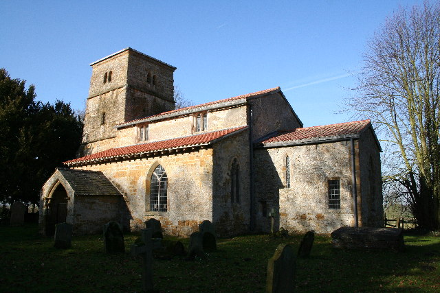
St Peter's Church, Kingerby

St Peter's Church is a redundant Anglican church in Kingerby, Lincolnshire, England. It is recorded in the National Heritage List for England as a designated...
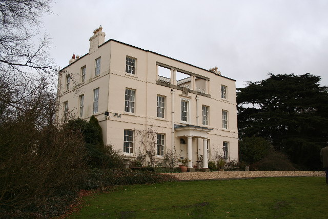
Kingerby Castle

Kingerby Castle was in the small settlement of Kingerby some five miles north-west of Market Rasen, Lincolnshire. It was a motte and bailey castle which...

Kingerby

Kingerby is a village and former civil parish, now in the parish of Osgodby, in the West Lindsey district of Lincolnshire, England. It is situated 5 miles...
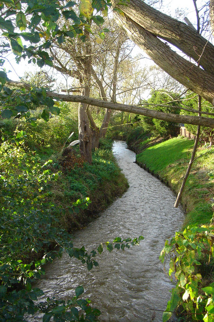
River Rase

The River Rase is 16 mile (25 km) long tributary of the River Ancholme that flows through Lincolnshire, in the east of England. == Course == The source...

Nearby Amenities

Located within 500m of 53.445815,-0.42452665
North Gulham Lodge
Place: isolated_dwelling
Source: Bing
Lat/Long: 53.4463462/-0.417453
Power: pole
Lat/Long: 53.4447049/-0.4298269
Power: pole
Lat/Long: 53.4447763/-0.4285891
Power: pole
Lat/Long: 53.4448622/-0.4273532
Power: pole
Lat/Long: 53.4449482/-0.4261235
Power: pole
Lat/Long: 53.4450257/-0.4248775
Power: pole
Lat/Long: 53.4451056/-0.4236985
Power: pole
Lat/Long: 53.4451806/-0.4225135
Power: pole
Lat/Long: 53.4452533/-0.4213406
Power: pole
Lat/Long: 53.445332/-0.4201617
Power: pole
Lat/Long: 53.4454058/-0.4190336
Power: pole
Lat/Long: 53.4454875/-0.4178086
Power: pole
Lat/Long: 53.4483755/-0.4187518
Power: pole
Lat/Long: 53.4476471/-0.4185909
Power: pole
Lat/Long: 53.4469331/-0.4184273
Power: pole
Lat/Long: 53.4462494/-0.4182181
Power: pole
Lat/Long: 53.4460785/-0.4180974
Power: pole
Lat/Long: 53.4447382/-0.4173276
The data included in this document is from www.openstreetmap.org. The data is made available under ODbL.

Have you been to Dark Plantation?

Leave your review of Dark Plantation below (or comments, questions and feedback).