Newton Spinney
Wood, Forest in Northamptonshire
England
Newton Spinney

Newton Spinney is a small village located in the county of Northamptonshire, England. Situated in the heart of the country, it is surrounded by lush greenery and majestic woodlands, making it an ideal destination for nature lovers and outdoor enthusiasts.
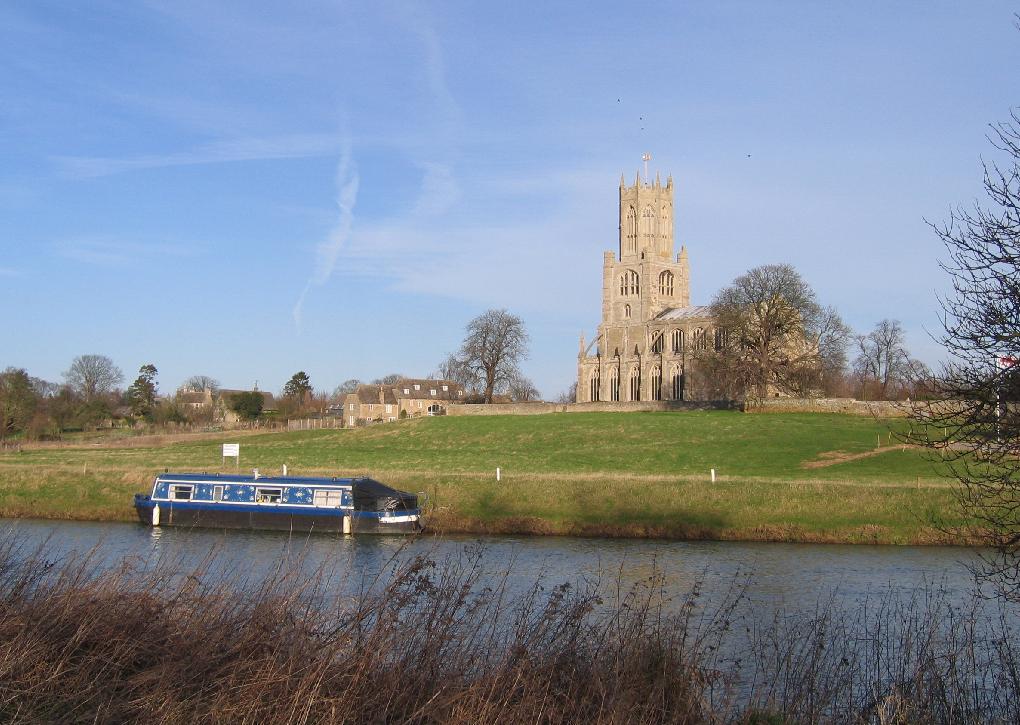
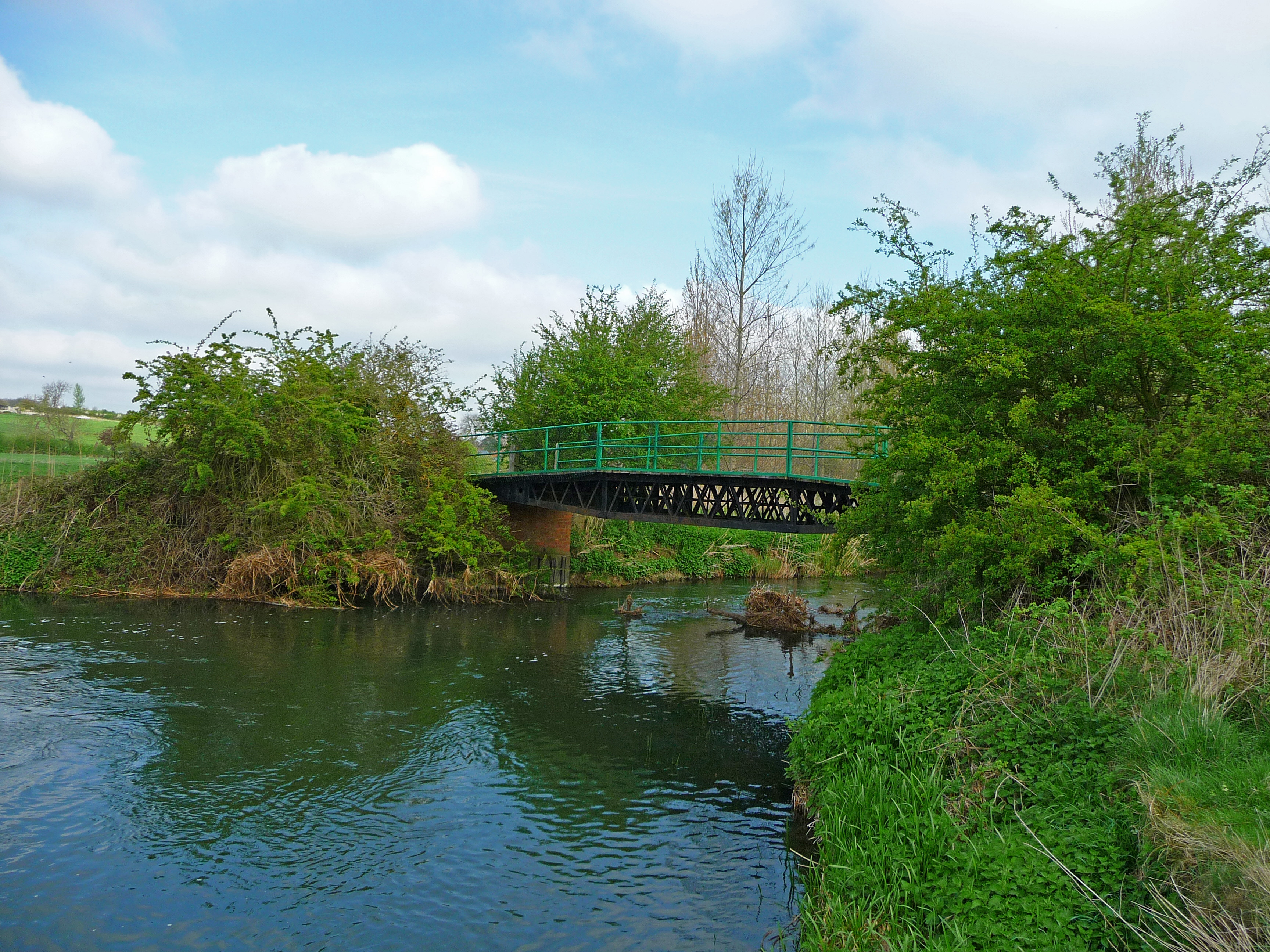
The village is well-known for its picturesque landscapes, with the Newton Spinney Wood being a prominent feature. This ancient forest covers a vast area, providing a serene and tranquil environment for visitors. The wood is home to a diverse range of flora and fauna, including several rare and endangered species. It offers a wide range of recreational activities such as hiking, bird watching, and nature photography.
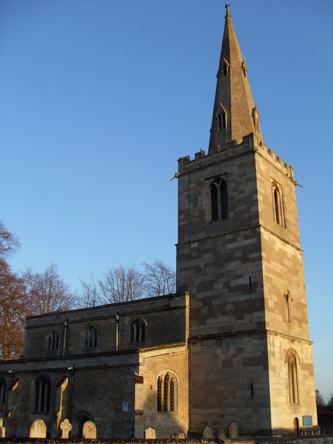
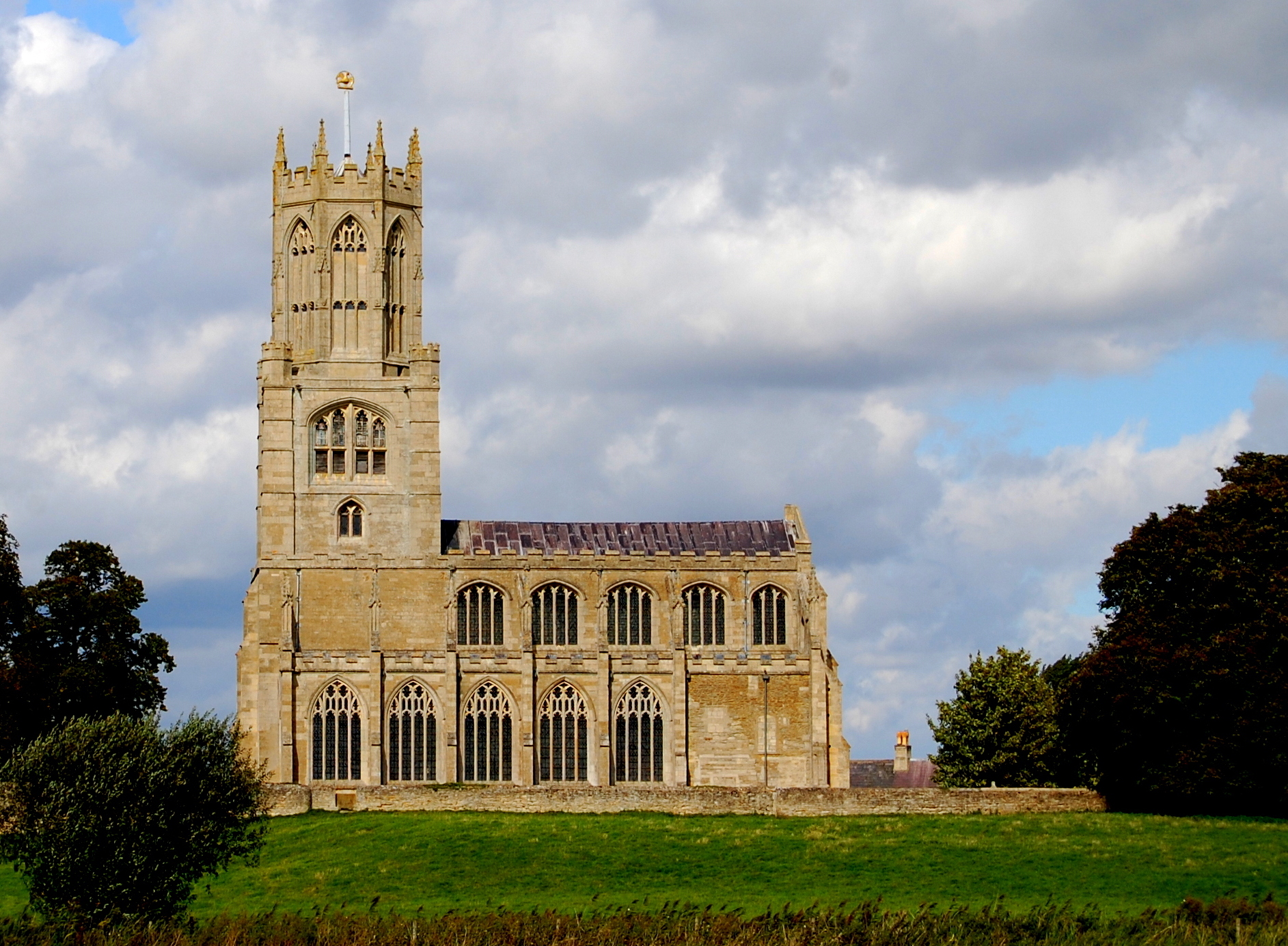
In addition to its natural beauty, Newton Spinney is also known for its rich history. The village dates back to the medieval period and has several historical landmarks, including a beautiful 12th-century church that stands as a testament to its past. The village also boasts a charming village green and a few traditional thatched-roof cottages, giving it a quintessentially English countryside ambiance.
Despite its small size, Newton Spinney offers a close-knit community feel, with friendly locals who take pride in their village. There are a few local amenities such as a village hall, a small shop, and a cozy pub, where residents and visitors can gather and socialize.
Overall, Newton Spinney is a hidden gem in Northamptonshire, offering a perfect blend of natural beauty, historical charm, and a tight-knit community. It is a place where one can escape the hustle and bustle of city life and immerse themselves in the tranquility of the surrounding woodlands.
If you have any feedback on the listing, please let us know in the comments section below.
Newton Spinney Images
Images are sourced within 2km of 52.545803/-0.45910227 or Grid Reference TL0495. Thanks to Geograph Open Source API. All images are credited.


Newton Spinney is located at Grid Ref: TL0495 (Lat: 52.545803, Lng: -0.45910227)
Unitary Authority: North Northamptonshire
Police Authority: Northamptonshire
What 3 Words
///hooked.admit.cuddling. Near Wansford, Cambridgeshire
Nearby Locations
Related Wikis

Woodnewton
Woodnewton is a village in Northamptonshire, England. Essentially a pair of parallel streets, the village lies to the north of a small stream, the Willow...
Fotheringhay
Fotheringhay is a village and civil parish in North Northamptonshire, England. It is 4 miles (6.4 km) north-east of Oundle and around 13 miles (21 km)...
St Leonard's Church, Apethorpe
St Leonard's Church is an Anglican church in the village of Apethorpe in Northamptonshire, England. It is an active parish church in the Diocese of Peterborough...

Apethorpe
Apethorpe (pronounced "Ap-thorp") is a village, civil parish, former manor and ecclesiastical parish in Northamptonshire, England (in the North Northamptonshire...
Nassington
Nassington is a village and civil parish in Northamptonshire, England. At the time of the 2001 census, the parish's population was 670 people, increasing...

Apethorpe Palace
Apethorpe Palace (pronounced Ap-thorp), formerly known as "Apethorpe Hall", is a Grade I listed country house, dating to the 15th century, close to Apethorpe...
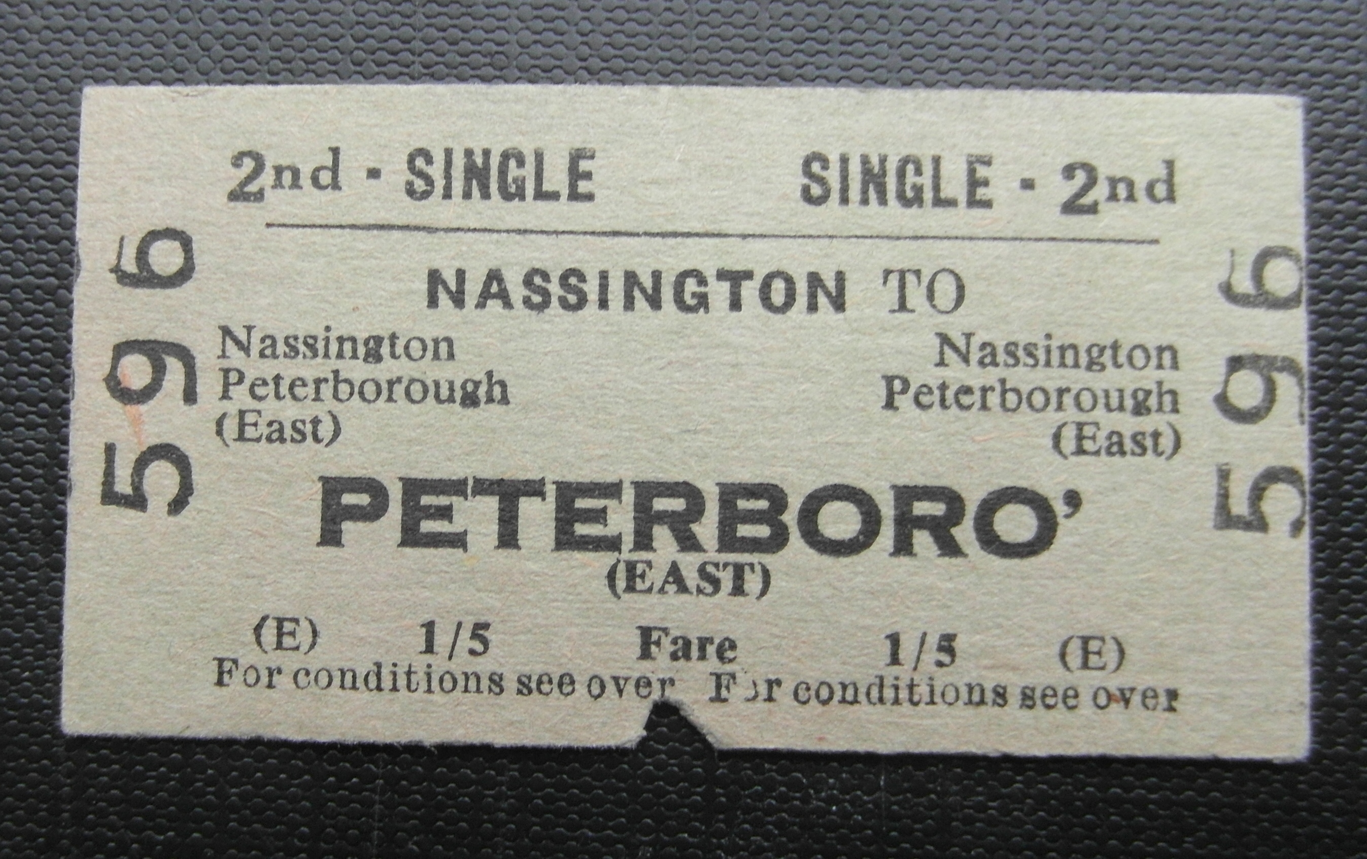
Nassington railway station
Nassington railway station is a former railway station in Nassington, Northamptonshire. It was owned by the London and North Western Railway but from 1883...
Church of St Mary and All Saints, Fotheringhay
The Church of St Mary and All Saints, Fotheringhay is a parish church in the Church of England in Fotheringhay, Northamptonshire. It is noted for containing...
Nearby Amenities
Located within 500m of 52.545803,-0.45910227Have you been to Newton Spinney?
Leave your review of Newton Spinney below (or comments, questions and feedback).