Eddleston

Settlement in Peeblesshire

Scotland

Eddleston

Old Milestone by the A703, Eddleston Parish Peebles by the A703, in parish of Eddleston (Peebles District), North of Eddleston, near turning for Scots Pine Tea Shop, East side of road.

Inscription reads:- : PEEBLESSHIRE / PEEBLES / 5 MILES {pointing hand} / PENICUIK / {pointing hand} 8 MILES / EDINBURGH / G.P.O. / {pointing hand} 17⅞ MILES :

Surveyed

Milestone Society National ID: BD_PBPK05.
Old Milestone by the A703, Eddleston Parish Credit: David Thom

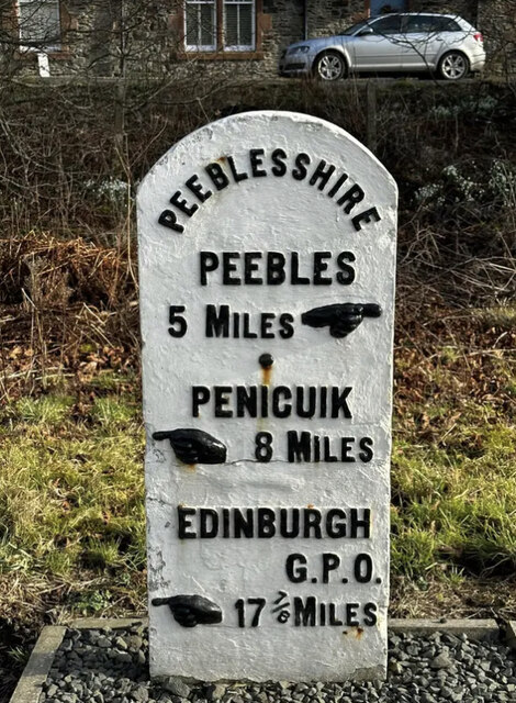
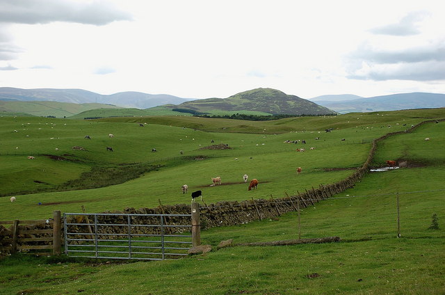
Eddleston is a small village located in the county of Peeblesshire, in the Scottish Borders region of Scotland. Situated approximately 5 miles north of the town of Peebles, Eddleston is nestled in the picturesque Eddleston Valley, surrounded by rolling hills and stunning countryside.

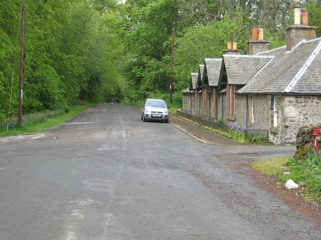
The village itself is home to a tight-knit community, with a population of around 500 residents. Eddleston boasts a charming mix of traditional stone-built cottages and modern houses, creating a delightful blend of old-world charm and contemporary living.

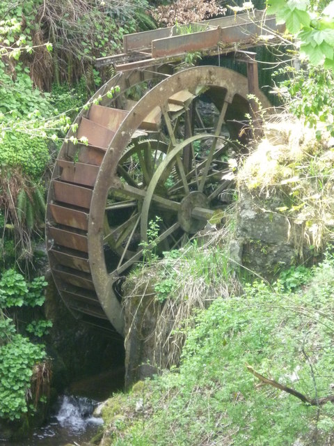
One of the notable features of Eddleston is its beautiful setting along the banks of the River Tweed, which provides a tranquil and scenic backdrop to the village. The river is renowned for its salmon fishing, attracting anglers from far and wide.

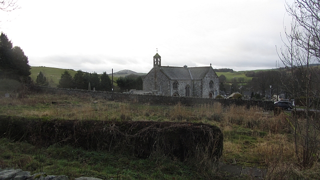
Eddleston is also known for its rich historical heritage. The nearby Eddleston Parish Church, dating back to the 12th century, is a testament to the village's long-standing history. The church's ancient graveyard contains fascinating tombstones and memorials, offering a glimpse into the past.

Although small in size, Eddleston offers a range of amenities for its residents and visitors. These include a primary school, a village hall, a local shop, and a pub, where locals and visitors can enjoy traditional Scottish hospitality.

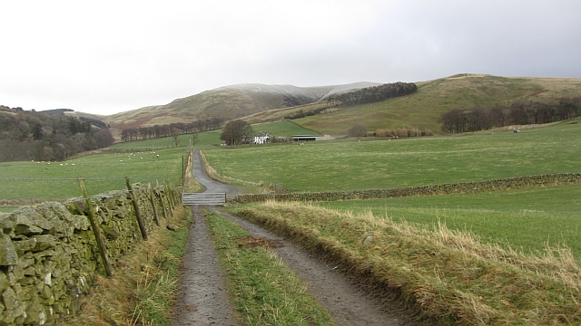
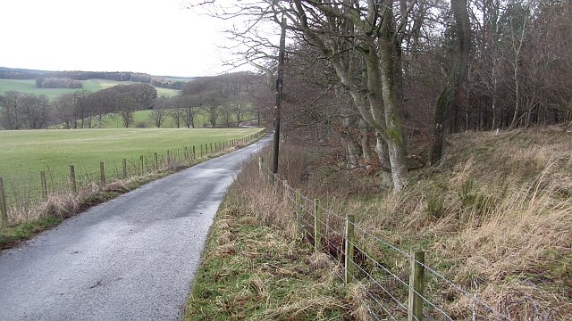
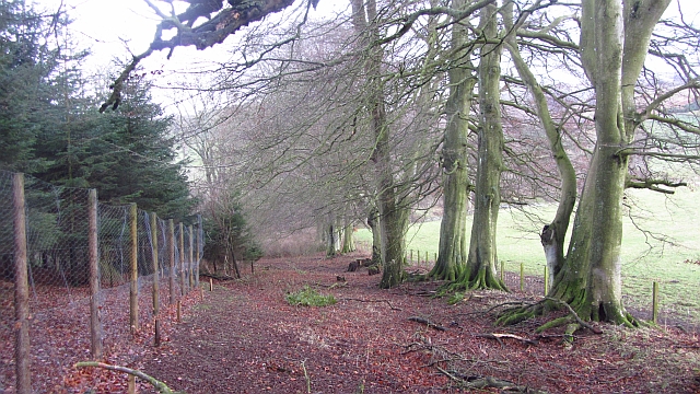
For outdoor enthusiasts, Eddleston is a haven for walking, cycling, and exploring the surrounding countryside. The village is situated close to the stunning Glentress Forest, which offers a range of outdoor activities, including mountain biking trails and walking paths.

Overall, Eddleston is a charming village that offers a peaceful and idyllic lifestyle, surrounded by breathtaking natural beauty and steeped in history.

If you have any feedback on the listing, please let us know in the comments section below.
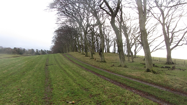
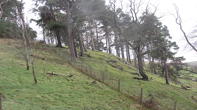
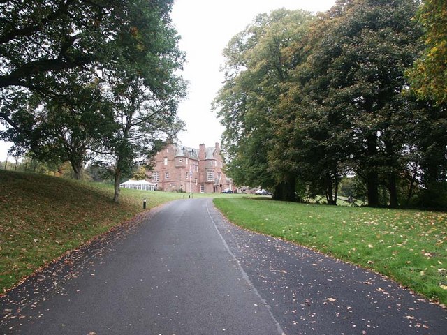
Eddleston Images

Images are sourced within 2km of 55.711935/-3.2085158 or Grid Reference NT2447. Thanks to Geograph Open Source API. All images are credited.

Old Milestone by the A703, Eddleston Parish Peebles by the A703, in parish of Eddleston (Peebles District), North of Eddleston, near turning for Scots Pine Tea Shop, East side of road.

Inscription reads:- : PEEBLESSHIRE / PEEBLES / 5 MILES {pointing hand} / PENICUIK / {pointing hand} 8 MILES / EDINBURGH / G.P.O. / {pointing hand} 17⅞ MILES :

Surveyed

Milestone Society National ID: BD_PBPK05.
Old Milestone by the A703, Eddleston Parish
Peebles by the A703, in parish of Eddleston (Peebles District), North of Eddleston, near turning for Scots Pine Tea Shop, East side of road. Inscription reads:- : PEEBLESSHIRE / PEEBLES / 5 MILES {pointing hand} / PENICUIK / {pointing hand} 8 MILES / EDINBURGH / G.P.O. / {pointing hand} 17⅞ MILES : Surveyed Milestone Society National ID: BD_PBPK05.
Barony Castle Hotel, Eddleston
Waterwheel on the Dean Burn
Old waterwheel at Barony Castle
Barony Castle map of Scotland, Eddleston When I heard that a topographical map of Scotland, carved in stone by Polish army veterans, existed in the grounds of the Barony Castle Hotel, I expected to find something the size of a dining table. I was taken aback on discovering the scale of this massive sculpture which is in fact made of moulded concrete. The viewing platform cannot do it justice until it is raised by another thirty feet at least to gain a good overview of the whole. Those who want the bird's eye view can find it on GoogleEarth at NT 23656 47179. Ground-level photographs fail to deliver the overall visual impact of the map on the beholder. This one is taken standing east of Caithness, looking south across the Moray Firth. For more about this remarkablea artefact, see <span class="nowrap"><a title="http://www.mapascotland.org/" rel="nofollow ugc noopener" href="http://www.mapascotland.org/">Link</a><img style="margin-left:2px;" alt="External link" title="External link - shift click to open in new window" src="https://s1.geograph.org.uk/img/external.png" width="10" height="10"/></span>
Barony Castle map of Scotland, Eddleston
When I heard that a topographical map of Scotland, carved in stone by Polish army veterans, existed in the grounds of the Barony Castle Hotel, I expected to find something the size of a dining table. I was taken aback on discovering the scale of this massive sculpture which is in fact made of moulded concrete. The viewing platform cannot do it justice until it is raised by another thirty feet at least to gain a good overview of the whole. Those who want the bird's eye view can find it on GoogleEarth at NT 23656 47179. Ground-level photographs fail to deliver the overall visual impact of the map on the beholder. This one is taken standing east of Caithness, looking south across the Moray Firth. For more about this remarkablea artefact, see LinkExternal link
Barony Castle map of Scotland, Forth Estuary and Fife For an explanation of the map, see <span class="nowrap"><a title="https://en.wikipedia.org/wiki/Great_Polish_Map_of_Scotland" rel="nofollow ugc noopener" href="https://en.wikipedia.org/wiki/Great_Polish_Map_of_Scotland">Link</a><img style="margin-left:2px;" alt="External link" title="External link - shift click to open in new window" src="https://s1.geograph.org.uk/img/external.png" width="10" height="10"/></span>
Barony Castle map of Scotland, Forth Estuary and Fife
For an explanation of the map, see LinkExternal link
Barony Castle map of Scotland, Galloway
Barony Castle map of Scotland, Outer Hebrides
Barony Castle map of Scotland, Isle of Lewis
Row of Cottages at Harcus North of Eddleston in Peeblesshire.
Row of Cottages at Harcus
North of Eddleston in Peeblesshire.
Gate on the Old Post Road near Stewarton The route keeps R of the wall, and an enclosed track is met at the S end of the field. The hill ahead is White Meldon.
Gate on the Old Post Road near Stewarton
The route keeps R of the wall, and an enclosed track is met at the S end of the field. The hill ahead is White Meldon.
The church, Eddleston Looking over what looks like the site of a demolished house towards the church.
The church, Eddleston
Looking over what looks like the site of a demolished house towards the church.
Boreland An untarred farm road soon joins the tarred main access for the farm. There is a dusting on Dundreich in the background.
Boreland
An untarred farm road soon joins the tarred main access for the farm. There is a dusting on Dundreich in the background.
Road to Boreland A farm access road, it passes The Grove,a deciduous woodland which contained a calling nuthatch.
Road to Boreland
A farm access road, it passes The Grove,a deciduous woodland which contained a calling nuthatch.
The Grove Woodland, mostly deciduous with oaks beyond the conifers, left.
The Grove
Woodland, mostly deciduous with oaks beyond the conifers, left.
Strip wood, Boreland A beech strip.
Strip wood, Boreland
A beech strip.
Dog Knowes Pine wood on a craggy hillside.
Dog Knowes
Pine wood on a craggy hillside.
Show me another place!

Eddleston is located at Grid Ref: NT2447 (Lat: 55.711935, Lng: -3.2085158)

Unitary Authority: The Scottish Borders

Police Authority: The Lothians and Scottish Borders

What 3 Words

///ship.quietest.claw. Near Peebles, Scottish Borders

Nearby Locations

Eddleston Bellfield Wood

Related Wikis

Eddleston railway station

Eddleston railway station served the village of Eddleston, Scottish Borders, Scotland from 1855 to 1962 on the Peebles Railway. == History == The station...

Eddleston

Eddleston (Scottish Gaelic: Baile Ghille Mhoire) is a small village and civil parish in the Scottish Borders area of Scotland. It lies 4 miles (6.4 km...

Great Polish Map of Scotland

The Great Polish Map of Scotland is a large (50 m x 40 m) three-dimensional, outdoor concrete scale model of Scotland, located in the grounds of the Barony...
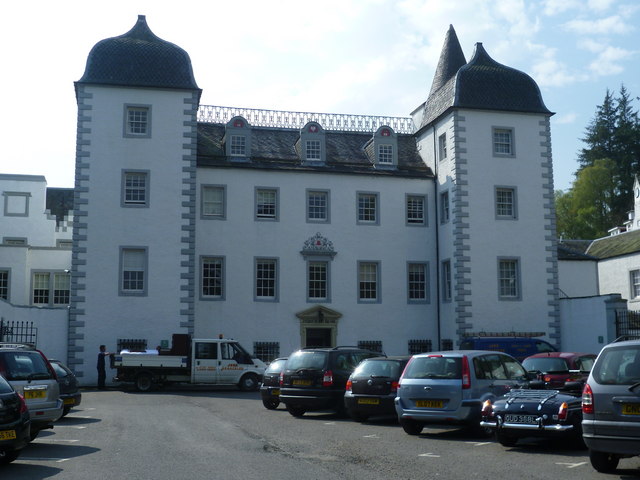
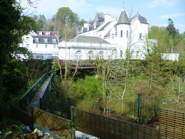
Black Barony

Barony Castle, also and formerly known as Black Barony, and Darnhall, is a historic house at Eddleston in the Scottish Borders area of Scotland. The house...

Darnhall Mains

Darnhall Mains is a farm and settlement off the A703, near Eddleston and the Eddleston Water in the Scottish Borders area of Scotland, in the former Peeblesshire...

Milkieston Rings

Milkieston Rings is a prehistoric site, a hillfort near the village of Eddleston and about 3 miles (5 km) north of Peebles, in the Scottish Borders, Scotland...

Northshield Rings

Northshield Rings is a prehistoric site, a hillfort near the village of Eddleston and about 6 miles (10 km) north of Peebles, in the Scottish Borders,...

Cringletie

Cringletie is a Scottish Baronial house by the Eddleston Water, around 3 kilometres (1.9 mi) south of Eddleston in the Scottish Borders area of Scotland...

Nearby Amenities

Located within 500m of 55.711935,-3.2085158
Eddleston
Name Ang: Edulfstun
Name Cy: Penteiacob
Name Gd: Baile Ghille Mhoire
Place: village
Population: 335
Wikidata: Q5336619
Wikipedia: en:Eddleston
Lat/Long: 55.7120182/-3.2066459
Restaurant
Horse Shoe Inn
Addr Postcode: EH45 8QP
Addr Street: Bellfield Road
Fhrs Id: 1106103
Source Addr: FHRS Open Data
Wikidata: Q56606269
Lat/Long: 55.7124079/-3.2063504
Telephone
Booth: K6
Covered: booth
Lat/Long: 55.712376/-3.2068176
Horse Shoe Inn Hotel
Tourism: hotel
Lat/Long: 55.7123079/-3.2063623
Bus Stop
Station Road
Bus: yes
Naptan AtcoCode: 69001287
Naptan Bearing: N
Naptan CommonName: Station Road
Naptan Indicator: at
Naptan NaptanCode: 72725346
Naptan Street: A703
Operator: Scottish Borders Council
Public Transport: platform
Ref: 69001287
Source: NaPTAN
Lat/Long: 55.7104511/-3.2075131
Bus Stop
Station Road
Bus: yes
Naptan AtcoCode: 69001288
Naptan Bearing: S
Naptan CommonName: Station Road
Naptan Indicator: opp
Naptan NaptanCode: 72725345
Naptan Street: A703
Operator: Scottish Borders Council
Public Transport: platform
Ref: 69001288
Source: NaPTAN
Lat/Long: 55.7104993/-3.2072409
Bus Stop
Horseshoe Inn
Bus: yes
Naptan AtcoCode: 6900970
Naptan Bearing: N
Naptan CommonName: Horseshoe Inn
Naptan Indicator: opp
Naptan NaptanCode: 72725357
Naptan Street: Old Manse Road
Naptan Verified: no
Operator: Scottish Borders Council
Public Transport: platform
Ref: 6900970
Source: NaPTAN
Lat/Long: 55.7121417/-3.2066747
Bus Stop
Horseshoe Inn
Bus: yes
Naptan AtcoCode: 6900971
Naptan Bearing: S
Naptan CommonName: Horseshoe Inn
Naptan Indicator: o/s
Naptan NaptanCode: 72725353
Naptan Street: A703
Operator: Scottish Borders Council
Public Transport: platform
Ref: 6900971
Source: NaPTAN
Lat/Long: 55.7121756/-3.2064436
Eddleston
Historic Railway: station
Railway: site
Wikidata: Q30624802
Wikipedia: en:Eddleston railway station
Lat/Long: 55.7114423/-3.2091452
Temple Hill
Place: locality
Lat/Long: 55.7094652/-3.2038892
Post Box
Brand: Royal Mail
Brand Wikidata: Q638098
Collection Times: Mo-Fr 16:00; Sa 10:30
Operator: Royal Mail
Operator Wikidata: Q638098
Post Box Type: lamp
Ref: EH45 57
Royal Cypher: scottish_crown
Lat/Long: 55.711241/-3.2084065
Power: pole
Lat/Long: 55.7082054/-3.2114102
Power: pole
Lat/Long: 55.7088054/-3.2109832
Power: pole
Lat/Long: 55.7093611/-3.2099868
Power: pole
Lat/Long: 55.709815/-3.2091937
Power: pole
Lat/Long: 55.7104544/-3.2080664
Power: pole
Lat/Long: 55.7108382/-3.2077373
Power: pole
Lat/Long: 55.7128071/-3.2079936
Power: pole
Lat/Long: 55.7133022/-3.2083889
Power: pole
Lat/Long: 55.7139997/-3.2089376
Power: pole
Lat/Long: 55.7145256/-3.209871
Power: pole
Lat/Long: 55.7150242/-3.210794
Power: pole
Lat/Long: 55.7155085/-3.211656
Power: pole
Lat/Long: 55.7158721/-3.2123014
Defibrillator
Defibrillator Location: outside Eddleston Village Hall - facing car park
Emergency: defibrillator
Indoor: no
Ref GB The Circuit: 4D885BFB-F850-4ED6-96FD-AF950124BBD5
Lat/Long: 55.7111037/-3.2071572
Entrance: yes
Lat/Long: 55.711137/-3.2070828
Noexit: yes
Lat/Long: 55.7118048/-3.2060941
Give Way
Direction: backward
Lat/Long: 55.711798/-3.2064453
Give Way
Direction: forward
Lat/Long: 55.7117138/-3.2059333
Entrance: yes
Lat/Long: 55.7125225/-3.2047597
Entrance: yes
Lat/Long: 55.7125255/-3.2049391
Give Way
Direction: backward
Lat/Long: 55.7132183/-3.2048549
Give Way
Direction: forward
Lat/Long: 55.7149635/-3.2057843
Addr Street: Bellfield Road
Lat/Long: 55.7137565/-3.2048179
Barrier: bollard
Lat/Long: 55.7135673/-3.2062054
The data included in this document is from www.openstreetmap.org. The data is made available under ODbL.

Have you been to Eddleston?

Leave your review of Eddleston below (or comments, questions and feedback).