Home Wood

Wood, Forest in Lincolnshire South Kesteven

England

Home Wood

Stanton's Pit
Stanton's Pit Credit: Bob Harvey

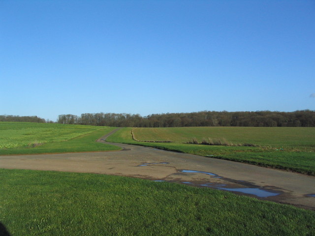
Home Wood is a picturesque forest located in Lincolnshire, England. Covering an area of approximately 200 acres, it is a haven for nature enthusiasts and those seeking a peaceful retreat from the hustle and bustle of daily life.

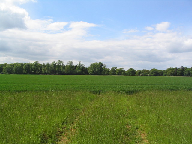
The forest is characterized by its dense foliage and towering trees, predominantly consisting of oak, beech, and birch. These trees create a lush and vibrant environment, providing a habitat for a diverse range of wildlife. Visitors can often spot various species of birds, such as woodpeckers and owls, as well as small mammals like foxes and rabbits.

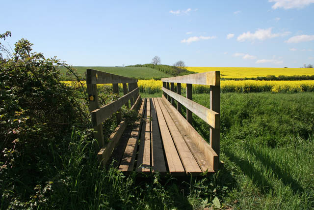
Traversing through Home Wood is a delight for hikers and nature walkers, as there are several well-maintained trails that wind their way through the forest. These trails offer breathtaking views of the surrounding landscape and provide an opportunity to immerse oneself in the tranquility of nature.

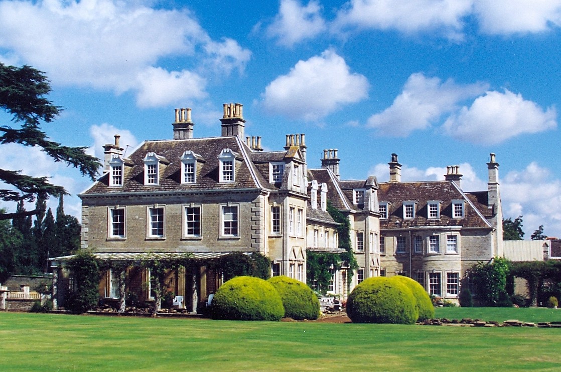
In addition to its natural beauty, Home Wood also holds historical significance. It is believed that the forest has been in existence for hundreds of years and has witnessed numerous changes throughout history. The remnants of an ancient Roman road can still be found within the forest, serving as a reminder of the area's rich heritage.

Home Wood is a popular destination for families, nature lovers, and individuals seeking a serene escape. With its lush greenery, abundant wildlife, and historical charm, it offers a truly enchanting experience for all who visit.

If you have any feedback on the listing, please let us know in the comments section below.
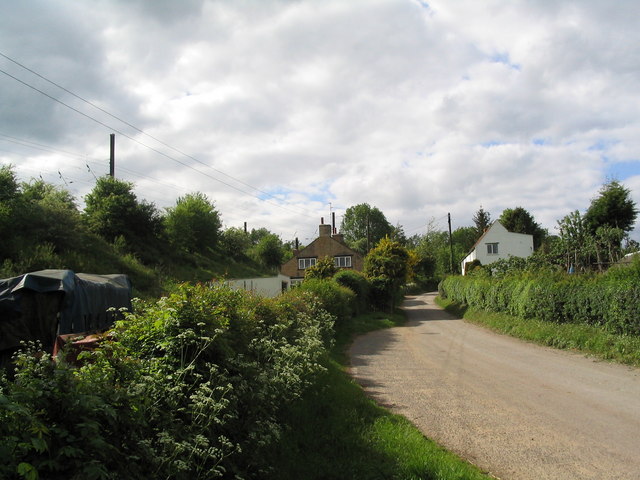
Home Wood Images

Images are sourced within 2km of 52.759042/-0.45643299 or Grid Reference TF0419. Thanks to Geograph Open Source API. All images are credited.

Stanton's Pit
Stanton's Pit
Roadside trees A flash of late afternoon low angle sunlight.
Roadside trees
A flash of late afternoon low angle sunlight.
View north from near Scottlethorpe Grange The road to Scottlethorpe runs across a valley in the middle distance and (invisibly) through the woods on the horizon
View north from near Scottlethorpe Grange
The road to Scottlethorpe runs across a valley in the middle distance and (invisibly) through the woods on the horizon
Road junction, Grimsthorpe Park The main road through the Park. Running from Chestnut Avenue to the south (bottom right), towards the castle at the north end of the Park (top).
Road junction, Grimsthorpe Park
The main road through the Park. Running from Chestnut Avenue to the south (bottom right), towards the castle at the north end of the Park (top).
'Pots and Pans', Grimsthorpe Park Bumpy ground marking former quarry. Extraction of good quality limestone remains an important activity in the area.
'Pots and Pans', Grimsthorpe Park
Bumpy ground marking former quarry. Extraction of good quality limestone remains an important activity in the area.
Track  to Hale House Plantation, Grimsthorpe Estate This may not be a right of way, I seem to have lost the cycle track.
Track to Hale House Plantation, Grimsthorpe Estate
This may not be a right of way, I seem to have lost the cycle track.
Looking across barley fields towards Scottlethorpe Grange
Woods of Grimsthorpe Estate from Hale House Road
Track past Kennel Plantation, Grimsthorpe Estate The wooden sign below the tree to the left of the track is one of a number of signs indicating a bicycle track.
Track past Kennel Plantation, Grimsthorpe Estate
The wooden sign below the tree to the left of the track is one of a number of signs indicating a bicycle track.
End of Halehouse Road at Hale House ruin, Grimsthorpe Estate Public access along the road/track leading south west from Scottlethorpe along the east side of Grimsthorpe Park ends here (the track turns left into a shooting range). However, other tracks do allow egress to Little Bytham.
End of Halehouse Road at Hale House ruin, Grimsthorpe Estate
Public access along the road/track leading south west from Scottlethorpe along the east side of Grimsthorpe Park ends here (the track turns left into a shooting range). However, other tracks do allow egress to Little Bytham.
Bridleway northwards down Fountains Hill Many of the fields in this area had been harvested by mid July
Bridleway northwards down Fountains Hill
Many of the fields in this area had been harvested by mid July
View to Elderwood Cottage From the bridleway running north from Witham on the Hill
View to Elderwood Cottage
From the bridleway running north from Witham on the Hill
View NE along disused railway track near Dobbin's Wood Part of an extensive former railway line running about 30 km W-E from Wymondham to Bourne. I'm not sure of its Right of Way status
View NE along disused railway track near Dobbin's Wood
Part of an extensive former railway line running about 30 km W-E from Wymondham to Bourne. I'm not sure of its Right of Way status
View north along edge of Dobbin's Wood
View south across hay field towards Dog Kennel Wood Taken from the disused railway track on the southern edge of Dobbin's Wood
View south across hay field towards Dog Kennel Wood
Taken from the disused railway track on the southern edge of Dobbin's Wood
Track crossing disused railway View east along disused railway, with track crossing from Hale House (left) to Little Bytham Lodge (right).
Track crossing disused railway
View east along disused railway, with track crossing from Hale House (left) to Little Bytham Lodge (right).
Chestnut Avenue to Grimsthorpe Castle Taken from the footpath.
Chestnut Avenue to Grimsthorpe Castle
Taken from the footpath.
Crossing the East Glen River This substantial wooden footbridge carries the public footpath from Bourne over the river. The footpath crosses the farmland and climbs over the hill, following the hedge, to Scottlethorpe Grange.
Crossing the East Glen River
This substantial wooden footbridge carries the public footpath from Bourne over the river. The footpath crosses the farmland and climbs over the hill, following the hedge, to Scottlethorpe Grange.
Show me another place!

Home Wood is located at Grid Ref: TF0419 (Lat: 52.759042, Lng: -0.45643299)

Administrative County: Lincolnshire

District: South Kesteven

Police Authority: Lincolnshire

What 3 Words

///fuels.topples.crusaders. Near Bourne, Lincolnshire

Nearby Locations

Stonepit Wood Home Wood

Related Wikis

Bourne Rural District

Bourne was a rural district in Lincolnshire, Parts of Kesteven from 1894 to 1931. It was created by the Local Government Act 1894 based on the Bourne rural...

South Kesteven Rural District

South Kesteven was a rural district in Lincolnshire, Parts of Kesteven in England from 1931 to 1974. It was formed under a County Review Order in 1931...

Witham Hall

Witham Hall is an independent boarding and day school situated in Witham on the Hill, Lincolnshire, England. == The hall == The house is described by Sir...

Vaudey Abbey

Vaudey Abbey , also known as Vandy Abbey or Vandey Abbey, was an English Cistercian abbey. It was founded in 1147 by William, Count of Aumale, Earl of...

Witham on the Hill

Witham on the Hill is a village and civil parish in the South Kesteven district of Lincolnshire, England. The population of the civil parish was 260 at...

Lound, Lincolnshire

Lound is a village in the South Kesteven district of Lincolnshire, England. It is situated about 2 miles (3 km) south-west from the town of Bourne. Originally...

Little Bytham railway station

Little Bytham railway station was a station in Little Bytham, Lincolnshire on the Great Northern Railway main line. It closed in 1959. The Midland and...

Counthorpe

Counthorpe is a hamlet in the civil parish of Counthorpe and Creeton in the South Kesteven district of Lincolnshire, England. It adjoins the hamlet of...

Have you been to Home Wood?

Leave your review of Home Wood below (or comments, questions and feedback).