Stroud Common

Wood, Forest in Surrey Waverley

England

Stroud Common

Christ Church, Shamley Green
Christ Church, Shamley Green Credit: Alex McGregor

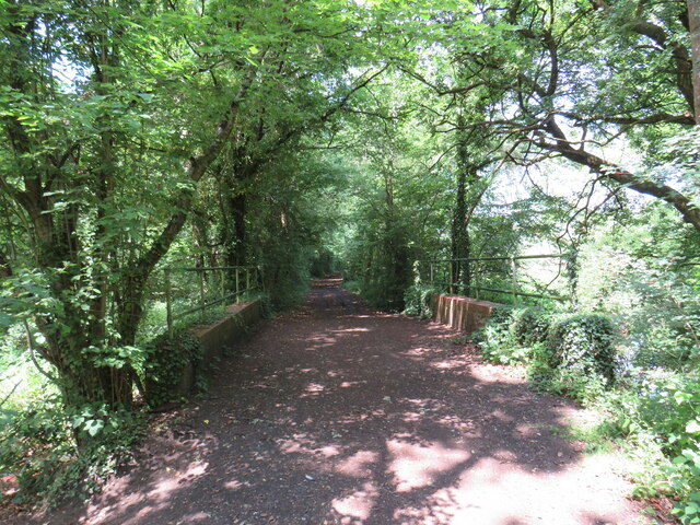
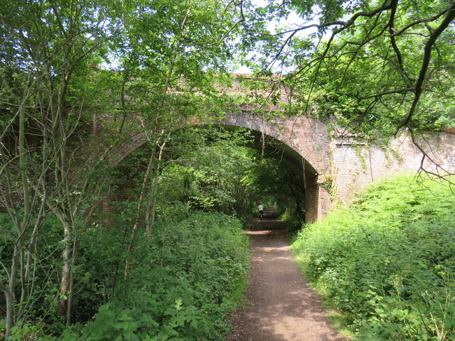
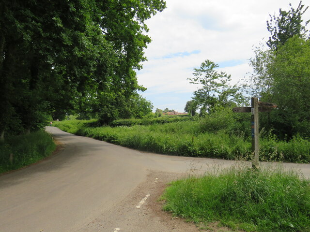
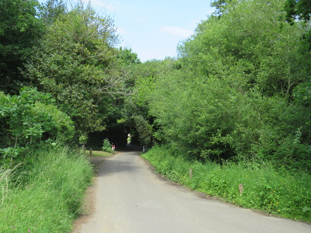
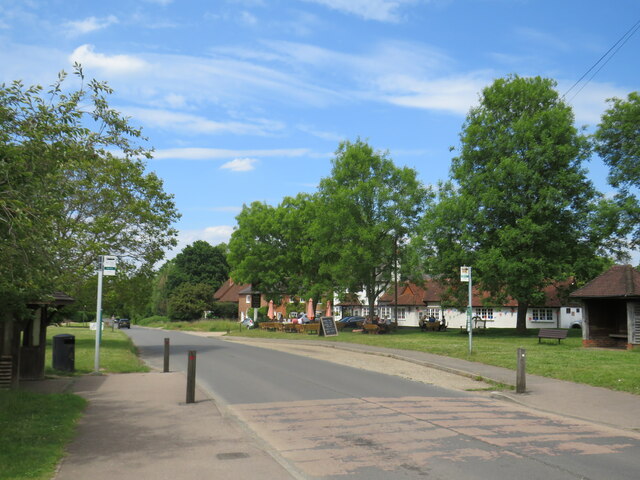
Stroud Common is a picturesque woodland area located in Surrey, England. Covering an area of approximately 100 hectares, it is a popular destination for nature enthusiasts and locals seeking tranquility amidst the bustle of city life. The common is situated near the town of Stroud and is easily accessible via well-maintained footpaths and roads.

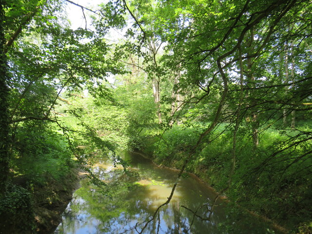
The woodland of Stroud Common is characterized by its diverse range of trees, including oak, beech, and birch. The dense canopy provides shade and shelter for numerous species of wildlife, making it a haven for birdwatchers and nature photographers. Visitors may spot common woodland birds such as robins, blackbirds, and blue tits, as well as the occasional elusive deer or fox.

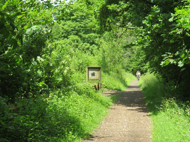
The common also boasts several well-marked trails, allowing visitors to explore its natural beauty at their own pace. These trails wind through the woodland, offering glimpses of wildflowers and ferns that flourish on the forest floor. In the springtime, the area is particularly stunning, as vibrant bluebells carpet the ground, creating a breathtaking sight.

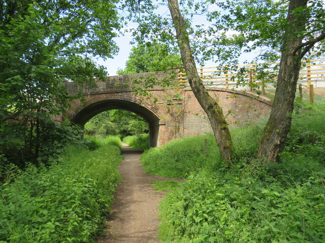
Stroud Common is not only cherished for its natural beauty but also for its historical significance. The woodland has been preserved for centuries and was once part of a larger royal hunting ground. Today, it serves as a protected area, managed by local authorities to ensure the preservation of its natural habitats.

Overall, Stroud Common is a hidden gem in the heart of Surrey, offering visitors the chance to immerse themselves in the tranquility of nature. With its scenic trails, diverse wildlife, and rich history, it is a place that truly captures the beauty and essence of the English countryside.

If you have any feedback on the listing, please let us know in the comments section below.

Stroud Common Images

Images are sourced within 2km of 51.172002/-0.51202723 or Grid Reference TQ0442. Thanks to Geograph Open Source API. All images are credited.

Christ Church, Shamley Green
Downs Link near Cranleigh The Downs Link path follows a dismantled railway line for most of its length.  It also forms part of route 223 of the National Cycle Network.

Here, a bridge takes the route across Cranleigh Waters, a tributary of the River Wey.
Downs Link near Cranleigh
The Downs Link path follows a dismantled railway line for most of its length. It also forms part of route 223 of the National Cycle Network. Here, a bridge takes the route across Cranleigh Waters, a tributary of the River Wey.
Cranleigh Waters, near Cranleigh Cranleigh Waters, also known as Bramley Way, is a tributary of the River Wey in Surrey.
Cranleigh Waters, near Cranleigh
Cranleigh Waters, also known as Bramley Way, is a tributary of the River Wey in Surrey.
Downs Link near Cranleigh The Downs Link path follows a dismantled railway line for most of its length.  It also forms part of route 223 of the National Cycle Network.

An information board alongside the path gives information about the Wey & Arun Canal, which passes beneath the path here.  The canal, opened in 1816, linked the Wey and Arun Navigations to provided a navigable route for barges between London and Portsmouth.
Downs Link near Cranleigh
The Downs Link path follows a dismantled railway line for most of its length. It also forms part of route 223 of the National Cycle Network. An information board alongside the path gives information about the Wey & Arun Canal, which passes beneath the path here. The canal, opened in 1816, linked the Wey and Arun Navigations to provided a navigable route for barges between London and Portsmouth.
Downs Link near Cranleigh The Downs Link path follows a dismantled railway line for most of its length.  It also forms part of route 223 of the National Cycle Network.

Here, a bridge carries a road across the former railway.
Downs Link near Cranleigh
The Downs Link path follows a dismantled railway line for most of its length. It also forms part of route 223 of the National Cycle Network. Here, a bridge carries a road across the former railway.
Downs Link near Cranleigh The Downs Link path follows a dismantled railway line for most of its length.  It also forms part of route 223 of the National Cycle Network.

Here, a bridge carries the path over a farm track.
Downs Link near Cranleigh
The Downs Link path follows a dismantled railway line for most of its length. It also forms part of route 223 of the National Cycle Network. Here, a bridge carries the path over a farm track.
Farm track near Cranleigh A farm track in Surrey countryside, near Cranleigh.
Farm track near Cranleigh
A farm track in Surrey countryside, near Cranleigh.
Downs Link near Cranleigh The Downs Link path follows a dismantled railway line for most of its length.  It also forms part of route 223 of the National Cycle Network.

The bridge ahead carries a farm track over the former railway route.
Downs Link near Cranleigh
The Downs Link path follows a dismantled railway line for most of its length. It also forms part of route 223 of the National Cycle Network. The bridge ahead carries a farm track over the former railway route.
Bridge over the Downs Link path near Cranleigh The Downs Link path follows a dismantled railway line for most of its length.  It also forms part of route 223 of the National Cycle Network.

The bridge was built to carry a farm track over the railway line.
Bridge over the Downs Link path near Cranleigh
The Downs Link path follows a dismantled railway line for most of its length. It also forms part of route 223 of the National Cycle Network. The bridge was built to carry a farm track over the railway line.
Hullbrook Lane, Shamley Green Hullbrook Lane forms part of the route of National Cycle Network route 22 as it enters the village of Shamley Green.  The small blue route marker is just visible, attached to the wooden signpost.
Hullbrook Lane, Shamley Green
Hullbrook Lane forms part of the route of National Cycle Network route 22 as it enters the village of Shamley Green. The small blue route marker is just visible, attached to the wooden signpost.
Lordshill Road, Shamley Green Lordshill Road on the edge of the village of Shamley Green in Surrey.  This section of road forms part of route 22 of the National Cycle Network.
Lordshill Road, Shamley Green
Lordshill Road on the edge of the village of Shamley Green in Surrey. This section of road forms part of route 22 of the National Cycle Network.
Hullbrook Lane, Shamley Green Hullbrook Lane entering the village of Shamley Green in Surrey.  Here, the speed limit changes to 20 miles per hour.

Hullbrook Lane is on route 22 of the National Cycle Network.
Hullbrook Lane, Shamley Green
Hullbrook Lane entering the village of Shamley Green in Surrey. Here, the speed limit changes to 20 miles per hour. Hullbrook Lane is on route 22 of the National Cycle Network.
Hullbrook Lane, Shamley Green Hullbrook Lane in the village of Shamley Green in Surrey.  This road is on route 22 of the National Cycle Network.
Hullbrook Lane, Shamley Green
Hullbrook Lane in the village of Shamley Green in Surrey. This road is on route 22 of the National Cycle Network.
Shamley Green A view towards the village green at Shamley Green in Surrey.  The road in the foreground forms part of route 22 of the National Cycle Network, indicated by the blue sign beneath the 30mph speed limit reminder sign.
Shamley Green
A view towards the village green at Shamley Green in Surrey. The road in the foreground forms part of route 22 of the National Cycle Network, indicated by the blue sign beneath the 30mph speed limit reminder sign.
The Green, Shamley Green The Green forms part of the route of the B2128 road as it passes through the village of Shamley Green.
The Green, Shamley Green
The Green forms part of the route of the B2128 road as it passes through the village of Shamley Green.
B2128 road and village sign, Shamley Green Shamley Green's village sign stands on the village green alongside the B2128 road.
B2128 road and village sign, Shamley Green
Shamley Green's village sign stands on the village green alongside the B2128 road.
Village shop and post office, Shamley Green The village shop and post office in Shamley Green.  The road passing between the building and the village green is on route 22 of the National Cycle Network.
Village shop and post office, Shamley Green
The village shop and post office in Shamley Green. The road passing between the building and the village green is on route 22 of the National Cycle Network.
B2128 road and village green, Shamley Green The B2128 road passing through the village of Shamley Green.
B2128 road and village green, Shamley Green
The B2128 road passing through the village of Shamley Green.
Show me another place!

Stroud Common is located at Grid Ref: TQ0442 (Lat: 51.172002, Lng: -0.51202723)

Administrative County: Surrey

District: Waverley

Police Authority: Surrey

What 3 Words

///pesky.clues.stage. Near Cranleigh, Surrey

Related Wikis

Cucknell's Wood

Cucknell's Wood is a 11-hectare (27-acre) nature reserve south-east of Shamley Green in Surrey. It is managed by the Surrey Wildlife Trust.Birds in this...

Christ Church, Shamley Green

Christ Church is a Church of England parish church in Shamley Green, Surrey, England. It was constructed in 1863 as a chapel of ease and became a parish...

Cranleigh School

Cranleigh School is a public school (English fee-charging boarding and day school) in the village of Cranleigh, Surrey. == History == It was opened on...

Winterfold Forest

Winterfold Forest is a wooded area of the broadest plateau of the western Greensand Ridge in Surrey, England. It blends seamlessly into the Hurt Wood...

St John's Seminary, Wonersh

St John's Seminary was a Roman Catholic seminary located at Wonersh near Guildford in Surrey, in the Diocese of Arundel and Brighton, United Kingdom. St...

Surrey Hills AONB

The Surrey Hills is a 422 km2 (163 sq mi) Area of Outstanding Natural Beauty (AONB) in Surrey, England, which principally covers parts of the North Downs...

Farley Green, Surrey

Farley Green is a small hamlet of Albury in the Greensand Ridge where it forms the south of the Surrey Hills AONB, to the south east of Guildford. �...

Glebelands School

Glebelands School is a county-funded and charity-supported secondary school in Cranleigh, Surrey, England. It is co-educational and takes students aged...

Nearby Amenities

Located within 500m of 51.172002,-0.51202723
Stroud Common
Place: hamlet
Source: npe; OS Open Local
Lat/Long: 51.1737716/-0.5152007
Upper House
Building: yes
Source: npe
Lat/Long: 51.1700074/-0.5177317
Bus Stop
Stroud Common
Naptan AtcoCode: 40004411077B
Naptan Bearing: NW
Naptan CommonName: Stroud Common
Naptan Indicator: Just after
Naptan Landmark: Stroud Common
Naptan NaptanCode: surdtjwj
Naptan Street: Guildford Road
Naptan Verified: no
Public Transport: platform
Source: naptan_import
Lat/Long: 51.1736536/-0.5147379
Bus Stop
Stroud Common
Naptan AtcoCode: 40004411077C
Naptan Bearing: SE
Naptan BusStopType: CUS
Naptan CommonName: Stroud Common
Naptan Indicator: Just Before
Naptan Landmark: Stroud Common
Naptan NaptanCode: surgwadw
Naptan Street: Guildford Road
Naptan Verified: no
Physically Present: no
Public Transport: platform
Source: naptan_import
Lat/Long: 51.1737793/-0.5146972
Man Made: mast
Tower Type: communication
Lat/Long: 51.169072/-0.5112789
Man Made: street_cabinet
Lat/Long: 51.1710155/-0.5114143
The data included in this document is from www.openstreetmap.org. The data is made available under ODbL.

Have you been to Stroud Common?

Leave your review of Stroud Common below (or comments, questions and feedback).