Great Morton Sale
Wood, Forest in Northamptonshire
England
Great Morton Sale

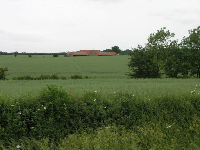
Great Morton Sale is a picturesque woodland located in Northamptonshire, England. Covering an expansive area, it is renowned for its diverse and enchanting forest. The woodland boasts an assortment of mature trees, including oak, beech, and birch, creating a rich tapestry of colors throughout the seasons.
This natural haven offers a tranquil escape for nature enthusiasts and outdoor adventurers. The forest is crisscrossed with well-maintained walking trails, allowing visitors to explore the beauty of the surroundings at their own pace. As they wander through the woodland, visitors can enjoy the soothing sounds of chirping birds, the rustling of leaves, and the occasional sighting of woodland creatures such as deer and squirrels.
The Great Morton Sale is also home to a variety of plant species, including beautiful wildflowers that add a splash of color to the forest floor. This biodiversity creates a vibrant ecosystem, supporting a range of wildlife.
In addition to its natural beauty, Great Morton Sale offers recreational activities for all ages. The forest has designated picnic areas and camping spots, allowing families and friends to enjoy a day out or a longer stay in the heart of nature. Furthermore, the woodland is a popular destination for birdwatching, photography, and nature study.
With its idyllic setting, diverse flora and fauna, and recreational opportunities, Great Morton Sale is a must-visit location for those seeking a serene and immersive experience in the natural wonders of Northamptonshire.
If you have any feedback on the listing, please let us know in the comments section below.
Great Morton Sale Images
Images are sourced within 2km of 52.562133/-0.47111436 or Grid Reference TL0397. Thanks to Geograph Open Source API. All images are credited.


Great Morton Sale is located at Grid Ref: TL0397 (Lat: 52.562133, Lng: -0.47111436)
Unitary Authority: North Northamptonshire
Police Authority: Northamptonshire
What 3 Words
///electric.outbid.smarting. Near Wansford, Cambridgeshire
Nearby Locations
Related Wikis
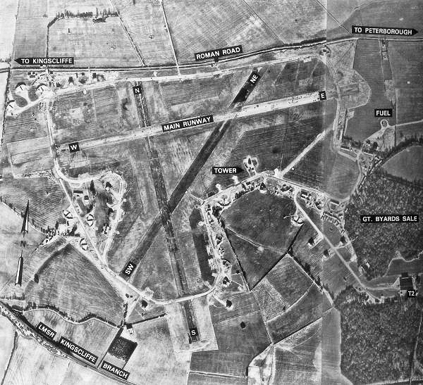
RAF Kings Cliffe
Royal Air Force Kings Cliffe or more simply RAF Kings Cliffe is a former Royal Air Force satellite station located near Kings Cliffe, Northamptonshire...
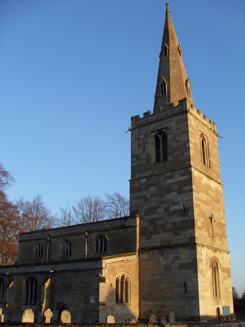
St Leonard's Church, Apethorpe
St Leonard's Church is an Anglican church in the village of Apethorpe in Northamptonshire, England. It is an active parish church in the Diocese of Peterborough...

Apethorpe
Apethorpe (pronounced "Ap-thorp") is a village, civil parish, former manor and ecclesiastical parish in Northamptonshire, England (in the North Northamptonshire...

Apethorpe Palace
Apethorpe Palace (pronounced Ap-thorp), formerly known as "Apethorpe Hall", is a Grade I listed country house, dating to the 15th century, close to Apethorpe...

King's Cliffe Banks
King's Cliffe Banks is a 7.7-hectare (19-acre) biological Site of Special Scientific Interest in King's Cliffe in Northamptonshire.This former quarry has...

Bedford Purlieus National Nature Reserve
Bedford Purlieus is a 211-hectare (520-acre) ancient woodland in Cambridgeshire, in the United Kingdom. It is a national nature reserve and Site of Special...

Woodnewton
Woodnewton is a village in Northamptonshire, England. Essentially a pair of parallel streets, the village lies to the north of a small stream, the Willow...

Yarwell
Yarwell is a village on the River Nene in the extreme east of the English county of Northamptonshire near the border with Cambridgeshire. Yarwell is one...
Related Videos

Landal - Rockingham Forest - Luxury Lodge Holiday
Take time to watch wildlife within peaceful forest or simply lay back & enjoy the comfort. From romantic retreats to fun family ...

Rockingham Forest Park Luxury Lodges: 5 Reasons Why YOU Should Stay at Landal Rockingham Forest
Rockingham Forest Park is one of our absolute favourite places to stay in the UK. This place offers luxury lodges, fantastic country ...

SIENNA LEARNS TO RIDE A BIKE | PLAYTIME | EXPRESSION SWING FAYRAH GOES TO ROBOT TOILET UNEXPECTEDLY
SIENNA LEARNS TO RIDE A BIKE | PLAYTIME | EXPRESSION SWING FAYRAH GOES TO ROBOT TOILET UNEXPECTEDLY ...

【4K】 ENGLISH VILLAGE | DJI MINI 2 | APETHORPE | 4K DRONE VIDEO TOUR
Apethorpe From Above Using My DJI Mavic Mini 2 In 4K, As You Can See Its A Beautiful Village Nestled In The Northamptonshire ...
Nearby Amenities
Located within 500m of 52.562133,-0.47111436Have you been to Great Morton Sale?
Leave your review of Great Morton Sale below (or comments, questions and feedback).