Furzefield Copse

Wood, Forest in Surrey Waverley

England

Furzefield Copse

Bungalows on Loxwood Road, Alfold Crossways
Bungalows on Loxwood Road, Alfold Crossways Credit: David Howard

Furzefield Copse is a captivating woodland situated in Surrey, England. Covering an area of approximately 50 hectares, this enchanting forest is a haven for nature enthusiasts and provides a peaceful escape from the bustling city life.

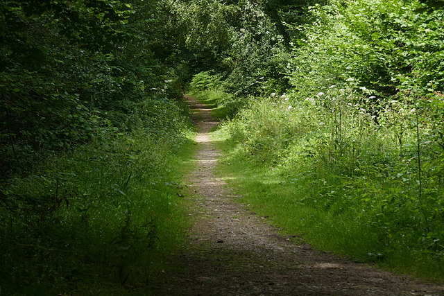
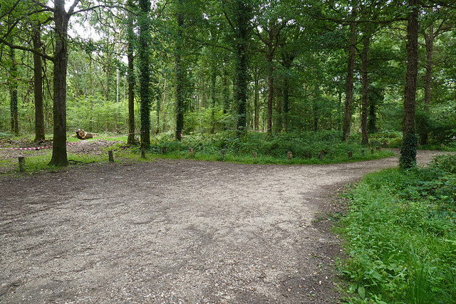
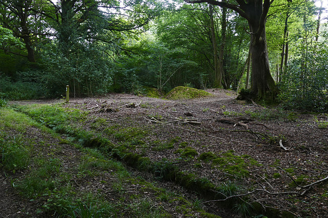
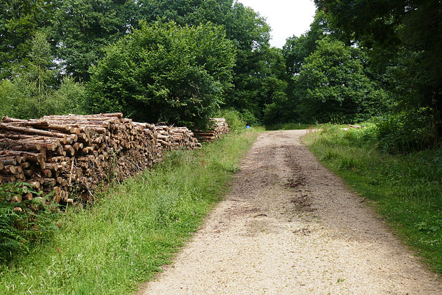
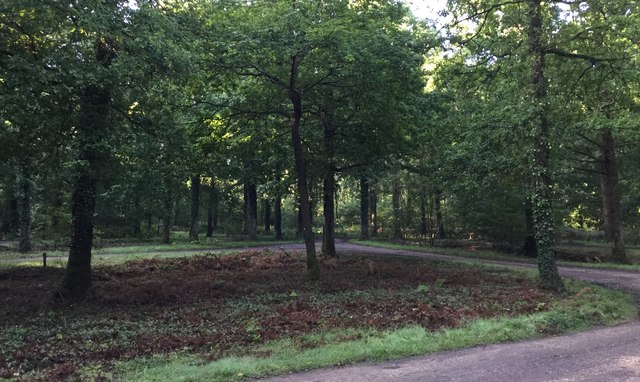
The copse is predominantly composed of mature deciduous trees, including oak, beech, and birch, which create a dense canopy overhead. These towering giants not only provide shade and shelter but also contribute to the copse's rich biodiversity. The forest floor is adorned with a vibrant carpet of wildflowers during spring, including bluebells, primroses, and wood anemones, adding a splash of color to the verdant landscape.

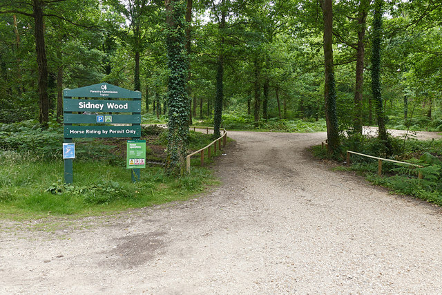
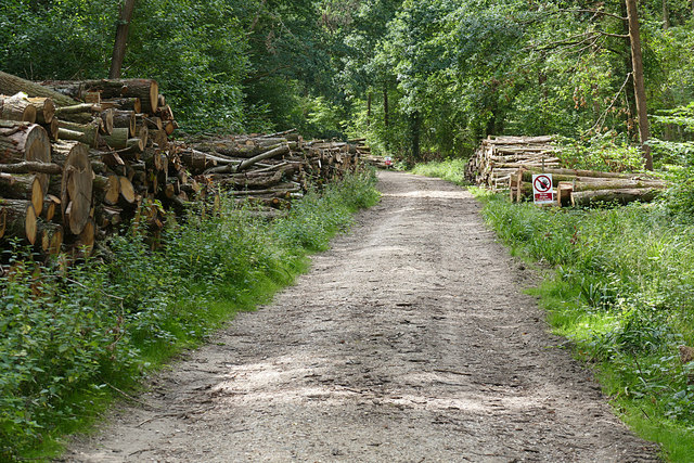
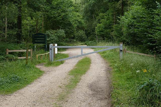
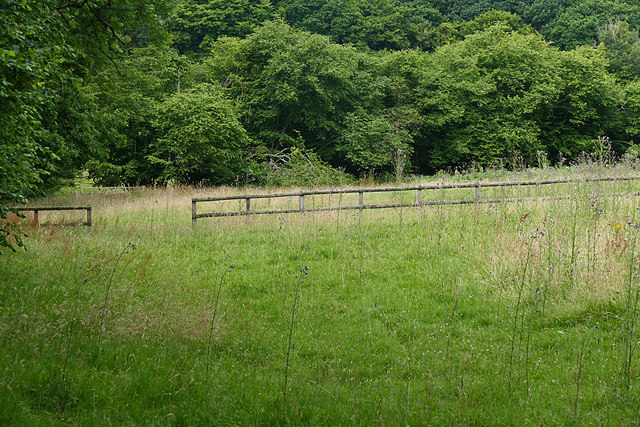
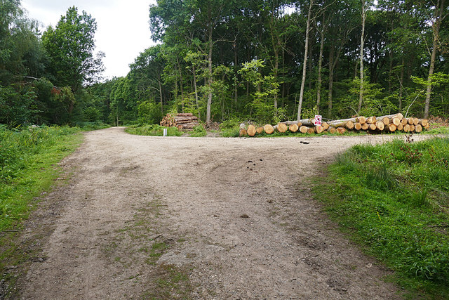
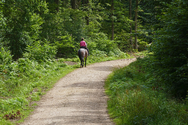
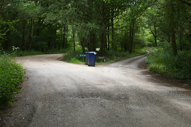
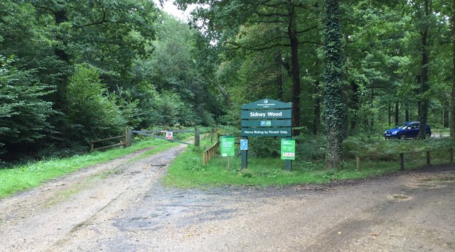
Numerous footpaths crisscross the copse, allowing visitors to explore its hidden treasures. These paths meander through the woodland, guiding visitors past ancient trees, babbling brooks, and moss-covered rocks. The peaceful ambiance of Furzefield Copse creates the perfect setting for a leisurely stroll, birdwatching, or simply immersing oneself in the tranquil surroundings.

As a haven for wildlife, Furzefield Copse teems with a diverse range of creatures. Squirrels scamper through the treetops, while rabbits dart in and out of the undergrowth. Birdsong fills the air, as various species, including robins, thrushes, and woodpeckers, make their homes within the copse. Lucky visitors may even catch a glimpse of shy deer grazing in the early morning mist.

Furzefield Copse is a precious natural gem, offering a tranquil retreat for those seeking solace in nature's embrace. Its breathtaking beauty and abundant wildlife make it an idyllic destination for nature lovers and a place to reconnect with the wonders of the natural world.

If you have any feedback on the listing, please let us know in the comments section below.

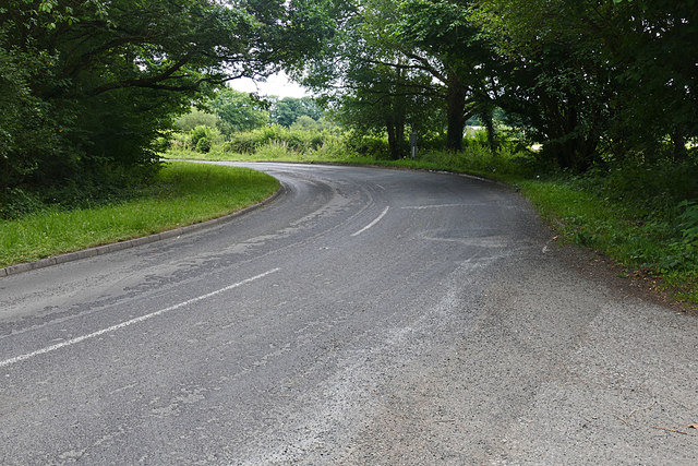
Furzefield Copse Images

Images are sourced within 2km of 51.10468/-0.52174592 or Grid Reference TQ0334. Thanks to Geograph Open Source API. All images are credited.

Bungalows on Loxwood Road, Alfold Crossways
Loxwood Road, Alfold Crossways
Sidney Wood car park The entrance to the car park in Sidney Wood, part of the Forest Enterprise Chiddingfold Forest complex.
Sidney Wood car park
The entrance to the car park in Sidney Wood, part of the Forest Enterprise Chiddingfold Forest complex.
Wood piles, Sidney Wood A track lined with recently harvested wood in this Forest Enterprise wood near Dunsfold.
Wood piles, Sidney Wood
A track lined with recently harvested wood in this Forest Enterprise wood near Dunsfold.
Dunsfold Road The rural road running south of the airfield from the entrance to Sidney Wood.
Dunsfold Road
The rural road running south of the airfield from the entrance to Sidney Wood.
Barrier, Sidney Wood A barrier across the track into Sidney Wood with the entrance to the carpark on the left just beyond.
Barrier, Sidney Wood
A barrier across the track into Sidney Wood with the entrance to the carpark on the left just beyond.
Overgrown track, Sidney Wood A shaded track through Sidney Wood. The left hand side was clear felled in the 1990s, now it is impenetrable.
Overgrown track, Sidney Wood
A shaded track through Sidney Wood. The left hand side was clear felled in the 1990s, now it is impenetrable.
Old paddock, Sidney Wood One of the paddocks off Sachell Hill, a public right of way near Sidney Wood.
Old paddock, Sidney Wood
One of the paddocks off Sachell Hill, a public right of way near Sidney Wood.
Sidney Wood car park The car park in the Forest Enterprise Sidney Wood.
Sidney Wood car park
The car park in the Forest Enterprise Sidney Wood.
Dunsfold Road Looking north towards Tickners Heath Farm.
Dunsfold Road
Looking north towards Tickners Heath Farm.
Forest Tracks, Sidney Wood The junction of two of the main forest tracks through Sidney Wood.
Forest Tracks, Sidney Wood
The junction of two of the main forest tracks through Sidney Wood.
Sachellhill Lane The junction of Sachelhill Lane, a footpath running along the east side of Sidney Wood, with the footpath off to the right towards Alfold.
Sachellhill Lane
The junction of Sachelhill Lane, a footpath running along the east side of Sidney Wood, with the footpath off to the right towards Alfold.
Paddocks, Sedgehurst The Paddocks of Sedgehurst, a property enclosed within the Forest Enterprise Sidney Wood.
Paddocks, Sedgehurst
The Paddocks of Sedgehurst, a property enclosed within the Forest Enterprise Sidney Wood.
Horse rider, Sidney Wood A horse rider on one of the main forestry tracks running through Sidney Wood.
Horse rider, Sidney Wood
A horse rider on one of the main forestry tracks running through Sidney Wood.
Sidney Wood, Dunsfold The main north south forestry track through Sidney Wood approaching the junction with the east west track.
Sidney Wood, Dunsfold
The main north south forestry track through Sidney Wood approaching the junction with the east west track.
The road to Sedgehurst The private road to Sedgehurst, a smallholding in Sidney Wood branching off from the car park access track.
The road to Sedgehurst
The private road to Sedgehurst, a smallholding in Sidney Wood branching off from the car park access track.
Sidney Wood Car Park Early morning at the car park.
Sidney Wood Car Park
Early morning at the car park.
Entrance to Sidney Wood Car Park The Forestry Commission Car Park at Sidney Wood.
Entrance to Sidney Wood Car Park
The Forestry Commission Car Park at Sidney Wood.
Show me another place!

Furzefield Copse is located at Grid Ref: TQ0334 (Lat: 51.10468, Lng: -0.52174592)

Administrative County: Surrey

District: Waverley

Police Authority: Surrey

What 3 Words

///relishing.mutual.barn. Near Cranleigh, Surrey

Related Wikis

Alfold F.C.

Alfold Football Club is a football club based in Alfold, Surrey, England. They are currently members of the Southern Combination Division One and play...

Alfold

Alfold is a village and civil parish in Surrey, England on the West Sussex border. Alfold is a dispersed or polyfocal village in the Green Belt, which...

Wey and Arun Canal

The Wey and Arun Canal is a partially open, 23-mile-long (37 km) canal in the southeast of England. It runs southwards from the River Wey at Gunsmouth...

Fir Tree Copse

Fir Tree Copse is a 6-hectare (15-acre) nature reserve south-east of Dunsfold in Surrey. It is managed by the Surrey Wildlife Trust and is part of the...

London to Portsmouth canal

The London to Portsmouth canal was a concept for the construction of a secure inland canal route from the British capital of London to the headquarters...

Dunsfold Aerodrome

Dunsfold Aerodrome (former ICAO code EGTD) is an unlicensed airfield in Surrey, England, near the village of Cranleigh. It extends across land in the villages...

Top Gear test track

The Top Gear test track is used by the BBC automotive television programme Top Gear. It is located at Dunsfold Aerodrome in Surrey, United Kingdom. The...

Rikkyo School in England

Rikkyo School in England (立教英国学院, Rikkyō Eikoku Gakuin) is a Japanese boarding primary and secondary school in Rudgwick, Horsham District, West Sussex...

Related Videos

Merry Christmas & Happy New Year

We would like to thank you all for your custom this year and wish you a very happy holiday. Best wishes. From everyone at MHH ...

SDTV’s Landor Experience- Exploring a 747!

landorexperience #britishairways #boeing #queenoftheskies #jumbojet #britshairways747 #747tour Hi all! Welcome to today's ...

on the Top Gear runway at Dunsfold.

I don't know how much my boss paid for it, but it must have been quite a few bob!!! For more travel videos from all over the world ...

Nearby Amenities

Located within 500m of 51.10468,-0.52174592
Bus Stop
Clappers Meadow
Naptan AtcoCode: 40004411041A
Naptan Bearing: S
Naptan CommonName: Clappers Meadow
Naptan Indicator: Just after
Naptan Landmark: Clappers Meadow
Naptan NaptanCode: surdtgtm
Naptan Street: Loxwood Road
Naptan Verified: no
Public Transport: platform
Source: naptan_import
Lat/Long: 51.1047668/-0.5163968
Bus Stop
Clappers Meadow
Naptan AtcoCode: 40004411041B
Naptan Bearing: N
Naptan BusStopType: CUS
Naptan CommonName: Clappers Meadow
Naptan Indicator: Just Before
Naptan Landmark: Clappers Meadow
Naptan NaptanCode: surgpaja
Naptan Street: Loxwood Road
Naptan Verified: no
Public Transport: platform
Source: naptan_import
Lat/Long: 51.1051887/-0.516367
Post Box
Collection Plate: CP7D
Collection Times: Mo-Fr 09:00; Sa 07:00
Operator: Royal Mail
Post Box Type: lamp
Ref: GU6 250D
Royal Cypher: EIIR
Royal Cypher Wikidata: Q33102113
Lat/Long: 51.1012005/-0.5229052
Eleven Acre Copse
Natural: wood
Lat/Long: 51.1068211/-0.5266215
Addr Housename: Little Pound
Lat/Long: 51.1029429/-0.5176434
Addr Housename: The Pound
Lat/Long: 51.102827/-0.517661
Addr Housenumber: 10
Lat/Long: 51.1028138/-0.5259682
Addr Housenumber: 9
Lat/Long: 51.1029098/-0.5258126
The data included in this document is from www.openstreetmap.org. The data is made available under ODbL.

Have you been to Furzefield Copse?

Leave your review of Furzefield Copse below (or comments, questions and feedback).