Nesfield's Plantation

Wood, Forest in Yorkshire Scarborough

England

Nesfield's Plantation

Fishing, The Mere, Scarborough Day 121: Olympus MJU 780 digital camera. 1/200 sec. f/3.3, 6.4 mm. ISO 80.
Fishing, The Mere, Scarborough Credit: JThomas

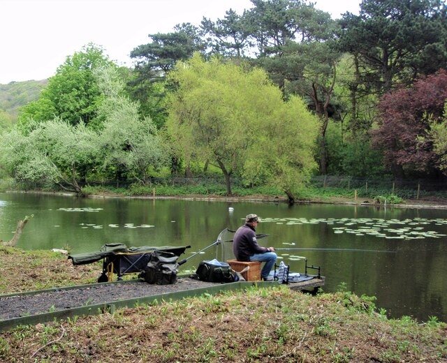
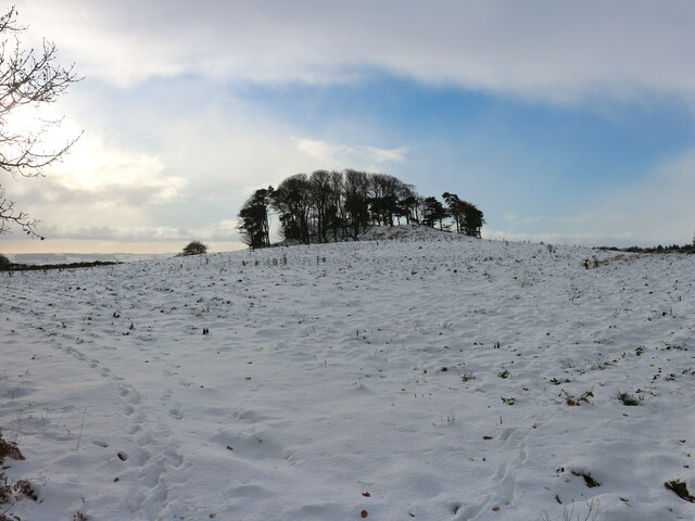
Nesfield's Plantation is a woodland located in Yorkshire, England. Situated in the scenic countryside of the region, it covers a vast area and is known for its lush greenery and diverse flora. The plantation is part of the wider Nesfield estate and has been well-preserved over the years, maintaining its natural beauty and serving as a valuable ecological habitat.

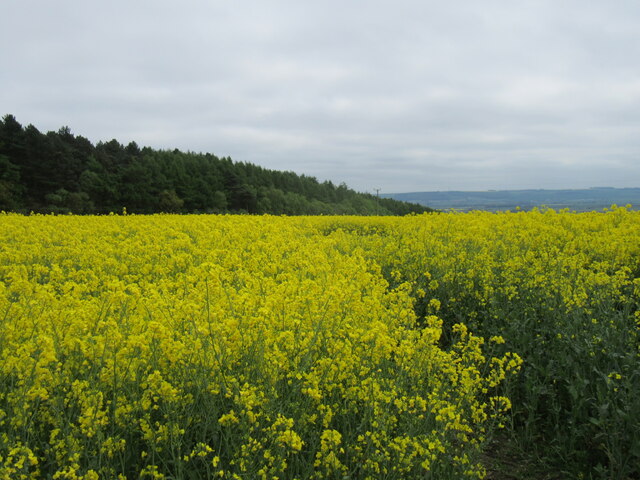
The woodland boasts a variety of tree species, including oak, beech, and birch, which create a dense canopy providing shelter and shade. Underneath, a rich undergrowth flourishes, with ferns, mosses, and wildflowers adding splashes of color to the forest floor. The plantation is also home to a range of wildlife, such as deer, squirrels, and various bird species, making it a popular spot for nature enthusiasts and photographers.

Nesfield's Plantation offers a network of well-maintained walking trails, allowing visitors to explore its enchanting surroundings. The paths wind through the woodland, providing opportunities to appreciate the tranquility and serenity of the area. Additionally, there are designated picnic areas where visitors can relax and enjoy the peaceful ambiance.

The plantation is open to the public year-round, attracting both locals and tourists alike. Its accessibility and proximity to nearby towns and villages make it a popular destination for day trips and outdoor activities. Nesfield's Plantation is not only a natural haven but also a place of historical significance, with traces of former agricultural use evident in some areas.

Overall, Nesfield's Plantation offers a captivating woodland experience, showcasing the beauty of Yorkshire's natural landscape and providing a sanctuary for both flora and fauna.

If you have any feedback on the listing, please let us know in the comments section below.

Nesfield's Plantation Images

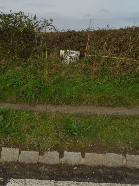
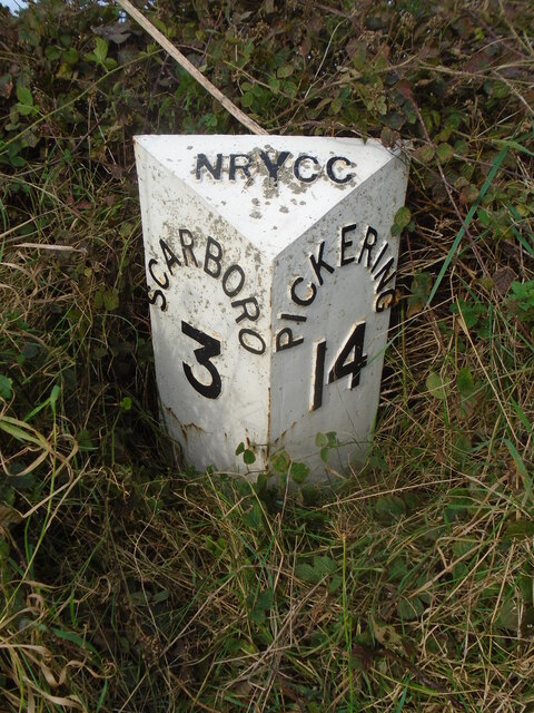
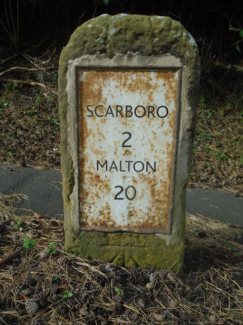
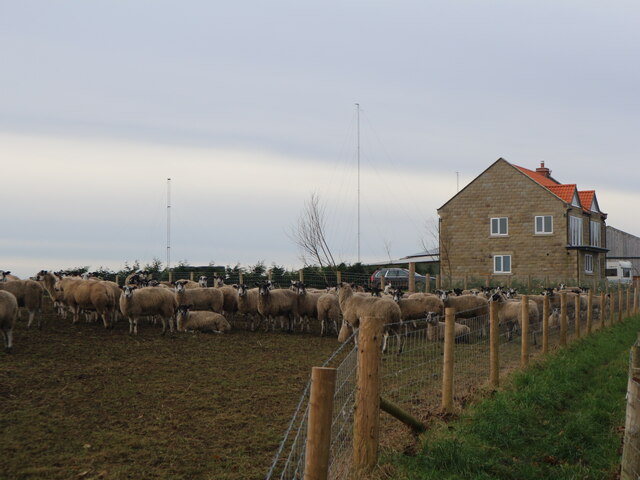
Images are sourced within 2km of 54.269967/-0.43598142 or Grid Reference TA0187. Thanks to Geograph Open Source API. All images are credited.

Fishing, The Mere, Scarborough Day 121: Olympus MJU 780 digital camera. 1/200 sec. f/3.3, 6.4 mm. ISO 80.
Fishing, The Mere, Scarborough
Day 121: Olympus MJU 780 digital camera. 1/200 sec. f/3.3, 6.4 mm. ISO 80.
The start of the Scarborough - Whitby railway Looking north towards Scalby.
The start of the Scarborough - Whitby railway
Looking north towards Scalby.
Sainsbury's Supermarket, Scarborough A large Sainsbury's supermarket located on land behind the terraced houses of Falsgrave Road.
Sainsbury's Supermarket, Scarborough
A large Sainsbury's supermarket located on land behind the terraced houses of Falsgrave Road.
Seamer Moor Lane
Seamer Moor Lane
Farmland near Irton
Farmland near Irton
Woodland Ravine This photograph of Woodland Ravine is taken from a slide with a process date of May 1973 and therefore could have been taken several weeks earlier.
Woodland Ravine
This photograph of Woodland Ravine is taken from a slide with a process date of May 1973 and therefore could have been taken several weeks earlier.
Benchmark in front of #34 Valley Road Ordnance Survey benchmark on the garden wall of #34 Valley Road and close to a telegraph pole. For a wider view see - <a href="https://www.geograph.org.uk/photo/7470126">TA0387 : Wall and benchmark of #34 Valley Road</a>
Benchmark in front of #34 Valley Road
Ordnance Survey benchmark on the garden wall of #34 Valley Road and close to a telegraph pole. For a wider view see - TA0387 : Wall and benchmark of #34 Valley Road
Wall and benchmark of #34 Valley Road The garden wall in front of #34 Valley Road has an Ordnance Survey benchmark just to the right of the telegraph pole - <a href="https://www.geograph.org.uk/photo/7470113">TA0387 : Benchmark in front of #34 Valley Road</a>
Wall and benchmark of #34 Valley Road
The garden wall in front of #34 Valley Road has an Ordnance Survey benchmark just to the right of the telegraph pole - TA0387 : Benchmark in front of #34 Valley Road
Benchmark by #45 Valley Road Ordnance Survey benchmark on the garden wall of #45 Valley Road, next door to Ashburton House B&B. For a wider view see <a href="https://www.geograph.org.uk/photo/7470333">TA0387 : Garden Wall and benchmark for #45 Valley Road</a>
Benchmark by #45 Valley Road
Ordnance Survey benchmark on the garden wall of #45 Valley Road, next door to Ashburton House B&B. For a wider view see TA0387 : Garden Wall and benchmark for #45 Valley Road
Garden Wall and benchmark for #45 Valley Road Stone garden wall and Ordnance Survey benchmark for #45 Valley Road, adjacent to Ashburton House B&B. For a close up see <a href="https://www.geograph.org.uk/photo/7470332">TA0387 : Benchmark by #45 Valley Road</a>
Garden Wall and benchmark for #45 Valley Road
Stone garden wall and Ordnance Survey benchmark for #45 Valley Road, adjacent to Ashburton House B&B. For a close up see TA0387 : Benchmark by #45 Valley Road
Benchmark on garden wall of #53 Valley Road Ordnance Survey benchmark on the south facing garden wall of #53 Valley Road. The cut mark was levelled at 30.812m above Newlyn Datum, verified 1968. For a wider view see <a href="https://www.geograph.org.uk/photo/7473901">TA0387 : Valley Road and its junction with Westbourne Grove</a>
Benchmark on garden wall of #53 Valley Road
Ordnance Survey benchmark on the south facing garden wall of #53 Valley Road. The cut mark was levelled at 30.812m above Newlyn Datum, verified 1968. For a wider view see TA0387 : Valley Road and its junction with Westbourne Grove
Valley Road and its junction with Westbourne Grove Valley Road turns right at its junction with Westbourne Grove joining from the left. There is an Ordnance Survey benchmark on the low stone wall on the right, close to the gatepost <a href="https://www.geograph.org.uk/photo/7473806">TA0387 : Benchmark on garden wall of #53 Valley Road</a>
Valley Road and its junction with Westbourne Grove
Valley Road turns right at its junction with Westbourne Grove joining from the left. There is an Ordnance Survey benchmark on the low stone wall on the right, close to the gatepost TA0387 : Benchmark on garden wall of #53 Valley Road
Moor Lane view Looking SE from Moor Lane.
Moor Lane view
Looking SE from Moor Lane.
Seamer Beacon in the snow Taken from a similar position as my earlier image <a href="https://www.geograph.org.uk/photo/4162501">TA0087 : Seamer Beacon</a> this shows the tree covered hill on Seamer Moor called Seamer Beacon in the snow. It is a natural hill the western slopes of which has three round barrows though the summit barrow was flattened in the 19th century when a folly known as Baron Albert's Tower was erected on it.
Seamer Beacon in the snow
Taken from a similar position as my earlier image TA0087 : Seamer Beacon this shows the tree covered hill on Seamer Moor called Seamer Beacon in the snow. It is a natural hill the western slopes of which has three round barrows though the summit barrow was flattened in the 19th century when a folly known as Baron Albert's Tower was erected on it.
Old milepost On the A170 about a mile east of Great Ayton this North Riding of Yorkshire milepost did its best to hide in the neglected verge.  It is southeast of a wood and a minor crossroads on Seamer Moor Hill.
Old milepost
On the A170 about a mile east of Great Ayton this North Riding of Yorkshire milepost did its best to hide in the neglected verge. It is southeast of a wood and a minor crossroads on Seamer Moor Hill.
Old milepost Grass and twigs cleared away the legends on the late 19thC or early 20thC milepost on the A170, Racecourse Road/Seamer Moor Hill, east of East Ayton can be seen.
Old milepost
Grass and twigs cleared away the legends on the late 19thC or early 20thC milepost on the A170, Racecourse Road/Seamer Moor Hill, east of East Ayton can be seen.
Old milestone Since Malton 13 there have no more of these stones along the original route of the York-Malton-Scarborough turnpike, 1752-1865, now A170.   This one is on Stepney Road, Scarborough.   In 2013 a Milestone Society member found the 33 x 55cm plate was loose on the worn stone.   It was just held in place by a prong on each corner.   Presumably all the other milestones like this one still to be found on the route from Malton are attached in the same way.  The plate was removed, repainted and reattached with lime mortar.  There is a benchmark at the base of the stone.
Old milestone
Since Malton 13 there have no more of these stones along the original route of the York-Malton-Scarborough turnpike, 1752-1865, now A170. This one is on Stepney Road, Scarborough. In 2013 a Milestone Society member found the 33 x 55cm plate was loose on the worn stone. It was just held in place by a prong on each corner. Presumably all the other milestones like this one still to be found on the route from Malton are attached in the same way. The plate was removed, repainted and reattached with lime mortar. There is a benchmark at the base of the stone.
New Farmhouse, Seamer Moor Erected during 2022 the new farmhouse stands at the top of the scarp edge  of  Row Brow over looking Scarborough. Taken from the public footpath that runs in front of the house. In the background can be seen one of the barns erected in 2018 and shown in <a href="https://www.geograph.org.uk/photo/5649120">TA0186 : A  new  barn  being  erected  in  a  field</a>.
New Farmhouse, Seamer Moor
Erected during 2022 the new farmhouse stands at the top of the scarp edge of Row Brow over looking Scarborough. Taken from the public footpath that runs in front of the house. In the background can be seen one of the barns erected in 2018 and shown in TA0186 : A new barn being erected in a field.
Show me another place!

Nesfield's Plantation is located at Grid Ref: TA0187 (Lat: 54.269967, Lng: -0.43598142)

Division: North Riding

Administrative County: North Yorkshire

District: Scarborough

Police Authority: North Yorkshire

What 3 Words

///icons.glaze.party. Near Scarborough, North Yorkshire

Related Wikis

St Augustine's Catholic School

St Augustine's Catholic School is a co-educational secondary school located in Scarborough, North Yorkshire, England. The school is under the jurisdiction...

Scarborough Sixth Form College

Scarborough Sixth Form College is located on the outskirts of Scarborough, North Yorkshire, England. == Background == The Sixth form college offers a variety...
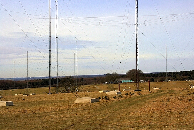
GCHQ Scarborough

GCHQ Scarborough is a satellite ground station located on Irton Moor, on the outskirts of Scarborough in North Yorkshire, England, operated by the British...

Graham School

Graham School is a coeducational secondary school in the west of Scarborough in North Yorkshire, England. It is situated to the west of the town within...

Nearby Amenities

Located within 500m of 54.269967,-0.43598142
Man Made: mast
Tower Type: communication
Lat/Long: 54.2672391/-0.4419175
Man Made: tower
Tower Type: communication
Lat/Long: 54.2667804/-0.4382981
Sandybed
Place: suburb
Lat/Long: 54.2732389/-0.4312841
The data included in this document is from www.openstreetmap.org. The data is made available under ODbL.

Have you been to Nesfield's Plantation?

Leave your review of Nesfield's Plantation below (or comments, questions and feedback).