Dropshort Plantation

Wood, Forest in Bedfordshire

England

Dropshort Plantation

Pylons near Ossory Farm
Pylons near Ossory Farm Credit: Mark Anderson

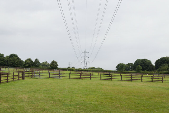
Dropshort Plantation is a woodland area located in Bedfordshire, England. Covering an area of approximately 30 hectares, the plantation is a designated Site of Special Scientific Interest (SSSI) due to its significant ecological value.

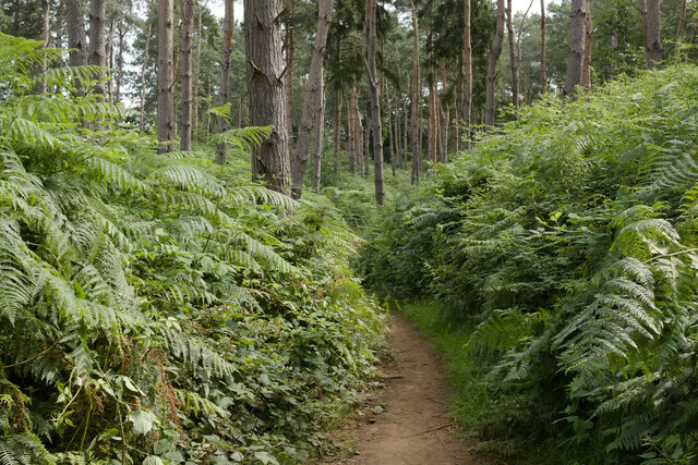
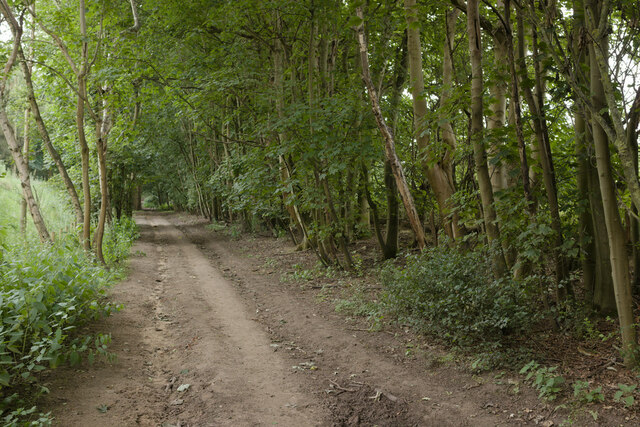
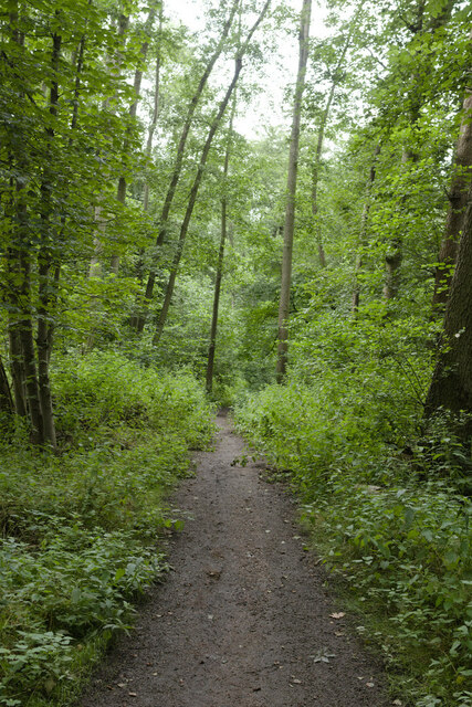
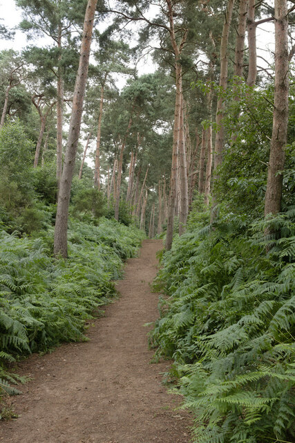
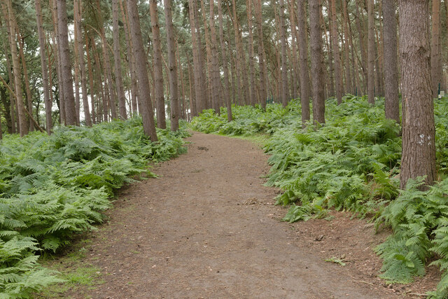
The woodland is predominantly composed of native broadleaf trees, including oak, birch, and beech, creating a diverse and vibrant ecosystem. The dense canopy provides a habitat for various animal species, such as birds, squirrels, and deer. The undergrowth is rich in native wildflowers, ferns, and mosses, contributing to the overall biodiversity of the area.

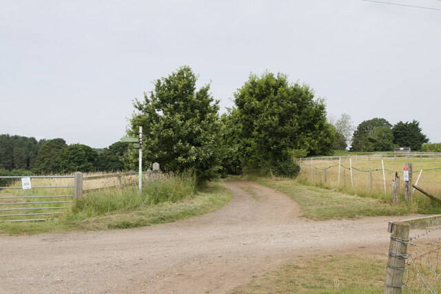
The plantation is managed by the local Bedfordshire Wildlife Trust, which ensures the preservation of its natural features. They maintain a network of well-maintained footpaths and trails that allow visitors to explore the woodland and enjoy its beauty. The trails are suitable for both walkers and cyclists, providing an opportunity for outdoor recreation and exercise.

Dropshort Plantation is not only a haven for wildlife but also serves as a valuable carbon sink, absorbing and storing carbon dioxide from the atmosphere. This contributes to mitigating the effects of climate change and helps maintain the overall environmental balance.

In addition to its ecological significance, the plantation also holds historical value. It is believed that the woodland has been present for centuries, with some parts potentially dating back to medieval times. The rich history and natural beauty make Dropshort Plantation a popular destination for nature enthusiasts, hikers, and those seeking a peaceful retreat in the heart of Bedfordshire.

If you have any feedback on the listing, please let us know in the comments section below.

Dropshort Plantation Images

Images are sourced within 2km of 52.03234/-0.51788149 or Grid Reference TL0138. Thanks to Geograph Open Source API. All images are credited.

Pylons near Ossory Farm
Footpath junction near Warren Farm
Cut Bench Mark, St Michael's Church, Millbrook Bench Mark Database: <span class="nowrap"><a title="https://www.bench-marks.org.uk/bm152583" rel="nofollow ugc noopener" href="https://www.bench-marks.org.uk/bm152583">Link</a><img style="margin-left:2px;" alt="External link" title="External link - shift click to open in new window" src="https://s1.geograph.org.uk/img/external.png" width="10" height="10"/></span>
Cut Bench Mark, St Michael's Church, Millbrook
Bench Mark Database: LinkExternal link
St Michael's Church, Millbrook There is a cut bench mark on the buttress to the right of the photograph and a closer view can be seen here: <a href="https://www.geograph.org.uk/photo/6922586">TL0138 : Cut Bench Mark, St Michael's Church, Millbrook</a>.
St Michael's Church, Millbrook
There is a cut bench mark on the buttress to the right of the photograph and a closer view can be seen here: TL0138 : Cut Bench Mark, St Michael's Church, Millbrook.
Path near Millbrook The path has been diverted so that it now meets the road at a traffic light controlled crossing.
Path near Millbrook
The path has been diverted so that it now meets the road at a traffic light controlled crossing.
Bridleway in the Woods This bridleway runs between Woburn Road and the edge of the Center Parcs holiday village.
Bridleway in the Woods
This bridleway runs between Woburn Road and the edge of the Center Parcs holiday village.
Bridleway near Center Parcs
Bridleway near Pond Plantation
Bridleway, Moor Plantation
Bridleway to the East of Center Parcs
Bridleway near Fordfield Farm
Center Parcs Center Parcs Woburn Forest
Center Parcs
Center Parcs Woburn Forest
Treehouse Holiday Lodge Treehouse accommodation, Center Parcs Woburn Forest.
Treehouse Holiday Lodge
Treehouse accommodation, Center Parcs Woburn Forest.
Holiday Lodges, Center Parcs
Christmas Bauble Sculpture, Center Parcs
Public bridleway on Jackdaw Hill (2) Forming part of the Greensand Ridge Walk and the John Bunyan Trail.
Public bridleway on Jackdaw Hill (2)
Forming part of the Greensand Ridge Walk and the John Bunyan Trail.
Public bridleway on Jackdaw Hill (3) Forming part of the Greensand Ridge Walk and the John Bunyan Trail.
Public bridleway on Jackdaw Hill (3)
Forming part of the Greensand Ridge Walk and the John Bunyan Trail.
Public bridleway on Jackdaw Hill (4) Linking the Greensand Ridge Walk and the John Bunyan Trail with the Marston Vale Trail a short distance west of their junction.
Public bridleway on Jackdaw Hill (4)
Linking the Greensand Ridge Walk and the John Bunyan Trail with the Marston Vale Trail a short distance west of their junction.
Show me another place!

Dropshort Plantation is located at Grid Ref: TL0138 (Lat: 52.03234, Lng: -0.51788149)

Unitary Authority: Central Bedfordshire

Police Authority: Bedfordshire

What 3 Words

///pulses.inflating.unusable. Near Millbrook, Bedfordshire

Related Wikis

Ampthill Tunnel

Ampthill tunnel is a railway tunnel at Ampthill on the Midland Main Line, being positioned between Bedford and Flitwick. It consists of two separate bores...

Millbrook Priory

Millbrook Priory was a priory in Bedfordshire, England. It was established in 1097 and disestablished in 1143. The little Priory of Beaulieu at Moddry...

Millbrook, Bedfordshire

Millbrook is a small village and civil parish near Bedford, England. It has a population of 130, increasing to 147 at the 2011 Census. Millbrook railway...

Ampthill Town F.C.

Ampthill Town Football Club is a football club based in Ampthill, Bedfordshire, England. The club are currently members of Spartan South Midlands League...

Nearby Amenities

Located within 500m of 52.03234,-0.51788149
Power: tower
Lat/Long: 52.0301653/-0.5159582
Power: tower
Lat/Long: 52.0333078/-0.5154845
Power: tower
Lat/Long: 52.0360762/-0.5151581
Barrier: swing_gate
Lat/Long: 52.0338185/-0.5112704
Post Box
Collection Times: Mo-Fr 09:00; Sa 07:00
Operator: Royal Mail
Post Box Type: wall
Ref: MK45 158D
Royal Cypher: EIIR
Royal Cypher Wikidata: Q33102113
Source: survey
Survey Date: 2016-12-12
Lat/Long: 52.0345687/-0.5235477
Ampthill Park
Leisure: park
Lat/Long: 52.0330119/-0.511132
Colour: red and white
Marker: aerial
Material: plastic
Utility: gas
Lat/Long: 52.03291/-0.5151336
Colour: red and white
Marker: aerial
Material: plastic
Utility: gas
Lat/Long: 52.0329331/-0.51481
Colour: red
Marker: post
Material: concrete
Utility: gas
Lat/Long: 52.0330993/-0.5148134
Colour: red and white
Marker: aerial
Material: plastic
Utility: gas
Lat/Long: 52.0323439/-0.5183104
Colour: red
Marker: post
Material: plastic
Utility: gas
Lat/Long: 52.0325453/-0.5182414
Colour: yellow
Marker: post
Material: concrete
Utility: gas
Lat/Long: 52.0323682/-0.5182966
Colour: yellow
Marker: post
Material: concrete
Utility: gas
Lat/Long: 52.0329333/-0.5148225
Man Made: street_cabinet
Utility: yes;gas
Lat/Long: 52.033079/-0.5150717
Barrier: swing_gate
Lat/Long: 52.0345022/-0.5116689
Ampthill Park
Leisure: park
Lat/Long: 52.0346099/-0.5129146
Bicycle: yes
Information: route_marker
Tourism: information
Lat/Long: 52.0316921/-0.5216669
The data included in this document is from www.openstreetmap.org. The data is made available under ODbL.

Have you been to Dropshort Plantation?

Leave your review of Dropshort Plantation below (or comments, questions and feedback).