Jewings Hurst

Wood, Forest in Surrey Waverley

England

Jewings Hurst

Bridleway 285 Dunsfold by The Mill House The overgrown mill pond is on the left.
Bridleway 285 Dunsfold by The Mill House Credit: Robin Webster

Jewings Hurst is a small village located in the county of Surrey, England. Situated in the heart of the Surrey Hills, it is surrounded by picturesque woodlands and forests, making it a haven for nature enthusiasts and outdoor lovers.

The village is characterized by its charming rural setting, with a scattering of traditional cottages and farmhouses nestled amongst the lush greenery. The woodlands that surround Jewings Hurst offer a tranquil escape from the hustle and bustle of city life, providing ample opportunities for hiking, cycling, and wildlife spotting.

The area is known for its diverse range of flora and fauna, with ancient oak and beech trees dominating the landscape. The woodlands are also home to various wildlife species, including deer, foxes, and a wide array of bird species.

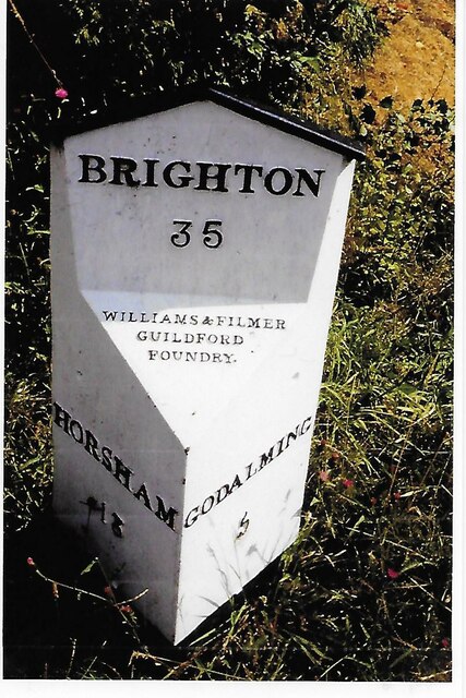
Jewings Hurst is located within close proximity to several other notable attractions in Surrey. The nearby town of Guildford offers a range of amenities, including shops, restaurants, and cultural attractions such as Guildford Castle and the Yvonne Arnaud Theatre.

For those seeking a peaceful retreat in the countryside, Jewings Hurst provides a perfect getaway. The village's natural beauty, combined with its convenient location, makes it an ideal destination for both day trips and longer stays. Whether it's exploring the enchanting woodlands or simply enjoying the serenity of rural life, Jewings Hurst offers a truly idyllic experience for visitors.

If you have any feedback on the listing, please let us know in the comments section below.

Jewings Hurst Images

Images are sourced within 2km of 51.119426/-0.55178124 or Grid Reference TQ0136. Thanks to Geograph Open Source API. All images are credited.

Bridleway 285 Dunsfold by The Mill House The overgrown mill pond is on the left.
Bridleway 285 Dunsfold by The Mill House
The overgrown mill pond is on the left.
Digger in yard, Field Place Farm It is making good the site of a former farm building.
Digger in yard, Field Place Farm
It is making good the site of a former farm building.
Field west of Hook House Lane
Fields west of Hook House Lane with water trough The nearer posts seem to have insulators but no electric fence wires.
Fields west of Hook House Lane with water trough
The nearer posts seem to have insulators but no electric fence wires.
Private drive leading to Pear Tree Green So says the large signpost, but the small one says public footpath. It is footpath 204 Dunsfold, a way towards Breakneck Hill.
Private drive leading to Pear Tree Green
So says the large signpost, but the small one says public footpath. It is footpath 204 Dunsfold, a way towards Breakneck Hill.
Barns at Red Leaf Farm A non-farming farm now.
Barns at Red Leaf Farm
A non-farming farm now.
Old Milestone, was at Park Hatch, B2130, Dunsfold Road The milestone was located opposite the junction with Dunsfold Common Road, on the East side of the road on the verge beside the drive to the house. Parish of Dunsfold (Waverley district). Cast iron post, Guildford iron casting design, erected by Godalming & Painshill turnpike trust in the 19th century.

Inscription read:-  HORSHAM / 13  ::  GODALMING / 5  ::  BRIGHTON / 35

This image was taken before 2003 when the milestone was smashed by a flail and the remains later totally removed.

Milestone Society National ID: SY_HOGO13
Old Milestone, was at Park Hatch, B2130, Dunsfold Road
The milestone was located opposite the junction with Dunsfold Common Road, on the East side of the road on the verge beside the drive to the house. Parish of Dunsfold (Waverley district). Cast iron post, Guildford iron casting design, erected by Godalming & Painshill turnpike trust in the 19th century. Inscription read:- HORSHAM / 13 :: GODALMING / 5 :: BRIGHTON / 35 This image was taken before 2003 when the milestone was smashed by a flail and the remains later totally removed. Milestone Society National ID: SY_HOGO13
Oak Tree Lane, Dunsfold Along the north side of the common.
Oak Tree Lane, Dunsfold
Along the north side of the common.
Houses on Oak Tree Lane, Dunsfold Oak Tree Cottage is the near house, Pond Cottage the far. Both are grade II listed buildings.
Houses on Oak Tree Lane, Dunsfold
Oak Tree Cottage is the near house, Pond Cottage the far. Both are grade II listed buildings.
Bridleway 285 Dunsfold Heading west towards Chiddingfold Road.
Bridleway 285 Dunsfold
Heading west towards Chiddingfold Road.
River Lox by bridleway bridge The mill stream from Dunsfold Mill (near) rejoins the main river here.
River Lox by bridleway bridge
The mill stream from Dunsfold Mill (near) rejoins the main river here.
Bridge over River Lox Bridleway 285 Dunsfold crosses.
Bridge over River Lox
Bridleway 285 Dunsfold crosses.
Barn at The Mill House
Animal shelter near former Dunsfold Mill Not in residence currently.
Animal shelter near former Dunsfold Mill
Not in residence currently.
Hedgerow trees, Dunsfold
Valley north of Hook House Lane
Hedge and field east of Hook House Lane
Narrow view south-east from Telegraph Hill Towards Dunsfold Aerodrome. Trees generally obscure views from the hill, which could not have been the case in telegraph days.
Narrow view south-east from Telegraph Hill
Towards Dunsfold Aerodrome. Trees generally obscure views from the hill, which could not have been the case in telegraph days.
Show me another place!

Jewings Hurst is located at Grid Ref: TQ0136 (Lat: 51.119426, Lng: -0.55178124)

Administrative County: Surrey

District: Waverley

Police Authority: Surrey

What 3 Words

///backers.purchaser.audit. Near Chiddingfold, Surrey

Related Wikis

Top Gear test track

The Top Gear test track is used by the BBC automotive television programme Top Gear. It is located at Dunsfold Aerodrome in Surrey, United Kingdom. The...

Dunsfold

Dunsfold is a village in the borough of Waverley, Surrey, England, 8.7 miles (14.0 kilometres) south of Guildford. It lies in the Weald and reaches in...

Dunsfold Aerodrome

Dunsfold Aerodrome (former ICAO code EGTD) is an unlicensed airfield in Surrey, England, near the village of Cranleigh. It extends across land in the villages...

Fir Tree Copse

Fir Tree Copse is a 6-hectare (15-acre) nature reserve south-east of Dunsfold in Surrey. It is managed by the Surrey Wildlife Trust and is part of the...

Wey and Arun Canal

The Wey and Arun Canal is a partially open, 23-mile-long (37 km) canal in the southeast of England. It runs southwards from the River Wey at Gunsmouth...

Hascombe Hill

Hascombe Hill or Hascombe Camp is the site of an Iron Age multivallate hill fort close to the village of Hascombe in Surrey, England. == History == The...

London to Portsmouth canal

The London to Portsmouth canal was a concept for the construction of a secure inland canal route from the British capital of London to the headquarters...

Alfold F.C.

Alfold Football Club is a football club based in Alfold, Surrey, England. They are currently members of the Southern Combination Division One and play...

Nearby Amenities

Located within 500m of 51.119426,-0.55178124
Barrier: stile
Lat/Long: 51.1181027/-0.5499396
Barrier: bollard
Lat/Long: 51.1183522/-0.5497393
Barrier: bollard
Lat/Long: 51.1189153/-0.5474193
Man Made: tower
Tower Type: communication
Lat/Long: 51.1189647/-0.5469098
The data included in this document is from www.openstreetmap.org. The data is made available under ODbL.

Have you been to Jewings Hurst?

Leave your review of Jewings Hurst below (or comments, questions and feedback).