Chennell's Copse

Wood, Forest in Surrey Waverley

England

Chennell's Copse

Bridleway 285 Dunsfold by The Mill House The overgrown mill pond is on the left.
Bridleway 285 Dunsfold by The Mill House Credit: Robin Webster

Chennell's Copse is a picturesque woodland located in the county of Surrey, England. Stretching across an area of approximately 100 acres, this enchanting forest is a haven for nature lovers, hikers, and wildlife enthusiasts alike.

The copse is characterized by its dense canopy of various tree species, including oak, beech, and birch. The trees form a majestic green cover, providing shelter and a habitat for a diverse range of flora and fauna. The forest floor is carpeted with a rich tapestry of wildflowers, ferns, and mushrooms, adding to the area's natural beauty.

Tranquil walking trails wind their way through Chennell's Copse, offering visitors the chance to immerse themselves in the serene surroundings. These paths lead explorers through sun-dappled clearings, babbling brooks, and hidden glens, creating a sense of tranquility and escape from the hustle and bustle of everyday life.

The copse is also home to a variety of wildlife, including deer, foxes, badgers, and a plethora of bird species. Birdwatchers can spot robins, blue tits, woodpeckers, and even the occasional owl perched on a branch. The forest is also known for its vibrant butterfly population, with numerous species fluttering amongst the foliage.

Chennell's Copse is a cherished natural treasure, with its untouched beauty and peaceful atmosphere providing a much-needed respite for visitors seeking solace in nature. Whether it's a leisurely stroll, a picnic in the shade, or simply a moment of tranquility, this woodland offers a truly enchanting experience for all who venture into its depths.

If you have any feedback on the listing, please let us know in the comments section below.

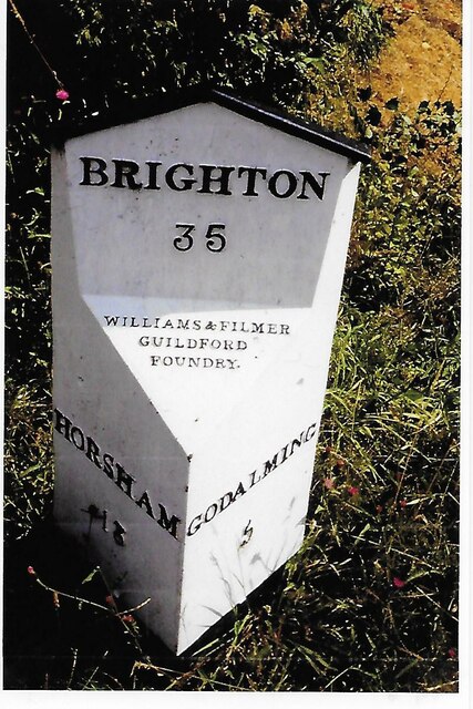
Chennell's Copse Images

Images are sourced within 2km of 51.119324/-0.55659963 or Grid Reference TQ0136. Thanks to Geograph Open Source API. All images are credited.

Bridleway 285 Dunsfold by The Mill House The overgrown mill pond is on the left.
Bridleway 285 Dunsfold by The Mill House
The overgrown mill pond is on the left.
Digger in yard, Field Place Farm It is making good the site of a former farm building.
Digger in yard, Field Place Farm
It is making good the site of a former farm building.
Field west of Hook House Lane
Fields west of Hook House Lane with water trough The nearer posts seem to have insulators but no electric fence wires.
Fields west of Hook House Lane with water trough
The nearer posts seem to have insulators but no electric fence wires.
Private drive leading to Pear Tree Green So says the large signpost, but the small one says public footpath. It is footpath 204 Dunsfold, a way towards Breakneck Hill.
Private drive leading to Pear Tree Green
So says the large signpost, but the small one says public footpath. It is footpath 204 Dunsfold, a way towards Breakneck Hill.
Barns at Red Leaf Farm A non-farming farm now.
Barns at Red Leaf Farm
A non-farming farm now.
Old Milestone, was at Park Hatch, B2130, Dunsfold Road The milestone was located opposite the junction with Dunsfold Common Road, on the East side of the road on the verge beside the drive to the house. Parish of Dunsfold (Waverley district). Cast iron post, Guildford iron casting design, erected by Godalming & Painshill turnpike trust in the 19th century.

Inscription read:-  HORSHAM / 13  ::  GODALMING / 5  ::  BRIGHTON / 35

This image was taken before 2003 when the milestone was smashed by a flail and the remains later totally removed.

Milestone Society National ID: SY_HOGO13
Old Milestone, was at Park Hatch, B2130, Dunsfold Road
The milestone was located opposite the junction with Dunsfold Common Road, on the East side of the road on the verge beside the drive to the house. Parish of Dunsfold (Waverley district). Cast iron post, Guildford iron casting design, erected by Godalming & Painshill turnpike trust in the 19th century. Inscription read:- HORSHAM / 13 :: GODALMING / 5 :: BRIGHTON / 35 This image was taken before 2003 when the milestone was smashed by a flail and the remains later totally removed. Milestone Society National ID: SY_HOGO13
Oak Tree Lane, Dunsfold Along the north side of the common.
Oak Tree Lane, Dunsfold
Along the north side of the common.
Houses on Oak Tree Lane, Dunsfold Oak Tree Cottage is the near house, Pond Cottage the far. Both are grade II listed buildings.
Houses on Oak Tree Lane, Dunsfold
Oak Tree Cottage is the near house, Pond Cottage the far. Both are grade II listed buildings.
Bridleway 285 Dunsfold Heading west towards Chiddingfold Road.
Bridleway 285 Dunsfold
Heading west towards Chiddingfold Road.
River Lox by bridleway bridge The mill stream from Dunsfold Mill (near) rejoins the main river here.
River Lox by bridleway bridge
The mill stream from Dunsfold Mill (near) rejoins the main river here.
Bridge over River Lox Bridleway 285 Dunsfold crosses.
Bridge over River Lox
Bridleway 285 Dunsfold crosses.
Barn at The Mill House
Animal shelter near former Dunsfold Mill Not in residence currently.
Animal shelter near former Dunsfold Mill
Not in residence currently.
Hedgerow trees, Dunsfold
Valley north of Hook House Lane
Hedge and field east of Hook House Lane
Narrow view south-east from Telegraph Hill Towards Dunsfold Aerodrome. Trees generally obscure views from the hill, which could not have been the case in telegraph days.
Narrow view south-east from Telegraph Hill
Towards Dunsfold Aerodrome. Trees generally obscure views from the hill, which could not have been the case in telegraph days.
Show me another place!

Chennell's Copse is located at Grid Ref: TQ0136 (Lat: 51.119324, Lng: -0.55659963)

Administrative County: Surrey

District: Waverley

Police Authority: Surrey

What 3 Words

///wonderfully.rave.sparrows. Near Chiddingfold, Surrey

Related Wikis

Dunsfold

Dunsfold is a village in the borough of Waverley, Surrey, England, 8.7 miles (14.0 kilometres) south of Guildford. It lies in the Weald and reaches in...

Top Gear test track

The Top Gear test track is used by the BBC automotive television programme Top Gear. It is located at Dunsfold Aerodrome in Surrey, United Kingdom. The...

Dunsfold Aerodrome

Dunsfold Aerodrome (former ICAO code EGTD) is an unlicensed airfield in Surrey, England, near the village of Cranleigh. It extends across land in the villages...

Fir Tree Copse

Fir Tree Copse is a 6-hectare (15-acre) nature reserve south-east of Dunsfold in Surrey. It is managed by the Surrey Wildlife Trust and is part of the...

Hascombe Hill

Hascombe Hill or Hascombe Camp is the site of an Iron Age multivallate hill fort close to the village of Hascombe in Surrey, England. == History == The...

Wey and Arun Canal

The Wey and Arun Canal is a partially open, 23-mile-long (37 km) canal in the southeast of England. It runs southwards from the River Wey at Gunsmouth...

London to Portsmouth canal

The London to Portsmouth canal was a concept for the construction of a secure inland canal route from the British capital of London to the headquarters...

Alfold F.C.

Alfold Football Club is a football club based in Alfold, Surrey, England. They are currently members of the Southern Combination Division One and play...

Nearby Amenities

Located within 500m of 51.119324,-0.55659963
Dunsfold
Is In: Surrey
Place: village
Wikidata: Q2346748
Wikipedia: en:Dunsfold
Lat/Long: 51.1164663/-0.5617782
Bus Stop
Binhams Meadow
Naptan AtcoCode: 40004411098A
Naptan Bearing: S
Naptan CommonName: Binhams Meadow
Naptan Indicator: Just Before
Naptan Landmark: Binhams Meadow
Naptan NaptanCode: surdtmgw
Naptan Street: Dunsfold Common Road
Naptan Verified: no
Public Transport: platform
Source: naptan_import
Lat/Long: 51.1190766/-0.563445
Bus Stop
Binhams Meadow
Naptan AtcoCode: 40004411098B
Naptan Bearing: N
Naptan BusStopType: CUS
Naptan CommonName: Binhams Meadow
Naptan Indicator: Just after
Naptan Landmark: Binhams Meadow
Naptan NaptanCode: surgpdjm
Naptan Street: Dunsfold Common Road
Naptan Verified: no
Public Transport: platform
Source: naptan_import
Lat/Long: 51.1189857/-0.563587
Telephone Exchange
Lat/Long: 51.1165402/-0.561968
Barrier: stile
Lat/Long: 51.1181027/-0.5499396
Barrier: bollard
Lat/Long: 51.1183522/-0.5497393
Barrier: stile
Lat/Long: 51.1232338/-0.5599972
Addr Housenumber: 5
Lat/Long: 51.1170292/-0.5616129
Addr Housenumber: 4
Lat/Long: 51.1169794/-0.5622989
Addr Housenumber: 1
Lat/Long: 51.1169653/-0.5626079
Addr Housenumber: 13
Lat/Long: 51.1175626/-0.5621016
Addr Housenumber: 14
Lat/Long: 51.117645/-0.5621363
Entrance: main
Lat/Long: 51.1184995/-0.5629249
Addr Housenumber: 8
Lat/Long: 51.1189423/-0.5617542
Addr Housenumber: 1
Lat/Long: 51.1188704/-0.562497
Addr Housenumber: 19
Lat/Long: 51.1181425/-0.5621959
Addr Housenumber: 24
Lat/Long: 51.1186221/-0.5622494
Addr Housenumber: 1
Lat/Long: 51.1178399/-0.5630448
The data included in this document is from www.openstreetmap.org. The data is made available under ODbL.

Have you been to Chennell's Copse?

Leave your review of Chennell's Copse below (or comments, questions and feedback).