Bedham Copse

Wood, Forest in Sussex Chichester

England

Bedham Copse

Woodland at Arundel Holt
Woodland at Arundel Holt Credit: Martyn Pattison

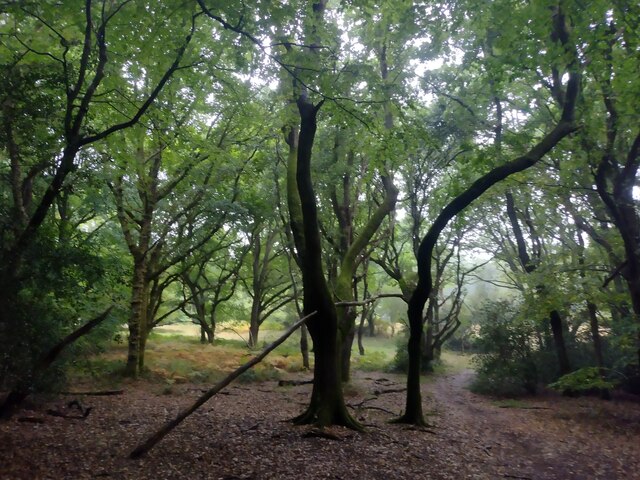
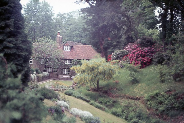
Bedham Copse is a serene and picturesque woodland located in the county of Sussex, England. Spanning across an area of approximately 50 acres, it is nestled in the heart of the South Downs National Park, making it a popular destination for nature enthusiasts and hikers alike.

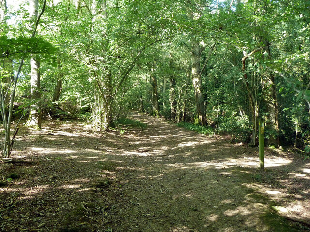
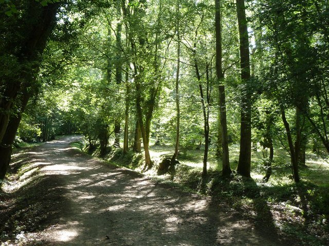
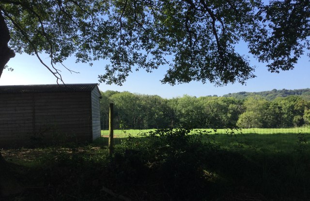
The copse is primarily composed of a mixture of broadleaf trees, including oak, beech, and ash, creating a diverse and vibrant ecosystem. The dense canopy provides shelter and nesting sites for a variety of avian species, making it a haven for birdwatchers. Additionally, the forest floor is adorned with an array of wildflowers, adding splashes of color to the landscape during the spring and summer months.

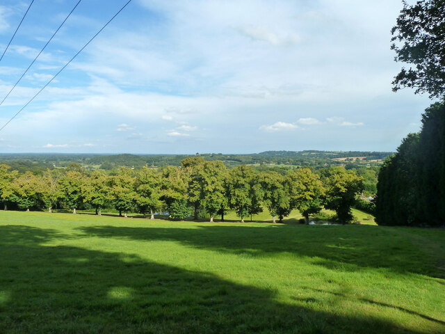
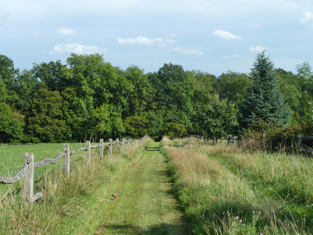
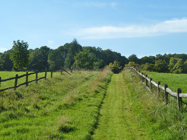
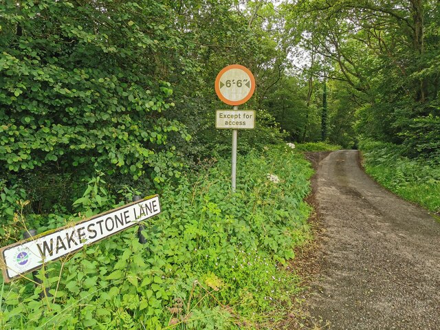
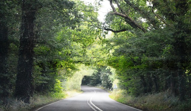
Tranquil footpaths wind their way through the copse, providing visitors with the opportunity to immerse themselves in the captivating beauty of nature. The paths are well-maintained, making them accessible for walkers of all abilities. Along the way, there are several designated viewpoints that offer breathtaking vistas of the surrounding countryside, including the rolling hills and valleys that characterize the Sussex landscape.

Bedham Copse is also home to a rich variety of wildlife. Deer, foxes, and badgers can often be spotted wandering through the undergrowth, while squirrels and rabbits scurry about in search of food. The copse is a designated Site of Special Scientific Interest (SSSI), highlighting its importance in preserving and protecting the native flora and fauna.

In conclusion, Bedham Copse is a captivating woodland in Sussex that boasts a diverse range of trees, wildlife, and scenic vistas. Whether you are seeking a peaceful walk, a birdwatching adventure, or simply a place to reconnect with nature, this enchanting forest is sure to leave a lasting impression.

If you have any feedback on the listing, please let us know in the comments section below.

Bedham Copse Images

Images are sourced within 2km of 50.989331/-0.55636065 or Grid Reference TQ0122. Thanks to Geograph Open Source API. All images are credited.

Woodland at Arundel Holt
Ruin, Bedham Built 1880 as a church and school, the school use closing in 1925 and final closure in 1959.
Ruin, Bedham
Built 1880 as a church and school, the school use closing in 1925 and final closure in 1959.
View east over field north of Mockbeggars
Footpath past pond by Mockbeggars Public footpath 776 passes between the pond and the buildings of Mockbeggars off to the right.
Footpath past pond by Mockbeggars
Public footpath 776 passes between the pond and the buildings of Mockbeggars off to the right.
Footpath 776 south-west from Mockbeggars
Footpath 776 towards Mockbeggars and Bedham Lane
Crossways in Quay Copse Bridleway 709, straight on, crosses footpath 776, right and left.
Crossways in Quay Copse
Bridleway 709, straight on, crosses footpath 776, right and left.
Bridleway 3421 in Quay Copse A way up from Pallingham Quay.
Bridleway 3421 in Quay Copse
A way up from Pallingham Quay.
Wakestone Lane
Wakestone Lane
Crowsole Mill At Little Bognor.
Crowsole Mill
At Little Bognor.
A272, Foxhill The A272 is a very rural A road, which follows an east to west route from near Heathfield to Winchester, passing through the Sussex countryside. It runs 86 miles from Sutton Scotney to Five Ashes <a href="https://www.geograph.org.uk/photo/6669405">TQ5523 : A267, A272 junction</a>.
<span class="nowrap"><a title="http://www.sabre-roads.org.uk/wiki/index.php?title=A272" rel="nofollow ugc noopener" href="http://www.sabre-roads.org.uk/wiki/index.php?title=A272">Link</a><img style="margin-left:2px;" alt="External link" title="External link - shift click to open in new window" src="https://s1.geograph.org.uk/img/external.png" width="10" height="10"/></span> 
Wikipedia: <span class="nowrap"><a title="http://en.wikipedia.org/wiki/A272_road" rel="nofollow ugc noopener" href="http://en.wikipedia.org/wiki/A272_road">Link</a><img style="margin-left:2px;" alt="External link" title="External link - shift click to open in new window" src="https://s1.geograph.org.uk/img/external.png" width="10" height="10"/></span>
A272, Foxhill
The A272 is a very rural A road, which follows an east to west route from near Heathfield to Winchester, passing through the Sussex countryside. It runs 86 miles from Sutton Scotney to Five Ashes TQ5523 : A267, A272 junction. LinkExternal link Wikipedia: LinkExternal link
A272 The A272 is a very rural A road, which follows an east to west route from near Heathfield to Winchester, passing through the Sussex countryside. It runs 86 miles from Sutton Scotney to Five Ashes <a href="https://www.geograph.org.uk/photo/6669405">TQ5523 : A267, A272 junction</a>.
<span class="nowrap"><a title="http://www.sabre-roads.org.uk/wiki/index.php?title=A272" rel="nofollow ugc noopener" href="http://www.sabre-roads.org.uk/wiki/index.php?title=A272">Link</a><img style="margin-left:2px;" alt="External link" title="External link - shift click to open in new window" src="https://s1.geograph.org.uk/img/external.png" width="10" height="10"/></span> 
Wikipedia: <span class="nowrap"><a title="http://en.wikipedia.org/wiki/A272_road" rel="nofollow ugc noopener" href="http://en.wikipedia.org/wiki/A272_road">Link</a><img style="margin-left:2px;" alt="External link" title="External link - shift click to open in new window" src="https://s1.geograph.org.uk/img/external.png" width="10" height="10"/></span>
A272
The A272 is a very rural A road, which follows an east to west route from near Heathfield to Winchester, passing through the Sussex countryside. It runs 86 miles from Sutton Scotney to Five Ashes TQ5523 : A267, A272 junction. LinkExternal link Wikipedia: LinkExternal link
A272, The Mens The A272 is a very rural A road, which follows an east to west route from near Heathfield to Winchester, passing through the Sussex countryside. It runs 86 miles from Sutton Scotney to Five Ashes <a href="https://www.geograph.org.uk/photo/6669405">TQ5523 : A267, A272 junction</a>.
<span class="nowrap"><a title="http://www.sabre-roads.org.uk/wiki/index.php?title=A272" rel="nofollow ugc noopener" href="http://www.sabre-roads.org.uk/wiki/index.php?title=A272">Link</a><img style="margin-left:2px;" alt="External link" title="External link - shift click to open in new window" src="https://s1.geograph.org.uk/img/external.png" width="10" height="10"/></span> 
Wikipedia: <span class="nowrap"><a title="http://en.wikipedia.org/wiki/A272_road" rel="nofollow ugc noopener" href="http://en.wikipedia.org/wiki/A272_road">Link</a><img style="margin-left:2px;" alt="External link" title="External link - shift click to open in new window" src="https://s1.geograph.org.uk/img/external.png" width="10" height="10"/></span>
A272, The Mens
The A272 is a very rural A road, which follows an east to west route from near Heathfield to Winchester, passing through the Sussex countryside. It runs 86 miles from Sutton Scotney to Five Ashes TQ5523 : A267, A272 junction. LinkExternal link Wikipedia: LinkExternal link
A272 The A272 is a very rural A road, which follows an east to west route from near Heathfield to Winchester, passing through the Sussex countryside. It runs 86 miles from Sutton Scotney to Five Ashes <a href="https://www.geograph.org.uk/photo/6669405">TQ5523 : A267, A272 junction</a>.
<span class="nowrap"><a title="http://www.sabre-roads.org.uk/wiki/index.php?title=A272" rel="nofollow ugc noopener" href="http://www.sabre-roads.org.uk/wiki/index.php?title=A272">Link</a><img style="margin-left:2px;" alt="External link" title="External link - shift click to open in new window" src="https://s1.geograph.org.uk/img/external.png" width="10" height="10"/></span> 
Wikipedia: <span class="nowrap"><a title="http://en.wikipedia.org/wiki/A272_road" rel="nofollow ugc noopener" href="http://en.wikipedia.org/wiki/A272_road">Link</a><img style="margin-left:2px;" alt="External link" title="External link - shift click to open in new window" src="https://s1.geograph.org.uk/img/external.png" width="10" height="10"/></span>
A272
The A272 is a very rural A road, which follows an east to west route from near Heathfield to Winchester, passing through the Sussex countryside. It runs 86 miles from Sutton Scotney to Five Ashes TQ5523 : A267, A272 junction. LinkExternal link Wikipedia: LinkExternal link
Barn in field A view of a barn in a field with the Bedham Hills in the background, taken from the Wey-South path.
Barn in field
A view of a barn in a field with the Bedham Hills in the background, taken from the Wey-South path.
Westlands beside the Wey-South Path A view of Westlands taken from the Wey-South path. A curious sign on the side of the building warns of low flying owls.
Westlands beside the Wey-South Path
A view of Westlands taken from the Wey-South path. A curious sign on the side of the building warns of low flying owls.
Round Copse Round Copse taken from the Wey-South path, with steps leading into a property.
Round Copse
Round Copse taken from the Wey-South path, with steps leading into a property.
Bedham Lane, Fittleworth
Show me another place!

Bedham Copse is located at Grid Ref: TQ0122 (Lat: 50.989331, Lng: -0.55636065)

Administrative County: West Sussex

District: Chichester

Police Authority: Sussex

What 3 Words

///palm.boomed.alerting. Near Petworth, West Sussex

Related Wikis

Bognor Common Quarry

Bognor Common Quarry is a 25.1-hectare (62-acre) geological Site of Special Scientific Interest east of Petworth in West Sussex. It is a Geological Conservation...

The Mens

The Mens is a 205.2-hectare (507-acre) biological Site of Special Scientific Interest west of Billingshurst in West Sussex. It is a Nature Conservation...
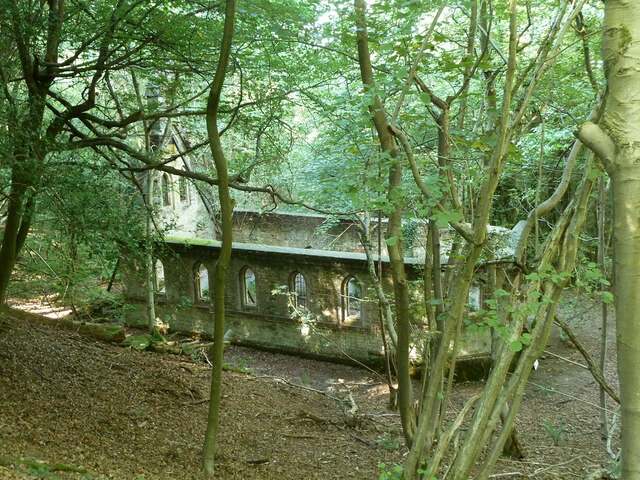
Bedham

Bedham is a hamlet 4 kilometres (2+1⁄2 miles) east of Petworth in the Chichester District of West Sussex, England. It is in the civil parish of Wisborough...

Egdean

Egdean (pronounced Egg-deen) is a small village in the Chichester district of West Sussex, England. It lies just off the A283 road 1.7 miles (2.8 km) southeast...

Fittleworth

Fittleworth is a village and civil parish in the District of Chichester in West Sussex, England located seven kilometres (3 miles) west from Pulborough...

Upper Arun

Upper Arun is a 17.6-hectare (43-acre) biological Site of Special Scientific Interest between Billingshurst and Pulborough in West Sussex.This 13-kilometre...

Stopham

Stopham is a hamlet and civil parish in the District of Chichester in West Sussex, England, about 1.5 miles (2.4 km) west of Pulborough on the A283 road...

Sacred Heart Church, Petworth

Sacred Heart Church is a Roman Catholic Parish church in Petworth, West Sussex, England. It was built in 1896 and designed by Frederick Walters. It is...

Nearby Amenities

Located within 500m of 50.989331,-0.55636065
Bedham
Is In: West Sussex, England, UK
Place: hamlet
Source: npe
Lat/Long: 50.9875752/-0.5515312
Barrier: block
Note: 3 massive rocks
Lat/Long: 50.9868206/-0.559891
Barrier: block
Note: tree
Lat/Long: 50.9896756/-0.5588064
Post Box
Ref: RH20 105
Lat/Long: 50.9871444/-0.5521281
Man Made: survey_point
Ref: S6411
Lat/Long: 50.9908965/-0.5601141
Place Of Worship
Bedham Old Church
Denomination: anglican
Disused: yes
Religion: christian
Ruins: church
Lat/Long: 50.9889528/-0.5544804
The data included in this document is from www.openstreetmap.org. The data is made available under ODbL.

Have you been to Bedham Copse?

Leave your review of Bedham Copse below (or comments, questions and feedback).