Priestley Plantation

Wood, Forest in Bedfordshire

England

Priestley Plantation

Farmland, Tingrith Spring barley to the north of Castle Farm.
Farmland, Tingrith Credit: Andrew Smith

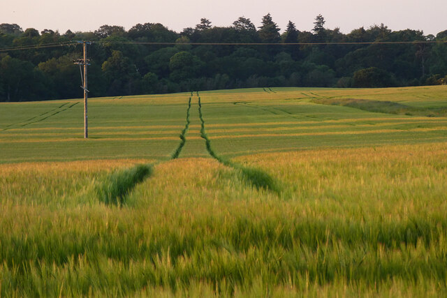
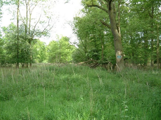
Priestley Plantation is a stunning woodland area located in Bedfordshire, England. Spanning over 100 acres, this plantation is a haven for nature enthusiasts and those seeking tranquility in the heart of the countryside. The plantation is situated on the outskirts of the picturesque village of Priestley, surrounded by rolling hills and lush green fields.

The woodland, consisting mainly of native broadleaf trees such as oak, beech, and ash, offers a diverse and rich habitat for a wide range of flora and fauna. A network of well-maintained footpaths and trails allows visitors to explore the plantation at their own pace, while also protecting the delicate ecosystem. As visitors meander through the plantation, they may encounter various species of birds, including woodpeckers and owls, as well as small mammals like foxes and rabbits.

Priestley Plantation is not only a natural paradise but also a site of historical significance. The area has been used for timber production for centuries, with evidence of charcoal production dating back to the medieval period. Today, the woodland is managed sustainably, with selective logging and replanting taking place to ensure the continued health and vitality of the forest.

Visitors to Priestley Plantation can enjoy a range of outdoor activities, including walking, jogging, and cycling. The plantation also offers designated picnic areas, allowing families and friends to relax and enjoy the peaceful surroundings. With its breathtaking beauty and rich biodiversity, Priestley Plantation is a must-visit destination for anyone seeking an escape from the bustle of everyday life.

If you have any feedback on the listing, please let us know in the comments section below.

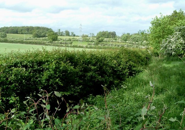
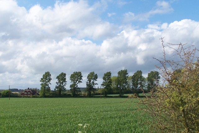
Priestley Plantation Images

Images are sourced within 2km of 51.989767/-0.52804033 or Grid Reference TL0133. Thanks to Geograph Open Source API. All images are credited.

Farmland, Tingrith Spring barley to the north of Castle Farm.
Farmland, Tingrith
Spring barley to the north of Castle Farm.
B road crossing M1 southbound
Footbridge crossing M1 southbound
Matrix gantry - M1 southbound
Footbridge over M1 southbound
Field access track Wood House is in Daintry Wood uses this track.
Field access track
Wood House is in Daintry Wood uses this track.
Southbound M1 near to Tingrith The M1 is a north–south motorway connecting London to Leeds, where it joins the A1(M) near Aberford. It was the first motorway to be completed in the United Kingdom.
The motorway is 193 miles long and was constructed in four phases. Most of the motorway was opened between 1959 and 1968 but the southern end was extended in 1977 and the northern end was extended in 1999.
Southbound M1 near to Tingrith
The M1 is a north–south motorway connecting London to Leeds, where it joins the A1(M) near Aberford. It was the first motorway to be completed in the United Kingdom. The motorway is 193 miles long and was constructed in four phases. Most of the motorway was opened between 1959 and 1968 but the southern end was extended in 1977 and the northern end was extended in 1999.
Bridge Over the M1 near Tingrith The M1 is a north–south motorway connecting London to Leeds, where it joins the A1(M) near Aberford. It was the first motorway to be completed in the United Kingdom.
The motorway is 193 miles long and was constructed in four phases. Most of the motorway was opened between 1959 and 1968 but the southern end was extended in 1977 and the northern end was extended in 1999.
Bridge Over the M1 near Tingrith
The M1 is a north–south motorway connecting London to Leeds, where it joins the A1(M) near Aberford. It was the first motorway to be completed in the United Kingdom. The motorway is 193 miles long and was constructed in four phases. Most of the motorway was opened between 1959 and 1968 but the southern end was extended in 1977 and the northern end was extended in 1999.
Kingshoe Wood The little green sign says "Private Woods, Keep Out". This wood borders the M1 for about half a mile.
Kingshoe Wood
The little green sign says "Private Woods, Keep Out". This wood borders the M1 for about half a mile.
View back to M1 from near Kingshoe Wood Taken from the opposite side of the road from Kingshoe Wood (See <a href="https://www.geograph.org.uk/photo/171929">SP9934 : Kingshoe Wood</a>), this view is across fields to where the M1 cuts straight across the fields. The line of the M1 can be made out by the three thin lampposts.
View back to M1 from near Kingshoe Wood
Taken from the opposite side of the road from Kingshoe Wood (See SP9934 : Kingshoe Wood), this view is across fields to where the M1 cuts straight across the fields. The line of the M1 can be made out by the three thin lampposts.
Rads End Farm This mellow bricked farm is on a right/left kink in the lane through Higher & Lower Rads End. I think the wooden top to the roof is a dovecote, and it looks as though two of its residents are flying above it.
Rads End Farm
This mellow bricked farm is on a right/left kink in the lane through Higher & Lower Rads End. I think the wooden top to the roof is a dovecote, and it looks as though two of its residents are flying above it.
Trees feeling the force of the wind strong winds blowing from left to right
Trees feeling the force of the wind
strong winds blowing from left to right
Gap in the Hedge Start of a footpath going through some woodland, close to M1.  Not used very often - hence the overgrown appearance
Gap in the Hedge
Start of a footpath going through some woodland, close to M1. Not used very often - hence the overgrown appearance
Road Junction Close to Eversholt.
Road Junction
Close to Eversholt.
Pumping Station, Steppingley ... and a white van. Not one of the fine Victorian Gothic pumping stations - more Brutalist really ! The track continuing on past the pumping station is part of the John Bunyan Trail.
Pumping Station, Steppingley
... and a white van. Not one of the fine Victorian Gothic pumping stations - more Brutalist really ! The track continuing on past the pumping station is part of the John Bunyan Trail.
The French Horn, Steppingley Now Steppingley's only pub, as the other one is now an Indian restaurant called "Saffron"
The French Horn, Steppingley
Now Steppingley's only pub, as the other one is now an Indian restaurant called "Saffron"
Near Flitwick Plantation On the road between Steppingley and Eversholt. The North-Eastern border of Flitwick Plantation is just ahead to the left of the road while a bluebell wood (<a href="https://www.geograph.org.uk/photo/173716">TL0034 : Bluebells in Rod Wood</a>) on the right near Warren Farm stops a little further on.
Near Flitwick Plantation
On the road between Steppingley and Eversholt. The North-Eastern border of Flitwick Plantation is just ahead to the left of the road while a bluebell wood (TL0034 : Bluebells in Rod Wood) on the right near Warren Farm stops a little further on.
Peakes End, Steppingley Peakes End (no sign of an apostrophe) is a little back lane in Steppingley. It leads to Park Farm which is in the adjacent southern square ([TL0134])
Peakes End, Steppingley
Peakes End (no sign of an apostrophe) is a little back lane in Steppingley. It leads to Park Farm which is in the adjacent southern square ([TL0134])
Show me another place!

Priestley Plantation is located at Grid Ref: TL0133 (Lat: 51.989767, Lng: -0.52804033)

Unitary Authority: Central Bedfordshire

Police Authority: Bedfordshire

What 3 Words

///skater.landscape.start. Near Steppingley, Bedfordshire

Nearby Locations

Priestley Plantation

Related Wikis

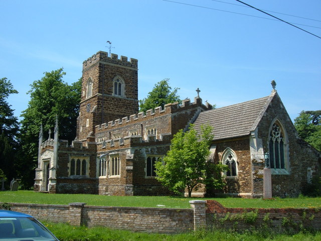
Church of St Nicholas, Tingrith

The Church of St Nicholas is a Grade I listed church in Tingrith, Bedfordshire, England. It became a listed building on 23 January 1961.The brown sandstone...

Tingrith

Tingrith is a small village and civil parish in Bedfordshire, England. It is located adjacent to the M1 motorway near the large village of Toddington....

Eversholt

Eversholt is a village and civil parish located in Bedfordshire, England. It was mentioned in the Domesday Book and is over 1000 years old. "Eversholt...

Flitwick Castle

Flitwick Castle was an 11th-century castle located in the town of Flitwick, in the county of Bedfordshire, England. It was a small, timber Motte-and-bailey...

Nearby Amenities

Located within 500m of 51.989767,-0.52804033
Power: tower
Lat/Long: 51.9913859/-0.5340734
Power: tower
Lat/Long: 51.9857443/-0.5267272
Power: tower
Lat/Long: 51.9870322/-0.5287924
Power: tower
Lat/Long: 51.9896608/-0.5211019
Power: tower
Lat/Long: 51.9924554/-0.5231833
Speed Camera
Lat/Long: 51.9906744/-0.5347651
Post Box
Brand: Royal Mail
Brand Wikidata: Q638098
Brand Wikipedia: en:Royal Mail
Collection Times: Mo-Fr 16:45; Sa 07:30
Operator: Royal Mail
Operator Wikidata: Q638098
Post Box Type: lamp
Ref: MK17 488
Royal Cypher: EIIR
Royal Cypher Wikidata: Q33102113
Source: survey
Lat/Long: 51.9886155/-0.5321567
Power: tower
Lat/Long: 51.9887607/-0.5315733
Power: pole
Lat/Long: 51.9925112/-0.5238166
Power: pole
Lat/Long: 51.9916293/-0.5231622
Power: pole
Lat/Long: 51.9907308/-0.522489
Power: pole
Lat/Long: 51.989013/-0.5212069
Power: pole
Lat/Long: 51.9926268/-0.5226526
Power: pole
Lat/Long: 51.991768/-0.5219981
Power: pole
Lat/Long: 51.9909141/-0.5213758
Colour: red and white
Marker: aerial
Material: plastic
Utility: gas
Lat/Long: 51.9896435/-0.5221606
Power: pole
Lat/Long: 51.9939238/-0.5267937
Power: pole
Lat/Long: 51.9935004/-0.5275403
Power: pole
Lat/Long: 51.9929667/-0.5285136
The data included in this document is from www.openstreetmap.org. The data is made available under ODbL.

Have you been to Priestley Plantation?

Leave your review of Priestley Plantation below (or comments, questions and feedback).