Roberts's Wood

Wood, Forest in Buckinghamshire

England

Roberts's Wood

Pasture, Chalfont St Peter
Pasture, Chalfont St Peter Credit: Andrew Smith

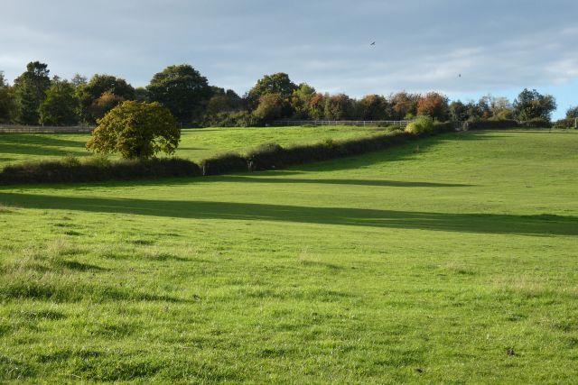
Roberts's Wood is a picturesque woodland located in Buckinghamshire, England. Covering an area of approximately 100 acres, it is a cherished natural gem in the heart of the county. The woodland is named after the Roberts family, who have owned and maintained the land for generations.

The wood boasts a diverse range of tree species, including oak, beech, and birch, creating a rich and vibrant canopy that provides shade and shelter for a variety of wildlife. The forest floor is adorned with a carpet of bluebells in the spring, creating a breathtaking sight for visitors.

Roberts's Wood is a haven for nature enthusiasts and offers numerous walking trails that wind through its enchanting landscape. Visitors can explore the wood's meandering paths, which offer glimpses of hidden ponds, meadows, and clearings. The tranquil atmosphere and the gentle rustle of leaves make it an ideal escape from the hustle and bustle of everyday life.

The wood is also home to a diverse array of wildlife, including deer, badgers, foxes, and a wide variety of bird species. Birdwatchers can spot woodpeckers, owls, and warblers amongst the branches, while those with a keen eye may catch a glimpse of a red squirrel darting through the trees.

Roberts's Wood is a cherished local treasure, loved by both residents and visitors alike. Its natural beauty and serene ambiance make it a perfect destination for nature lovers, hikers, and those seeking a peaceful retreat in the heart of Buckinghamshire.

If you have any feedback on the listing, please let us know in the comments section below.

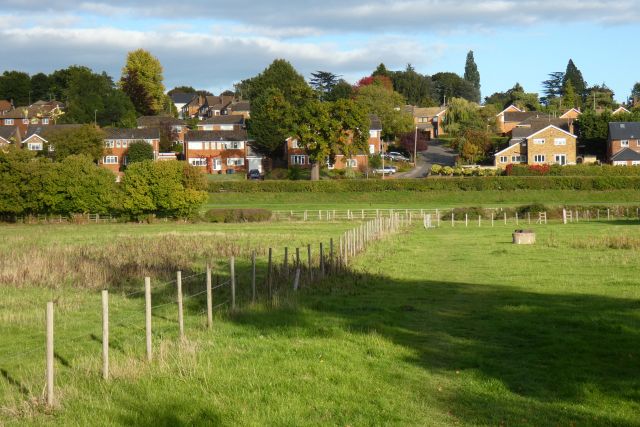
Roberts's Wood Images

Images are sourced within 2km of 51.618251/-0.54120286 or Grid Reference TQ0192. Thanks to Geograph Open Source API. All images are credited.

Pasture, Chalfont St Peter
Pasture, Chalfont St Giles
Playground and skate park, Chalfont St Peter
Chalfont St. Peter & Chalfont St. Giles Parish Councils
High Street, Chalfont St Peter
Chalfont St Peter AFC, Gravel Hill
Allotment Gardens, Chalfont St Peter
Playing field, Chalfont St Peter
Heritage Plaque in Church Lane, Chalfont St Peter This plaque is in Church Lane at the entrance to St Peter's Garden. It is one of several on the Celfunde Inheritance Walk and has the image of John Nembhard Hibbert and the following wording:
  In 1866 John Nembhard Hibbert of Chalfont Park 'gave a parcel of land containing one Rood 
  and twenty seven Perches situated in the said parish of Chalfont St Peter bounded on the
 south-east, south-west and south by allotment gardens and on the north-east and north-west
 by Love's Delight Meadow to the ancient Parish Church for a burial ground'.
Heritage Plaque in Church Lane, Chalfont St Peter
This plaque is in Church Lane at the entrance to St Peter's Garden. It is one of several on the Celfunde Inheritance Walk and has the image of John Nembhard Hibbert and the following wording: In 1866 John Nembhard Hibbert of Chalfont Park 'gave a parcel of land containing one Rood and twenty seven Perches situated in the said parish of Chalfont St Peter bounded on the south-east, south-west and south by allotment gardens and on the north-east and north-west by Love's Delight Meadow to the ancient Parish Church for a burial ground'.
Market Place, formerly Gold Hill Lane Plaque This heritage plaque is fixed on a wall at the east end of the Co-op Shop in Market Place. It shows an image of Gold Hill Lane c.1900 and the following wording:

 Gold Hill Lane c.1900. Now Market Place, then with allotments to the right and Bishop's
 Grocers, hardware and second hand furniture shop on the left.
Market Place, formerly Gold Hill Lane Plaque
This heritage plaque is fixed on a wall at the east end of the Co-op Shop in Market Place. It shows an image of Gold Hill Lane c.1900 and the following wording: Gold Hill Lane c.1900. Now Market Place, then with allotments to the right and Bishop's Grocers, hardware and second hand furniture shop on the left.
Broadway in the 1930's Plaque This heritage plaque is fixed on a wall at the east end of the Co-op Shop in Market Place and has an image of Broadway in the 1930's. It also has the following wording:

 Broadway in the 1930's. JHE Bishop Ironmongers, formerly P.Clark Stores, alongside his
 second hand goods warehouse. Tea rooms are on the right, with The Broadway Cinema on the
 left.
Broadway in the 1930's Plaque
This heritage plaque is fixed on a wall at the east end of the Co-op Shop in Market Place and has an image of Broadway in the 1930's. It also has the following wording: Broadway in the 1930's. JHE Bishop Ironmongers, formerly P.Clark Stores, alongside his second hand goods warehouse. Tea rooms are on the right, with The Broadway Cinema on the left.
The Hub, Gold Hill Baptist Church, Chalfont St Peter (1) Situated in Church Lane SL9 9RF, this church opened in September 2021 replacing the one in Gold Hill East, <a title="https://www.geograph.org.uk/photo/2065434" href="https://www.geograph.org.uk/photo/2065434">Link</a> refers. It has a large auditorium, a large welcoming foyer, a multi-purpose activity hall, community rooms of various sizes and a terrace looking out to the village at the front.
The Hub, Gold Hill Baptist Church, Chalfont St Peter (1)
Situated in Church Lane SL9 9RF, this church opened in September 2021 replacing the one in Gold Hill East, Link refers. It has a large auditorium, a large welcoming foyer, a multi-purpose activity hall, community rooms of various sizes and a terrace looking out to the village at the front.
The Hub, Gold Hill Baptist Church, Chalfont St Peter (2) Located in Church Lane, this church holds services on Sundays and various activities during the week. In addition to being a home for the church, it is also a centre of community activity. Further information on this church can be obtained on Facebook and its website "<span class="nowrap"><a title="www.goldhill.org"" rel="nofollow ugc noopener" href="http://www.goldhill.org"">Link</a><img style="margin-left:2px;" alt="External link" title="External link - shift click to open in new window" src="https://s1.geograph.org.uk/img/external.png" width="10" height="10"/></span>.  On the right of the photo is the entrance to St Peter's Garden with a heritage plaque fixed on the wall,
<a title="https://www.geograph.org.uk/photo/7579714" href="https://www.geograph.org.uk/photo/7579714">Link</a> refers.
The Hub, Gold Hill Baptist Church, Chalfont St Peter (2)
Located in Church Lane, this church holds services on Sundays and various activities during the week. In addition to being a home for the church, it is also a centre of community activity. Further information on this church can be obtained on Facebook and its website "LinkExternal link. On the right of the photo is the entrance to St Peter's Garden with a heritage plaque fixed on the wall, Link refers.
Supermarket at Chalfont St Peter This looks like a conversion of a warehouse. However there is off street parking
Supermarket at Chalfont St Peter
This looks like a conversion of a warehouse. However there is off street parking
Street Scene Chalfont St Peter The greenery makes all the difference
Street Scene Chalfont St Peter
The greenery makes all the difference
The Poachers Pub Chalfont St Peter The pub sign is out of keeping  wonder why
The Poachers Pub Chalfont St Peter
The pub sign is out of keeping wonder why
White Hart Pub Chalfont St Peter The tradition of hanging baskets for pubs is an attractive idea. Must tell the Poachers for next year.
White Hart Pub Chalfont St Peter
The tradition of hanging baskets for pubs is an attractive idea. Must tell the Poachers for next year.
Church at Chalfont St.Peter In 1708 the medieval church was destroyed by the Tower falling into the nave. A contemporary style church replaced it but was largely altered and extended in the mid 19th century.
Church at Chalfont St.Peter
In 1708 the medieval church was destroyed by the Tower falling into the nave. A contemporary style church replaced it but was largely altered and extended in the mid 19th century.
Show me another place!

Roberts's Wood is located at Grid Ref: TQ0192 (Lat: 51.618251, Lng: -0.54120286)

Unitary Authority: Buckinghamshire

Police Authority: Thames Valley

What 3 Words

///tubes.alone.jokes. Near Chalfont St Peter, Buckinghamshire

Related Wikis

Chalfont Common

Chalfont Common is a hamlet in the parish of Chalfont St Peter, Buckinghamshire, England. It is located in the Chiltern Hills, approximately one mile...

Chiltern tunnel

The Chiltern Tunnel is a high-speed railway tunnel currently under construction in Buckinghamshire and Hertfordshire, England, and will upon completion...

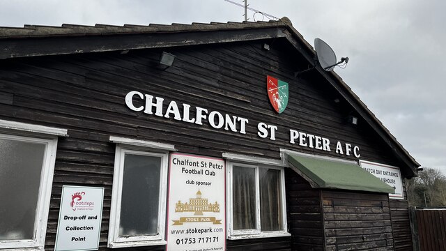
Chalfont St Peter A.F.C.

Chalfont St Peter Association Football Club is a football club based in Chalfont St Peter, Buckinghamshire, England. They are currently members of the...
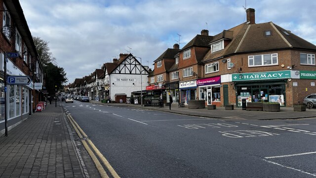
Chalfont St Peter

Chalfont St Peter is a large village and civil parish in southeastern Buckinghamshire, England. It is in a group of villages called The Chalfonts which...

Newland Park, Chalfont St Peter

Newland Park is a Grade II listed country house and estate near the village of Chalfont St Peter in Buckinghamshire. == History == Henry Gott bought Newland...

Chiltern Open Air Museum

Chiltern Open Air Museum (COAM) is an independent open-air museum of vernacular buildings and a tourist attraction located near Chalfont St Peter and Chalfont...

West Hyde

West Hyde is a village situated alongside the A412 road, in the Three Rivers District in south-west Hertfordshire, England. At the 2011 the population...

Chalfonts Community College

Chalfonts Community College is a co-educational secondary school in Chalfont St Peter, Buckinghamshire. It takes children from the age of 11 through to...

Nearby Amenities

Located within 500m of 51.618251,-0.54120286
Direction: 160
Generator Method: photovoltaic
Generator Output Electricity: yes
Generator Solar Modules: 16
Generator Source: solar
Generator Type: solar_photovoltaic_panel
Location: roof
Power: generator
Lat/Long: 51.6183511/-0.5458197
Direction: 160
Generator Method: photovoltaic
Generator Output Electricity: yes
Generator Solar Modules: 12
Generator Source: solar
Generator Type: solar_photovoltaic_panel
Location: roof
Power: generator
Lat/Long: 51.616502/-0.547643
Direction: 160
Generator Method: photovoltaic
Generator Output Electricity: yes
Generator Solar Modules: 4
Generator Source: solar
Generator Type: solar_photovoltaic_panel
Location: roof
Power: generator
Lat/Long: 51.6165373/-0.5477759
Direction: 240
Generator Method: photovoltaic
Generator Output Electricity: yes
Generator Solar Modules: 12
Generator Source: solar
Generator Type: solar_photovoltaic_panel
Location: roof
Power: generator
Lat/Long: 51.6201478/-0.546939
Direction: 240
Generator Method: photovoltaic
Generator Output Electricity: yes
Generator Solar Modules: 12
Generator Source: solar
Generator Type: solar_photovoltaic_panel
Location: roof
Power: generator
Lat/Long: 51.6200181/-0.546814
Direction: 240
Generator Method: photovoltaic
Generator Output Electricity: yes
Generator Solar Modules: 30
Generator Source: solar
Generator Type: solar_photovoltaic_panel
Location: roof
Power: generator
Lat/Long: 51.6200404/-0.5469938
Direction: 250
Generator Method: photovoltaic
Generator Output Electricity: yes
Generator Solar Modules: 10
Generator Source: solar
Generator Type: solar_photovoltaic_panel
Location: roof
Power: generator
Lat/Long: 51.6202965/-0.547038
Direction: 250
Generator Method: photovoltaic
Generator Output Electricity: yes
Generator Solar Modules: 18
Generator Source: solar
Generator Type: solar_photovoltaic_panel
Location: roof
Power: generator
Lat/Long: 51.6205478/-0.5474133
Direction: 155
Generator Method: photovoltaic
Generator Output Electricity: yes
Generator Solar Modules: 14
Generator Source: solar
Generator Type: solar_photovoltaic_panel
Location: roof
Power: generator
Lat/Long: 51.6200617/-0.5432774
The data included in this document is from www.openstreetmap.org. The data is made available under ODbL.

Have you been to Roberts's Wood?

Leave your review of Roberts's Wood below (or comments, questions and feedback).