Eaton

Settlement in Cheshire

England

Eaton

After the harvest A field of stubble.
After the harvest Credit: John H Darch

Eaton is a small village located in the county of Cheshire, England. Situated approximately 7 miles south of the city of Chester, it falls within the Eaton and Eccleston civil parish. The village is primarily residential and is known for its picturesque countryside setting.

Eaton is home to a close-knit community, with a population of around 1,500 residents. The village boasts a range of amenities, including a local primary school, village hall, and a couple of small shops. The nearby Eaton Golf Club offers recreational opportunities for golf enthusiasts.

The village is surrounded by beautiful Cheshire countryside, providing residents with ample opportunities for outdoor activities such as walking, hiking, and cycling. The area is dotted with charming country lanes, fields, and woodlands, making it an ideal spot for nature lovers.

Eaton benefits from excellent transport links, with the A55 and A483 major roads nearby, providing easy access to Chester, Wrexham, and other neighboring towns. The nearby Chester railway station offers regular train services to major cities such as Manchester and Liverpool.

Overall, Eaton offers a tranquil and idyllic setting for those seeking a peaceful residential area within easy reach of larger urban centers. Its natural beauty and community spirit make it an attractive place to live for families and individuals looking to enjoy the best of both rural and suburban lifestyles.

If you have any feedback on the listing, please let us know in the comments section below.

Eaton Images

Images are sourced within 2km of 53.165471/-2.634786 or Grid Reference SJ5763. Thanks to Geograph Open Source API. All images are credited.

After the harvest A field of stubble.
After the harvest
A field of stubble.
Rushton Potato Store Historic barn at Red Beech Farm.
Rushton Potato Store
Historic barn at Red Beech Farm.
Oulton Park estate wall On Kings Lane.
Oulton Park estate wall
On Kings Lane.
Fields near Eaton
Fields near Eaton
Edgewell Lane - Eaton
Fields near Eaton
Fields near Eaton
Oulton Park (BTCC)
Oulton Park (BTCC)
Forest Road, Tarporley
Portal Golf course, Tarporley In the [former] grounds of Arderne Hall.
Portal Golf course, Tarporley
In the [former] grounds of Arderne Hall.
Fishing Lake at Limetree Farm
Oulton Mill Pool Viewed from the direction of Cotebrook towards Oulton Park and Little Budworth.
The old mill house can be seen on the right behind the dam.
Oulton Mill Pool
Viewed from the direction of Cotebrook towards Oulton Park and Little Budworth. The old mill house can be seen on the right behind the dam.
Rushton footpath Footpath running SE from Beech Lane, Rushton. Another runs NE from here, off to the left of the image.
Rushton footpath
Footpath running SE from Beech Lane, Rushton. Another runs NE from here, off to the left of the image.
Moss Hall Farm, Rushton This is a large farm north-east of Eaton that has added a vegetable packing operation to its mixed farming (dairy, potatoes, wheat ...) ... Several footpaths converge here ... as do a Rottweiler and a Jack Russell.
Moss Hall Farm, Rushton
This is a large farm north-east of Eaton that has added a vegetable packing operation to its mixed farming (dairy, potatoes, wheat ...) ... Several footpaths converge here ... as do a Rottweiler and a Jack Russell.
Buttercup meadow, Rushton Between Dogmore Lane and Kings Lane, Rushton - smallholding with horses (one in the distance at the top of the field).
Buttercup meadow, Rushton
Between Dogmore Lane and Kings Lane, Rushton - smallholding with horses (one in the distance at the top of the field).
Thatched cottage at Rushton Thatched cottage at the junction of Rushton Lane and Brownhills Road, by the wall of Oulton Park. Pretty - but pretty noisy on practice or race days!
Thatched cottage at Rushton
Thatched cottage at the junction of Rushton Lane and Brownhills Road, by the wall of Oulton Park. Pretty - but pretty noisy on practice or race days!
Thatching at Eaton Eaton Lane at the centre of Eaton (parish of Rushton). The old smithy is on the left. Behind it, thatchers are working on the cottage roof at the junction of Royal Lane and Edgewell Lane.
Thatching at Eaton
Eaton Lane at the centre of Eaton (parish of Rushton). The old smithy is on the left. Behind it, thatchers are working on the cottage roof at the junction of Royal Lane and Edgewell Lane.
Rushton - view towards Rhuddall Heath View from Rushton footpath 1, looking across Eaton Lane towards Rhuddall Heath. Peckforton Hills faintly visible in the distance.
Rushton - view towards Rhuddall Heath
View from Rushton footpath 1, looking across Eaton Lane towards Rhuddall Heath. Peckforton Hills faintly visible in the distance.
Winterford Lane, Rushton View south along Winterford Lane from its junction with Rushton footpath 1. A quiet lane between Eaton and Alpraham.
Winterford Lane, Rushton
View south along Winterford Lane from its junction with Rushton footpath 1. A quiet lane between Eaton and Alpraham.
Show me another place!

Eaton is located at Grid Ref: SJ5763 (Lat: 53.165471, Lng: -2.634786)

Unitary Authority: Cheshire West and Chester

Police Authority: Cheshire

What 3 Words

///social.perfumes.column. Near Tarporley, Cheshire

Nearby Locations

Eaton

Related Wikis

Eaton, Rushton

Eaton is a small village and former civil parish in the Cheshire West and Chester district, in the ceremonial county of Cheshire, England, about two miles...

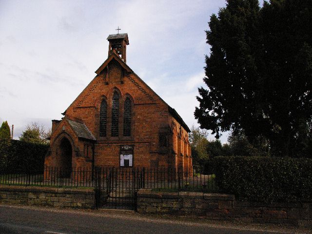
St Thomas' Church, Eaton

St Thomas' Church is in Royal Lane, Eaton, Cheshire, England. It is an active Anglican parish church in the deanery of Malpas, the archdeaconry of Chester...

Rushton, Cheshire

Rushton is a village and civil parish in the unitary authority of Cheshire West and Chester and the ceremonial county of Cheshire, in the north west of...
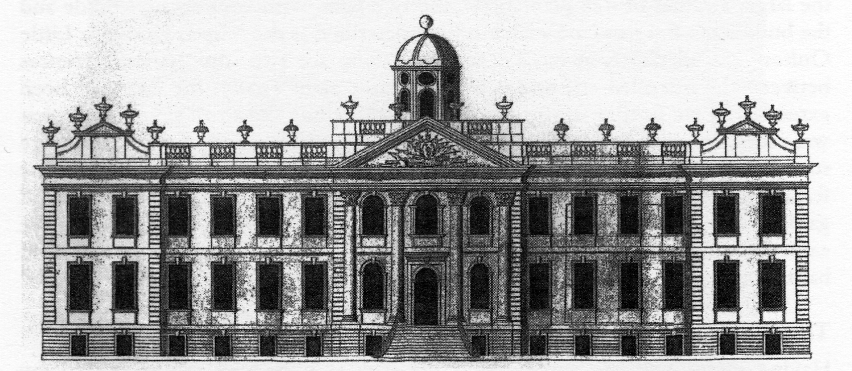
Portal, Tarporley

Portal is a country house standing to the northeast of the village of Tarporley, Cheshire, England. It was built in 1900–05. The architect was Walter...

Oulton Park

Oulton Park is a hard surfaced track used for motor racing, close to the village of Little Budworth, Cheshire, England. It is about 5-mile (8.0 km) from...

Oulton Estate

In the early 18th century the Oulton Estate was home to the Egerton family and comprised a manor house and a formal garden surrounded by farmland in Cheshire...

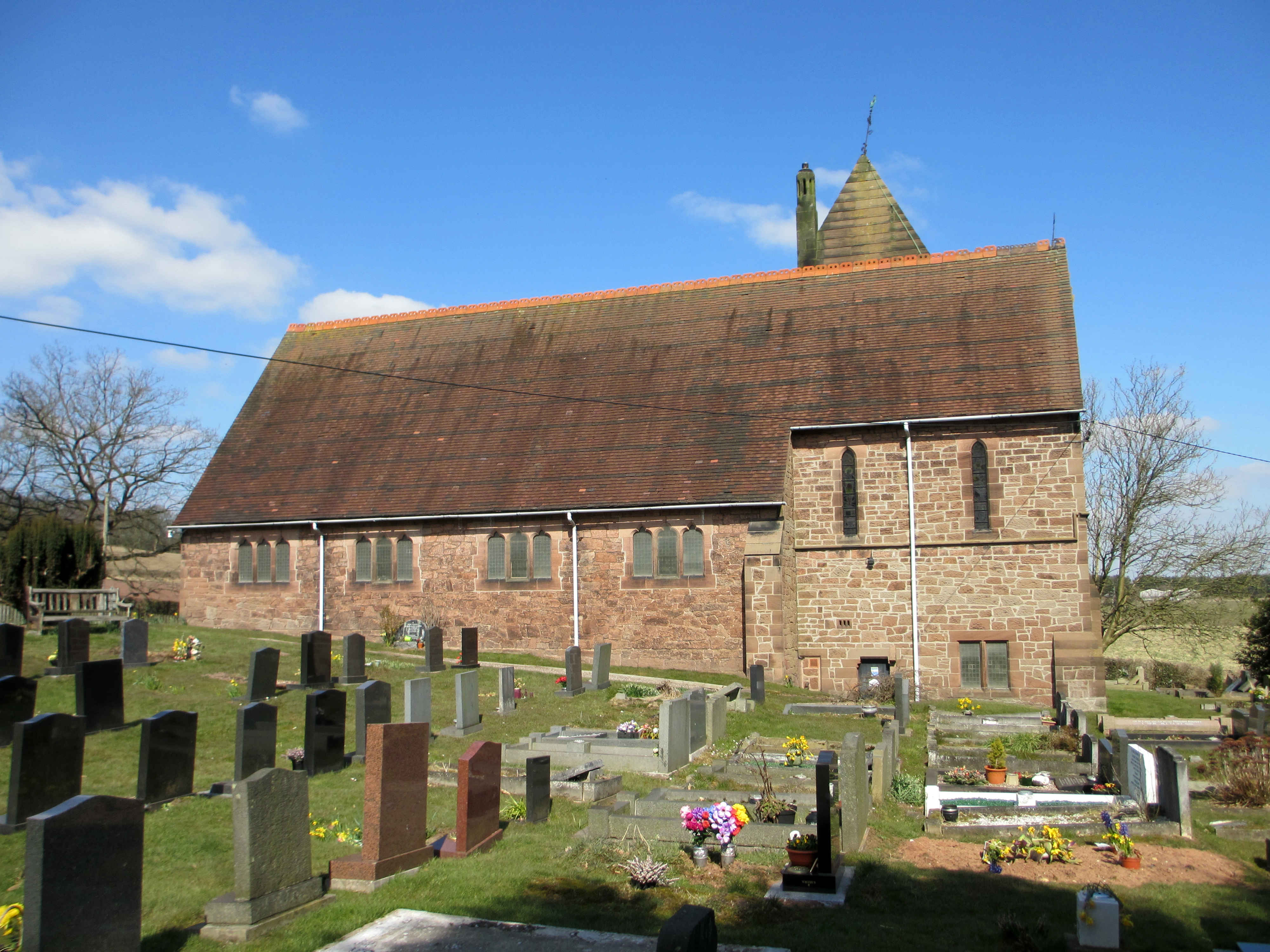
St John's Church, Cotebrook

St John and the Holy Cross Church is in Stable Lane, Cotebrook, Cheshire, England. It is an active Anglican church in the parish of Tarporley, the deanery...

Monument to Captain John Francis Egerton

The Monument to Captain John Francis Egerton stands in the grounds of the Oulton Estate, Little Budworth, Cheshire, England. John Francis Egerton died...

Nearby Amenities

Located within 500m of 53.165471,-2.634786
Eaton
Place: village
Lat/Long: 53.1659609/-2.6389284
Barrier: stile
Foot: yes
Lat/Long: 53.161879/-2.6388881
Village Cross
Historic: wayside_cross
Lat/Long: 53.1659001/-2.640166
Fire Hydrant
Emergency: fire_hydrant
Lat/Long: 53.1658685/-2.6420244
Barrier: stile
Foot: yes
Material: wood
Stile: stepover
Lat/Long: 53.1646547/-2.6352071
Fire Hydrant
Emergency: fire_hydrant
Lat/Long: 53.166196/-2.6362827
Bench
Backrest: yes
Lat/Long: 53.1662002/-2.6390588
Post Box
Post Box Type: lamp
Royal Cypher: EIIR
Royal Cypher Wikidata: Q33102113
Lat/Long: 53.1662002/-2.6391458
Telephone
Booth: K6
Covered: booth
Man Made: telephone_box
Lat/Long: 53.1665834/-2.6389747
Fire Hydrant
Emergency: fire_hydrant
Lat/Long: 53.1666044/-2.63882
Bus Stop
Eaton, Lower Lane / Village Green
Bus: yes
Naptan AtcoCode: 0610VR128
Naptan Bearing: SW
Naptan CommonName: Village Green
Naptan Crossing: Lower Lane
Naptan Indicator: o/s
Naptan Landmark: Village Green
Naptan LocalityName: Eaton
Naptan NaptanCode: chwampa
Naptan ShortCommonName: Village Green
Naptan Street: Lower Lane
Naptan Verified: no
Public Transport: platform
Source: naptan_import
Lat/Long: 53.1661242/-2.6391596
Bus Stop
Eaton, Royal Lane / St Thomas Church
Bus: yes
Naptan AtcoCode: 0610VR19141
Naptan Bearing: S
Naptan BusStopType: CUS
Naptan CommonName: St Thomas Church
Naptan Crossing: Royal Lane
Naptan Indicator: o/s
Naptan Landmark: St Thomas Church
Naptan LocalityName: Eaton
Naptan NaptanCode: chwadgjd
Naptan ShortCommonName: St Thomas Church
Naptan Street: Royal Lane
Naptan Verified: no
Public Transport: platform
Source: naptan_import
Lat/Long: 53.165528/-2.6398754
Bus Stop
Eaton, Lower Lane / Village Green
Bus: yes
Naptan AtcoCode: 0610VR465
Naptan Bearing: NE
Naptan BusStopType: CUS
Naptan CommonName: Village Green
Naptan Crossing: Lower Lane
Naptan Indicator: nr
Naptan Landmark: Village Green
Naptan LocalityName: Eaton
Naptan NaptanCode: chwdpdw
Naptan ShortCommonName: Village Green
Naptan Street: Lower Lane
Naptan Verified: no
Public Transport: platform
Source: naptan_import
Lat/Long: 53.1663439/-2.6389881
Grit Bin
Lat/Long: 53.1660652/-2.6359789
Bench
Backrest: yes
Lat/Long: 53.1660271/-2.6358561
Waste Basket
Waste: dog_excrement
Lat/Long: 53.1660207/-2.6359198
Barrier: stile
Stile: stepover
Lat/Long: 53.1626555/-2.6371229
Barrier: stile
Material: wood
Stile: stepover
Lat/Long: 53.1630525/-2.636874
Grit Bin
Lat/Long: 53.1649947/-2.6369936
The data included in this document is from www.openstreetmap.org. The data is made available under ODbL.

Have you been to Eaton?

Leave your review of Eaton below (or comments, questions and feedback).